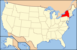
| [3] |
Name on the Register |
Image |
Date listed[4] |
Location |
City or town |
Description |
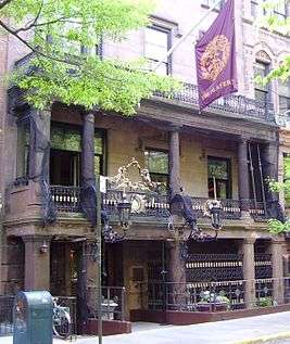
|---|
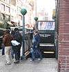
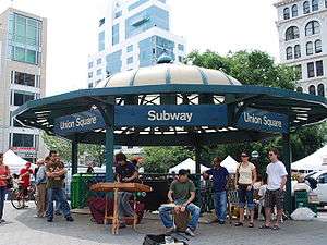
| 1 |
14th Street-Union Square Subway Station (IRT; Dual System BMT) |
|
000000002005-07-06-0000July 6, 2005
(#05000671) |
Broadway, Fourth ave., and E. 14th St.
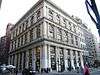
40°44′07″N 73°59′28″W / 40.735278°N 73.991111°W / 40.735278; -73.991111 (14th Street-Union Square Subway Station (IRT; Dual System BMT)) |
Union Square |
Subway station (4 5 6 <6> L N Q R W trains)
|
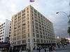
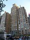
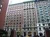
| 2 |
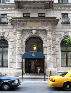
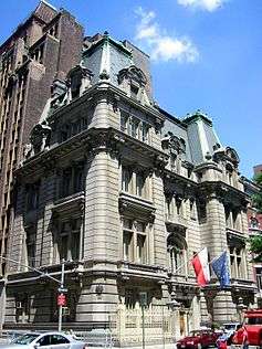
240 Central Park South |
|
000000002009-05-12-0000May 12, 2009
(#09000304) |
240 Central Park South
40°46′04″N 73°58′52″W / 40.767664°N 73.980983°W / 40.767664; -73.980983 (240 Central Park South) |
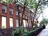
New York |
|
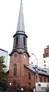
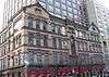
| 3 |
28th Street Subway Station (IRT) |
|
000000002005-03-30-0000March 30, 2005
(#05000230) |
Under Park Avenue S, bet E 29th and 27th Sts.
40°44′36″N 73°59′04″W / 40.743333°N 73.984444°W / 40.743333; -73.984444 (28th Street Subway Station (IRT)) |
Rose Hill |
Subway station (4 6 <6> trains)
|
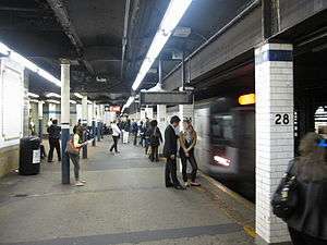
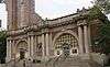
| 4 |
33rd Street Subway Station (IRT) |
|
000000002004-09-17-0000September 17, 2004
(#04001014) |
33rd St. and Park Ave.
40°44′53″N 73°58′55″W / 40.748056°N 73.981944°W / 40.748056; -73.981944 (33rd Street Subway Station (IRT)) |
Murray Hill |
Subway station (4 6 <6> trains)
|
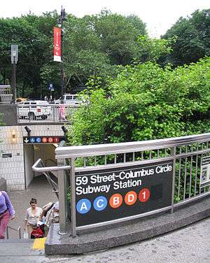
| 5 |
59th Street-Columbus Circle Subway Station (IRT) |
|
000000002004-09-17-0000September 17, 2004
(#04001015) |
Junction of Broadway and Central Park South
40°46′05″N 73°58′57″W / 40.768056°N 73.9825°W / 40.768056; -73.9825 (59th Street-Columbus Circle Subway Station (IRT)) |
Columbus Circle |
Subway station (1 2 trains)
|
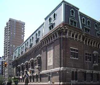
| 6 |
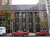
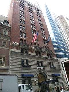
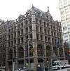
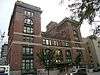
69th Regiment Armory |
|
000000001994-01-28-0000January 28, 1994
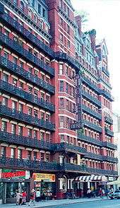
(#93001538) |
68 Lexington Ave.
40°44′28″N 73°59′05″W / 40.741111°N 73.984722°W / 40.741111; -73.984722 (69th Regiment Armory) |
New York |
|
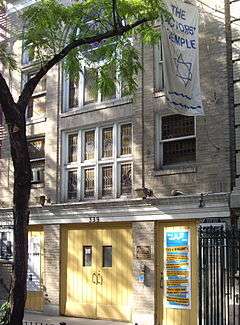
| 7 |
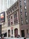
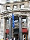
Actors Temple |
|
000000002005-05-19-0000May 19, 2005
(#05000445) |
339 W. 47th St.
40°45′40″N 73°59′22″W / 40.761111°N 73.989444°W / 40.761111; -73.989444 (Actors Temple) |
Hell's Kitchen, Manhattan |
|
| 8 |
Alwyn Court Apartments |
|
000000001979-12-26-0000December 26, 1979
(#79001599) |
180 W. 58th St.
40°45′57″N 73°58′48″W / 40.765833°N 73.98°W / 40.765833; -73.98 (Alwyn Court Apartments) |
New York |
|
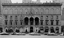
| 9 |
American Fine Arts Society |
|
000000001980-05-06-0000May 6, 1980
(#80002662) |
215 W. 57th St.
40°45′57″N 73°58′52″W / 40.765833°N 73.981111°W / 40.765833; -73.981111 (American Fine Arts Society) |
New York |
|
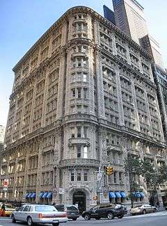
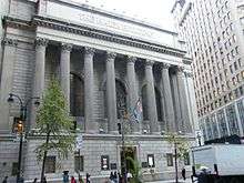
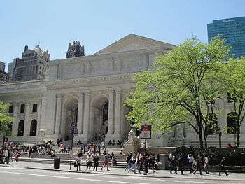
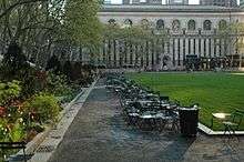
| 10 |
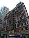
American Radiator Building |
|
000000001980-05-07-0000May 7, 1980
(#80002663) |
40-52 W. 40th St.
40°45′10″N 73°59′04″W / 40.752778°N 73.984444°W / 40.752778; -73.984444 (American Radiator Building) |
Midtown Manhattan |
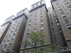
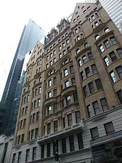
Black and gold building aka American Standard Building and recently The Bryant Park Hotel
|
| 11 |
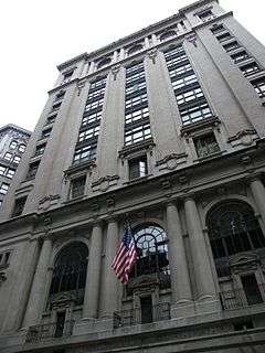
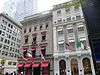
Appellate Division Courthouse of New York State |
|
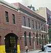
000000001982-07-26-0000July 26, 1982
(#82003366) |
27 Madison Ave.
40°44′32″N 73°59′13″W / 40.742222°N 73.986944°W / 40.742222; -73.986944 (Appellate Division Courthouse of New York State) |
New York |
|
| 12 |
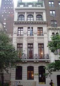
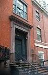
Chester A. Arthur House |
|
000000001966-10-15-0000October 15, 1966
(#66000534) |
123 Lexington Ave.
40°44′34″N 73°58′57″W / 40.742778°N 73.9825°W / 40.742778; -73.9825 (Chester A. Arthur House) |
New York |
Home of former US president Chester A. Arthur
|
| 13 |
Association of the Bar of the City of New York |
|
000000001980-01-03-0000January 3, 1980
(#80002666) |
42 W. 44th St.
40°45′18″N 73°58′57″W / 40.755°N 73.9825°W / 40.755; -73.9825 (Association of the Bar of the City of New York) |
New York |
|
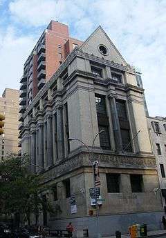
| 14 |
Bank of the Metropolis |
|
000000002003-11-15-0000November 15, 2003
(#03001153) |
31 Union Square West
40°44′12″N 73°59′29″W / 40.736667°N 73.991389°W / 40.736667; -73.991389 (Bank of the Metropolis) |
New York |
|
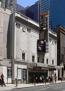
| 15 |
Biltmore Theater |
|
000000002004-10-27-0000October 27, 2004
(#04001203) |
261-265 W. 47th St.
40°45′37″N 73°59′14″W / 40.760278°N 73.987222°W / 40.760278; -73.987222 (Biltmore Theater) |
New York |
|
| 16 |
Building at 304 Park Avenue South |
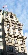
|
000000002005-03-15-0000March 15, 2005
(#05000167) |
304 Park Ave. S
40°44′24″N 73°59′14″W / 40.74°N 73.987222°W / 40.74; -73.987222 (Building at 304 Park Avenue South) |
New York |
|
| 17 |
Building at 315-325 West 36th Street |
|
000000002004-05-27-0000May 27, 2004
(#04000542) |
315-325 W. 36th St.
40°45′15″N 73°59′39″W / 40.754167°N 73.994167°W / 40.754167; -73.994167 (Building at 315-325 West 36th Street) |
New York |
|
| 18 |
Candler Building |
|
000000001982-07-08-0000July 8, 1982
(#82003368) |
220 West 42nd St. and 221 West 41st St.
40°45′22″N 73°59′18″W / 40.756111°N 73.988333°W / 40.756111; -73.988333 (Candler Building) |
New York |
|
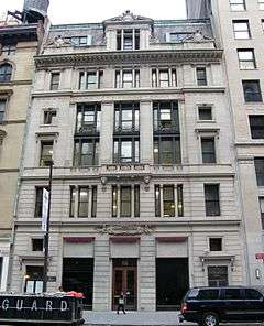
| 19 |
Carnegie Hall |
|
000000001966-10-15-0000October 15, 1966
(#66000535) |
7th Ave., 56th to 57th Sts.
40°45′55″N 73°58′48″W / 40.765278°N 73.98°W / 40.765278; -73.98 (Carnegie Hall) |
New York |
Internationally-known classical music venue
|
| 20 |
Central IND Substation |
|
000000002006-02-09-0000February 9, 2006
(#06000019) |
136 W. 53rd St. (btwn 6th & 7th)
40°45′44″N 73°58′52″W / 40.762222°N 73.981111°W / 40.762222; -73.981111 (Central IND Substation) |
New York |
|
| 21 |
Central Synagogue |
|
000000001970-10-09-0000October 9, 1970
(#70000423) |
646-652 Lexington Ave.
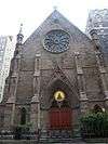
40°45′34″N 73°58′16″W / 40.759444°N 73.971111°W / 40.759444; -73.971111 (Central Synagogue) |
New York |
|
| 22 |
Century Association Building |
|
000000001982-07-15-0000July 15, 1982
(#82003369) |
5-7 W. 43rd St.
40°45′16″N 73°58′52″W / 40.754444°N 73.981111°W / 40.754444; -73.981111 (Century Association Building) |
New York |
|
| 23 |
Century Building |
|
000000001997-09-18-0000September 18, 1997
(#97001148) |
33 E. 17th St.
40°44′13″N 73°59′25″W / 40.736944°N 73.990278°W / 40.736944; -73.990278 (Century Building) |
New York |
|
| 24 |
Chanin Building |
|
000000001980-04-23-0000April 23, 1980
(#80002676) |
122 E. 42nd St.
40°45′04″N 73°58′32″W / 40.751111°N 73.975556°W / 40.751111; -73.975556 (Chanin Building) |
New York |
|
| 25 |
Chelsea Historic District |
|
000000001977-12-06-0000December 6, 1977
(#77000954) |
Roughly bounded by 19th and 22nd Sts., 9th and 10th Aves.
40°44′43″N 74°00′15″W / 40.745278°N 74.004167°W / 40.745278; -74.004167 (Chelsea Historic District) |
New York |
|
| 26 |
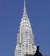
Chrysler Building |
|
000000001976-12-08-0000December 8, 1976
(#76001237) |
405 Lexington Ave.
40°45′05″N 73°58′31″W / 40.751389°N 73.975278°W / 40.751389; -73.975278 (Chrysler Building) |
New York |
|
| 27 |
Church of St. Mary the Virgin Complex |
|
000000001990-04-16-0000April 16, 1990
(#90000606) |
145 W. 46th St.
40°45′30″N 73°59′02″W / 40.758333°N 73.983889°W / 40.758333; -73.983889 (Church of St. Mary the Virgin Complex) |
New York |
|
| 28 |
Church of the Holy Apostles |
|
000000001972-04-26-0000April 26, 1972
(#72000867) |
300 9th Ave.
40°44′57″N 73°59′57″W / 40.749167°N 73.999167°W / 40.749167; -73.999167 (Church of the Holy Apostles) |
New York |
|
| 29 |
Church of the Holy Communion and Buildings |
|
000000001980-04-17-0000April 17, 1980
(#80002680) |
656-662 6th Ave. (@ 20th)
40°44′28″N 73°59′40″W / 40.741111°N 73.994444°W / 40.741111; -73.994444 (Church of the Holy Communion and Buildings) |
Flatiron District |
Location of The Limelight nightclub
|
| 30 |
Church of the Immaculate Conception and Clergy Houses |
|
000000001980-03-28-0000March 28, 1980
(#80002681) |
406-414 E. 14th St.
40°43′52″N 73°58′56″W / 40.731111°N 73.982222°W / 40.731111; -73.982222 (Church of the Immaculate Conception and Clergy Houses) |
New York |
|
| 31 |
Church of the Incarnation and Parish House |
|
000000001982-07-08-0000July 8, 1982
(#82003371) |
205-209 Madison Ave. (@ 35th)
40°44′54″N 73°58′57″W / 40.748333°N 73.9825°W / 40.748333; -73.9825 (Church of the Incarnation and Parish House) |
New York |
|
| 32 |
Church of the Transfiguration and Rectory |
|
000000001973-06-04-0000June 4, 1973
(#73001216) |
1 E. 29th St.
40°44′44″N 73°59′14″W / 40.745556°N 73.987222°W / 40.745556; -73.987222 (Church of the Transfiguration and Rectory) |
New York |
|
| 33 |
Church Missions House |
|
000000001982-06-03-0000June 3, 1982
(#82003370) |
281 Park Ave., S. (@ 22nd)
40°44′21″N 73°59′14″W / 40.739167°N 73.987222°W / 40.739167; -73.987222 (Church Missions House) |
New York |
|
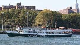
| 34 |
CIRCLE LINE X (sightseeing vessel) |
|
000000002014-09-22-0000September 22, 2014
(#14000702) |
Pier 83 & West 42nd St.
Coordinates missing |
New York |
Former World War II amphibious landing craft was used for half a century as sightseeing vessel; now being converted into a museum.
|
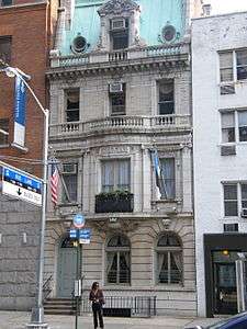
| 35 |
Civic Club |
|
000000001982-09-16-0000September 16, 1982
(#82003372) |
243 E. 34th St.
40°44′41″N 73°58′34″W / 40.744722°N 73.976111°W / 40.744722; -73.976111 (Civic Club) |
New York |
Nowadays it's the New York Estonian House.
|
| 36 |
Colony Arcade Building |
Upload image |
000000002014-09-10-0000September 10, 2014
(#14000580) |
63-67 W. 38th St.
40°45′08″N 73°59′07″W / 40.7522°N 73.9854°W / 40.7522; -73.9854 (Colony Arcade Building) |
Garment District |
Neo-Gothic 1912 building was crucial to city's developing fashion industry in the early 20th century. Now redeveloped into a hotel.
|
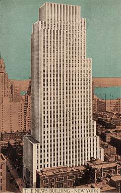
| 37 |
Daily News Building |
|
000000001982-11-14-0000November 14, 1982
(#82001191) |
220 E. 42nd St.
40°44′58″N 73°58′25″W / 40.749444°N 73.973611°W / 40.749444; -73.973611 (Daily News Building) |
New York |
|
| 38 |
Decker Building |
|
000000002003-11-21-0000November 21, 2003
(#03001179) |
33 Union Square W.
40°44′12″N 73°59′29″W / 40.736667°N 73.991389°W / 40.736667; -73.991389 (Decker Building) |
New York |
|
| 39 |
DeLamar Mansion |
|
000000001983-08-25-0000August 25, 1983
(#83001722) |
233 Madison Ave. (@ 37th)
40°44′59″N 73°58′54″W / 40.749722°N 73.981667°W / 40.749722; -73.981667 (DeLamar Mansion) |
New York |
|
| 40 |
Adelaide L. T. Douglas House |
|
000000001982-07-15-0000July 15, 1982
(#82003373) |
57 Park Ave. (btwn East 37 & 38)
40°44′57″N 73°58′48″W / 40.749167°N 73.98°W / 40.749167; -73.98 (Adelaide L. T. Douglas House) |
New York |
now the Guatemalan Mission to the UN
|
| 41 |
The Emerson |
|
000000002009-08-20-0000August 20, 2009
(#09000634) |
554 W. 53rd St.
40°46′01″N 73°59′30″W / 40.767017°N 73.991528°W / 40.767017; -73.991528 (The Emerson) |
New York |
|
| 42 |
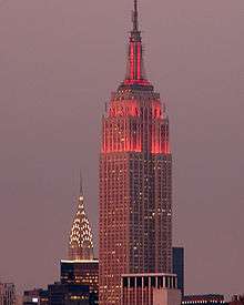
Empire State Building |
|
000000001982-11-17-0000November 17, 1982
(#82001192) |
350 Fifth Ave.
40°44′53″N 73°59′10″W / 40.748056°N 73.986111°W / 40.748056; -73.986111 (Empire State Building) |
New York |
Second tallest building in Manhattan after One World Trade Center and an international symbol of New York City
|
| 43 |
Engineering Societies' Building and Engineers' Club |
|
000000002007-08-30-0000August 30, 2007
(#07000867) |
23 and 25-33 W. 39th St. and 28, 32-34, and 36 W. 40th St.
40°45′09″N 73°59′04″W / 40.7525°N 73.984444°W / 40.7525; -73.984444 (Engineering Societies' Building and Engineers' Club) |
New York |
|
| 44 |
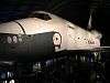
ENTERPRISE (space shuttle) |
|
000000002013-03-13-0000March 13, 2013
(#13000071) |
Pier 86, W. 46th St. and 12th Ave.
40°45′56″N 74°00′07″W / 40.765693°N 74.001874°W / 40.765693; -74.001874 (ENTERPRISE (space shuttle)) |
New York |
First space shuttle built; was never taken into orbit but helped immensely in development of later vehicles that were. Now on exhibit at Intrepid museum.
|
| 45 |
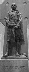
Father Francis D. Duffy Statue and Duffy Square |
|
000000002001-03-12-0000March 12, 2001
(#01000243) |
Triangle bounded by Broadway, Seventh Ave., W. 47th. and W. 46th St.
40°45′32″N 73°59′07″W / 40.758889°N 73.985278°W / 40.758889; -73.985278 (Father Francis D. Duffy Statue and Duffy Square) |
New York |
|
| 46 |
Film Center Building |
|
000000001984-09-07-0000September 7, 1984
(#84002768) |
630-9th Ave.
40°45′35″N 73°59′30″W / 40.759722°N 73.991667°W / 40.759722; -73.991667 (Film Center Building) |
New York |
|
| 47 |
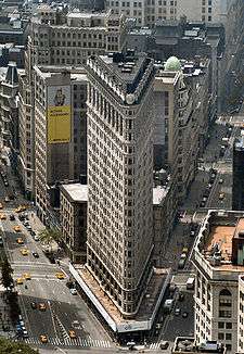
Flatiron Building |
|
000000001979-11-20-0000November 20, 1979
(#79001603) |
5th Ave. and Broadway
40°44′29″N 74°01′33″W / 40.7414°N 74.0258°W / 40.7414; -74.0258 (Flatiron Building) |
New York |
|
| 48 |
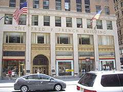
Fred F. French Building |
|
000000002004-01-28-0000January 28, 2004
(#03001514) |
551 Fifth Ave.
40°45′20″N 73°58′47″W / 40.755556°N 73.979722°W / 40.755556; -73.979722 (Fred F. French Building) |
New York |
|
| 49 |
FRYING PAN SHOALS LIGHTSHIP NO. 115 (lightship) |
|
000000001999-01-28-0000January 28, 1999
(#98001615) |
Pier 66, W. 26th and West Side Highway.
40°45′00″N 74°00′37″W / 40.75°N 74.010278°W / 40.75; -74.010278 (FRYING PAN SHOALS LIGHTSHIP NO. 115 (lightship)) |
New York |
|
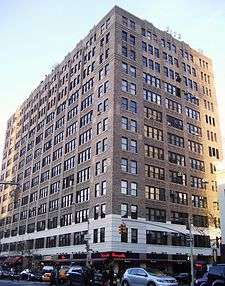
| 50 |
Garment Center Historic District |
|
000000002008-11-05-0000November 5, 2008
(#08001034) |
Roughly bounded by Sixth Ave. on the E., Ninth Ave. on the W., W. 35th St. on the S., and W. 41st St. on the N.
40°45′14″N 73°59′25″W / 40.753758°N 73.990392°W / 40.753758; -73.990392 (Garment Center Historic District) |
Garment District |
|
| 51 |
General Electric Building |
|
000000002004-01-28-0000January 28, 2004
(#03001515) |
570 Lexington Ave.
40°45′26″N 73°58′38″W / 40.757222°N 73.977222°W / 40.757222; -73.977222 (General Electric Building) |
Rockefeller Center |
|
| 52 |
General Society of Mechanics and Tradesmen |
|
000000002008-11-12-0000November 12, 2008
(#08001048) |
20 W. 44th St
40°45′19″N 73°58′53″W / 40.755328°N 73.981317°W / 40.755328; -73.981317 (General Society of Mechanics and Tradesmen) |
New York |
|
| 53 |
Germania Life Insurance Company Building |
|
000000002001-05-25-0000May 25, 2001
(#01000556) |
50 Union Sq. E
40°44′12″N 73°59′21″W / 40.736667°N 73.989167°W / 40.736667; -73.989167 (Germania Life Insurance Company Building) |
New York |
|
| 54 |
Gilsey Hotel |
|
000000001978-12-14-0000December 14, 1978
(#78001872) |
1200 Broadway (@ 29th)
40°44′45″N 73°59′19″W / 40.745833°N 73.988611°W / 40.745833; -73.988611 (Gilsey Hotel) |
New York |
|
| 55 |
Gramercy Park Historic District |
|
000000001980-01-23-0000January 23, 1980
(#80002691) |
Roughly bounded by 3rd and Park Aves., S., E. 18th and 22nd Sts.
40°44′16″N 73°59′10″W / 40.737778°N 73.986111°W / 40.737778; -73.986111 (Gramercy Park Historic District) |
New York |
|
| 56 |
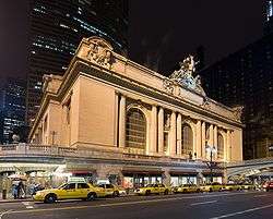
Grand Central Terminal |
|
000000001975-01-17-0000January 17, 1975
(#75001206) |
71-105 E. 42nd St.
40°45′10″N 73°58′35″W / 40.752778°N 73.976389°W / 40.752778; -73.976389 (Grand Central Terminal) |
Midtown Manhattan |
1913 Beaux Arts landmark still used by Metro-North Railroad. Construction helped trigger development of Park Avenue.
|
| 57 |
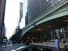
Grand Central Terminal Park Avenue Viaduct |
|
000000001983-08-11-0000August 11, 1983
(#83001726) |
71-105 E. 42nd St., Park Ave. between E. 40th and E. 42nd Sts.
40°44′59″N 73°58′40″W / 40.749722°N 73.977778°W / 40.749722; -73.977778 (Grand Central Terminal Park Avenue Viaduct) |
Pershing Square |
Elevated roadway bringing Park Avenue around Grand Central Terminal
|
| 58 |
Grand Hotel |
|
000000001983-09-15-0000September 15, 1983
(#83001725) |
1232-1238 Broadway
40°44′50″N 73°59′19″W / 40.747222°N 73.988611°W / 40.747222; -73.988611 (Grand Hotel) |
New York |
|
| 59 |
Greenwich Savings Bank |
|
000000002005-11-16-0000November 16, 2005
(#05001286) |
1352-1362 Broadway (@ 35th)
40°45′05″N 73°59′15″W / 40.751389°N 73.9875°W / 40.751389; -73.9875 (Greenwich Savings Bank) |
New York |
|
| 60 |
Harvard Club of New York City |
|
000000001980-03-28-0000March 28, 1980
(#80002693) |
27 W. 44th St.
40°45′18″N 73°58′53″W / 40.755°N 73.981389°W / 40.755; -73.981389 (Harvard Club of New York City) |
New York |
|
| 61 |
Hotel Chelsea |
|
000000001977-12-27-0000December 27, 1977
(#77000958) |
222 W. 23rd St.
40°44′35″N 73°59′39″W / 40.743056°N 73.994167°W / 40.743056; -73.994167 (Hotel Chelsea) |
Chelsea |
|
| 62 |
Hotel Gerard |
|
000000001983-02-10-0000February 10, 1983
(#83001729) |
123 W. 44th St.
40°45′48″N 73°59′34″W / 40.763333°N 73.992778°W / 40.763333; -73.992778 (Hotel Gerard) |
New York |
|
| 63 |
House at 146 East 38th Street |
|
000000002008-05-21-0000May 21, 2008
(#08000450) |
145 E. 38th St.
40°44′55″N 73°58′37″W / 40.748567°N 73.977°W / 40.748567; -73.977 (House at 146 East 38th Street) |
New York |
(new listing; refnum08000450; Murray Hill, New York County, New York MPS)
|
| 64 |
House at 17 West 16th Street |
|
000000001983-05-26-0000May 26, 1983
(#83001730) |
17 W. 16th St.
40°44′16″N 73°59′38″W / 40.737778°N 73.993889°W / 40.737778; -73.993889 (House at 17 West 16th Street) |
New York |
|
| 65 |
House at 20 West 16th St |
|
000000002007-05-30-0000May 30, 2007
(#07000484) |
20 W. 16th St.
40°44′15″N 73°59′40″W / 40.7375°N 73.994444°W / 40.7375; -73.994444 (House at 20 West 16th St) |
New York |
|
| 66 |
House at 203 East 29 Street |
|
000000001982-07-08-0000July 8, 1982
(#82003377) |
203 E. 29th St.
40°44′33″N 73°58′49″W / 40.7425°N 73.980278°W / 40.7425; -73.980278 (House at 203 East 29 Street) |
New York |
|
| 67 |
Houses at 311 and 313 East 58th Street |
|
000000001982-11-14-0000November 14, 1982
(#82001197) |
311-313 E. 58th St.
40°45′35″N 73°57′53″W / 40.759722°N 73.964722°W / 40.759722; -73.964722 (Houses at 311 and 313 East 58th Street) |
New York |
|
| 68 |
Houses at 326, 328 and 330 East 18th Street |
|
000000001982-09-30-0000September 30, 1982
(#82003380) |
326-330 E. 18th St.
40°44′03″N 73°58′57″W / 40.734167°N 73.9825°W / 40.734167; -73.9825 (Houses at 326, 328 and 330 East 18th Street) |
Kips Bay |
|
| 69 |
Houses at 437-459 West 24th Street |
|
000000001982-10-29-0000October 29, 1982
(#82001196) |
437-459 W. 24th St.
40°44′53″N 74°00′11″W / 40.748056°N 74.003056°W / 40.748056; -74.003056 (Houses at 437-459 West 24th Street) |
New York |
|
| 70 |
Houses at 647, 651-53 Fifth Avenue and 4 East 52nd Street |
|
000000001983-09-08-0000September 8, 1983
(#83001733) |
647, 651-53 5th Ave. and 4 E. 52nd St.
40°45′34″N 73°58′36″W / 40.759444°N 73.976667°W / 40.759444; -73.976667 (Houses at 647, 651-53 Fifth Avenue and 4 East 52nd Street) |
New York |
|
| 71 |
JOHN J. HARVEY (fireboat) |
|
000000002000-06-15-0000June 15, 2000
(#00000576) |
Pier 63, North R.
40°45′00″N 74°00′39″W / 40.75°N 74.010833°W / 40.75; -74.010833 (JOHN J. HARVEY (fireboat)) |
Chelsea |
|
| 72 |
Knickerbocker Hotel |
|
000000001980-04-11-0000April 11, 1980
(#80002697) |
142 W. 42nd St.
40°45′19″N 73°59′12″W / 40.755278°N 73.986667°W / 40.755278; -73.986667 (Knickerbocker Hotel) |
Times Square |
|
| 73 |
Knox Building |
|
000000001982-06-03-0000June 3, 1982
(#82003381) |
452 5th Ave. (@ 40th)
40°45′08″N 73°58′57″W / 40.752222°N 73.9825°W / 40.752222; -73.9825 (Knox Building) |
New York |
|
| 74 |
Lamb's Club |
|
000000001982-06-03-0000June 3, 1982
(#82003382) |
128 W. 44th St.
40°45′23″N 73°59′07″W / 40.756389°N 73.985278°W / 40.756389; -73.985278 (Lamb's Club) |
New York |
Former home of the Lamb's Club, is being gut renovated into a hotel in 2009.
|
| 75 |
James F. D. Lanier Residence |
|
000000001982-06-03-0000June 3, 1982
(#82003383) |
123 E. 35th
40°44′51″N 73°58′49″W / 40.7475°N 73.980278°W / 40.7475; -73.980278 (James F. D. Lanier Residence) |
New York |
|
| 76 |
Lescaze House |
|
000000001980-05-19-0000May 19, 1980
(#80002698) |
211 E. 48th St.
40°45′15″N 73°58′17″W / 40.754167°N 73.971389°W / 40.754167; -73.971389 (Lescaze House) |
New York |
|
| 77 |
Lever House |
|
000000001983-10-02-0000October 2, 1983
(#83004078) |
390 Park Ave.
40°45′34″N 73°58′23″W / 40.759444°N 73.973056°W / 40.759444; -73.973056 (Lever House) |
New York |
|
| 78 |
Lincoln Building |
|
000000001983-09-08-0000September 8, 1983
(#83001735) |
1 Union Sq. W.
40°44′08″N 73°59′32″W / 40.735556°N 73.992222°W / 40.735556; -73.992222 (Lincoln Building) |
New York |
|
| 79 |
Look Building |
|
000000002005-02-24-0000February 24, 2005
(#05000087) |
488 Madison Ave. (@ 52nd)
40°45′31″N 73°58′33″W / 40.758611°N 73.975833°W / 40.758611; -73.975833 (Look Building) |
New York |
|
| 80 |
R. H. Macy and Company Store |
|
000000001978-06-02-0000June 2, 1978
(#78001873) |
151 W. 34th St.
40°45′41″N 73°58′22″W / 40.761389°N 73.972778°W / 40.761389; -73.972778 (R. H. Macy and Company Store) |
Herald Square |
Home of first major American department store.
|
| 81 |
Marble Collegiate Reformed Church |
|
000000001980-04-09-0000April 9, 1980
(#80002699) |
275 5th Ave. (@ 30th)
40°44′44″N 73°59′15″W / 40.745556°N 73.9875°W / 40.745556; -73.9875 (Marble Collegiate Reformed Church) |
New York |
|
| 82 |
McGraw-Hill Building |
|
000000001980-03-28-0000March 28, 1980
(#80002701) |
326 W. 42nd St.
40°45′25″N 73°59′31″W / 40.756944°N 73.991944°W / 40.756944; -73.991944 (McGraw-Hill Building) |
New York |
|
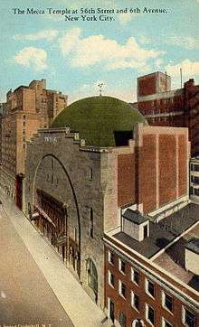
| 83 |
Mecca Temple |
|
000000001984-09-07-0000September 7, 1984
(#84002788) |
131 N. 55th St.
40°45′50″N 73°58′48″W / 40.763889°N 73.98°W / 40.763889; -73.98 (Mecca Temple) |
New York |
Known as New York City Center Theater. Moorish-revival interior and exterior details. Harry P. Knowles, architect.
|
| 84 |
Merchants Refrigerating Company Warehouse |
|
000000001985-05-31-0000May 31, 1985
(#85001171) |
501 W. 16th St.
40°44′38″N 74°00′28″W / 40.743889°N 74.007778°W / 40.743889; -74.007778 (Merchants Refrigerating Company Warehouse) |
New York |
|
| 85 |
Metropolitan Life Home Office Complex |
|
000000001996-01-19-0000January 19, 1996
(#95001544) |
Roughly bounded by Madison Ave., E. 23rd St., Park Ave. S. and E. 25th St.
40°44′28″N 73°59′14″W / 40.741111°N 73.987222°W / 40.741111; -73.987222 (Metropolitan Life Home Office Complex) |
New York |
|
| 86 |
Metropolitan Life Insurance Company |
|
000000001978-06-02-0000June 2, 1978
(#78001874) |
1 Madison Ave.
40°44′29″N 73°59′16″W / 40.741389°N 73.987778°W / 40.741389; -73.987778 (Metropolitan Life Insurance Company) |
New York |
|
| 87 |
William H. Moore House |
|
000000001972-03-16-0000March 16, 1972
(#72000878) |
4 E. 54th St.
40°45′38″N 73°58′31″W / 40.760556°N 73.975278°W / 40.760556; -73.975278 (William H. Moore House) |
New York |
|
| 88 |
Pierpont Morgan Library |
|
000000001966-11-13-0000November 13, 1966
(#66000544) |
33 E. 36th St.
40°44′56″N 73°58′54″W / 40.748889°N 73.981667°W / 40.748889; -73.981667 (Pierpont Morgan Library) |
New York |
Now known as "The Morgan Library & Museum"
|
| 89 |
Murray Hill Historic District |
|
000000002003-10-05-0000October 5, 2003
(#03000997) |
E. 34th, 35th, 36th, 37th, 38th & 39th Sts., Lexington, Madison & Park Aves.
40°44′54″N 73°58′47″W / 40.748333°N 73.979722°W / 40.748333; -73.979722 (Murray Hill Historic District) |
Murray Hill |
One of last intact 19th-century residential districts in Manhattan; many buildings by prominent architects. Boundary increase on February 27, 2013.
|
| 90 |
New Amsterdam Theater |
|
000000001980-01-10-0000January 10, 1980
(#80002664) |
214 W. 42nd St.
40°45′21″N 73°59′18″W / 40.755833°N 73.988333°W / 40.755833; -73.988333 (New Amsterdam Theater) |
New York |
|
| 91 |
New York Bible Society |
Upload image |
000000002014-02-05-0000February 5, 2014
(#13001152) |
5 E. 48th St.
Coordinates missing |
New York |
|
| 92 |
New York Life Building |
|
000000001978-06-02-0000June 2, 1978
(#78001876) |
51 Madison Ave. (@ 27th)
40°44′34″N 73°59′09″W / 40.742778°N 73.985833°W / 40.742778; -73.985833 (New York Life Building) |
New York |
|
| 93 |
New York Public Library |
|
000000001966-10-15-0000October 15, 1966
(#66000546) |
5th Ave. and 42nd St.
40°45′12″N 73°58′56″W / 40.753333°N 73.982222°W / 40.753333; -73.982222 (New York Public Library) |
New York |
Main branch of New York Public Library system; one of the world's largest public libraries.
|
| 94 |
New York Public Library and Bryant Park |
|
000000001966-10-15-0000October 15, 1966
(#66000547) |
Avenue of the Americas, 5th Ave., 40th and 42nd Sts.
40°45′12″N 73°58′56″W / 40.753333°N 73.982222°W / 40.753333; -73.982222 (New York Public Library and Bryant Park) |
New York |
|
| 95 |
New York Savings Bank |
|
000000002000-01-07-0000January 7, 2000
(#99001657) |
81 Eighth Ave. (@ 14th)
40°44′24″N 74°00′11″W / 40.74°N 74.003056°W / 40.74; -74.003056 (New York Savings Bank) |
New York |
|
| 96 |
New York School of Applied Design |
|
000000001982-12-16-0000December 16, 1982
(#82001202) |
160 Lexington Ave. (@ 30th)
40°44′38″N 73°58′56″W / 40.743889°N 73.982222°W / 40.743889; -73.982222 (New York School of Applied Design) |
New York |
|
| 97 |
New York Yacht Club |
|
000000001982-10-29-0000October 29, 1982
(#82001203) |
37 W. 44th St.
40°45′19″N 73°58′54″W / 40.755278°N 73.981667°W / 40.755278; -73.981667 (New York Yacht Club) |
New York |
|
| 98 |
Andrew S. Norwood House |
|
000000001979-07-09-0000July 9, 1979
(#79001606) |
241 W. 14th St.
40°44′23″N 74°00′07″W / 40.739722°N 74.001944°W / 40.739722; -74.001944 (Andrew S. Norwood House) |
New York |
|
| 99 |
Old Colony Club |
|
000000001980-04-23-0000April 23, 1980
(#80002706) |
120 Madison Ave.
40°44′43″N 73°59′06″W / 40.745278°N 73.985°W / 40.745278; -73.985 (Old Colony Club) |
New York |
|
| 100 |
Old Grolier Club |
|
000000001980-04-23-0000April 23, 1980
(#80002707) |
29 E. 32nd St.
40°44′47″N 73°59′02″W / 40.746389°N 73.983889°W / 40.746389; -73.983889 (Old Grolier Club) |
New York |
|
| 101 |
Osborne Apartments |
|
000000001993-04-22-0000April 22, 1993
(#93000333) |
205 W. 57th St.
40°45′56″N 73°58′51″W / 40.765556°N 73.980833°W / 40.765556; -73.980833 (Osborne Apartments) |
New York |
|
| 102 |
Pier 57 |
|
000000002004-08-11-0000August 11, 2004
(#04000821) |
Eleventh Ave. at end of W. 15th St.
40°44′37″N 74°00′40″W / 40.743611°N 74.011111°W / 40.743611; -74.011111 (Pier 57) |
New York |
|
| 103 |
The Players |
|
000000001966-10-15-0000October 15, 1966
(#66000549) |
16 Gramercy Park
40°44′15″N 73°59′13″W / 40.7375°N 73.986944°W / 40.7375; -73.986944 (The Players) |
New York |
|
| 104 |
Plaza Hotel |
|
000000001978-11-29-0000November 29, 1978
(#78001878) |
Fifth Ave. and Fifty-ninth St.
40°45′51″N 73°58′27″W / 40.764167°N 73.974167°W / 40.764167; -73.974167 (Plaza Hotel) |
New York |
Famous Upper East Side hotel being remodeled into condos. Setting for Eloise books.
|
| 105 |
Prince George Hotel |
|
000000001999-02-12-0000February 12, 1999
(#99000195) |
10-20 E. 28th and 17-19 E. 27 Sts.
40°44′41″N 73°59′12″W / 40.744722°N 73.986667°W / 40.744722; -73.986667 (Prince George Hotel) |
New York |
|
| 106 |
Public Baths |
|
000000001980-04-23-0000April 23, 1980
(#80002709) |
Asser Levy Pl. and E. 23rd St.
40°44′09″N 73°58′35″W / 40.735833°N 73.976389°W / 40.735833; -73.976389 (Public Baths) |
Kips Bay |
|
| 107 |
Public School 35 |
|
000000001980-10-27-0000October 27, 1980
(#80002710) |
931 1st Ave. (@ 52nd)
40°45′17″N 73°57′57″W / 40.754722°N 73.965833°W / 40.754722; -73.965833 (Public School 35) |
New York |
|
| 108 |
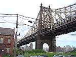
Queensboro Bridge |
|
000000001978-12-20-0000December 20, 1978
(#78001879) |
59th St.
40°45′26″N 73°57′22″W / 40.757222°N 73.956111°W / 40.757222; -73.956111 (Queensboro Bridge) |
New York |
|
| 109 |
R & S Building |
|
000000001986-09-22-0000September 22, 1986
(#86002683) |
492 First Ave. (@ 29th)
40°44′26″N 73°58′31″W / 40.740556°N 73.975278°W / 40.740556; -73.975278 (R & S Building) |
Kips Bay |
|
| 110 |
Racquet and Tennis Club Building |
|
000000001983-07-13-0000July 13, 1983
(#83001741) |
370 Park Ave. (@ 53rd)
40°45′31″N 73°58′25″W / 40.758611°N 73.973611°W / 40.758611; -73.973611 (Racquet and Tennis Club Building) |
New York |
Ornate private club; now a foil
|
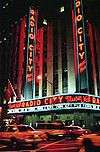
| 111 |
Radio City Music Hall |
|
000000001978-05-08-0000May 8, 1978
(#78001880) |
1260 Avenue of the Americas (50th and 6th)
40°45′36″N 73°59′03″W / 40.76°N 73.984167°W / 40.76; -73.984167 (Radio City Music Hall) |
New York |
Major live-entertainment venue since the 1920s; home to the Rockettes
|
| 112 |
Residences at 5-15 West 54th Street |
|
000000001990-01-04-0000January 4, 1990
(#89002260) |
5-15 W. 54th St.
40°45′42″N 73°58′35″W / 40.761667°N 73.976389°W / 40.761667; -73.976389 (Residences at 5-15 West 54th Street) |
New York |
|
| 113 |
Rockefeller Center |
|
000000001987-12-23-0000December 23, 1987
(#87002591) |
Bounded by Fifth Ave., W. Forty-eighth St., Seventh Ave., & W. Fifty-first St.
40°45′32″N 73°58′46″W / 40.758889°N 73.979444°W / 40.758889; -73.979444 (Rockefeller Center) |
New York |
Trend-setting urban office complex. Home to many NBC broadcasts. Setting and location for 2000s sitcom 30 Rock.
|
| 114 |
Bayard Rustin Residence |
Upload image |
000000002016-03-08-0000March 8, 2016
(#16000062) |
340 W. 28th St. (Building 7B Apartment 9J of Penn South)
40°44′56″N 73°59′52″W / 40.74887°N 73.99772°W / 40.74887; -73.99772 (Bayard Rustin Residence) |
New York |
Bayard Rustin, a civil rights activist who later came out and fought for gay rights, lived in this apartment building for most of his later life
|
| 115 |
St. Bartholomew's Church and Community House |
|
000000001980-04-16-0000April 16, 1980
(#80002719) |
109 E. 50th St.
40°45′26″N 73°58′25″W / 40.757222°N 73.973611°W / 40.757222; -73.973611 (St. Bartholomew's Church and Community House) |
New York |
|
| 116 |
St. George's Episcopal Church |
|
000000001976-12-08-0000December 8, 1976
(#76001249) |
E. 16th St. and Rutherford Place
40°44′04″N 73°59′06″W / 40.734444°N 73.985°W / 40.734444; -73.985 (St. George's Episcopal Church) |
New York |
|
| 117 |
St. Luke's Evangelical Lutheran Church |
|
000000002007-06-01-0000June 1, 2007
(#07000483) |
208 W. 46th St.
40°45′35″N 73°59′21″W / 40.759722°N 73.989167°W / 40.759722; -73.989167 (St. Luke's Evangelical Lutheran Church) |
New York |
|
| 118 |
St. Patrick's Cathedral Complex |
|
000000001976-12-08-0000December 8, 1976
(#76001250) |
Bounded by 5th and Madison Aves., E. 50th and E. 51st Sts.
40°45′31″N 73°58′35″W / 40.758611°N 73.976389°W / 40.758611; -73.976389 (St. Patrick's Cathedral Complex) |
New York |
|
| 119 |
St. Thomas Church and Parish House |
|
000000001980-04-09-0000April 9, 1980
(#80002722) |
1-3 W. 53rd St.
40°45′39″N 73°58′36″W / 40.760833°N 73.976667°W / 40.760833; -73.976667 (St. Thomas Church and Parish House) |
New York |
|
| 120 |
Salmagundi Club |
|
000000001974-07-25-0000July 25, 1974
(#74001275) |
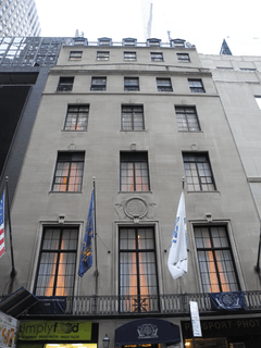
47 5th Ave.
40°44′03″N 73°59′00″W / 40.734167°N 73.983333°W / 40.734167; -73.983333 (Salmagundi Club) |
Kips Bay |
|
| 121 |
Margaret Sanger Clinic |
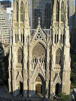
|
000000001993-09-14-0000September 14, 1993
(#93001599) |
17 W. 16th St.
40°44′17″N 73°59′39″W / 40.738056°N 73.994167°W / 40.738056; -73.994167 (Margaret Sanger Clinic) |
New York |
Workplace of birth control pioneer Margaret Sanger.
|
| 122 |
Scribner Building |
|
000000001980-05-06-0000May 6, 1980
(#80002715) |
153-157 5th Ave. (@ 21st)
40°44′25″N 73°59′27″W / 40.740278°N 73.990833°W / 40.740278; -73.990833 (Scribner Building) |
New York |
Known also as the Old Scribner Building. Note, Charles Scribner Building is different.
|
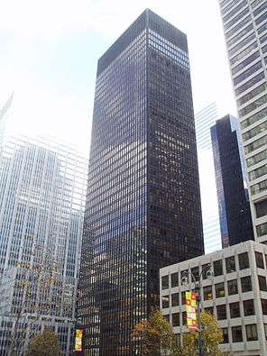
| 123 |
Seagram Building |
|
000000002006-02-24-0000February 24, 2006
(#06000056) |
375 Park Ave.
40°45′30″N 73°58′22″W / 40.758333°N 73.972778°W / 40.758333; -73.972778 (Seagram Building) |
New York |
Milestone modernist building by Ludwig Mies van der Rohe
|
| 124 |
Seville Hotel |
|
000000002005-02-24-0000February 24, 2005
(#05000088) |
22 East 29th St.
40°44′40″N 73°59′10″W / 40.744444°N 73.986111°W / 40.744444; -73.986111 (Seville Hotel) |
New York |
|
| 125 |
Sidewalk Clock at 200 5th Avenue, Manhattan |
|
000000001985-04-18-0000April 18, 1985
(#85000927) |
200 5th Ave.
40°44′30″N 73°59′24″W / 40.741667°N 73.99°W / 40.741667; -73.99 (Sidewalk Clock at 200 5th Avenue, Manhattan) |
New York |
|
| 126 |
Sidewalk Clock at 519 3rd Avenue, Manhattan |
|
000000001985-04-18-0000April 18, 1985
(#85000928) |
519 3rd Ave.
40°44′46″N 73°58′41″W / 40.746111°N 73.978056°W / 40.746111; -73.978056 (Sidewalk Clock at 519 3rd Avenue, Manhattan) |
New York |
No longer in location.
|
| 127 |
Sidewalk Clock at 522 5th Avenue, Manhattan |
|
000000001985-04-18-0000April 18, 1985
(#85000929) |
522 5th Ave.
40°45′16″N 73°58′50″W / 40.754444°N 73.980556°W / 40.754444; -73.980556 (Sidewalk Clock at 522 5th Avenue, Manhattan) |
New York |
|
| 128 |
Sniffen Court Historic District |
|
000000001973-11-28-0000November 28, 1973
(#73001224) |
E. 36th St., between Lexington and 3rd Aves.
40°44′51″N 73°58′40″W / 40.7475°N 73.977778°W / 40.7475; -73.977778 (Sniffen Court Historic District) |
New York |
|
| 129 |
Society for the Lying-In Hospital |
|
000000001983-09-01-0000September 1, 1983
(#83001746) |
305 2nd Ave. (@ 18th)
40°44′05″N 73°59′03″W / 40.734722°N 73.98416°W / 40.734722; -73.98416 (Society for the Lying-In Hospital) |
New York |
|
| 130 |
Stuyvesant Square Historic District |
|
000000001980-11-21-0000November 21, 1980
(#80002723) |
Roughly bounded by Nathan D. Perleman Pl., 3rd Ave., E. 18th and E. 15th Sts.
40°44′02″N 73°59′06″W / 40.733889°N 73.985°W / 40.733889; -73.985 (Stuyvesant Square Historic District) |
New York |
|
| 131 |
Substation 13 |
|
000000002006-02-09-0000February 9, 2006
(#06000026) |
225 W 53rd St.
40°45′50″N 73°59′03″W / 40.763889°N 73.984167°W / 40.763889; -73.984167 (Substation 13) |
New York |
|
| 132 |
Substation 42 |
|
000000002006-02-09-0000February 9, 2006
(#06000024) |
154 E. 57th St.
40°45′37″N 73°58′07″W / 40.760278°N 73.9685°W / 40.760278; -73.9685 (Substation 42) |
New York |
|
| 133 |
Ed Sullivan Theater |
|
000000001997-11-17-0000November 17, 1997
(#97001303) |
1697-1699 Broadway
40°45′49″N 73°59′00″W / 40.763611°N 73.983333°W / 40.763611; -73.983333 (Ed Sullivan Theater) |
New York |
|
| 134 |
Sutton Place Historic District |
|
000000001985-09-12-0000September 12, 1985
(#85002294) |
1-21 Sutton Pl. & 4-16 Sutton Sq.
40°45′28″N 73°57′57″W / 40.757778°N 73.965833°W / 40.757778; -73.965833 (Sutton Place Historic District) |
New York |
|
| 135 |
Theodore Roosevelt Birthplace National Historic Site |
|
000000001966-10-15-0000October 15, 1966
(#66000054) |
28 E. 20th St.
40°44′18″N 73°59′21″W / 40.738333°N 73.989167°W / 40.738333; -73.989167 (Theodore Roosevelt Birthplace National Historic Site) |
New York |
Birthplace of Theodore Roosevelt
|
| 136 |
Tiffany and Company Building |
|
000000001978-06-02-0000June 2, 1978
(#78001886) |
401 5th Ave., at 36th
40°45′00″N 73°58′53″W / 40.75°N 73.981389°W / 40.75; -73.981389 (Tiffany and Company Building) |
New York |
Former Tiffany's building
|
| 137 |
Samuel J. Tilden House |
|
000000001976-05-11-0000May 11, 1976
(#76001251) |
14-15 Gramercy Park South
40°44′15″N 73°59′14″W / 40.7375°N 73.987222°W / 40.7375; -73.987222 (Samuel J. Tilden House) |
New York |
Also known as "National Arts Club". Home of Tilden, winner of popular vote in disputed 1876 presidential election
|
| 138 |
Times Square Hotel |
|
000000001995-05-04-0000May 4, 1995
(#95000530) |
255 W. 43rd St.
40°45′28″N 73°59′22″W / 40.757778°N 73.989444°W / 40.757778; -73.989444 (Times Square Hotel) |
Times Square |
|
| 139 |
Times Square-42nd Street Subway Station |
|
000000002004-09-17-0000September 17, 2004
(#04001016) |
Junction of W. 42nd St. and Broadway/7th Ave.
40°45′19″N 73°59′15″W / 40.755278°N 73.987500°W / 40.755278; -73.987500 (Times Square-42nd Street Subway Station) |
Times Square |
Subway station (1 2 3 7 <7> N Q R W S trains)
|
| 140 |
Town Hall |
|
000000001980-04-23-0000April 23, 1980
(#80002724) |
113-123 W. 43rd St.
40°45′21″N 73°59′05″W / 40.755833°N 73.984722°W / 40.755833; -73.984722 (Town Hall) |
Midtown Manhattan |
Public-affairs media developed here with "America's Town Hall of the Air" radio program in 1930s. Has been host to many major artists as concert venue.
|
| 141 |
Trinity Chapel Complex |
|
000000001982-12-16-0000December 16, 1982
(#82001205) |
15 W. 25th St.
40°44′37″N 73°59′25″W / 40.743611°N 73.990278°W / 40.743611; -73.990278 (Trinity Chapel Complex) |
NoMad |
|
| 142 |
Tudor City Historic District |
|
000000001986-09-11-0000September 11, 1986
(#86002516) |
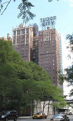
Roughly bounded by Forty-third St., First Ave., Forty-first St., and Second Ave.
40°44′56″N 73°58′17″W / 40.748889°N 73.971389°W / 40.748889; -73.971389 (Tudor City Historic District) |
Turtle Bay |
|
| 143 |
Turtle Bay Gardens Historic District |
|
000000001983-07-21-0000July 21, 1983
(#83001750) |
226-246 E. 49th St. and 227-245 E. 48th St.
40°45′15″N 73°58′13″W / 40.754167°N 73.970278°W / 40.754167; -73.970278 (Turtle Bay Gardens Historic District) |
Turtle Bay |
|
| 144 |
U.S. General Post Office |
|
000000001973-01-29-0000January 29, 1973
(#73002257) |
8th Ave. between 31st and 33rd Sts.
40°45′37″N 73°59′03″W / 40.760278°N 73.984167°W / 40.760278; -73.984167 (U.S. General Post Office) |
New York |
|
| 145 |
Union Square |
|
000000001997-12-09-0000December 9, 1997
(#97001678) |
Bounded by E 14th & E 17th Sts. and Union Square East & Union Square West
40°44′10″N 73°59′25″W / 40.736111°N 73.990278°W / 40.736111; -73.990278 (Union Square) |
New York |
Site of many political demonstrations over the years
|
| 146 |
United Charities Building Complex |
|
000000001985-03-28-0000March 28, 1985
(#85000661) |
105 E. 22nd St,. 289 Park Ave. S. and 111-113 E. 22nd St.
40°44′22″N 73°59′14″W / 40.739444°N 73.987222°W / 40.739444; -73.987222 (United Charities Building Complex) |
New York |
|
| 147 |
University Club |
|
000000001980-04-16-0000April 16, 1980
(#80002726) |
1 W. 54th St.
40°45′40″N 73°58′34″W / 40.761111°N 73.976111°W / 40.761111; -73.976111 (University Club) |
New York |
|
| 148 |
US Post Office-Madison Square Station |
|
000000001989-05-11-0000May 11, 1989
(#88002364) |
149-153 E. 23rd St.
40°44′23″N 73°59′04″W / 40.739722°N 73.984444°W / 40.739722; -73.984444 (US Post Office-Madison Square Station) |
Gramercy Park |
|
| 149 |
US Post Office-Old Chelsea Station |
|
000000001989-05-11-0000May 11, 1989
(#88002365) |
217 W. 18th St.
40°46′07″N 73°59′56″W / 40.768611°N 73.998889°W / 40.768611; -73.998889 (US Post Office-Old Chelsea Station) |
Chelsea |
|
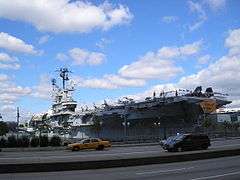
| 150 |
USS INTREPID (aircraft carrier) |
|
000000001986-01-14-0000January 14, 1986
(#86000082) |
Intrepid Sq., 45th and West Side Highway
40°45′51″N 73°59′59″W / 40.764167°N 73.999722°W / 40.764167; -73.999722 (USS INTREPID (aircraft carrier)) |
New York |
|
| 151 |
Villard Houses |
|
000000001975-09-02-0000September 2, 1975
(#75001210) |
29½ 50th St., 24-26 E. 51st St., and 451, 453, 455, and 457 Madison Ave.
40°45′29″N 73°58′31″W / 40.758056°N 73.975278°W / 40.758056; -73.975278 (Villard Houses) |
New York |
|
| 152 |
Webster Hotel |
|
000000001984-09-07-0000September 7, 1984
(#84002806) |
40 W. 45th St.
40°45′22″N 73°58′56″W / 40.756111°N 73.982222°W / 40.756111; -73.982222 (Webster Hotel) |
New York |
|
| 153 |
West 28th Street Subway Station (Dual System IRT) |
|
000000002005-03-30-0000March 30, 2005
(#05000235) |
Seventh Ave. bet. West 26th and West 29th Sts.
40°44′48″N 73°59′39″W / 40.746667°N 73.994167°W / 40.746667; -73.994167 (West 28th Street Subway Station (Dual System IRT)) |
Chelsea |
Subway station (1 2 trains)
|
| 154 |
R. C. Williams Warehouse |
|
000000002005-02-24-0000February 24, 2005
(#05000086) |
259-273 Tenth Ave.
40°44′57″N 74°00′14″W / 40.749167°N 74.003889°W / 40.749167; -74.003889 (R. C. Williams Warehouse) |
New York |
|
| 155 |
Women's National Republican Club |
|
000000002013-02-27-0000February 27, 2013
(#13000040) |
3 W. 51st St.
40°45′34″N 73°58′39″W / 40.759562°N 73.97744°W / 40.759562; -73.97744 (Women's National Republican Club) |
New York |
Georgian home of early women's political organization |


.jpg)


.jpg)