National Register of Historic Places listings in Lauderdale County, Mississippi
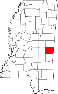
Location of Lauderdale County in Mississippi
This is a list of the National Register of Historic Places listings in Lauderdale County, Mississippi.
This is intended to be a complete list of the properties and districts on the National Register of Historic Places in Lauderdale County, Mississippi, United States. Latitude and longitude coordinates are provided for many National Register properties and districts; these locations may be seen together in a map.[1]
There are 46 properties and districts listed on the National Register in the county. Another 7 properties were once listed but have been removed.[2]
- This National Park Service list is complete through NPS recent listings posted December 16, 2016.[3]
Current listings


Former listings
| [4] | Name on the Register | Image | Date listed | Date removed | Location | City or town | Summary |
|---|---|---|---|---|---|---|---|
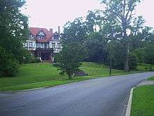
| 1 | Dial House | Upload image | (#79003388) | 1003 30th Ave. 32°22′00″N 88°42′32″W / 32.366667°N 88.708889°W |
Meridian | ||
| 2 | Dixie Gas Station |  |
(#79003389) | |
Meridian | Demolished in 1986.[6] | |
| 3 | Gulf, Mobile & Ohio Freight Depot | Upload image | (#79003392) | 20 22nd Ave. |
Meridian | Destroyed by fire on June 10, 1985.[7] | |
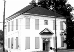
| 4 | Meridian Baptist Seminary | Upload image | (#79001326) | 16th St. and 31st Ave. |
Meridian | Destroyed by fire in 2007.[8] | |
| 5 | Meyer-Loeb Building | Upload image | (#79003398) | 2100 4th St. |
Meridian | Demolished in 1980.[9] | |
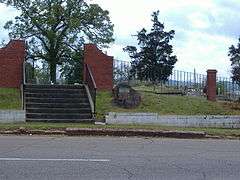
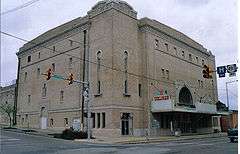
| 6 | Scottish Rite Cathedral | Upload image | (#79003404) | 1101 23rd Ave. |
Meridian | Destroyed by fire on March 20, 1985.[10] | |
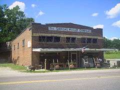
| 7 | Suttle Building | Upload image | (#79003406) | 801 22nd Ave. |
Meridian | Demolished in February 1999.[11] |
See also
| Wikimedia Commons has media related to National Register of Historic Places in Lauderdale County, Mississippi. |
- List of National Historic Landmarks in Mississippi
- National Register of Historic Places listings in Mississippi
References
- ↑ The latitude and longitude information provided in this table was derived originally from the National Register Information System, which has been found to be fairly accurate for about 99% of listings. For about 1% of NRIS original coordinates, experience has shown that one or both coordinates are typos or otherwise extremely far off; some corrections may have been made. A more subtle problem causes many locations to be off by up to 150 yards, depending on location in the country: most NRIS coordinates were derived from tracing out latitude and longitudes off of USGS topographical quadrant maps created under the North American Datum of 1927, which differs from the current, highly accurate WGS84 GPS system used by most on-line maps. Chicago is about right, but NRIS longitudes in Washington are higher by about 4.5 seconds, and are lower by about 2.0 seconds in Maine. Latitudes differ by about 1.0 second in Florida. Some locations in this table may have been corrected to current GPS standards.
- ↑ National Park Service (2009-03-13). "National Register Information System". National Register of Historic Places. National Park Service.
- ↑ "National Register of Historic Places: Weekly List Actions". National Park Service, United States Department of the Interior. Retrieved on December 16, 2016.
- 1 2 Numbers represent an ordering by significant words. Various colorings, defined here, differentiate National Historic Landmarks and historic districts from other NRHP buildings, structures, sites or objects.
- ↑ The eight-digit number below each date is the number assigned to each location in the National Register Information System database, which can be viewed by clicking the number.
- ↑ National Register of Historic Places: Nomination form for Dixie Gas Station (#79003389). National Park Service.
- ↑ National Register of Historic Places: Nomination form for Gulf, Mobile & Ohio Freight Depot (#79003392). National Park Service.
- ↑ "Cause of Seminary Fire "Undetermined"". Meridian, Mississippi: WTOK-TV.com. October 24, 2007. Retrieved 2010-07-18.
- ↑ National Register of Historic Places: Nomination form for Meyer-Loeb Building (#79003398). National Park Service.
- ↑ "Letter from Kenneth H. P'Pool, Deputy State Historic Preservation Officer, to Carol D. Shull, Chief of Registration for the National Register". May 11, 1987.
The properties listed below no longer exist and have been recommended by the Mississippi State Professional Review Board for delisting from the National Register of Historic Places: [...] Scottish Rite Cathedral. 1101 23rd Avenue, Meridian, Lauderdale County. Listed 12/18/1979. Destroyed by fire 3/20/1985
Attached is the original National Register of Historic Places nomination form for Scottish Rite Cathedral (#79003404), including one image (January 1979). Jody Cook (February 1979). National Park Service. - ↑ National Register of Historic Places: Nomination form for Suttle Building (#79003406). National Park Service.
| Topics | |
|---|---|
| Lists by states |
|
| Lists by insular areas | |
| Lists by associated states | |
| Other areas | |
| |
Municipalities and communities of Lauderdale County, Mississippi, United States | ||
|---|---|---|
| Cities | | |
| Towns | ||
| CDPs | ||
| Other unincorporated communities |
| |
This article is issued from Wikipedia - version of the 5/21/2016. The text is available under the Creative Commons Attribution/Share Alike but additional terms may apply for the media files.