Nanpara
| Nanpara | |
|---|---|
| City | |
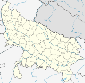 Nanpara  Nanpara Location in Uttar Pradesh, India | |
| Coordinates: 27°52′N 81°30′E / 27.87°N 81.5°ECoordinates: 27°52′N 81°30′E / 27.87°N 81.5°E | |
| Country | India |
| State | Uttar Pradesh |
| District | Bahraich |
| Government | |
| • Body | Nanpara Nagar Palika Parishad |
| • MP | Savitri Bai Phule (BJP) |
| • Mayor | Abdul Waheed |
| Area | |
| • Total | 36 km2 (14 sq mi) |
| Elevation | 132 m (433 ft) |
| Population (2011)[1] | |
| • Total | 48,337 |
| • Density | 1,300/km2 (3,500/sq mi) |
| Time zone | IST (UTC+5:30) |
| Postal Code | 271865 |
| Area code(s) | 05253 |
| Vehicle registration | UP-40 |
| Website |
nnpnanpara |
Nanpara is a city and a municipal board in Bahraich district in the Indian state of Uttar Pradesh. It is a region along the Nepal Border and includes tracts of dense forests.It is a city surrounded by large number of villages.
Geography
Nanpara is located at 27°52′N 81°30′E / 27.87°N 81.5°E.[2] It has an average elevation of 132 metres (433 feet). It is located at 20 km from the Indo-Nepal border, and 36 km from the district Bahraich. This town has a strategic and economic importance due to the transportation of goods in Nepal and recent activities of drugs, crossing through the Nepal border. It has a municipality also. It is well connected by road transport and Railway.It is connected to Lucknow and Nepal via 4-lane NH 28C highway.
Demographics
As of 2001 India census,[3] Nanpara had a population of 48,337. Males constitute 53% of the population and females 47%. Nanpara has an average literacy rate of 50%, lower than the national average of 59.5%: male literacy is 78%, and female literacy is 89%. In Nanpara, 18% of the population is under 6 years of age.
History
The Nanpara Taluqdari
The Nanpara Taluqdari was one of the taluqdaris (feudatory states) in British India.[4] The title of "Raja" was conferred on the Nanpara House in 1763 by the Nawab Shuja-ud-Daula, the King of Oudh and has then recognized by British.[5] With holding of 439 villages it was the largest Muslim taluqdars (landowners) in British India.
Nanpara was an important frontier estate, bordering Nepal territory in the Bahraich district of Oudh. Of the 439 villages, 438 were in the Bahriach district and one in the Barabanki district. It comprised an area of 468 sq miles, or about the same area of the then former German principality of Lippe. In 1914-15 The gross rental of the estate amounted to over rupees 12,00,000 and the government demanded land revenue and cesses of rupees 2,80,000. Taking a population of 350 person per sq miles [it was estimated that was the district average in the census of 1911] the estate contained a population of over 154,000.[6]
In 1632, Rasul Khan a pathan received a commission from the Emperor to subdue the Banjaras; and obtained for his services and for the pay of his troops, the grant of Nanpara and four other villages in pargana Solonabad, in addition to one-tenth of the rent of the this disturbed territory. Rasul Khan lived at Kummaria in Bundi, and both him and his son Jahan Khan, who succeeded him, are buried there. Jahan Khan's successor, Mohammad Khan, was the first to settle in Nanpara. Mohammad Khan's son and successor, Karam Khan, was so successful against the Banjaras that he gained amongst the country folk the title of Raja, which was confirmed by Nawab of Oudh Shuja-ud-Daula in 1763, and was recognised as hereditary by the then British Government of India in 1877.[7] This was because of the fact that this area was home to the Nanpara and Utraula principalities, both of which are now situated in Bahraich and Balrampur District, which was the centre of the largest Pathan settlement outside Rohilkhand.
Main localities
- Kayasth Tola
- Raja Masjid
- Raja Bazaar
- Raja Kothi
- Siphon (Saryu Nahar)
- Purani Bazaar (South)
- Purani Bazaar (North)
- Qila
- Station Bazaar
- Kababchi Gali
- Kasai Mandi
- Gandhi Park
- Sabji Mandi
- Galla Mandi
- Phal Mandi
- Chikwa Mohalla
- Choori Wali Gali
- Bara Mohalla
- Imamgunj Chauraha
- Bhopatpur
- Aastana of Mufti-e-Nanpara
- Kaali Kunda
- Jubligunj (North)
- Jubligunj (South)
- Kasgar Tola
- Hasangunj
- Kayasth Tola
- Radhan Tola
- Meharban Nagar
- Cheeni Mill
- Eidgah
- Patel Nagar (radhan Tola
- Miryasi Tola
- Bhisti Tola
- Ghosi Tola
- Ghasyari Tola
- Imambara
- Purani Tehseel
- New Tehseel
- Banjaaran Taada
- Bypass (Katarniya road)
- Bypass (Nawabgunj road)
- Bypass (Bahraich road)
- Kavi Nagar
- Meherbaan Nagar (East)
- Meherbaan Nagar (West)
- 5 no. Tubewell
- Dagra No.1
- Dagra No.2
- Colony No.1
- Colony No.2
- Colony No.3
- Bawarchi Tola
Tourism
Nanpara is an important junction connecting key areas of the region. Its geographic location provides an international role. The India-Nepal road to the Rupadiha-Nepalganj border lies towards the north. The east-bound road connects the region with G.T Road via Sitatpur. In the south-east roads connect to the district capital Bahraich and a prominent place called Srawasti. The state capital Lucknow is about 160 km from Nanpara via Bahraich. A well-known national park in India, Dudhwa, is about 100 km from Nanpara Junction. Dudhwa is recognized as the second most populated tiger reserve in India. There is also a bird sanctuary and fauna-rich dense forests near Nanpara.
Major tourist attractions:
- Dargah Sayyad Salaar Masood Ghazi (situated in Bahraich,holds a fair for 4 months)
- Raja Kothi (Nawab Saadat Ali Palace)
- Saryu Nahar
- Dargah Gaushiya
- Katerniaghat Wildlife Sanctuary (40 km)
- Jama Masjid Mohalla Qila Nanpara
- Dudhwa National Park (120 km)
- Kakraha Rest House (25 km)
- Motipur Forest Range (16 km)
- Jamunha, Nepal (18 km)
- Mata Bageshwari temple (18 km in Nepal)
- Duggu village (Archaeological survey of India) Recent findings indicate that Mughal coin making factory was present
- Sailani Peer Baba Majar (15 km)
- Maharaja Agarasen Mela (held in Bahraich to celebrate valour and bravery of his rule)
- Buddha Enlightenment Temple (65 km,situated in Shravasti)
- Pattan Devi Mata Mandir (70 km,situated in Balrampur)
- Sahet Mahet City (65 km,situated in Shravasti)
- Daku Angulimal Cave(65 km,situated in Shravasti)
- Risiya Ecological Park (20 km)
- Dargha Kherullah Sha Baba Nanpara
- Dargha Pipar Sha Baba Nanpara
- Al Mazma ur Razvi, Razvi Manzil Nanpara Shareef
- Khanquah E RazBiya (Mufti E Nanpara)
Education
ICSE & ISC
- St. Peter Inter College (SPIC)
CBSE
- St. Michael School
- Reaan International public School
- Dada Public School
- Pioneer Group of College
- St.Francis Xavier School
U.P. Board
- Rahat Janta Inter College
- Sri Shankar Inter College
- Saadat Inter College
- Saraswati Vidya
- Sundar Sishu Mandir
- sunder shishu mandir j h school
- Pioneer Montessori School
- Mazdoor Montessori School
- J.P. Girls Inter College
- Vaidh Bhagwan Deen Girls Inter College
- Iqra Public School
- DADA PUBLIC SCHOOL(E-LEARING)
Islamic and madarsas
- Madarsa Azizul Uloom
- Madarsa Misbahul Uloom
- Madrasa khairul Uloom
- Madrasa Bahrul Uloom
- Madrasa Kashiful Uloom
- Madrasa Faizul Uloom
Degree colleges
- Mithlesh Nandini Reshma Arif degree college (MNRA), Nanpara
- Ameer Hasan Farooqui Masoodiya mubaraka degree college, Nanpara
- Seemant Degree College, Rupaidiha
- Lord buddha p.g. College, Rupaidiha
Other institutes
- Unique Computer Institute
- SIIT Computer Institute
- Vision Computer Institute
- Global Computer Institute Nanpara Mobile No. 8808412627, 8004352661
- AIM Career Avenues
- Dr. A.R. Kidwai Public School
- Unique Montessori School
- Alvi Montessori School
- Sir Syed Public School
- National Montessori School
- Soft Petal Academy
- Soman life Public School
- Dayanand Sisu Mandir School
- Sapling Public School
- Lucknow Public School
- St. John School
- Pioneer Computer Institute
- Little flower mantessori school kamchiyara
Internet
The city has broadband internet connectivity and video conferencing facilities. Major companies like Sify, BSNL, Bharti Airtel, Reliance Communications, Tata Communications, Aircel have a wide infrastructure to provide broadband Internet. The city has both 2G and 3G network facilities with minimum 50 towers with upcoming 4G towers.
References
- ↑ "Census of India Search details". censusindia.gov.in. Retrieved 10 May 2015.
- ↑ Falling Rain Genomics, Inc - Nanpara
- ↑ "Census of India 2011: Data from the 2001 Census, including cities, villages and towns (Provisional)". Census Commission of India. Archived from the original on 2004-06-16. Retrieved 2008-11-01.
- ↑ The Feudatory and zemindari India, Volume 17, Issue 2. 1937. Retrieved 4 August 2014.
- ↑ The Indian Year Book, Volume 29. Bennett, Coleman & Company. 1942. p. 1286. Retrieved 6 August 2014.
- ↑ Survey of The Kingdom of Oudh (East India Collection folio 3 ed.). London: Oriental & India collection.
- ↑ Blue book on Oudh. 1856. pp. 6, 8 and Appendix B.
Further reading
- Ghoshal, Benöd Chandra (1918). Some Notes on Raj Nanpara, Or, the Tragic Story of the Premier Mohamedan Estate in Oudh. Anglo-Oriental Press.