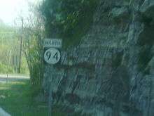
New Jersey Route 94
| |||||||
|---|---|---|---|---|---|---|---|
| 94th Infantry Division Memorial Highway | |||||||
 | |||||||
| Route information | |||||||
| Maintained by NJDOT and DRJTBC | |||||||
| Length: | 45.94 mi[1] (73.93 km) | ||||||
| Existed: | 1953 (1927 as Route 8) – present | ||||||
| Major junctions | |||||||
| South end: | Portland–Columbia Toll Bridge in Knowlton | ||||||
|
| |||||||
| North end: |
| ||||||
| Location | |||||||
| Counties: | Warren, Sussex | ||||||
| Highway system | |||||||
| |||||||

Route 94 is a state highway in the northwestern part of the New Jersey, United States. It runs 45.94 mi (73.93 km) from the Portland–Columbia Toll Bridge over the Delaware River in Knowlton Township, Warren County, where it connects to Pennsylvania Route 611 (PA 611), northeast to the New York state line in Vernon Township, Sussex County. At the New York border, New York State Route 94 (NY 94) continues to Newburgh, New York. Route 94 is mostly a two-lane undivided road that runs through mountain and valley areas of Warren and Sussex counties, serving Columbia, Blairstown, Newton, and Hamburg. The route intersects several roads, including U.S. Route 46 (US 46) and Interstate 80 (I-80) in Knowlton Township, US 206 in Newton, Route 15 in Lafayette Township, and Route 23 in Hamburg.
What is now Route 94 was legislated as part of two separate routes in 1927. The portion of road between Route 6/US 46 near the Delaware Bridge to Newton became Route 8, while the route north of Newton to the New York border became a part of Route 31. Prior to 1953, the only portion of Route 31 north of Newton that was a state highway was between North Church and Hamburg. In 1953, Route 94 was designated to replace all of Route 8 as well as Route 31 north of Newton; the number was chosen to match NY 94. After the Portland–Columbia Toll Bridge and the Delaware Water Gap Toll Bridge were both completed in December 1953, the southern terminus of Route 94 was cut back to an intersection with US 611 in Columbia, which had been rerouted into New Jersey across both bridges, following a freeway between Columbia and the Delaware Water Gap Toll Bridge that would later become a part of I-80. The former alignment of Route 94 between the Delaware Bridge and the Portland–Columbia Toll Bridge became a part of US 46. By 1969, US 611 was routed out of New Jersey, and Route 94 was extended to the state line on the Portland–Columbia Toll Bridge. Through the 1960s and 1970s, a freeway was proposed for the Route 94 corridor. This freeway, proposed to be a part of the Interstate Highway System, was never built.
Route description
Warren County
Route 94 begins at the two-lane undivided Portland–Columbia Toll Bridge over the Delaware River in Knowlton Township, where it connects to PA 611 on the Pennsylvania side of the river. This bridge is maintained by the Delaware River Joint Toll Bridge Commission; the rest of Route 94 is maintained by the New Jersey Department of Transportation (NJDOT). Immediately after the bridge, the route comes to a large interchange with the western terminus of US 46 as well as with I-80 a short distance later, near the community of Columbia.[1][2] In the area of the US 46/I-80 interchange, the directions of Route 94 split, carrying two lanes in each direction.[1]
From here, the route becomes a two-lane undivided road that continues northeast through a mix of woods and farms with some development, passing under the abandoned Lackawanna Cut-Off. After passing through the community of Hainesburg, the road turns more to the east and enters Blairstown Township. Route 94 turns northeast before reaching the community of Blairstown, where the road continues east past some development before intersecting CR 521. It forms a short wrong-way concurrency with that route, along which it crosses the Paulins Kill. A short distance later, Route 94 enters Frelinghuysen Township, passing through more rural surroundings.[1][2] The road turns northeast through the community of Marksboro before heading east again. After the intersection with CR 661, Route 94 makes a sharp turn to the north-northeast.[2]
Sussex County
The route continues into Sussex County at Fredon Township, heading through rural areas.[1][2] The road turns more to the northeast as a two-lane road before heading east again and entering Newton.[1] Here, Route 94 becomes High Street and passes several homes, intersecting CR 519. CR 519 forms a concurrency with Route 94 and the two routes continue to downtown Newton.[1][2] In the downtown area, the road comes to the Park Place square, where it meets US 206. At this point, all three routes run concurrent north on four-lane undivided Water Street for a short distance.[1] CR 519 splits from the road by turning north on Mill Street, while US 206 and Route 94 continue north as a three-lane road with a center left-turn lane, where a shopping district lines the road as it leaves Newton for Hampton Township.[1][2] The road narrows back to two lanes as it heads into areas of farmland.[2] Route 94 splits from US 206 by making a right turn to continue east.[1]

The road passes a mobile home park before making a turn northeast and heading into Lafayette Township.[1][2] In Lafayette Township, the route resumes to the east through a mix of rural and industrial areas.[2] The road continues to a junction with Route 15, where Route 94 makes a right turn to head southeast along Route 15 in a wrong way concurrency.[1] Upon splitting, Route 15 stays straight and heads southeast as Route 94 turns at a right hand reverse jughandle to head northeast. Route 94 continues through more rural areas with occasional development and enters Sparta Township, where it is known as North Church Road. Here, the road passes near some residential developments before continuing into Hardyston Township. In Hardyston Township, the route runs through the community of North Church.[1][2] After making a sharp turn to the east, Route 94 enters Hamburg and becomes Vernon Avenue.[1] The route passes a few homes before intersecting Route 23 in the center of town. From this intersection, the route makes a turn to the northeast before leaving the town and heading back into Hardyston Township. The road passes rural developed areas before entering Vernon Township.[1][2]
At this point, the surroundings become more wooded and mountainous as the road passes near residential areas and reaches the community of McAfee.[2] In McAfee, CR 517 intersects with Route 94 and the two routes head east for a short wrong way concurrency, crossing the New York, Susquehanna and Western Railway before CR 517 turns to the south.[1] Route 94 continues northeast as McAfee Vernon Road, briefly becoming a divided highway as it passes the entrance to the Mountain Creek ski resort.[2] Continuing northeast, the route comes to an intersection with CR 515, which it runs concurrent with on Vernon Warwick Road.[1] The two routes continue north, with CR 515 splitting from Route 94 a short distance after crossing the Appalachian Trail. From here, Route 94 continues through more countryside before reaching the New York state line, where the road continues into that state as NY 94.[1][2]
History

In the 1927 renumbering of state highways, Route 8 was defined to run along present-day Route 94 from Route 6 (current US 46) at the Delaware Bridge north to Columbia before turning northeast to Route 31 (now U.S. Route 206) in Newton. Past Newton, Route 31 continued northeast to the New York state line (current US 206 north of here was Route S31). In the original version of the renumbering bill, Route 31 was to reach the border via Sussex, incorporating pre-1927 Route 8 (now Route 284) from Sussex to the state line.[3][4] However, in the final version, Route 31 ran via Hamburg, using the same alignment as a planned spur of pre-1927 Route 8 from Lafayette to North Church.[5] Route 8 was eventually taken over by the state. On the other hand, by 1949, only one section of Route 31 north of the Route S31 split had been taken between North Church to Hamburg.[6]
.svg.png)
In the 1953 renumbering, Route 8 was renumbered to Route 94, which was extended northeast past Newton along former Route 31 to the New York state line, matching NY 94 across the border. It was initially only marked south of Hamburg, as none of the route north of Hamburg was state-maintained.[7][8] Originally, Route 94 began at the now razed Delaware Bridge, where US 46 would cross into Pennsylvania. Route 94 would wind right and north-east a few to Columbia, where it joined its current route.[8] In December 1953, both the Portland–Columbia Toll Bridge and Delaware Water Gap Toll Bridge opened.[9][10] That year a section of Old Mine Road was rebuilt and aligned as a four lane freeway between Columbia and the Delaware Water Gap Toll Bridge.[11] Following this, US 46 was rerouted over the first several miles of Route 94 between the Delaware Bridge and Columbia, and Route 94 was cut back to Columbia, near the Portland-Columbia Toll Bridge. Here, US 46 would end and US 611, would cross the Portland-Columbia Toll Bridge from Pennsylvania and follow the freeway north to the Delaware Water Gap Toll Bridge. The freeway portion that US 611 followed became a part of I-80 in 1959.[12] When US 611 was removed from New Jersey by 1969, Route 94 was extended to the state line on the Portland-Columbia Toll Bridge. Also by this time, the unsigned portions of Route 94 north of Newton were signed.[13] In 1973, this whole area was realigned into a complex interchange as the New Jersey portion of Interstate 80 was completed.[14]
In 1964, a Route 94 freeway was proposed to run from I-80 in Netcong north to the planned Route 23 freeway in Hamburg, following US 206 north to Newton and current Route 94 to Hamburg.[15] In the late 1960s, the NJDOT planned for the Route 94 freeway to run from I-80/US 46 in Columbia northeast to the New York border near Wawayanda State Park.[16] The NJDOT hoped to get funding for the freeway in 1970 for it to become an Interstate highway as it was planned to serve a proposed national recreation area along the Delaware River that would have been built in conjunction with the controversial Tocks Island Dam project. This proposed Interstate, which was to run from I-80 in Hope Township to I-84 in Port Jervis and continue northeast along US 209, was denied funding.[17][18] After reviewing the proposal again in 1972, the NJDOT determined that the freeway would cost $96 million. It was eventually canceled due to environmental concerns and financial constraints.[19]
Major intersections
| County | Location | mi[1] | km | Destinations | Notes |
|---|---|---|---|---|---|
| Northampton | Portland | 0.00 | 0.00 | Pennsylvania border, southern terminus | |
| Delaware River | 0.00 | 0.00 | Portland–Columbia Toll Bridge (Southbound toll, cash or E-ZPass) | ||
| Warren | Knowlton Township | 0.12 | 0.19 | Interchange | |
| 0.47 | 0.76 | Exit 4C (I-80) | |||
| Blairstown Township | 9.12 | 14.68 | South end of CR 521 overlap | ||
| 9.43 | 15.18 | North end of CR 521 overlap | |||
| Sussex | Newton | 22.16 | 35.66 | South end of CR 519 overlap | |
| 22.47 | 36.16 | South end of US 206 overlap | |||
| 22.55 | 36.29 | North end of CR 519 overlap | |||
| Hampton Township | 24.91 | 40.09 | North end of US 206 overlap | ||
| Lafayette Township | 27.70 | 44.58 | South end of NJ 15 overlap | ||
| 28.00 | 45.06 | North end of NJ 15 overlap | |||
| Hamburg | 35.61 | 57.31 | |||
| Vernon Township | 38.23 | 61.53 | South end of CR 517 overlap | ||
| 38.62 | 62.15 | North end of CR 517 overlap | |||
| 41.76 | 67.21 | South end of CR 515 overlap | |||
| 43.97 | 70.76 | North end of CR 515 overlap | |||
| 45.94 | 73.93 | New York border, northern terminus | |||
1.000 mi = 1.609 km; 1.000 km = 0.621 mi
| |||||
See also
 U.S. Roads portal
 New Jersey portal
References
- 1 2 3 4 5 6 7 8 9 10 11 12 13 14 15 16 17 18 19 "Route 94 straight line diagram" (PDF). New Jersey Department of Transportation. Retrieved 2007-04-09.
- 1 2 3 4 5 6 7 8 9 10 11 12 13 14 Google (2009-11-18). "overview of New Jersey Route 94" (Map). Google Maps. Google. Retrieved 2009-11-18.
- ↑ State of New Jersey, Laws of 1927, Chapter 319.
- ↑ 1927 New Jersey Road Map (Map). State of New Jersey. Retrieved 2008-10-08.
- ↑ Road Map of New York (Map). Cartography by Standard Oil Company. Socony. 1931.
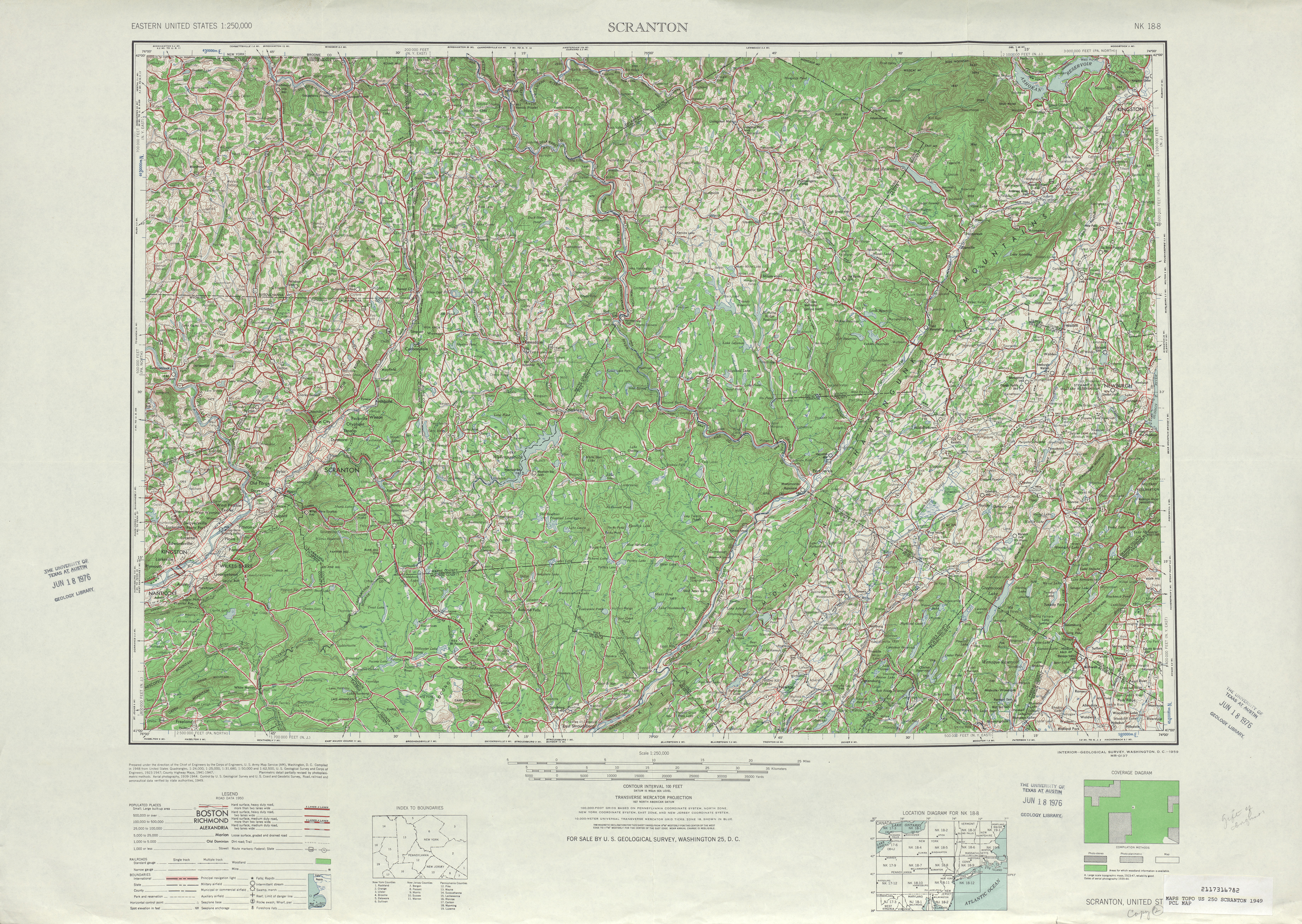
- ↑ Scranton, Pennsylvania 1:250,000 quadrangle (Map). United States Geological Survey. 1949. Retrieved 2009-11-19.
- ↑ 1953 renumbering, New Jersey Department of Highways, retrieved 2009-07-31
- 1 2 "New Road Signs Ready in New Jersey". The New York Times. 1952-12-16. Retrieved 2009-07-20.
- ↑ "Portland-Columbia Toll Bridge". Delaware River Joint Toll Bridge Commission. Retrieved 2009-11-19.
- ↑ "Delaware Water Gap Toll Bridge". Delaware River Joint Toll Bridge Commission. Retrieved 2009-11-19.
- ↑ "New Span Crosses Delaware River; Fine, Driscoll at Ceremonies for Water Gap Bridge -- Road to Link Poconos and New York". The New York Times. December 17, 1953. p. 51.
- ↑ Pennsylvania State Transportation (PDF) (Map). PennDOT. 1960. § 1. Retrieved 2010-01-15.
- ↑ Map of New Jersey (Map). Cartography by H.M. Gousha. Chevron Oil Company. 1969.
- ↑ "Missing Link of I-80 Opened in Ceremony Near Columbia". The New York Times. November 9, 1973.
- ↑ "Expressway Plans". Regional Plan Association News. May 1964.
- ↑ New Jersey Highway Facts. New Jersey Department of Transportation. 1969.
- ↑ Report on the Status of the Federal-Aid Highway Program. U.S. Senate Committee on Public Works. 1970.
- ↑ "Interstate 80-84 Links Opposed". The New York Times. November 27, 1972.
- ↑ Master Plan for Transportation. New Jersey Department of Transportation. 1972.
External links
| Wikimedia Commons has media related to New Jersey Route 94. |
- Expanded view of road jurisdiction in the area near the southern terminus of NJ 94 in Knowlton Township
- Expanded view of road jurisdiction in the area of the confluence of NJ 94 and US 206 in Newton
- New Jersey Highway Ends – 94
- Speed Limits for State Roads: Route 94