N'Délé
| N'Délé | |
|---|---|
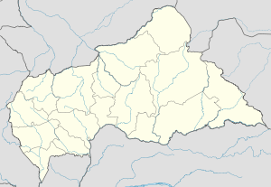 N'Délé Location in Central African Republic | |
| Coordinates: 8°24′33″N 20°39′11″E / 8.40917°N 20.65306°ECoordinates: 8°24′33″N 20°39′11″E / 8.40917°N 20.65306°E | |
| Countrey |
|
| Prefecture | Bamingui-Bangoran |
| Population (2013) | |
| • Total | 13,704 |
N'Délé or Ndele is a market town and sub prefecture in the north eastern Central African Republic, lying east of the Bamingui-Bangoran National Park. Ndélé is the capital of Bamingui-Bangoran, one of the 14 prefectures of the Central African Republic. N'Délé had a population of 10,850 as of the 2003 census; and a calculated 2013 population of 13,704.[1]
The tata, or fortified wall, creates a citadel-like palace on a hill overlooking N'Délé. It was constructed at the behest of Sultan Mohammed al-Sanussi in the late 19th Century.[2] N'Délé, the tata, and the Kaga-Kpoungouvou Caves were collectively added to the UNESCO World Heritage Tentative List on April 11, 2006 in the Cultural category.[2] There is an airport in the city. When the fighting resumed in December 2012 between the FACA loyalists and the rebel coalition of Séléka, the city fell to rebel forces.[3][4]
Climate
N'Délé has a tropical savanna climate (Köppen climate classification Aw).
| Climate data for N'Délé | |||||||||||||
|---|---|---|---|---|---|---|---|---|---|---|---|---|---|
| Month | Jan | Feb | Mar | Apr | May | Jun | Jul | Aug | Sep | Oct | Nov | Dec | Year |
| Average high °C (°F) | 36.5 (97.7) |
37.8 (100) |
38.5 (101.3) |
37.0 (98.6) |
34.6 (94.3) |
31.8 (89.2) |
30.4 (86.7) |
29.4 (84.9) |
30.5 (86.9) |
31.7 (89.1) |
33.3 (91.9) |
34.7 (94.5) |
33.85 (92.93) |
| Daily mean °C (°F) | 27.2 (81) |
29.4 (84.9) |
30.1 (86.2) |
30.0 (86) |
28.6 (83.5) |
26.7 (80.1) |
25.4 (77.7) |
25.4 (77.7) |
25.4 (77.7) |
25.9 (78.6) |
25.8 (78.4) |
25.1 (77.2) |
27.08 (80.75) |
| Average low °C (°F) | 18.0 (64.4) |
20.7 (69.3) |
21.3 (70.3) |
22.9 (73.2) |
22.6 (72.7) |
21.2 (70.2) |
20.7 (69.3) |
21.3 (70.3) |
20.4 (68.7) |
20.1 (68.2) |
18.5 (65.3) |
16.2 (61.2) |
20.33 (68.59) |
| Average precipitation mm (inches) | 0 (0) |
6 (0.24) |
24 (0.94) |
65 (2.56) |
122 (4.8) |
151 (5.94) |
205 (8.07) |
235 (9.25) |
231 (9.09) |
131 (5.16) |
9 (0.35) |
0 (0) |
1,179 (46.4) |
| Mean monthly sunshine hours | 279 | 263 | 250 | 209 | 222 | 189 | 160 | 151 | 157 | 201 | 277 | 268 | 2,626 |
| Source #1: Normales et records pour la période 2002-2013 à N'Dele ,[5] | |||||||||||||
| Source #2: Climate : N'Délé for rainfall totals ,[6] Étude méthodologique pour l'utilisation des données climatologiques de l'Afrique tropicale for sunshine hours[7] | |||||||||||||
References
- ↑ "Central African Republic: largest cities and towns and statistics of their population". World Gazetteer. Archived from the original on 11 January 2013. Retrieved 30 March 2013.
- 1 2 "Le Tata (palais fortifié) du Sultan Sénoussi, les grottes de Kaga-Kpoungouvou, la ville de Ndélé". UNESCO World Heritage Centre. Retrieved 30 March 2013.
- ↑ "Centrafrique: Bangui sous la menace des rebelles" (in French). Le Figaro. 26 December 2012. Retrieved 30 March 2013.
- ↑ "La France n'est pas en Centrafrique pour y protéger «un régime" (in French). Libération. 27 December 2012. Retrieved 30 March 2013.
- ↑ "Normales et records pour la période 2002-2013 à N'Dele". Infoclimat. Retrieved 2014-01-13.
- ↑ "Climate : N'Délé for rainfall totals". Infoclimat. Retrieved 2014-01-13.
- ↑ "Étude méthodologique pour l'utilisation des données climatologiques de l'Afrique tropicale for sunshine hours""Étude méthodologique pour l'utilisation des données climatologiques de l'Afrique tropicale for sunshine hours" (PDF). Infoclimat. Retrieved 2014-01-13.
Books
- D. Cordell, Dar al-Kuti and the Last Years of the Trans-Saharan Slave Trade. Madison: The University of Wisconsin Press, 1985.
