Municipal District of Ranchland No. 66
| Municipal District of Ranchland No. 66 | |
|---|---|
| Municipal district | |
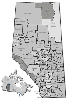 Location of Ranchland No. 66 in Alberta | |
| Coordinates: 50°20′58″N 113°46′18″W / 50.34944°N 113.77167°WCoordinates: 50°20′58″N 113°46′18″W / 50.34944°N 113.77167°W | |
| Country |
|
| Province |
|
| Region | Southern Alberta |
| Census division | No. 15 |
| Established | 1995 |
| Incorporated | 1995 |
| Government[1] | |
| • Reeve | Cameron Gardner |
| • Governing body | M.D. of Ranchland Council |
| • Office location | Chain Lakes Provincial Park |
| Area (2011)[2] | |
| • Total | 2,639.16 km2 (1,018.99 sq mi) |
| Population (2011)[2] | |
| • Total | 79 |
| • Density | 0.0/km2 (0/sq mi) |
| • Dwellings | 39 |
| Time zone | MST (UTC-7) |
| Website |
mdranchland |
The Municipal District of Ranchland No. 66 is a municipal district in southwest Alberta, Canada. Located in Census Division No. 15, its municipal office is located in Chain Lakes Provincial Park,[3] approximately 38 km (24 mi) southwest of the Town of Nanton.
History
The municipal district was incorporated in 1995 from the Improvement District No. 6.
Demographics
The Municipal District of Ranchland No. 66's 2013 municipal census counted a population of 104.[4]
In the 2011 Census, the Municipal District of Ranchland No. 66 had a population of 79 living in 31 of its 45 total dwellings, a -8.1% change from its 2006 population of 86. With a land area of 2,639.16 km2 (1,018.99 sq mi), it had a population density of 0.0/km2 (0.1/sq mi) in 2011.[2]
In 2006, Ranchland No. 66 had a population of only 86, living in 39 dwellings, a 10.4% decrease from 2001. The municipal district has a land area of 2,639.16 km2 (1,018.99 sq mi) and a population density of 0.0/km2 (0/sq mi).[5]
In 2001, the municipal district was the least populated in Alberta, with only 108 in 61 dwellings, an 11.1% decrease from 1996. On a surface of 2,639.16 km² it had a density of 0.1 inhabitants/km².[6]
Communities
There are no communities located within the Municipal District of Ranchland No. 66.[7]
See also
References
- ↑ "Municipal Officials Search". Alberta Municipal Affairs. November 18, 2016. Retrieved November 21, 2016.
- 1 2 3 "Population and dwelling counts, for Canada, provinces and territories, and census subdivisions (municipalities), 2011 and 2006 censuses (Alberta)". Statistics Canada. 2012-02-08. Retrieved 2012-02-08.
- ↑ "Directions to MD Ranchland Administration building" (PDF). Municipal District of Ranchland No. 66. Retrieved 2012-03-26.
- ↑ "2013 Municipal Affairs Population List" (PDF) (PDF). Alberta Municipal Affairs. November 20, 2013. ISBN 978-1-4601-1418-6. Retrieved December 5, 2013.
- ↑ Statistics Canada. "Canada 2006 Census: Ranchland No. 66 - Community Profile". Retrieved 2007-06-11.
- ↑ M.D. of Ranchland community profile - Statistics Canada. 2002. 2001 Community Profiles. Released June 27, 2002. Last modified: 2005-11-30. Statistics Canada Catalogue no. 93F0053XIE.
- ↑ "Specialized and Rural Municipalities and Their Communities" (PDF). Alberta Municipal Affairs. 2012-03-01. Retrieved 2012-08-12.
External links

| Subdivisions | |||||||||||
|---|---|---|---|---|---|---|---|---|---|---|---|
| Communities | |||||||||||
| Cities and urban service areas | |||||||||||
| Rural municipalities |
| ||||||||||
| Specialized municipalities | |||||||||||
| |||||||||||