Muar District
| Muar District دايره موار 麻坡县 | ||
|---|---|---|
| District of Malaysia | ||
| ||
| Country | Malaysia | |
| State | Johor | |
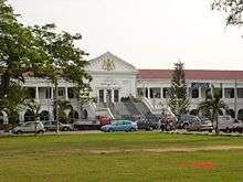
| Seat | Muar Town | |
| Government | ||
| • District Officer | Tuan Haji Ramlee A. Rahman | |
| Area | ||
| • Total | 1,376 km2 (531 sq mi) | |
| Elevation | 36.88 m (121.00 ft) | |
| Population (2010) | ||
| • Total | 247,957 | |
| • Density | 180/km2 (470/sq mi) | |
| • Demonym | Muarian | |
| Time zone | MST (UTC+8) | |
| • Summer (DST) | Not observed (UTC) | |
| Postal code | 84xxx | |
| National calling code | 06 | |
| License plate prefix | Jxx | |
| Website |
www | |

The Muar District is a district in Johor, Malaysia. Muar is located at the mouth of the Muar River, on the coast of the Straits of Malacca. The Muar District covers 1,376 km2, with a population of 247,957 (2010).[1]
History
The district was formerly divided administratively into Bandar Maharani municipality and Ledang township. Upon upgrade of Tangkak sub-district to full-fledged Ledang District, Bandar Maharani is now administered by Muar Municipal Council (formerly South Muar Town Council, later Muar Town Council) under the Muar District Office, while Tangkak of Ledang is administered by Tangkak Town Council (formerly North Muar Town Council) under the Ledang District Office.
A new administration hub and transportation hub integrated with bus terminal and market called Maharani Sentral are being planned to be built at the location near Muar Bypass in between Jalan Haji Kosai and Jalan Temenggung.
Administrative divisions
Muar District is divided into 12 mukims, which are:[2]
- Ayer Hitam
- Bukit Kepong
- Jalan Bakri
- Jorak
- Lenga
- Muar Town
- Parit Bakar
- Parit Jawa
- Seri Menanti
- Sungai Balang
- Sungai Raya
- Sungai Terap
Towns
- Muar
- Pagoh
- Parit Jawa
- Sungai Balang
- Bukit Kepong
- Bukit Pasir
- Panchor
- Lenga
- Pekan Bakri, Jalan Bakri
- Bukit Naning
See also
| Wikimedia Commons has media related to Muar. |
References
- ↑ "Taburan Penduduk dan Ciri-ciri Asas Demografi, Malaysia, 2010" (PDF). Jabatan Perangkaan Malaysia. p. 27. Retrieved 17 July 2012.
- ↑ http://apps.water.gov.my/jpskomuniti/dokumen/profail%20muar_ogos%2020111.pdf