River Moyola
Coordinates: 54°48′00″N 7°04′59″W / 54.800°N 7.083°W
| Moyola River | |
|---|---|
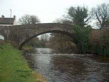 Castledawson Bridge over the Moyola | |
| Country | Northern Ireland |
| Basin | |
| Main source | Sperrin Mountains |
| River mouth | Lough Neagh |
| Physical characteristics | |
| Length | 27 mi (43 km) |
The River Moyola or Moyola River stretches for approximately 27 miles from the Sperrin Mountains to Lough Neagh.[1] The Moyola starts a small river (3-5m) for the first few miles of its length and proceeds to expand to a medium sized river (5-20m) and then to a large river (20m+) for its last couple of miles before Lough Neagh. In ancient times, the River Moyola was known as the 'Bior', and served as the border between the Airgiallan kingdoms of Fir Li and Ui Tuirtri.
According to Deirdre and Laurence Flanagan in their book, Irish Place Names, the River Moyola dervies its name from Magh nÉola, meaning Éolas Plain.[2]
Hydrology
The flow or discharge of the river is measured near to its mouth in Lough Neagh. The catchment area to the gauging station is 304 square kilometres (117 sq mi), which yields an average flow of 8.4 cubic metres per second (300 cu ft/s). [3] The maximum recorded flow between 1971 and 2012 was 156 cubic metres per second (5,500 cu ft/s) on 19 January 1988.[4]
The catchment has a varied geology including limestone, schist, shale and basalt with outcrops of chalk. Overlying this solid geology are superficial deposits of glacial till, plus sand and aggregates. Land use is primarily grassland, with areas of bog and heathland, but includes the towns of Magherafelt and Maghera.[3] The average annual rainfall in the catchment is 1,224 millimetres (48.2 in),[5] which is somewhat higher than the average for United Kingdom at 1,101 millimetres (43.3 in).[6]
Mentions in literature
The river is mentioned in frequently in the poetry of Seamus Heaney, such as Gifts of Rain and A New Song,[7] Whitby-sur-Moyola[8] and Moyulla.[9] Critic Daniel Tobin suggests that for Heaney his "childhood river, Moyola, is not unlike Wordsworth's Derwent."[10]
References
- ↑ 54°42′50″N 6°32′20″W / 54.714°N 6.539°W
- ↑ Deirdre & Laurence Flanagan, Irish Place Names; ISBN 0-7171-3396-6
- 1 2 "203020 - Moyola at Moyola New Bridge". The National River Flow Archive. Centre for Ecology & Hydrology. Retrieved 20 June 2014.
- ↑ "203020 - Moyola at Moyola New Bridge - Annual Maximum". The National River Flow Archive. Centre for Ecology & Hydrology. Retrieved 20 June 2014.
- ↑ "203020 - Moyola at Moyola New Bridge - Rainfall". The National River Flow Archive. Centre for Ecology & Hydrology. Retrieved 20 June 2014.
- ↑ "Climate tables UK 1961-90". Met Office. Retrieved 10 May 2013.
- ↑ Heaney, Seamus (1972). Wintering out. London, UK: Faber & Faber. ISBN 0-571-10158-5.
- ↑ Heaney, Seamus (1996). The spirit level. London, UK: Faber & Faber. ISBN 0-571-17822-7.
- ↑ Heaney, Seamus (2006). District and circle. London, UK: Faber & Faber. ISBN 0-571-23096-2.
- ↑ Tobin, Daniel (1998). Passage to the center: imagination and the Sacred in the poetry of Seamus Heaney. Lexington, KY: The University Press of Kentucky. ISBN 0-813-12083-7.