Mount Olive, Jefferson County, Alabama
| Mount Olive, Alabama | |
|---|---|
| Census-designated place (CDP) & Unincorporated community | |
 Location in Jefferson County and the state of Alabama | |
| Coordinates: 33°41′3″N 86°52′30″W / 33.68417°N 86.87500°W | |
| Country | United States |
| State | Alabama |
| County | Jefferson |
| Area | |
| • Total | 9.3 sq mi (24.1 km2) |
| • Land | 9.3 sq mi (24.1 km2) |
| • Water | 0 sq mi (0 km2) |
| Elevation | 607 ft (185 m) |
| Population (2010)[1] | |
| • Total | 4,079 |
| • Density | 440/sq mi (170/km2) |
| Time zone | Central (CST) (UTC-6) |
| • Summer (DST) | CDT (UTC-5) |
| ZIP code | 35117 |
| Area code(s) | 205 |
| FIPS code | 01-52344 |
| GNIS feature ID | 0123277 |
Mount Olive, also spelled Mt. Olive is an unincorporated community and a census-designated place (CDP) in Jefferson County, Alabama. Its location is in the suburbs of Birmingham. As of the 2010 census, the population of the community is 4,079. Mount Olive is bordered on the south and the east by the town of Gardendale, and in fact, some areas that had previously been in Mount Olive have been annexed into Gardendale over the years. Running along part of the border between Mt. Olive and Gardendale is the major expressway, Interstate 65. Eventually, part of Birmingham's Northern Beltline will cut through northwestern sections of Mt. Olive. Mt. Olive has its own elementary school, and was formerly the home of a junior high school. Beyond elementary school, most of its students currently go on to Bragg Middle School and eventually Gardendale High School, though that status is subject to change in the next year as Gardendale breaks away from the Jefferson County Schools to form its own district, which by law is bounded by the city limits; both systems are in negotiations as of December 2014 to determine of Mount Olive students can still attend Gardendale schools.
Geography
Mount Olive is located at 33°41′3″N 86°52′31″W / 33.68417°N 86.87528°W (33.684191, -86.875139).[2]
According to the U.S. Census Bureau, the community has a total area of 9.3 square miles (24.1 km²), all land.
Demographics
| Historical population | |||
|---|---|---|---|
| Census | Pop. | %± | |
| 2000 | 3,957 | — | |
| 2010 | 4,079 | 3.1% | |
| U.S. Decennial Census[3] | |||
As of the census[4] of 2000, there were 3,957 people, 1,499 households, and 1,221 families residing in the community. The population density was 417.6 people per square mile (161.2/km²). There were 1,553 housing units at an average density of 163.9 per square mile (63.3/km²). The racial makeup of the community was 98.10% White, 0.08% Black or African American, 0.33% Native American, 0.05% Asian, and 1.44% from two or more races. 0.78% of the population were Hispanic or Latino of any race.
There were 1,499 households out of which 34.8% had children under the age of 18 living with them, 72.1% were married couples living together, 6.8% had a female householder with no husband present, and 18.5% were non-families. 16.6% of all households were made up of individuals and 7.7% had someone living alone who was 65 years of age or older. The average household size was 2.63 and the average family size was 2.95.
In the community the population was spread out with 23.5% under the age of 18, 6.5% from 18 to 24, 31.0% from 25 to 44, 25.3% from 45 to 64, and 13.6% who were 65 years of age or older. The median age was 39 years. For every 100 females there were 98.3 males. For every 100 females age 18 and over, there were 94.6 males.
The median income for a household in the community was $48,291, and the median income for a family was $52,425. Males had a median income of $41,250 versus $27,021 for females. The per capita income for the community was $21,311. About 4.0% of families and 4.6% of the population were below the poverty line, including 1.8% of those under age 18 and 9.0% of those age 65 or over.
2010 census
As of the census[5] of 2010, there were 4,079 people, 1,551 households, and 1,217 families residing in the community. The population density was 440 people per square mile (170/km²). There were 1,631 housing units at an average density of 175.4 per square mile (67.7/km²). The racial makeup of the community was 97.7% White, 1.0% Black or African American, 0.2% Native American, 0.3% Asian, and .5% from two or more races. 0.5% of the population were Hispanic or Latino of any race.
There were 1,551 households out of which 30.4% had children under the age of 18 living with them, 66.9% were married couples living together, 8.5% had a female householder with no husband present, and 21.5% were non-families. 19.2% of all households were made up of individuals and 8.5% had someone living alone who was 65 years of age or older. The average household size was 2.63 and the average family size was 3.01.
In the community the population was spread out with 22.5% under the age of 18, 7.4% from 18 to 24, 24.6% from 25 to 44, 30.0% from 45 to 64, and 15.5% who were 65 years of age or older. The median age was 41.7 years. For every 100 females there were 95.3 males. For every 100 females age 18 and over, there were 98.6 males.
The median income for a household in the community was $63,942, and the median income for a family was $81,477. Males had a median income of $51,035 versus $34,426 for females. The per capita income for the community was $28,151. About 4.5% of families and 6.2% of the population were below the poverty line, including 8.5% of those under age 18 and 0.0% of those age 65 or over.
Notes
- ↑ "American FactFinder". United States Census Bureau. Retrieved 2011-05-14.
- ↑ "US Gazetteer files: 2010, 2000, and 1990". United States Census Bureau. 2011-02-12. Retrieved 2011-04-23.
- ↑ "U.S. Decennial Census". Census.gov. Retrieved June 6, 2013.
- ↑ "American FactFinder". United States Census Bureau. Retrieved 2008-01-31.
- ↑ "American FactFinder". United States Census Bureau. Retrieved 2015-07-29.
Coordinates: 33°41′03″N 86°52′31″W / 33.684191°N 86.875139°W
Municipalities and communities of Jefferson County, Alabama, United States | ||
|---|---|---|
| Cities | 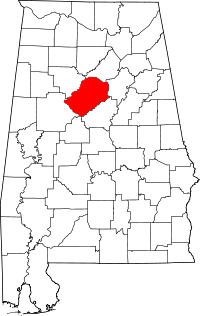 | |
| Towns | ||
| CDPs | ||
| Unincorporated communities | ||
| Former towns | ||
| Footnotes | ‡This populated place also has portions in an adjacent county or counties | |