Matajur
| Matajur | |
|---|---|
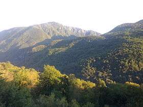 View of Matajur from the village of Borjana (southwestern Slovenia) | |
| Highest point | |
| Elevation | 1,650 m (5,410 ft) |
| Prominence | 1,385 m (4,544 ft) |
| Coordinates | 46°12′44″N 13°31′45″E / 46.21222°N 13.52917°ECoordinates: 46°12′44″N 13°31′45″E / 46.21222°N 13.52917°E |
| Geography | |
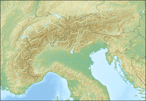 Matajur Location in the Alps | |
| Location | Slovenia / Italy |
| Parent range | Julian Alps and Prealps |
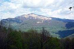
Matajur (pronounced [mataˈjuːɾ]) is a 1642 m mountain in the Julian Alps on the border between Italy and Slovenia. It is located on the border between the Soča Valley and the Italian mountainous region known as Venetian Slovenia, with views over the Adriatic Sea. Its prominence is 1385 m.
Name
Matajur was attested as Mons Regis circa 680, and as in Monte Majori in 1275. The Slovene name Matajur is derived via vowel harmony or akanye from *Motajur (< Mǫtmajur), which was borrowed from a Friulian name that developed from Romance Monte(m) maiōre(m) 'higher mountain'. It is known as Mat'jur in the local dialect, and in Friulian as Mòntmaiôr or Mataiûr (a reborrowing from Slovene).[1]
History
On 26 October 1917, Oberleutnant Erwin Rommel captured the mountain with 100 men, against an Italian force of over 7000.
See also
References
- ↑ Snoj, Marko. 2009. Etimološki slovar slovenskih zemljepisnih imen. Ljubljana: Modrijan and Založba ZRC, p. 254.