Mount Marami
| Mount Marami | |
|---|---|
| Mount Mataas na Gulod | |
 Mt. Marami and Mataas na Gulod | |
| Highest point | |
| Coordinates | 14°12′16″N 120°41′11″E / 14.20444°N 120.68639°ECoordinates: 14°12′16″N 120°41′11″E / 14.20444°N 120.68639°E |
| Geography | |
.svg.png) Mount Marami Location within the Philippines | |
| Location | Mounts Palay-Palay–Mataas-na-Gulod Protected Landscape, Luzon |
| Country | Philippines |
| Region | CALABARZON |
| Provinces | |
| Municipalities | |
| Geology | |
| Mountain type | Stratovolcano |
| Volcanic arc/belt | Bataan Arc |
| Last eruption | Unknown |
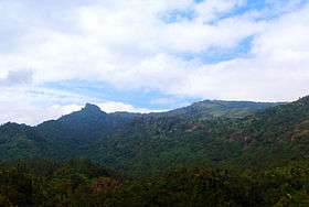
Mount Marami, or Mataas na Gulod Boulders, is a dormant volcano in Cavite province on the island of Luzon, Philippines. The mountain rises to an elevation of 405 m (1,329 ft) above mean sea level and is one of the ancient volcanic features of Bataan Arc.[1]
History
The rock pillars feature was once called as Nagbuo by the locals. And as soon as mountaineers frequented the area, it was called Marami (en. plenty) as referencing to its feature having multiple rocky pillars. [2]
Hiking activity

The Silyang Bato is an adjacent rock pillar feature from Mt. Marami's Summit of Maragondon, Cavite in the Philippines
See also
References
- ↑ Tectonophysics. Amsterdam: Elsevier Science Publishers. 1990. p. 266.
- ↑ "Mt. Marami (405+)". Pinoy Mountaineer. Retrieved 17 January 2015.
| Wikimedia Commons has media related to Mount Marami. |
This article is issued from Wikipedia - version of the 7/26/2016. The text is available under the Creative Commons Attribution/Share Alike but additional terms may apply for the media files.