Mount Kilimanjaro
| Kilimanjaro | |
|---|---|
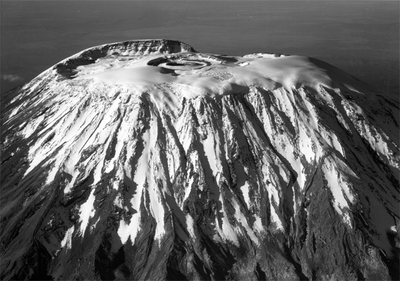
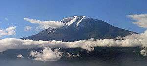 Kibo summit of Kilimanjaro | |
| Highest point | |
| Elevation | 5,895 m (19,341 ft) [1][2] |
| Prominence |
5,885 m (19,308 ft) [3] Ranked 4th[4] |
| Isolation | 5,510 kilometres (3,420 mi) |
| Listing | |
| Coordinates | 03°04′33″S 37°21′12″E / 3.07583°S 37.35333°ECoordinates: 03°04′33″S 37°21′12″E / 3.07583°S 37.35333°E |
| Geography | |
 Kilimanjaro Mount Kilimanjaro's location in Tanzania | |
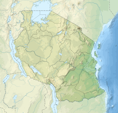
| Location | Kilimanjaro Region, Tanzania |
| Parent range | Eastern Rift mountains |
| Topo map | Kilimanjaro map and guide by Wielochowski[5] |
| Geology | |
| Mountain type | Stratovolcano |
| Last eruption | Between 150,000 and 200,000 years ago |
| Climbing | |
| First ascent | 6 October 1889 by Hans Meyer and Ludwig Purtscheller |
| Easiest route | Hiking |

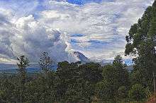
Mount Kilimanjaro (pronunciation: /ˌkɪlɪmənˈdʒɑːroʊ/),[6] with its three volcanic cones, "Kibo", "Mawenzi", and "Shira", is a dormant volcano in Tanzania. It is the highest mountain in Africa, and rises approximately 4,900 m (16,000 ft) from its base to 5,895 metres (19,341 ft) above sea level. The first recorded ascent to the summit of the mountain was by Hans Meyer and Ludwig Purtscheller in 1889. The mountain is part of the Kilimanjaro National Park and is a major climbing destination. The mountain has been the subject of many scientific studies because of its shrinking glaciers.
Geology and physical features
Kilimanjaro rises approximately 4,900 m (16,000 ft) from its southern base in the plains near the municipality of Moshi to its summit height of 5,895 metres (19,341 ft).[2] Kilimanjaro is the highest volcano outside South America.[7]
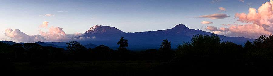
Kilimanjaro is a large stratovolcano and is composed of three distinct volcanic cones: Kibo, the highest; Mawenzi at 5,149 metres (16,893 ft);[8] and Shira, the shortest at 4,005 metres (13,140 ft).[9] Mawenzi and Shira are extinct, while Kibo is dormant and could erupt again.[10]
Uhuru Peak is the highest summit on Kibo's crater rim. The Tanzania National Parks Authority, a Tanzanian governmental agency,[1] and the United Nations Educational, Scientific and Cultural Organization[2] list the height of Uhuru Peak as 5,895 m (19,341 ft). That height is based on a British Ordnance Survey in 1952.[11] Since then, the height has been measured as 5,892 metres (19,331 ft) in 1999, 5,891 metres (19,327 ft) in 2008, and 5,888 metres (19,318 ft) in 2014.[11]
Geology
The interior of the volcanic edifice is poorly known, given the lack of large scale erosion that could have exposed the interiors of the volcano.[12]
Eruptive activity at the Shira centre commenced about 2.5 million years ago, with the last important phase occurring about 1.9 million years ago, just before the northern part of the edifice collapsed.[10] Shira is topped by a broad plateau at 3,800 metres (12,500 ft), which may be a filled caldera. The remnant caldera rim has been degraded deeply by erosion. Before the caldera formed and erosion began, Shira might have been between 4,900 m (16,000 ft) and 5,200 m (17,000 ft) high. It is mostly composed of basic lavas with some pyroclastics. The formation of the caldera was accompanied by lava emanating from ring fractures, but there was no large scale explosive activity. Two cones formed subsequently, the phonolitic one at the northwest end of the ridge and the doleritic "Platzkegel" in the caldera centre.[10][12][13]
Both Mawenzi and Kibo began erupting about 1 million years ago.[10] They are separated by the "Saddle Plateau" at 4,400 metres (14,400 ft) elevation.[14]:3
The youngest dated rocks at Mawenzi are about 448,000 years old.[10] Mawenzi forms a horseshoe shaped ridge with pinnacles and ridges opening to the northeast which has a tower like shape resulting from deep erosion and a mafic dyke swarm. Several large cirques cut into the ring, the largest of these sits on top of the Great Barranco gorge. Also notable are the Ost and West Barrancos on the northeastern side of the mountain. Most of the eastern side of the mountain has been removed by erosion. Mawenzi has a subsidiary peak named Neumann Tower (4,425 metres (14,518 ft)).[10][12][13]
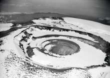
Kibo is the largest cone and is more than 15 miles (24 km) wide at the "Saddle Plateau" altitude. The last activity here has been dated to between 150,000 and 200,000 years ago and created the current Kibo summit crater. Kibo still has gas-emitting fumaroles in the crater.[10][12][13] Kibo is capped by an almost symmetrical cone with escarpments rising 180 metres (590 ft) to 200 metres (660 ft) on the south side. These escarpments define a 2.5-kilometre-wide (1.6 mi) caldera[15] caused by the collapse of the summit. Within this caldera is the Inner Cone and within the crater of the Inner Cone is the Reusch Crater, which the Tanganyika government in 1954 named after Gustav Otto Richard Reusch upon his climbing the mountain for the 25th time (out of 65 attempts during his lifetime).[16][17] The Ash Pit, 350 metres (1,150 ft) deep, lies within the Reusch Crater.[18] About 100,000 years ago, part of Kibo's crater rim collapsed, creating the area known as the Western Breach and the Great Barranco.[19]
An almost continuous layer of lavas buries most older geological features, with the exception of exposed strata within the Great West Notch and the Kibo Barranco. The former exposes intrusions of syenite.[12] Kibo has five main lava formations:[10]
- Phonotephrites and tephriphonolites of the "Lava Tower group", on a dyke cropping out at 4,600 metres (15,100 ft), 482,000 years ago
- Tephriphonolite to phonolite lavas "characterized by rhomb mega-phenocrysts of sodic feldspars" of the "Rhomb Porphyry group", 460,000–360,000 years ago
- aphyric phonolite lavas, "commonly underlain by basal obsidian horizons", of the "Lent group", 359,000–337,000 years ago
- porphyritic tephriphonolite to phonolite lavas of the "Caldera rim group", 274,000–170,000 years ago
- phonolite lava flows with aegirine phenocrysts, of the "Inner Crater group", which represents the last volcanic activity on Kibo
Kibo has more than 250 parasitic cones on its northwest and southeast flanks that were formed between 150,000 and 200,000 years ago[10] and erupted picrobasalts, trachybasalts, ankaramites, and basanites.[10][12][13] They reach as far as Lake Chala and Taveta in the southeast and the Lengurumani Plain in the northwest. Most of these cones are well preserved, with the exception of the Saddle Plateau cones that were heavily affected by glacial action. Despite their mostly small size, lava from the cones has obscured large portions of the mountain. The Saddle Plateau cones are mostly cinder cones with terminal effusion of lava, while the Upper Rombo Zone cones mostly generated lava flows. All Saddle Plateau cones predate the last glaciation.[12]
According to reports gathered in the 19th century from the Maasai, Lake Chala on Kibo's eastern flank was the site of a village that was destroyed by an eruption.[20]
Drainage
The mountain is drained by a network of rivers and streams, especially on the wetter and more heavily eroded southern side and especially above 1,200 metres (3,900 ft). Below that altitude, increased evaporation and human water usage reduces the waterflows. The Lumi and Pangani rivers drain Kilimanjaro on the eastern and southern sides, respectively.[21]
Name
The origin of the name "Kilimanjaro" is not precisely known, but a number of theories exist. European explorers had adopted the name by 1860 and reported that "Kilimanjaro" was the mountain's Kiswahili name.[22] The 1907 edition of The Nuttall Encyclopædia also records the name of the mountain as "Kilima-Njaro".[23]
Johann Ludwig Krapf wrote in 1860 that Swahilis along the coast called the mountain "Kilimanjaro". Although he did not support his claim,[24] he claimed that "Kilimanjaro" meant either "mountain of greatness" or "mountain of caravans". Under the latter meaning, "Kilima" meant "mountain" and "Jaro" possibly meant "caravans".[22]
Jim Thompson claimed in 1885, although he also did not support his claim,[24] that the term Kilima-Njaro "has generally been understood to mean" the Mountain (Kilima) of Greatness (Njaro). "Though not improbably it may mean" the "White" mountain.[25]
"Njaro" is an ancient Kiswahili word for "shining".[26] Similarly, Krapf wrote that a chief of the Wakamba people, whom he visited in 1849, "had been to Jagga and had seen the Kima jaJeu, mountain of whiteness, the name given by the Wakamba to Kilimanjaro...."[27] More correctly in the Kikamba language, this would be Kiima Kyeu, and this possible derivation has been popular with several investigators.[24]
Others have assumed that "Kilima" is Kiswahili for "mountain". The problem with this assumption is that "Kilima" actually means "hill" and is, therefore, the diminutive of "Mlima", the proper Kiswahili word for mountain. However, "[i]t is ... possible ... that an early European visitor, whose knowledge of [Kiswahili] was not extensive, changed mlima to kilima by analogy with the two Wachagga names; Kibo and Kimawenzi."[24]
A different approach is to assume that the "Kileman" part of Kilimanjaro comes from the Kichagga "kileme", which means "which defeats", or "kilelema", which means "which has become difficult or impossible". The "Jaro" part would "then be derived from njaare, a bird, or, according to other informants, a leopard, or, possibly from jyaro a caravan." Considering that the name Kilimanjaro has never been current among the Wachagga people, it is possible that the name was derived from Wachagga saying that the mountain was unclimbable, "kilemanjaare" or "kilemajyaro" and porters misinterpreted this as being the name of the mountain.[24]
In the 1880s, the mountain became a part of German East Africa and was called "Kilima-Ndscharo" in German following the Kiswahili name components.[28]
On 6 October 1889, Hans Meyer reached the highest summit on the crater ridge of Kibo. He named it "Kaiser-Wilhelm-Spitze" ("Kaiser Wilhelm peak").[29] That name apparently was used until Tanzania was formed in 1964,[30] when the summit was renamed "Uhuru Peak", meaning "Freedom Peak" in Kiswahili.[31]
History
First sightings by non-indigenous explorers
The mountain may have been known to non-Africans since antiquity. Sailors' reports recorded by Ptolemy mention a "Moon Mountain" and a spring lake of the Nile, which may indicate Kilimanjaro; although available historical information does not allow differentiation among Mount Kenya, the mountains of Ethiopia, the Virunga Mountains, Kilimanjaro, and the Rwenzori Mountains. Before Ptolemy, Aeschylus and Herodotus referred to "Egypt nurtured by the snows" and a spring between two mountains, respectively. One of these mentions two tall mountains in the coastal regions with a valley with traces of fire in between. Martín Fernández de Enciso, a Spanish traveller to Mombasa who obtained information about the interior from native caravans, said in his Summa de Geografía (1519) that west of Mombasa "stands the Ethiopian Mount Olympus, which is exceedingly high, and beyond it are the Mountains of the Moon, in which are the sources of the Nile".[20][32]:1–5[33]:114
The German missionaries Johannes Rebmann of Mombasa and Krapf were the first Europeans to try to reach the snowy mountain. According to English geographer Halford Mackinder and English explorer Harry Johnston, Rebmann in 1848 was the first European to report the existence of Kilimanjaro.[34][35] Hans Meyer has claimed that Rebmann first arrived in Africa in 1846 and has quoted Rebmann's diary entry of 11 May 1848 as saying, "This morning, at 10 o'clock, we obtained a clearer view of the mountains of Jagga, the summit of one of which was covered by what looked like a beautiful white cloud. When I inquired as to the dazzling whiteness, the guide merely called it 'cold' and at once I knew it could be neither more nor less than snow.... Immediately I understood how to interpret the marvelous tales Dr. Krapf and I had heard at the coast, of a vast mountain of gold and silver in the far interior, the approach to which was guarded by evil spirits."[32]:6 In light of these sources, J. Shearson Hyland's assertion that Rebmann first saw the mountain in 1840[20] appears to be erroneous.
Climbing history
Nineteenth-century explorers
In August 1861, the Prussian officer Baron Karl Klaus von der Decken accompanied by English geologist R. Thornton made a first attempt to climb Kibo but "got no farther than 8,200 feet (2,500 m) owing to the inclemency of the weather."[32]:9[36] In December 1862, von der Decken tried a second time together with Otto Kersten. They reached a height of 14,000 feet (4,300 m).[37]
In August 1871, missionary Charles New became the "first European to reach the equatorial snows" on Kilimanjaro at an elevation of slightly more than 13,000 feet (4,000 m).[32]:11
In June 1887, the Hungarian Count Sámuel Teleki and Austrian Lieutenant Ludwig von Höhnel made an attempt to climb the mountain. Approaching from the saddle between Mawenzi and Kibo, Höhnel stopped at 4,950 meters (16,240 ft), but Teleki pushed through until he reached the snow at 5,300 meters (17,400 ft).[38]
Later in 1887 during his first attempt to climb Kilimanjaro, the German geology professor Hans Meyer reached the lower edge of the ice cap on Kibo, where he was forced to turn back because he lacked the equipment needed to handle the ice.[39]:81 The following year, Meyer planned another attempt with Oscar Baumann, a cartographer, but the mission was aborted after the pair were held hostage and ransomed during the Abushiri Revolt.[39]:82
In the autumn of 1888, the American naturalist Dr. Abbott and the German explorer Otto Ehrenfried Ehlers approached the summit from the northwest. While Abbott turned back earlier, Ehlers at first claimed to have reached the summit rim but, after severe criticism of that claim, later withdrew it.[32]:17–19
In 1889, Meyer returned to Kilimanjaro with the Austrian mountaineer Ludwig Purtscheller for a third attempt.[39]:82 The success of this attempt was based on the establishment of several campsites with food supplies so that multiple attempts at the top could be made without having to descend too far.[39]:82 Meyer and Purtscheller pushed to near the crater rim on October 3 but turned around exhausted from hacking footsteps in the icy slope.[39]:82 Three days later, on Purtscheller's fortieth birthday, they reached the highest summit on the southern rim of the crater.[39]:82 They were the first to confirm that Kibo has a crater.[39]:82 After descending to the saddle between Kibo and Mawenzi, Meyer and Purtscheller attempted to climb the more technically challenging Mawenzi but could reach only the top of Klute Peak, a subsidiary peak, before retreating due to illness.[39]:84 On October 18, they reascended Kibo to enter and study the crater, cresting the rim at Hans Meyers Notch.[39]:84 In total, Meyer and Purtscheller spent 16 days above 15,000 feet (4,600 m) during their expedition.[39]:84 They were accompanied in their high camps by Mwini Amani of Pangani, who cooked and supplied the sites with water and firewood.[32]:135–186
The first ascent of the highest summit of Mawenzi was made on 29 July 1912, by the German climbers Edward Oehler and Fritz Klute, who christened it Hans Meyer Peak. Oehler and Klute went on to make the third-ever ascent of Kibo, via the Drygalski Glacier, and descended via the Western Breach.[39]:85
In 1989, the organizing committee of the 100-year celebration of the first ascent decided to award posthumous certificates to the African porter-guides who had accompanied Meyer and Purtscheller.[40] One person in pictures or documents of the 1889 expedition was thought to match a living inhabitant of Marangu, Yohani Kinyala Lauwo.[40] Lauwo did not know his own age.[40] Nor did he remember Meyer or Purtscheller, but he remembered joining a Kilimanjaro expedition involving a Dutch doctor who lived near the mountain and that he did not get to wear shoes during the climb.[40] Lauwo claimed that he had climbed the mountain three times before the beginning of World War I.[40] The committee concluded that he had been a member of Meyer's team and therefore must have been born around 1871.[40] Lauwo died on 10 May 1996, 107 years after the first ascent, but now is sometimes even suggested as co-first-ascendant of Kilimanjaro.[41]
Fastest male ascent and descent
The fastest ascent-descent has been recorded by the Swiss-Ecuadorian mountain guide Karl Egloff (born 16 March 1981 in Quito), who ran to the top and back in 6 hours and 42 minutes on 13 August 2014.[42] Previous records were held by Spanish mountain runner Kílian Jornet (7 hours, 14 minutes on 29 September 2010) and by Tanzanian guide Simon Mtuy (9 hours, 21 minutes on 22 February 2006).[43][44]
Fastest female ascent and descent
The female ascent record is held by Anne-Marie Flammersfeld. On 27 July 2015, she climbed to the summit in 8 hours, 32 minutes via the Umbwe Route, which is about 30 kilometres (19 mi) long. Born in Germany but living in Switzerland, she broke the record of Britain's Becky Shuttleworth who climbed to the summit in 11 hours, 34 minutes on 20 September 2014.[43][45]
Flammersfeld then needed 4 hours, 26 minutes to run down to the Mweka Gate, for a combined asent and descent time of 12 hours, 58 minutes.[45] That broke the previous record of 18 hours, 31 minutes held by Debbie Bachman.[46]
Youngest and oldest people to summit
Despite an age-limit of 10 years for a climbing permit, exceptions are occasionally granted, and Keats Boyd of Los Angeles was only seven years old when he summited Kilimanjaro on 21 January 2008. The oldest person to reach Uhuru Peak was Angela Vorobeva at age 86 years and 267 days. The oldest man to summit the mountain is American Robert Wheeler, who was 85 years and 201 days when he summited on 2 October 2014. In October 2015.
Ascents by people with disabilities
Wheelchair-bound Bernard Goosen scaled Kilimanjaro in six days in 2007, while in 2012 Kyle Maynard, who has no forearms or lower legs, crawled unassisted to the summit of Mount Kilimanjaro.[43]
First Descent By Snowboard
The first descent by snowboard was accomplished by Ace Bailey on July1st, 1988. This descent, at the time, was also the highest altitude descent by snowboard ever accomplished. This record was held until July the following year. The ride was photographed by Barry Lewis.[47]
Trekking Kilimanjaro

Overview
Kilimanjaro National Park generated US $51 million in revenue in 2013,[48]:285 the second-most of any Tanzanian national park.[49]:258 (The Ngorongoro Conservation Area, which includes the heavily visited Ngorongoro Crater, is not a national park.) The Tanzania National Parks Authority reported that the park recorded 57,456 tourists during the 2011-12 budget year, of whom 16,425 hiked the mountain, which was well below the capacity of 28,470 as specified in the park's General Management Plan.[50] The mountain climbers generated irregular and seasonal jobs for about 11,000 guides, porters, and cooks in 2007,[51] although serious concerns have been raised about their poor working conditions and inadequate wages.[48]:287–291[49]:259[51]
There are seven official trekking routes by which to ascend and descend Mount Kilimanjaro: Lemosho, Machame, Marangu, Mweka, Rongai, Shira, and Umbwe.[52] Of all the routes, Machame is considered the most scenic, albeit steeper, route.[53] It can be done in six or seven days.[53] The Rongai is the easiest and least scenic of all camping routes.[54] The Marangu is also relatively easy, but this route tends to be very busy, the ascent and descent routes are the same, and accommodation is in shared huts with all other climbers.[55]
People who wish to trek to the summit of Kilimanjaro are advised to undertake appropriate research[56] and ensure that they are both properly equipped and physically capable. Though the climb is technically not as challenging as when climbing the high peaks of the Himalayas or Andes, the high elevation, low temperature, and occasional high winds make this a difficult and dangerous trek. Acclimatisation is essential, and even the most experienced trekkers suffer some degree of altitude sickness.[57]
-
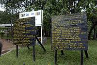
Caution signs at the Machamé trailhead
-
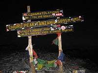
Sign at Uhuru peak, indicating to trekkers that they have reached the top
-
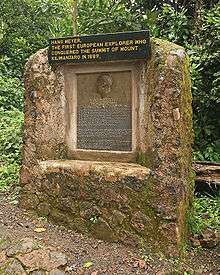
Memorial recognizing the German Hans Meyer as the first European to "conquer" Kilimanjaro
Dangers
A small study of people attempting to reach the summit of Kilimanjaro in July and August 2005 found that 61.3 percent succeeded and 77 percent experienced acute mountain sickness (AMS).[58] A retrospective study of 917 persons who attempted to reach the summit via the Lemosho or Machame routes found that 70.4 percent experienced AMS, defined in this study to be headache, nausea, diarrhea, vomiting, or loss of appetite.[59]
Kilimanjaro's summit is well above the altitude at which life-threatening high altitude pulmonary edema (HAPE) or high altitude cerebral edema (HACE), the most severe forms of AMS, can occur.[60] These health risks are increased substantially by excessively fast climbing schedules motivated by high daily national park fees, busy holiday travel schedules, and the lack of permanent shelter on most routes.[61]
A daily dose of 250 milligrams of acetazolamide is associated with a 48 percent relative-risk reduction of AMS compared to placebo, with a higher dose not providing additional protection but causing more adverse side effects.[62] The six-day Machame route, which involves one night of "sleeping low", may delay the onset of AMS but does not ultimately prevent its occurrence.[63]
Falls on steep portions of the mountain and rock slides have killed trekkers. For this reason, the route via the Arrow Glacier was closed for several years, reopening in December 2007.[64]
Deaths
According to the Kilimanjaro Christian Medical Centre in Moshi, 25 people died from January 1996 to October 2003 while climbing the mountain. Seventeen were female and eight were male, ranging in age from 29 to 74. Fourteen died from advanced high altitude illness, including one with HACE, five with HAPE, and six with both HACE and HAPE. The remaining eleven deaths resulted from trauma (three), myocardial infarction (four), pneumonia (two), cardio-pulmonary failure of other underlying cause (one), and acute appendicitis (one). The overall mortality rate was an estimated 13.6 per 100,000 climbers (0.0136 percent).[65]
On 18 July 2016, South African rally champion Gugu Zulu died while climbing Mount Kilimanjaro.[66] Gugu was climbing Kilimanjaro with his wife Letshego and project leader Richard Mabaso. The team was led by experienced mountaineer, Sibusiso Vilane. Gugu was part of the Trek4Mandela initiative that saw prominent South Africans try to summit the mountain for Mandela Day.
On 12 September 2015, 33-year-old Scott Dinsmore from the United States was killed in a rock fall while climbing Kilimanjaro.[67][68]
On 19 September 2008, ex-Central Intelligence Agency agent Ken Moskow died from altitude sickness while just 20 yards (18 m) short of reaching the summit of Kilimanjaro.[69]
In January 2006, three persons from the United States were killed in a rock fall while climbing Kilimanjaro.[70]
Mapping
A map of the Kibo cone on Mount Kilimanjaro was published by the British government's Directorate of Overseas Surveys in 1964 based on aerial photography conducted in 1962 (Subset of Kilimanjaro, East Africa (Tanganyika) Series Y742, Sheet 56/2, D.O.S. 422 1964, Edition 1, Scale 1:50,000).[71]
Tourist mapping was first published by the Ordnance Survey in England in 1989 based on the original DOS mapping (1:100,000, 100 ft intervals, DOS 522).[72] West Col Productions produced a map with tourist information in 1990 (1:75,000, 100 metre contour intervals, inset maps of Kibo and Mawenzi on 1:20,000 and 1:30,000 scales respectively and 50 metre contour interval).[72] In the last few years, numerous other maps have become available of various qualities.[5]
Vegetation
Natural forests cover about 1,000 square kilometres (250,000 acres) on Kilimanjaro.[73] In the foothill area maize, beans, and sunflowers (on the western side also wheat) are cultivated. Remnants of the former savanna vegetation with Acacia, Combretum, Terminalia and Grewia also occur. Between 1,000 metres (3,300 ft) and 1,800 metres (5,900 ft), coffee also appears as part of the "Chagga home gardens" agroforestry. Native vegetation at this altitude range (Strombosia, Newtonia, and Entandrophragma) is limited to inaccessible valleys and gorges[74] and is completely different from vegetation at higher altitudes. On the southern slope montane forests first contain Ocotea usambarensis as well as ferns and epiphytes, farther up in cloud forests Podocarpus latifolius, Hagenia abyssinica and Erica excelsa grow as well as fog-dependent mosses. On the drier northern slopes olive, Croton-Calodendrum, Cassipourea, and Juniperus form forests in order of increasing altitude. Between 3,100 metres (10,200 ft) and 3,900 metres (12,800 ft) lie Erica bush and heathlands, followed by Helichrysum until 4,500 metres (14,800 ft).[75][76] Neophytes have been observed, including Poa annua.[77]
Records from the Maundi crater at 2,780 metres (9,120 ft) indicate that the vegetation of Kilimanjaro has varied over time. Forest vegetation retreated during the Last Glacial Maximum and the ericaceous vegetation belt lowered by 1,500 metres (4,900 ft) between 42,000 and 30,000 years ago because of the drier and colder conditions.[74]
Animal life
Large animals are rare on Kilimanjaro and are more frequent in the forests and lower parts of the mountain. Elephants and Cape buffaloes are among the animals that can be potentially hazardous to trekkers. Bushbucks, chameleons, dik-diks, duikers, mongooses, sunbirds, and warthogs have been reported as well. Zebras and hyenas have sporadically been observed on the Shira plateau.[78]
Specific species associated with the mountain include the Kilimanjaro shrew[79] and the chameleon Kinyongia tavetana.[80]
Climate
The climate of Kilimanjaro is influenced by the height of the mountain, which allows the simultaneous influence of the equatorial trade winds and the high altitude anti-trades, and the isolated position of the mountain. Kilimanjaro has daily upslope and nightly downslope winds, a regimen stronger on the southern than the northern side of the mountain. The flatter southern flanks are more extended and affect the atmosphere more strongly.[14]:3–4
Kilimanjaro has two distinct rainy seasons, one from March to May and another around November. The northern slopes receive much less rainfall than the southern ones.[73] The lower southern slope receives 800 to 900 millimetres (31 to 35 in) annually, rising to 1,500 to 2,000 millimetres (59 to 79 in) at 1,500 metres (4,900 ft) altitude and peaking "partly over" 3,000 millimetres (120 in) in the forest belt at 2,000 to 2,300 metres (6,600 to 7,500 ft). In the alpine zone, annual precipitation decreases to 200 millimetres (7.9 in).[75]:18
The average temperature in the summit area is approximately −7 °C (19 °F). Nighttime surface temperatures on the Northern Ice Field (NIF) fall on average to −9 °C (16 °F) with an average daytime high temperature of −4 °C (25 °F). During nights of extreme radiational cooling, the NIF can cool to as low as −15 to −27 °C (5 to −17 °F).[81]:674
Snowfall can occur any time of year but is associated mostly with northern Tanzania's two rainy seasons (November–December and March–May).[81]:673 Precipitation in the summit area occurs principally as snow and graupel (250 to 500 millimetres (9.8 to 19.7 in) per year) and ablates within days or years.[82]
Glaciers
Kibo's diminishing ice cap exists because Kilimanjaro is a little-dissected, massive mountain that rises above the snow line. The cap is divergent and outwards splits up into individual glaciers. The central portion of the ice cap is interrupted by the presence of the Kibo crater.[14]:5 The summit glaciers and ice fields do not display significant horizontal movements because their low thickness precludes major deformation.[82]
Geological evidence shows five successive glacial episodes during the Quaternary period, namely First (500,000 BP), Second (greater than 360,000 years ago to 240,000 BP), Third (150,000 to 120,000 BP), Fourth (also known as "Main") (20,000 to 17,000 BP), and Little (16,000 to 14,000 BP). The Third may have been the most extensive, and the Little appears to be statistically indistinguishable from the Fourth.[83]
A continuous ice cap covering approximately 400 square kilometres (150 sq mi) down to an elevation of 3,200 metres (10,500 ft) covered Kilimanjaro during the Last Glacial Maximum in the Pleistocene epoch (the Main glacial episode), extending across the summits of Kibo and Mawenzi.[9][15] Because of the exceptionally prolonged dry conditions during the subsequent Younger Dryas stadial, the ice fields on Kilimanjaro may have become extinct 11,500 years BP.[82] Ice cores taken from Kilimanjaro's Northern Ice Field (NIF) indicates that the glaciers there have a "basal age" of about 11,700 years,[84] although an analysis of ice taken in 2011 from exposed vertical cliffs in the NIF supports an age extending only to 800 years BP.[85]
Higher precipitation rates at the beginning of the Holocene epoch (11,500 years BP) allowed the ice cap to reform.[82] The glaciers survived a widespread drought during a three century period beginning around 4,000 years BP.[82][86]
.jpg)
.jpg)
In the late 1880s, the summit of Kibo was completely covered by an ice cap covering about 20 square kilometres (7.7 sq mi) with outlet glaciers cascading down the western and southern slopes, and except for the inner cone, the entire caldera was buried. Glacier ice also flowed through the Western Breach.[9][15]
The slope glaciers retreated rapidly between 1912 and 1953, in response to a sudden shift in climate at the end of the 19th century that made them "drastically out of equilibrium", and more slowly thereafter. Their continuing demise indicates they are still out of equilibrium in response to a constant change in climate over the last 100 years.[9]
In contrast to the persistent slope glaciers, the glaciers on Kilimanjaro's crater plateau have appeared and disappeared repeatedly during the Holocene epoch, with each cycle lasting a few hundred years.[87]:1088 It appears that decreasing specific humidity instead of temperature changes has caused the shrinkage of the slope glaciers since the late 19th century. No clear warming trend at the elevation of those glaciers occurred between 1948 and 2005. Although air temperatures at that elevation are always below freezing, solar radiation causes melting on their vertical faces. "There is no pathway for the plateau glaciers other than to continuously retreat once their vertical margins are exposed to solar radiation."[9] Vertical ice margin walls are a unique characteristic of the summit glaciers and a major place of the shrinkage of the glaciers. They manifest stratifications, calving, and other ice features.[81]
Almost 85 percent of the ice cover on Kilimanjaro disappeared from October 1912 to June 2011, with coverage decreasing from 11.40 square kilometres (4.40 sq mi) to 1.76 square kilometres (0.68 sq mi).[88]:423 From 1912 to 1953, there was about a 1.1 percent average annual loss.[86] The average annual loss for 1953 to 1989 was 1.4 percent while the loss rate for 1989 to 2007 was 2.5 percent.[86] Of the ice cover still present in 2000, almost 40 percent had disappeared by 2011.[88]:425 The glaciers are thinning in addition to losing areal coverage,[86] and do not have active accumulation zones with retreat occurring on all glacier surfaces. Loss of glacier mass is caused by both melting and sublimation.[82] While the current shrinking and thinning of Kilimanjaro's ice fields appears to be unique within its almost twelve millennium history, it is contemporaneous with widespread glacier retreat in mid-to-low latitudes across the globe.[86] At the current rate, most of the ice on Kilimanjaro will disappear by 2040 and "it is highly unlikely that any ice body will remain after 2060".[88]:430
A complete disappearance of the ice would be of only "negligible importance" to the water budget of the area around the mountain. The forests of Kilimanjaro, far below the ice fields, "are [the] essential water reservoirs for the local and regional populations".[89]
The Kilimanjaro glaciers have been used for deriving ice core records, including two from the southern icefield. Based on this data, this icefield formed between 1,250 and 1,450 years BP.[90]
Mythology
Local legends by the Chagga people tell how a man named Tone once provoked a god, Ruwa, to bring famine upon the land. The people became angry at Tone, forcing him to flee. Nobody wanted to protect him but a solitary dweller who had stones that turned miraculously into cattle. The dweller bid that Tone never open the stable of the cattle. When Tone did not heed the warning and the cattle escaped, Tone followed it but the fleeing cattle threw up hills to run on, including Mawenzi and Kibo. Tone finally collapsed on Kibo, ending the pursuit.
Another legend has it that Kibo and Mawenzi were good neighbours, until Mawenzi played a prank on Kibo and threw away embers he had received from Kibo and claimed that they had burned out. Kibo eventually got angry and beat Mawenzi badly, explaining why the mountain is so badly degraded. This theory explains Mawenzi's name as "the Battered".
Other legends tell of ivory-filled graves of elephants on the mountain, and of a cow named Rayli that produces miraculous fat from her tail glands. If a man tries to steal such a gland but is too slow in his moves, Rayli will blast a powerful snort and blow the thief hurling down into the plain.[91]
In popular culture
- Under Kilimanjaro is a non-fiction novel by Ernest Hemingway about his travels in the region.[92]
- Sia lives on Kilimanjaro is a children's book by Astrid Lindgren.[93]
- The Snows of Kilimanjaro is a short story by Hemingway that references Kilimanjaro.[94] The story was adapted into a film in 1952.[95]
- In the film An Inconvenient Truth, former United States vice president Al Gore stated, "Within the decade, there will be no more snows of Kilimanjaro."[96]
- The rock band Toto song mentions Kilimanjaro in its 1982 song "Africa".
- in the 1994 Disney film The Lion King, Kilimanjaro can be seen in the background during the opening music sequence "Circle of Life", as the film was set in Tanzania.
- Popular British YouTuber KSI made a song in 2015 called Kilimanjaro.
Miscellany
- According to the Tanzania National Parks Authority, the first wedding performed on the mountain below the summit took place on 21 September 2014, when an American couple exchanged vows at Shira 2 Camp.[97][98] In 2011, a couple had exchanged their vows at the summit.[99]
- On 26 September 2014, a new world record for the highest-ever cricket match was set when a group of international cricketers played on a flat crater on the mountain at an elevation of 5,730 metres (18,800 ft).[100]
See also
- Balletto Glacier
- Barranco Glacier
- Credner Glacier
- Furtwängler Glacier
- Great Penck Glacier
- List of volcanoes in Tanzania
- Little Penck Glacier
- Rebmann Glacier
References
- 1 2 "Mount Kilimanjaro National Park". Tanzania National Parks. Tanzania National Parks. Retrieved 16 July 2015.
- 1 2 3 "Kilimanjaro National Park". World Heritage List. UNESCO World Heritage Centre. Retrieved 16 July 2015.
- ↑ "Kilimanjaro". Peakbagger.com. Retrieved 16 August 2012.
- ↑ "World Peaks with 4000 meters of Prominence". Peakbagger.com. Retrieved 8 November 2015.
- 1 2 Kilimanjaro Map and tourist Guide (Map) (4th ed.). 1:75,000 with 1:20,000 and 1:30,000 insets. EWP Map Guides. Cartography by EWP. EWP. 2009. ISBN 0-906227-66-6.
- ↑ "Oxford dictionary: definition of Kilimanjaro, Mount (British & World English)". Oxford dictionary. Oxford University Press. Retrieved 16 July 2015.
- ↑ "Mt Kilimanjaro Volcano". Volcano Live - John Seach. Retrieved 22 November 2015.
- ↑ "Mawenzi". Peakware. Interactive Outdoors, Inc. Retrieved 16 July 2015.
- 1 2 3 4 5 Nicolas J. Cullen; Thomas Mölg; Georg Kaser; Khalid Hussein; Konrad Steffen & Douglas R. Hardy (2006). "Kilimanjaro Glaciers: Recent areal extent from satellite data and new interpretation of observed 20th century retreat rates" (PDF). Geophysical Research Letters. 33 (16). Bibcode:2006GeoRL..3316502C. doi:10.1029/2006GL027084.
- 1 2 3 4 5 6 7 8 9 10 Nonnotte, Philippe; Hervé Guillou; Bernard Le Gall; Mathieu Benoit; Joseph Cotten; Stéphane Scaillet (2008). "New K-Ar age determinations of Kilimanjaro volcano in the North Tanzanian diverging rift, East Africa" (PDF). Journal of Volcanology and Geothermal Research. 173 (1-2): 99–112. doi:10.1016/j.jvolgeores.2007.12.042. Retrieved 29 July 2015.
- 1 2 Pascal Sirguey, Nicolas J. Cullen and Jorge Filipe Dos Santos. "The New Digital Orthometric Elevation Model of Kilimanjaro" (PDF). CEUR Workshop Proceedings. Retrieved 16 July 2015.
- 1 2 3 4 5 6 7 W. H. Wilcockson (1956). "Preliminary Notes on the Geology of Kilimanjaro". Geological Magazine. 93 (3): 218–228. doi:10.1017/S0016756800066590.
- 1 2 3 4 John Barry Dawson (2008). The Gregory Rift Valley and Neogene-recent Volcanoes of Northern Tanzania. Geological Society of London. p. 56. ISBN 978-1-86239-267-0.
- 1 2 3 C. Gillman (1923). "An Ascent of Kilimanjaro". The Geographical Journal. 61 (1): 1–21. doi:10.2307/1780513. JSTOR 1780513. (registration required (help)).
- 1 2 3 Young, James A. T. "Glaciers of the Middle East and Africa" (PDF). U.S. Geological Professional Survey. U.S. Department of the Interior. pp. G61, G58, G59 G62. Retrieved 16 August 2012.
- ↑ "Gustav Otto Richard Reusch". Biographies. The Center for Volga German Studies at Concordia University. Retrieved 16 July 2015.
- ↑ Richard Leider (10 May 2010). The Power of Purpose: Find Meaning, Live Longer, Better. Berrett-Koehler Publishers. p. 12. ISBN 978-1-60509-527-1.
- ↑ "Kilimanjaro". Volcano World. Oregon State University. Retrieved 16 July 2015.
- ↑ Alex Stewart (23 April 2012). Kilimanjaro: A Complete Trekker's Guide: Preparations, practicalities and trekking routes to the 'Roof of Africa'. Cicerone Press Limited. p. 100. ISBN 978-1-84965-622-1.
- 1 2 3 J. Shearson Hyland (1889). "Ueber die Gesteine des Kilimandscharo und dessen Umgebung.". Mineralogische und petrographische Mitteilungen (in German). 10 (3): 203–268. doi:10.1007/BF02993444 – via Springer Link.
- ↑ William Dubois Newmark (1991). The Conservation of Mount Kilimanjaro. IUCN. pp. 105–106. ISBN 978-2-8317-0070-0.
- 1 2 Johann Ludwig Krapf; Ernest George Ravenstein (1860). Travels, Researches, and Missionary Labours, During an Eighteen Years' Residence in Eastern Africa: Together with Journeys to Jagga, Usambara, Ukambani, Shoa, Abessinia and Khartum, and a Coasting Voyage from Nombaz to Cape Delgado. Trübner and Company, Paternoster Row. p. 255.
- ↑ James Wood (1907). "Kilima-Njaro". 1907 Nuttall Encyclopædia of General Knowledge. fromoldbooks.org. Retrieved 16 July 2015.
- 1 2 3 4 5 Hutchinson, J. A. (1965). "The Meaning of Kilimanjaro". Department of Language and Liguistics. Dar Es Salaam: University College.
- ↑ Through Masai land: a journey of exploration among the snowclad volcanic mountains and strange tribes of eastern equatorial Africa, authored by Johann Ludwig Krapf and Ernest George Ravenstein, Low, Marston, Searle, & Rivington, London, 1887
- ↑ "Perspective with Landsat Overlay". SRTM TANZANIA IMAGES. California Institute of Technology. Retrieved 16 July 2015.
- ↑ Johann Ludwig Krapf; Ernest George Ravenstein (1860). Travels, Researches, and Missionary Labours, During an Eighteen Years' Residence in Eastern Africa: Together with Journeys to Jagga, Usambara, Ukambani, Shoa, Abessinia and Khartum, and a Coasting Voyage from Nombaz to Cape Delgado. Trübner and Company, Paternoster Row. p. 544.
- ↑ Briggs, Philip (1996): "Guide to Tanzania; 2nd edition." Bradt Guides.
- ↑ Demhardt, I.J. GERMAN CONTRIBUTIONS TO THE CARTOGRAPHY OF SOUTH WEST AND EAST AFRICA FROM MID 19th CENTURY TO WORLD WAR I (PDF). University of Technology Darmstadt. Retrieved 16 July 2015.
- ↑ P. C. Spink (1945). "Further Notes on the Kibo Inner Crater and Glaciers of Kilimanjaro and Mount Kenya". The Geographical Journal. 106 (5-6): 213. doi:10.2307/1788958. JSTOR 1788958.
- ↑ D. F. O. Dangar (1965). "Dangar Alpine Notes" (PDF). The Alpine Journal. 70 (310-311): 328.
- 1 2 3 4 5 6 Hans Meyer (1891). Across East African glaciers: an account of the first ascent of Kilimanjaro. G. Philip & son.
- ↑ Cameron M. Burns (2006). Kilimanjaro & East Africa: A Climbing and Trekking Guide. The Mountaineers Books. ISBN 978-0-89886-604-9.
- ↑ Mackinder, Halford (1900). "A Journey to the Summit of Mount Kenya, British East Africa". The Geographical Journal. 15 (5): 453–476. JSTOR 1774261.
- ↑ "Kilimanjaro", authored by Sir. H. H. Johnston, in The Twentieth Century, published by Nineteenth Century and After, printed by Spottswoode, Ballantine & Co. Ltd., London, June 1916, volume 79, page 879
- ↑ Dundas, Charles (2012) [1924]. Kilimanjaro and its People: A History of the Wachagga, Their Laws, Customs and Legends, Together with Some Account of the Highest Mountain in Africa. Routledge. p. 20. Retrieved 4 November 2014.
- ↑ "Baron Carl Claus von der Decken - 1833-1865 - Collectors in East Africa - 31.". Conchological Society of Great Britain and Ireland. Retrieved 16 July 2015.
- ↑ Ludwig Ritter von Höhnel (1894). Discovery of Lakes Rudolf and Stefanie: A Narrative of Count Samuel Teleki's Exploring & Hunting Expedition in Eastern Equatorial Africa in 1887 & 1888. Longmans, Green. p. 195.
- 1 2 3 4 5 6 7 8 9 10 11 Alex Stewart (9 September 2010). Kilimanjaro: A Complete Trekker's Guide: Preparations, Practicalities and Trekking Routes to the 'Roof of Africa'. Cicerone Press Limited. ISBN 978-1-84965-071-7.
- 1 2 3 4 5 6 "Meyer And Purtscheller Were Not Alone". Tanzanian Affairs. January 1, 1990. Retrieved 16 July 2015.
- ↑ "The Old Man of Mt. Kilimanjaro". The Honeyguide: Summer 2000. Another Land. Retrieved 16 July 2015.
- ↑ Matt Hart, Where in the World Did Karl Egloff Come From?, Outside 5, Mar 2015
- 1 2 3 "Amazing Kilimanjaro Records". Mount Kilimanjaro Facts. Climb Kilimanjaro Guide. Retrieved 16 July 2015.
- ↑ "Kilimanjaro records". Background information on Kilimanjaro. Climb Mount Kilimanjaro Ltd. Retrieved 16 July 2015.
- 1 2 "Record climbs", Climb Mount Kilimanjaro, accessed 7 November 2015
- ↑ "NEW FEMALE SPEED RECORD ON KILIMANJARO", Climb Kilimanjaro Guide, accessed 7 November 2015
- ↑ "Kilimanjaro First Decent".
- 1 2 Ghazali Musa; James Higham; Anna Thompson-Carr, eds. (5 June 2015). Mountaineering Tourism. Routledge. ISBN 978-1-317-66874-9.
- 1 2 Ian Christie; Eneida Fernandes; Hannah Messerli; Louise Twining-Ward (2014). Tourism in Africa: Harnessing Tourism for Growth and Improved Livelihoods. World Bank Publications. ISBN 9781464801976.
- ↑ "PRESS STATEMENT: NUMBER OF MOUNT KILIMANJARO CLIMBERS NOT A THREAT", Tanzania National Parks, 5 March 2014, accessed 31 July 2015
- 1 2 "Making success work for the poor: Package tourism in Northern Tanzania", Overseas Development Institute, authored by Jonathan Mitchell, Jodie Keane, and Jenny Laidlaw, 9 January 2008, accessed 31 July 2015
- ↑ "Mt. Kilimanjaro Routes: The Advantages and Disadvantage of All Mount Kilimanjaro Climbing Routes". Mount Kilimanjaro Guide. Retrieved 16 July 2015.
- 1 2 "Climbing Mount Kilimanjaro on the Machame Route". Mount Kilimanjaro Guide. Retrieved 16 July 2015.
- ↑ "Climbing Mount Kilimanjaro on the Rongai Route". Mount Kilimanjaro Guide. Retrieved 16 July 2015.
- ↑ "Marangu Route". Kilimanjaro Routes. Retrieved 16 July 2015.
- ↑ R. Stoppelenburg. "Prepare yourself for the Kilimanjaro climb".
- ↑ Muza, SR; Fulco, CS; Cymerman, A (2004). "Altitude Acclimatization Guide". US Army Research Inst. of Environmental Medicine Thermal and Mountain Medicine Division Technical Report (USARIEM-TN-04-05). Retrieved 2009-03-05.
- ↑ Davies, Andrew J.; Kalson, Nicholas S.; Stokes, Suzy; Earl, Mark D.; Whitehead, Adam G.; Frost, Hannah; Tyrell-Marsh, Ian; Naylor, Jon (2009). "Determinants of Summiting Success and Acute Mountain Sickness on Mt Kilimanjaro (5895 m)" (PDF). Wilderness & Environmental Medicine. 20 (4): 315. doi:10.1580/1080-6032-020.004.0311. ISSN 1080-6032.
- ↑ Eigenberger, Paul; Faino, Anna; Maltzahn, Joanne; Lisk, Christina; Frank, Eddie; Frank, Amy; Loomis, Zoe; Schroeder, Thies; Strand, Matthew; Irwin, David (2014). "A retrospective study of acute mountain sickness on Mt. Kilimanjaro using trekking company data" (PDF). Aviation, Space, and Environmental Medicine. 85 (11): 1126.
- ↑ Cymerman, A; Rock, PB. "Medical Problems in High Mountain Environments. A Handbook for Medical Officers". USARIEM-TN94-2. US Army Research Inst. of Environmental Medicine Thermal and Mountain Medicine Division Technical Report. Retrieved 2009-03-05.
- ↑ Andrew J. Davies; Nicholas S. Kalson; Suzy Stokes; Mark D. Earl; Adam G. Whitehead; Hannah Frost; Ian Tyrell-Marsh; Jon Naylor (2009). "Determinants of Summiting Success and Acute Mountain Sickness on Mt Kilimanjaro (5895 m)" (PDF). Wilderness and Environmental Medicine. 20 (4): 311–317. doi:10.1580/1080-6032-020.004.0311.
- ↑ Neil D. Ritchie; Amy V. Baggott & W. T. Andrew Todd (2012). "Acetazolamide for the Prevention of Acute Mountain Sickness—A Systematic Review and Meta-analysis". Journal of Travel Medicine. 19 (5): 298–307. doi:10.1111/j.1708-8305.2012.00629.x.
- ↑ Joel Meyer (2012). "Twice-Daily Assessment of Trekkers on Kilimanjaro's Machame Route to Evaluate the Incidence and Time-Course of Acute Mountain Sickness". High Altitude Medicine & Biology. 13 (4): 281–284. doi:10.1089/ham.2012.1024.
- ↑ "Lava Tower en route to Barranco Camp". Africa Travel. About.com. Retrieved 23 March 2011.
- ↑ Markus Hauser, Andreas Mueller, Britta Swai, Sendui Ole Nguyaine (2004). "Deaths Due to High Altitude Illness Among Tourists Climbing Mt Kilimanjaro". Proceedings of the 2004 South African Travel Medicine Society.
- ↑ "SA rally champion Gugu Zulu dies on Kilimanjaro in Mandela tribute climb", Article, News24.com, 18 July 2016, accessed 18 July 2016
- ↑ "East Bay entrepreneur, author Scott Dinsmore killed while climbing Mount Kilimanjaro", San Jose Mercury News, reported by David DeBolt, accessed 7 November 2015
- ↑ "Entrepreneur TED speaker, 33, killed by falling boulder while climbing Mount Kilimanjaro with his wife during year-long trip around the world", Daily Mail, 17 September 2015, reported by Josh Gardner, accessed 7 November 2015
- ↑ "Ex-CIA Agent Ken Moskow; Died Atop Mount Kilimanjaro", Obituary, Washington Post, 6 October 2008, accessed 7 November 2015
- ↑ "3 American Climbers Killed by Rockslide", Los Angeles Times, 6 January 2006, accessed 7 November 2015
- ↑ Pascal SRIGUEY & Nicolas J. CULLEN (2014). "A Century of Photogrammetry on Kilimanjaro" (PDF). Engaging the Challenges – Enhancing the Relevance. FIG Congress 2014. Kuala Lumpur, Malaysia. Retrieved 16 July 2015.
- 1 2 Alex Stewart (23 April 2012). Kilimanjaro: A Complete Trekker's Guide: Preparations, practicalities and trekking routes to the 'Roof of Africa'. Cicerone Press Limited. p. 33. ISBN 978-1-84965-622-1.
- 1 2 Andreas Hemp (2006). "Continuum or zonation? Altitudinal gradients in the forest vegetation of Mt. Kilimanjaro" (PDF). Plant Ecology. 184 (1): 27–42. doi:10.1007/s11258-005-9049-4.
- 1 2 Lisa Schüler; Andreas Hemp; Wolfgang Zech; Hermann Behling (2012). "Vegetation, climate and fire-dynamics in East Africa inferred from the Maundi crater pollen record from Mt Kilimanjaro during the last glacial–interglacial cycle". Quaternary Science Reviews. 39: 1–13. doi:10.1016/j.quascirev.2012.02.003 – via ScienceDirect.
- 1 2 Andreas Hemp (2007). "Introduced plants on Kilimanjaro: tourism and its impact" (PDF). Plant Ecology. 197 (1): 17–29. doi:10.1007/s11258-007-9356-z.
- ↑ L. A. Bruijnzeel; F. N. Scatena; L. S. Hamilton (6 January 2011). Tropical Montane Cloud Forests: Science for Conservation and Management. Cambridge University Press. p. 136. ISBN 978-1-139-49455-7.
- ↑ Andreas Hemp (2007). "Introduced plants on Kilimanjaro: tourism and its impact" (PDF). Plant Ecology. 197 (1): 17–29. doi:10.1007/s11258-007-9356-z.
- ↑ Cameron M. Burns (2006). Kilimanjaro & East Africa: A Climbing and Trekking Guide. The Mountaineers Books. p. 50. ISBN 978-0-89886-604-9.
- ↑ "Crocidura monax". IUCN Red List of Threatened Species. International Union for Conservation of Nature and Natural Resources. Retrieved August 15, 2015.
- ↑ "Kinyongia tavetana (STEINDACHNER, 1891)". The Reptile Database. Zoological Museum Hamburg. Retrieved 15 August 2015.
- 1 2 3 Vijay P. Singh; Pratap Singh; Umesh K. Haritashya (1 July 2011). Encyclopedia of Snow, Ice and Glaciers. Springer Science & Business Media. ISBN 978-90-481-2641-5.
- 1 2 3 4 5 6 P. Gabrielli; D. R. Hardy; N. Kehrwald; M. Davis; G. Cozzi; C. Turetta; C. Barbante; L. G. Thompson (2014). "Deglaciated areas of Kilimanjaro as a source of volcanic trace elements deposited on the ice cap during the late Holocene" (PDF). Quaternary Science Reviews. 93 (1): 1–10. doi:10.1016/j.quascirev.2014.03.007.
- ↑ Bryan G. Mark & Henry A. Osmaston (2008). "Quaternary glaciation in Africa: Key chronologies and climatic implications" (PDF). Journal of Quaternary Science. 23: 589–608. doi:10.1002/jqs.1222.
- ↑ Thompson, Lonnie G. "Kilimanjaro Ice Core Records: Evidence of Holocene Climate Change in Tropical Africa" (PDF). Science Magazine. Retrieved 16 August 2012.
- ↑ "The controversial age of Kilimanjaro's plateau glaciers", Geophysical Research Abstracts, authored by Chiara Uglietti, Alexander Zapf, Sönke Szidat, Gary Salazar, Doug Hardy, Margit Schwikowski, EGU General Assembly 2015, 12-17 April 2015, Vienna, Austria, accessed 9 November 2015
- 1 2 3 4 5 L. G. Thompson; H. H. Brecher; E. Mosley-Thompson; D. R. Hardy; B. G. Mark (2009). "Glacier loss on Kilimanjaro continues unabated". Proceedings of the National Academy of Sciences. 106 (47): 19770–5. doi:10.1073/pnas.0906029106.
- ↑ Kaser, Georg; Mölg, Thomas; Cullen, Nicolas J.; Hardy, Douglas R.; Winkler, Michael (2010). "Is the decline of ice on Kilimanjaro unprecedented in the Holocene?". The Holocene. 20 (7): 1079–1091. doi:10.1177/0959683610369498. ISSN 0959-6836.
- 1 2 3 Cullen, N. J.; Sirguey, P.; Mölg, T.; Kaser, G.; Winkler, M.; Fitzsimons, S. J. (2013). "A century of ice retreat on Kilimanjaro: the mapping reloaded" (PDF). The Cryosphere. 7 (2): 419–431. doi:10.5194/tc-7-419-2013. ISSN 1994-0424.
- ↑ Georg Kaser; Thomas Mölg; Nicolas J. Cullen; Douglas R. Hardy; Michael Winkler; Rainer Prinz & Lindsey Nicholson. "East African glacier loss and climate change: Corrections to the UNEP article Africa without ice and snow" (PDF). 6: 1–6.
- ↑ L. G. Thompson; M. E. Davis (2007). "Ice Core Records - Africa". Encyclopedia of Quaternary Science: 1220–1225. doi:10.1016/B0-44-452747-8/00351-3.
- ↑ Charles Dundas (12 November 2012). Kilimanjaro and Its People: A History of Wachagga, their Laws, Customs and Legends, Together with Some. Routledge. pp. 84–88. ISBN 978-1-136-24940-2.
- ↑ "An American Literary Treasure". Kent State University Press. Retrieved 2009-10-22.
- ↑ Sia Bor På Kilimandjaro. Sia Lives on Kilimanjaro. Photographs by Anna Riwkin-Brick. Text by A. Lindgren. London; Stockholm printed. 1959.
- ↑ Ernest Hemingway (1995). The Snows of Kilimanjaro and Other Stories. Simon and Schuster. ISBN 978-0-684-80444-6.
- ↑ "Notes - The Snows of Kilimanjaro". AFI Catalog. Turner Classic Movies. Retrieved 16 June 2013.
- ↑ Neil Modie (21 January 2008). "Mount Kilimanjaro: On Africa's roof, still crowned with snow". The New York Times. The New York Times Company. Retrieved 26 June 2015. (subscription required (help)).
- ↑ "American couple to exchange vows on Mount Kilimanjaro". Daily News. Retrieved 29 September 2014.
- ↑ "Couple marries on top of Mount Kilimanjaro, Africa's highest peak". India Today. 22 September 2014. Retrieved 7 October 2014.
- ↑ "More couples exchange marriage vows on Africa's roof". The Guardian. 24 September 2014. Retrieved 1 October 2014.
- ↑ "Cricketers play on Kilimanjaro to set new world record". BBC News. 26 September 2014. Retrieved 29 September 2014.
External links
- Mount Kilimanjaro National Park
- NASA Earth Explorer page
- Weather forecase for Mount Kilimanjaro (19,565 feet)
- Glacial Recession on Kilimanjaro (pictures of southern icefields)
- Mount Kilimanjaro live webcam
- Kilimanjaro flora picture gallery
- Aerial photographs of Mount Kilimanjaro, 1937-38
- Kilimanjaro
- How hard is it to climb Mount Kilimanjaro?