Mount Arlington, New Jersey
| Mount Arlington, New Jersey | |
|---|---|
| Borough | |
| Borough of Mount Arlington | |
|
"Castle on the Lake" in Mount Arlington | |
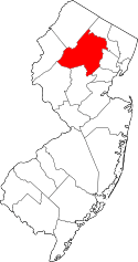
 Mount Arlington highlighted in Morris County. Inset map: Morris County highlighted in the State of New Jersey. | |
 Census Bureau map of Mount Arlington, New Jersey | |
| Coordinates: 40°55′15″N 74°38′27″W / 40.920851°N 74.640828°WCoordinates: 40°55′15″N 74°38′27″W / 40.920851°N 74.640828°W[1][2] | |
| Country |
|
| State |
|
| County | Morris |
| Incorporated | November 3, 1890 |
| Named for | Henry Bennet, 1st Earl of Arlington |
| Government[3] | |
| • Type | Borough |
| • Body | Borough Council |
| • Mayor | Michael Stanzilis (R; serving on interim basis term ending December 31, 2018)[4][5] |
| • Administrator | Carolyn Rinaldi[6] |
| • Clerk | Linda DeSantis[7] |
| Area[1] | |
| • Total | 2.919 sq mi (7.560 km2) |
| • Land | 2.172 sq mi (5.625 km2) |
| • Water | 0.747 sq mi (1.935 km2) 25.60% |
| Area rank |
339th of 566 in state 27th of 39 in county[1] |
| Elevation[8] | 1,079 ft (329 m) |
| Population (2010 Census)[9][10][11] | |
| • Total | 5,050 |
| • Estimate (2015)[12] | 5,300 |
| • Rank |
375th of 566 in state 30th of 39 in county[13] |
| • Density | 2,325.2/sq mi (897.8/km2) |
| • Density rank |
262nd of 566 in state 11th of 39 in county[13] |
| Time zone | Eastern (EST) (UTC-5) |
| • Summer (DST) | Eastern (EDT) (UTC-4) |
| ZIP code | 07856[14][15] |
| Area code(s) | 973[16] |
| FIPS code | 3402748690[1][17][18] |
| GNIS feature ID | 0885312[1][19] |
| Website |
mountarlingtonnj |

Mount Arlington is a borough in Morris County, New Jersey, United States. As of the 2010 United States Census, the borough's population was 5,050,[9][10][11] reflecting an increase of 387 (+8.3%) from the 4,663 counted in the 2000 Census, which had in turn increased by 1,033 (+28.5%) from the 3,630 counted in the 1990 Census.[20] It is located on the southeast shore of Lake Hopatcong, New Jersey's largest lake and a major recreational resource.
History
While Mount Arlington is now mostly a suburban residential community, it was once a thriving resort community. In the era before the world wars and the advent of air travel, it was a welcome respite for the residents of nearby New York City and Newark.
Every summer, thousands would arrive by train at Landing Station, and then travel by water taxi across Lake Hopatcong to the area's many large resort hotels to escape the city heat and enjoy the famous "Mount Arlington breeze" which always cooled the summer evenings. There was also a major amusement park, Bertrand Island, which featured a world-famous carousel and roller coaster, which operated until the park was closed in 1983.[21]
Mount Arlington was incorporated as a borough by an act of the New Jersey Legislature on November 3, 1890, from portions of Roxbury Township, based on the results of a referendum held two days earlier. Additional territory was acquired from Roxbury Township on July 25, 1891, on May 31, 1893, and on May 31, 1894.[22] The borough is named for Henry Bennet, 1st Earl of Arlington.[23]
In March 2014, members of the public petitioned the New Jersey Department of Community Affairs to form the Roxbury Mount Arlington Study Commission to consider a possible consolidation of Mount Arlington and the neighboring municipality of Roxbury Township. In March 2015, the commission was formed with five members and two alternates from each municipality. If the commission votes to recommend a merger, the decision would have to be ratified by a referendum of the voters in each community.[24]
Geography
According to the United States Census Bureau, the borough had a total area of 2.919 square miles (7.560 km2), including 2.172 square miles (5.625 km2) of land and 0.747 square miles (1.935 km2) of water (25.60%).[1][2]
Demographics
| Historical population | |||
|---|---|---|---|
| Census | Pop. | %± | |
| 1900 | 275 | — | |
| 1910 | 277 | 0.7% | |
| 1920 | 213 | −23.1% | |
| 1930 | 306 | 43.7% | |
| 1940 | 456 | 49.0% | |
| 1950 | 639 | 40.1% | |
| 1960 | 1,246 | 95.0% | |
| 1970 | 3,590 | 188.1% | |
| 1980 | 4,251 | 18.4% | |
| 1990 | 3,630 | −14.6% | |
| 2000 | 4,663 | 28.5% | |
| 2010 | 5,050 | 8.3% | |
| Est. 2015 | 5,300 | [12][25] | 5.0% |
| Population sources:1900-1920[26] 1900-1910[27] 1910-1930[28] 1930-1990[29] 2000[30][31] 2010[10] | |||
Census 2010
The 2010 United States Census counted 5,050 people, 2,283 households, and 1,347 families residing in the borough. The population density was 2,325.2 per square mile (897.8/km2). The borough contained 2,545 housing units at an average density of 1,171.8 per square mile (452.4/km2). The racial makeup of the borough was 90.44% (4,567) White, 2.32% (117) Black or African American, 0.18% (9) Native American, 3.58% (181) Asian, 0.04% (2) Pacific Islander, 1.41% (71) from other races, and 2.04% (103) from two or more races. Hispanics or Latinos of any race were 8.22% (415) of the population.[9]
Out of a total of 2,283 households, 21.8% had children under the age of 18 living with them, 47.2% were married couples living together, 8.9% had a female householder with no husband present, and 41.0% were non-families. 34.6% of all households were made up of individuals, and 14.9% had someone living alone who was 65 years of age or older. The average household size was 2.21 and the average family size was 2.88.[9]
In the borough, 17.9% of the population were under the age of 18, 5.8% from 18 to 24, 24.7% from 25 to 44, 31.2% from 45 to 64, and 20.4% who were 65 years of age or older. The median age was 45.8 years. For every 100 females the census counted 85.6 males, but for 100 females at least 18 years old, it was 80.9 males.[9]
The Census Bureau's 2006-2010 American Community Survey showed that (in 2010 inflation-adjusted dollars) median household income was $77,240 (with a margin of error of +/- $14,564) and the median family income was $93,780 (+/- $8,872). Males had a median income of $61,838 (+/- $16,955) versus $59,950 (+/- $11,428) for females. The per capita income for the borough was $43,226 (+/- $4,107). About 0.0% of families and 2.8% of the population were below the poverty line, including 2.9% of those under age 18 and 5.7% of those age 65 or over.[32]
Census 2000
As of the 2000 United States Census[17] there were 4,663 people, 1,918 households, and 1,262 families residing in the borough. The population density was 2,207.1 people per square mile (853.3/km2). There were 2,039 housing units at an average density of 965.1 per square mile (373.1/km2). The racial makeup of the borough was 91.42% White, 1.82% African American, 0.19% Native American, 3.82% Asian, 0.04% Pacific Islander, 1.27% from other races, and 1.44% from two or more races. Hispanic or Latino of any race were 4.55% of the population.[30][31]
There were 1,918 households out of which 28.3% had children under the age of 18 living with them, 54.5% were married couples living together, 8.7% had a female householder with no husband present, and 34.2% were non-families. 27.9% of all households were made up of individuals and 6.2% had someone living alone who was 65 years of age or older. The average household size was 2.42 and the average family size was 2.99.[30][31]
In the borough the population was spread out with 22.1% under the age of 18, 5.3% from 18 to 24, 35.5% from 25 to 44, 26.5% from 45 to 64, and 10.6% who were 65 years of age or older. The median age was 38 years. For every 100 females there were 90.6 males. For every 100 females age 18 and over, there were 87.1 males.[30][31]
The median income for a household in the borough was $67,213, and the median income for a family was $79,514. Males had a median income of $53,049 versus $40,417 for females. The per capita income for the borough was $32,222. About 2.3% of families and 3.3% of the population were below the poverty line, including 5.3% of those under age 18 and 3.4% of those age 65 or over.[30][31]
Government
Local government
Mount Arlington is governed under the Borough form of New Jersey municipal government. The governing body consists of a Mayor and a Borough Council comprising six council members, with all positions elected at-large on a partisan basis as part of the November general election. A Mayor is elected directly by the voters to a four-year term of office. The Borough Council consists of six members elected to serve three-year terms on a staggered basis, with two seats coming up for election each year in a three-year cycle.[3] The Borough form of government used by Mount Arlington, the most common system used in the state, is a "weak mayor / strong council" government in which council members act as the legislative body with the mayor presiding at meetings and voting only in the event of a tie. The mayor can veto ordinances subject to an override by a two-thirds majority vote of the council. The mayor makes committee and liaison assignments for council members, and most appointments are made by the mayor with the advice and consent of the council.[33][34]
As of 2016, the Mayor of Mount Arlington is Republican Michael Stanzilis, who is serving on an interim basis the term of office ending December 31, 2018. In April 2016, Stanzilis was selected by the Borough Council from three names nominated by the Republican municipal committee to fill the seat following the death of Arthur R. Ondish; Stanzilis will serve on an interim basis until the November 2016 general election when voters will choose a candidate to serve the two years remaining on the term of office.[4][35] Members of the Borough Council are Council President Robert W. Sorge (R, 2018), Andrew Cangiano (R, 2016), Paula J. Danchuk (R, 2016), Jack Delaney (R, 2017; appointed to serve an unexpired term), Stephen Sadow (R, 2017) and John Windish (R, 2018).[36][37][38][39][40][41][42]
In May 2016, the Borough Council appointed Jack Delaney to fill the council seat expiring in December 2017 that had been held by Michael Stanzilis until he was appointed as interim mayor; Delaney will serve on an interim basis until the November 2016 general election.[43]
Dover serves as the lead agency operating a joint municipal court that includes Mount Arlington and the neighboring municipalities of Mine Hill Township, Victory Gardens and Wharton.[44] Established in 2009, the joint municipal court was forecast to offer annual savings in excess of $250,000 over the 10-year life of the agreement.[45]
Federal, state and county representation
Mount Arlington is located in the 7th Congressional District[46] and is part of New Jersey's 25th state legislative district.[10][47][48] Prior to the 2010 Census, Mount Arlington had been part of the 11th Congressional District, a change made by the New Jersey Redistricting Commission that took effect in January 2013, based on the results of the November 2012 general elections.[49]
New Jersey's Seventh Congressional District is represented by Leonard Lance (R, Clinton Township).[50] New Jersey is represented in the United States Senate by Cory Booker (D, Newark, term ends 2021)[51] and Bob Menendez (D, Paramus, 2019).[52][53]
For the 2016–2017 session (Senate, General Assembly), the 25th Legislative District of the New Jersey Legislature is represented in the State Senate by Anthony Bucco (R, Boonton Town) and in the General Assembly by Tony Bucco (R, Boonton Township) and Michael Patrick Carroll (R, Morris Township).[54] The Governor of New Jersey is Chris Christie (R, Mendham Township).[55] The Lieutenant Governor of New Jersey is Kim Guadagno (R, Monmouth Beach).[56]
Morris County is governed by a seven-member Board of Chosen Freeholders, who are elected at-large to three-year terms on a staggered basis, with either two or three seats up for election each year as part of the November general election. The Freeholder Board sets policies for the operation of six super-departments, more than 30 divisions plus authorities, commissions, boards and study committees.[57] Actual day-to-day operation of departments is supervised by County Administrator, John Bonanni.[58] As of 2016, Morris County's Freeholders are Freeholder Director Kathryn A. DeFillippo (Roxbury Township, term ends December 31, 2016),[59] Deputy Freeholder William "Hank" Lyon (Montville, 2017),[60] Douglas Cabana (Boonton Township, 2016),[61] John Cesaro (Parsippany-Troy Hills Township, 2018),[62] Thomas J. Mastrangelo (Montville, 2016)[63] Christine Myers (Mendham Township, 2018),[64] and Deborah Smith (Denville, 2018).[65][58][66] Constitutional officers are County Clerk Ann F. Grossi (Parsippany-Troy Hills Township, 2018),[67] Sheriff Edward V. Rochford (Morris Plains, 2016)[68] and Surrogate John Pecoraro (Mendham Borough, 2019).[58][69]
Politics
As of March 23, 2011, there were a total of 3,687 registered voters in Mount Arlington, of which 726 (19.7%) were registered as Democrats, 1,448 (39.3%) were registered as Republicans and 1,511 (41.0%) were registered as Unaffiliated. There were 2 voters registered to other parties.[70]
In the 2012 presidential election, Republican Mitt Romney received 58.0% of the vote (1,457 cast), ahead of Democrat Barack Obama with 41.2% (1,036 votes), and other candidates with 0.8% (20 votes), among the 2,525 ballots cast by the borough's 3,904 registered voters (12 ballots were spoiled), for a turnout of 64.7%.[71][72] In the 2008 presidential election, Republican John McCain received 56.6% of the vote (1,535 cast), ahead of Democrat Barack Obama with 41.4% (1,123 votes) and other candidates with 1.0% (28 votes), among the 2,714 ballots cast by the borough's 3,695 registered voters, for a turnout of 73.5%.[73] In the 2004 presidential election, Republican George W. Bush received 59.9% of the vote (1,456 ballots cast), outpolling Democrat John Kerry with 39.1% (951 votes) and other candidates with 0.5% (16 votes), among the 2,432 ballots cast by the borough's 3,396 registered voters, for a turnout percentage of 71.6.[74]
In the 2013 gubernatorial election, Republican Chris Christie received 71.8% of the vote (1,177 cast), ahead of Democrat Barbara Buono with 26.2% (430 votes), and other candidates with 2.0% (32 votes), among the 1,664 ballots cast by the borough's 3,790 registered voters (25 ballots were spoiled), for a turnout of 43.9%.[75][76] In the 2009 gubernatorial election, Republican Chris Christie received 62.5% of the vote (1,130 ballots cast), ahead of Democrat Jon Corzine with 28.3% (512 votes), Independent Chris Daggett with 7.5% (136 votes) and other candidates with 0.8% (15 votes), among the 1,808 ballots cast by the borough's 3,679 registered voters, yielding a 49.1% turnout.[77]
Education
The Mount Arlington School District serves public school students in Kindergarten through eighth grade. As of the 2012-13 school year, the district's two schools had an enrollment of 360 students and 32.3 classroom teachers (on an FTE basis), for a student–teacher ratio of 11.15:1.[78] Schools in the district (with 2012-13 enrollment from the National Center for Education Statistics[79]) are Edith M. Decker School[80] (116 students in K-2) and Mount Arlington Public School[81] (244 students in 3-8).[82] Both schools are located along the eastern bank of Lake Hopatcong.
For ninth through twelfth grades, public school students attend Roxbury High School in Roxbury Township, as part of a sending/receiving relationship with the Roxbury School District.[83]
Transportation
Roads and highways
As of May 2010, the borough had a total of 21.12 miles (33.99 km) of roadways, of which 15.10 miles (24.30 km) were maintained by the municipality, 4.65 miles (7.48 km) by Morris County and 1.37 miles (2.20 km) by the New Jersey Department of Transportation.[84]
Public transportation
New Jersey Transit provides service at the Mount Arlington station[85] on the Morristown Line[86] and the Montclair-Boonton Line[87] to Newark Broad Street Station, Hoboken Terminal, Secaucus Junction and New York Penn Station in Midtown Manhattan via Midtown Direct service.[88]
Lakeland Bus Lines provides service along Interstate 80 operating between Newton and the Port Authority Bus Terminal in Midtown Manhattan.[89][90]
Notable people
People who were born in, residents of, or otherwise closely associated with Mount Arlington include:
- Brendan Buckley, drummer with Shakira's band.[91]
- Lotta Crabtree (1847–1924), actress.[92]
References
- 1 2 3 4 5 6 2010 Census Gazetteer Files: New Jersey County Subdivisions, United States Census Bureau. Accessed May 21, 2015.
- 1 2 US Gazetteer files: 2010, 2000, and 1990, United States Census Bureau. Accessed September 4, 2014.
- 1 2 2012 New Jersey Legislative District Data Book, Rutgers University Edward J. Bloustein School of Planning and Public Policy, March 2013, p. 116.
- 1 2 Mayor, Borough of Mount Arlington. Accessed July 25, 2016.
- ↑ 2016 New Jersey Mayors Directory, New Jersey Department of Community Affairs. Accessed June 14, 2016. As of date accessed, no mayor is listed.
- ↑ Municipal Administrator, Borough of Mount Arlington. Accessed July 25, 2016.
- ↑ Clerk, Borough of Mount Arlington. Accessed July 25, 2016.
- ↑ U.S. Geological Survey Geographic Names Information System: Borough of Mount Arlington, Geographic Names Information System. Accessed March 8, 2013.
- 1 2 3 4 5 DP-1 - Profile of General Population and Housing Characteristics: 2010 for Mount Arlington borough, Morris County, New Jersey, United States Census Bureau. Accessed December 20, 2012.
- 1 2 3 4 Municipalities Grouped by 2011-2020 Legislative Districts, New Jersey Department of State, p. 12. Accessed January 6, 2013.
- 1 2 Profile of General Demographic Characteristics: 2010 for Mount Arlington borough, New Jersey Department of Labor and Workforce Development. Accessed December 20, 2012.
- 1 2 PEPANNRES - Annual Estimates of the Resident Population: April 1, 2010 to July 1, 2015 - 2015 Population Estimates for New Jersey municipalities, United States Census Bureau. Accessed May 22, 2016.
- 1 2 GCT-PH1 Population, Housing Units, Area, and Density: 2010 - State -- County Subdivision from the 2010 Census Summary File 1 for New Jersey, United States Census Bureau. Accessed December 20, 2012.
- ↑ Look Up a ZIP Code for Mount Arlington, NJ, United States Postal Service. Accessed January 23, 2012.
- ↑ Zip Codes, State of New Jersey. Accessed August 28, 2013.
- ↑ Area Code Lookup - NPA NXX for Mount Arlington, NJ, Area-Codes.com. Accessed August 28, 2013.
- 1 2 American FactFinder, United States Census Bureau. Accessed September 4, 2014.
- ↑ A Cure for the Common Codes: New Jersey, Missouri Census Data Center. Accessed October 29, 2012.
- ↑ US Board on Geographic Names, United States Geological Survey. Accessed September 4, 2014.
- ↑ Table 7. Population for the Counties and Municipalities in New Jersey: 1990, 2000 and 2010, New Jersey Department of Labor and Workforce Development, February 2011. Accessed December 20, 2012.
- ↑ Hughes, Jennifer V. "Catch a Train, but Look at the Prancing Horses", The New York Times, November 25, 2007. Accessed December 20, 2012. "The murals are an homage to the Bertrand Island Amusement Park, along Lake Hopatcong, which drew visitors to the area from the early 1900s to its closing in 1983."
- ↑ Snyder, John P. The Story of New Jersey's Civil Boundaries: 1606-1968, Bureau of Geology and Topography; Trenton, New Jersey; 1969. p. 195. Accessed October 29, 2012.
- ↑ Hutchinson, Viola L. The Origin of New Jersey Place Names, New Jersey Public Library Commission, May 1945. Accessed September 8, 2015.
- ↑ Westhoven, William. "Roxbury-Mt. Arlington consolidation commission named", Daily Record (Morristown), March 30, 2015. "The public is about to get its first chance to meet the chosen members of the Roxbury Mount Arlington Study Commission and discuss the dominant topic on its agenda — a possible consolidation of the neighboring municipalities."
- ↑ Census Estimates for New Jersey April 1, 2010 to July 1, 2015, United States Census Bureau. Accessed May 22, 2016.
- ↑ Compendium of censuses 1726-1905: together with the tabulated returns of 1905, New Jersey Department of State, 1906. Accessed October 23, 2013.
- ↑ Thirteenth Census of the United States, 1910: Population by Counties and Minor Civil Divisions, 1910, 1900, 1890, United States Census Bureau, p. 338. Accessed December 20, 2012.
- ↑ Fifteenth Census of the United States : 1930 - Population Volume I, United States Census Bureau, p. 717. Accessed January 23, 2012.
- ↑ Table 6. New Jersey Resident Population by Municipality: 1930 - 1990, New Jersey Department of Labor and Workforce Development. Accessed June 28, 2015.
- 1 2 3 4 5 Census 2000 Profiles of Demographic / Social / Economic / Housing Characteristics for Mount Arlington borough, New Jersey, United States Census Bureau. Accessed December 20, 2012.
- 1 2 3 4 5 DP-1: Profile of General Demographic Characteristics: 2000 - Census 2000 Summary File 1 (SF 1) 100-Percent Data for Mount Arlington borough, Morris County, New Jersey, United States Census Bureau. Accessed December 20, 2012.
- ↑ DP03: Selected Economic Characteristics from the 2006-2010 American Community Survey 5-Year Estimates for Mount Arlington borough, Morris County, New Jersey, United States Census Bureau. Accessed December 20, 2012.
- ↑ Cerra, Michael F. "Forms of Government: Everything You've Always Wanted to Know, But Were Afraid to Ask", New Jersey State League of Municipalities. Accessed November 30, 2014.
- ↑ "Forms of Municipal Government in New Jersey", p. 6. Rutgers University Center for Government Studies. Accessed June 3, 2015.
- ↑ Condon, Mike. " Stanzilis is interim mayor of Mount ArlingtonWill serve until year's end", New Jersey Hills, April 6, 2016. Accessed July 25, 2016. "Borough Councilman Michael Stanzilis was chosen by the council to serve as interim mayor for the rest of this year Tuesday night. Should he wish to continue as mayor, he will have to run in November to fill the two year unexpired term of deceased Mayor Art Ondish."
- ↑ Borough Council, Borough of Mount Arlington. Accessed July 25, 2016.
- ↑ 2016 Municipal Data Sheet, Borough of Mount Arlington. Accessed July 25, 2016.
- ↑ Morris County Manual 2016, Morris County, New Jersey Clerk. Accessed July 19, 2016.
- ↑ Morris County Municipal Elected Officials For The Year 2016], Morris County, New Jersey Clerk, updated June 3, 2016. Accessed July 19, 2016.
- ↑ November 3, 2015 Official General Election Winners, Morris County, New Jersey Clerk. Accessed July 19, 2016.
- ↑ November 4, 2014 General Election Winners, Morris County, New Jersey Clerk. Accessed July 19, 2016.
- ↑ November 5, 2013 General Election Winners, Morris County, New Jersey Clerk. Accessed July 19, 2016.
- ↑ Condon, Mike. "Four vie for two council seats in Mount Arlington", Roxbury Register, May 24, 2016. Accessed July 25, 2016. "Meanwhile, when the council met on Tuesday, May 17, Republican Jack Delaney was chosen by the council to fill Stanzilis’ unexpired term. The term is for one year. He will have to run to retain the seat in the November election, according to Borough Clerk Linda DeSantis."
- ↑ Mayor and Board of Aldermen, Town of Dover Minutes of the Reorganization Meeting for January 1, 2015, Town of Dover. Accessed July 29, 2015.
- ↑ Forrest, Cindy. "Victory Gardens Council judges proposal for joint municipal court", The Record (Bergen County), May 18, 2012. Accessed July 29, 2015. "With Dover as the lead agency, four other area towns - Rockaway Borough, Wharton, Mine Hill, and Mt. Arlington - entered into a landmark municipal court shared-services agreement in 2009 anticipating an estimated $2.65 million savings over the 10-year life of the contract."
- ↑ Plan Components Report, New Jersey Redistricting Commission, December 23, 2011. Accessed January 6, 2013.
- ↑ 2016 New Jersey Citizen's Guide to Government, p. 61, New Jersey League of Women Voters. Accessed July 20, 2016.
- ↑ Districts by Number for 2011-2020, New Jersey Legislature. Accessed January 6, 2013.
- ↑ 2011 New Jersey Citizen's Guide to Government, p. 61, New Jersey League of Women Voters. Accessed May 22, 2015.
- ↑ Directory of Representatives: New Jersey, United States House of Representatives. Accessed January 5, 2012.
- ↑ About Cory Booker, United States Senate. Accessed January 26, 2015. "He now owns a home and lives in Newark's Central Ward community."
- ↑ Biography of Bob Menendez, United States Senate, January 26, 2015. "He currently lives in Paramus and has two children, Alicia and Robert."
- ↑ Senators of the 114th Congress from New Jersey. United States Senate. Accessed January 26, 2015. "Booker, Cory A. - (D - NJ) Class II; Menendez, Robert - (D - NJ) Class I"
- ↑ Legislative Roster 2016-2017 Session, New Jersey Legislature. Accessed January 17, 2016.
- ↑ "About the Governor". State of New Jersey. Retrieved 2010-01-21.
- ↑ "About the Lieutenant Governor". State of New Jersey. Retrieved 2010-01-21.
- ↑ What is a Freeholder?, Morris County, New Jersey. Accessed July 5, 2016.
- 1 2 3 Morris County Manual 2016, Morris County Clerk. Accessed July 5, 2016.
- ↑ Kathryn A. DeFillippo, Morris County, New Jersey. Accessed July 5, 2016.
- ↑ William “Hank” Lyon, Morris County, New Jersey. Accessed July 5, 2016.
- ↑ Douglas R. Cabana, Morris County, New Jersey. Accessed July 5, 2016.
- ↑ John Cesaro, Morris County, New Jersey. Accessed July 5, 2016.
- ↑ Thomas J. Mastrangelo, Morris County, New Jersey. Accessed July 5, 2016.
- ↑ Christine Myers, Morris County, New Jersey. Accessed July 5, 2016.
- ↑ Deborah Smith, Morris County, New Jersey. Accessed July 5, 2016.
- ↑ Freeholders, Morris County, New Jersey. Accessed July 5, 2016.
- ↑ Ann F. Grossi, Esq., Office of the Morris County Clerk. Accessed July 5, 2016.
- ↑ About Us: Sheriff Edward V. Rochford, Morris County Sheriff's Office. Accessed July 5, 2016.
- ↑ Morris County Surrogate Court, Morris County, New Jersey. Accessed July 5, 2016.
- ↑ Voter Registration Summary - Morris, New Jersey Department of State Division of Elections, March 23, 2011. Accessed December 20, 2012.
- ↑ "Presidential General Election Results - November 6, 2012 - Morris County" (PDF). New Jersey Department of Elections. March 15, 2013. Retrieved December 24, 2014.
- ↑ "Number of Registered Voters and Ballots Cast - November 6, 2012 - General Election Results - Morris County" (PDF). New Jersey Department of Elections. March 15, 2013. Retrieved December 24, 2014.
- ↑ 2008 Presidential General Election Results: Morris County, New Jersey Department of State Division of Elections, December 23, 2008. Accessed December 20, 2012.
- ↑ 2004 Presidential Election: Morris County, New Jersey Department of State Division of Elections, December 13, 2004. Accessed December 20, 2012.
- ↑ "Governor - Morris County" (PDF). New Jersey Department of Elections. January 29, 2014. Retrieved December 24, 2014.
- ↑ "Number of Registered Voters and Ballots Cast - November 5, 2013 - General Election Results - Morris County" (PDF). New Jersey Department of Elections. January 29, 2014. Retrieved December 24, 2014.
- ↑ 2009 Governor: Morris County, New Jersey Department of State Division of Elections, December 31, 2009. Accessed December 20, 2012.
- ↑ District information for Mount Arlington School District, National Center for Education Statistics. Accessed March 3, 2015.
- ↑ School Data for the Mount Arlington School District, National Center for Education Statistics. Accessed March 3, 2015.
- ↑ Edith M. Decker School, Mount Arlington School District. Accessed March 3, 2015.
- ↑ Mount Arlington Public School, Mount Arlington School District. Accessed March 3, 2015.
- ↑ New Jersey School Directory for the Mount Arlington School District, New Jersey Department of Education. Accessed March 3, 2015.
- ↑ O'Dea, Colleen. "State orders impact study of school regionalization", Daily Record (Morristown), November 23, 2008. Accessed January 30, 2011. "Mount Arlington, K-8, sends its high school students to Roxbury, K-12."
- ↑ Morris County Mileage by Municipality and Jurisdiction, New Jersey Department of Transportation, May 2010. Accessed July 18, 2014.
- ↑ Mount Arlington train station, New Jersey Transit. Accessed October 23, 2013.
- ↑ Morristown Line, New Jersey Transit. Accessed October 23, 2013.
- ↑ Montclair-Boonton Line, New Jersey Transit. Accessed October 23, 2013.
- ↑ MorrisCounty Bus / Rail Connections, New Jersey Transit, backed up by the Internet Archive as of May 22, 2009. Accessed December 20, 2012.
- ↑ Lakeland Rt 80 Newton to PABT, Lakeland Bus Lines. Accessed August 3, 2015.
- ↑ Morris County System Map, New Jersey Transit. Accessed August 3, 2015.
- ↑ Brendan Buckley Artist profile, RhythmTech. Accessed August 18, 2007.
- ↑ Morris County Heritage Commission, Morris County, New Jersey. Accessed September 20, 2007.
External links
- Mount Arlington web site
- Mount Arlington School District
- Mount Arlington School District's 2014–15 School Report Card from the New Jersey Department of Education
- School Data for the Mount Arlington School District, National Center for Education Statistics
- Regional area newspaper
- Save the Mt. Arlington Police web site