Motokaji Station
Motokaji Station 元加治駅 | |
|---|---|
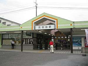 Station entrance, August 2009 | |
| Location |
167 Noda, Iruma-shi, Saitama-ken (埼玉県入間市野田167) Japan |
| Operated by |
|
| Line(s) |
|
| Platforms | 1 island platform |
| Other information | |
| Station code | SI25 |
| History | |
| Opened | 1926 |
| Traffic | |
| Passengers (FY2014) | 6,828 daily |
Motokaji Station (元加治駅 Motokaji-eki) is a railway station on the Seibu Ikebukuro Line in Iruma, Saitama, Japan, operated by the private railway operator Seibu Railway.
Lines
Motokaji Station is served by the Seibu Ikebukuro Line from Ikebukuro in Tokyo, with some services inter-running via the Tokyo Metro Yurakucho Line to Shin-Kiba and the Tokyo Metro Fukutoshin Line to Shibuya and onward via the Tokyu Toyoko Line and Minato Mirai Line to Motomachi-Chukagai. Located between Bushi and Hannō, it is 41.0 km from the Ikebukuro terminus.[1]
Service pattern
Trains that stop here:
- Local
- Semi Express
- Commuter Semi Express
- Rapid
- Commuter express
- Express
Station layout
The station consists of a ground-level island platform serving two tracks. The station building and entrance is situated on the north side and is connected to the platform by a footbridge.[2]
Platforms
| 1 | ■ Seibu Ikebukuro Line | for Tokorozawa, Nerima, and Ikebukuro Tokyu Toyoko Line for Yokohama Minatomirai Line for Motomachi-Chukagai |
| 2 | ■ Seibu Ikebukuro Line | for Hannō and Seibu-Chichibu |
Adjacent stations
| « | Service | » | ||
|---|---|---|---|---|
| Seibu Ikebukuro Line | ||||
| Chichibu/Musashi limited express: Does not stop at this station | ||||
| Rapid express: Does not stop at this station | ||||
| Bushi | Express | Hannō | ||
| Bushi | Commuter express | Hannō | ||
| Bushi | Rapid | Hannō | ||
| Bushi | Commuter semi express | Hannō | ||
| Bushi | Semi express | Hannō | ||
| Bushi | Local | Hannō | ||
History
The station opened on 3 April 1926.[1]
Station numbering was introduced on all Seibu Railway lines during fiscal 2012, with Motokaji Station becoming "SI25".[3]
Through-running to and from Yokohama and Motomachi-Chukagai via the Tokyu Toyoko Line and Minatomirai Line commenced on 16 March 2013.[4]
Passenger statistics
In fiscal 2014, the station was the least used station on the Ikebukuro-Hannō section of the Seibu Ikebukuro Line (75th out of 92 on the Seibu network as a whole) with an average of 6,828 passengers daily.[5]
The passenger figures for previous years are as shown below.
| Fiscal year | Daily average |
|---|---|
| 2000 | 6,735[1] |
| 2009 | 6,951[6] |
| 2010 | 6,784[7] |
| 2011 | 6,890[8] |
| 2012 | 6,940[9] |
| 2013 | 6,974[9] |
Surrounding area
References
- 1 2 3 Terada, Hirokazu (July 2002). データブック日本の私鉄 [Databook: Japan's Private Railways]. Japan: Neko Publishing. p. 201. ISBN 4-87366-874-3.
- ↑ Kawashima, Ryozo (February 2011). 日本の鉄道 中部ライン 全線・全駅・全配線 第11巻 埼玉南部・東京多摩北部 [Railways of Japan - Chubu Line - Lines/Stations/Track plans - Vol 11 Southern Saitama and Northern Tama Tokyo]. Japan: Kodansha. p. 189-73. ISBN 978-4-06-270071-9.
- ↑ 西武線全駅で駅ナンバリングを導入します [Station numbering to be introduced at all Seibu stations] (pdf). News Release (in Japanese). Japan: Seibu Railway. 23 February 2012. Retrieved 22 February 2013.
- ↑ 東急東横線・メトロ副都心線相互直通、16日スタート [Tokyu Toyoko Line and Tokyo Metro Fukutoshin Line inter-running to start on 16 March]. Nikkei.com (in Japanese). Japan: Nikkei Inc. 15 March 2013. Retrieved 2 April 2013.
- ↑ 駅別乗降人員 2014年度 1日平均 [Average daily station usage figures (fiscal 2014)] (PDF) (in Japanese). Japan: Seibu Railway. Retrieved 6 February 2016.
- ↑ 駅別乗降人員 2010(平成22)年度 1日平均 [Average daily station usage figures (fiscal 2010)] (PDF) (in Japanese). Japan: Seibu Railway. Retrieved 22 February 2013.
- ↑ 各駅の乗車人員 (2010年度) [Station passenger figures (Fiscal 2010)] (in Japanese). Japan: East Japan Railway Company. Retrieved 22 February 2013.
- ↑ 駅別乗降人員 2011(平成23)年度 1日平均 [Average daily station usage figures (fiscal 2011)] (PDF) (in Japanese). Japan: Seibu Railway. Retrieved 22 February 2013.
- 1 2 駅別乗降人員 2013(平成25)年度 1日平均 [Average daily station usage figures (fiscal 2013)] (PDF) (in Japanese). Japan: Seibu Railway. Retrieved 22 June 2014.
External links
| Wikimedia Commons has media related to Motokaji Station. |
- Motokaji Station information (Seibu Railway) (Japanese)
- Motokaji Station information (Saitama Prefectural Government) (Japanese)
Coordinates: 35°50′26″N 139°20′44″E / 35.8405°N 139.3455°E