Latah County, Idaho
| Latah County, Idaho | ||
|---|---|---|
| ||
 Location in the U.S. state of Idaho | ||
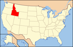 Idaho's location in the U.S. | ||
| Founded | May 14, 1888 | |
| Named for | Latah Creek | |
| Seat | Moscow | |
| Largest city | Moscow | |
| Area | ||
| • Total | 1,077 sq mi (2,789 km2) | |
| • Land | 1,077 sq mi (2,789 km2) | |
| • Water | 0.9 sq mi (2 km2), 0.09% | |
| Population (est.) | ||
| • (2015) | 38,778 | |
| • Density | 35/sq mi (14/km²) | |
| Congressional district | 1st | |
| Time zone | Pacific: UTC-8/-7 | |
| Website |
latah | |

Latah County (pron. /ˈleɪtɑː/ LAY-tah) is a county located in the north central region of the U.S. state of Idaho. As of the 2010 census, the population was 37,244.[1] The county seat and largest city is Moscow,[2] the home of the University of Idaho, the state's flagship and land-grant university.
The county was created 128 years ago in 1888 and named for Latah Creek in its northwest corner. The name in the Nez Perce language means "the place of pine trees and pestle." The tribe found shade under the white pine trees for doing their work and stones suitable for use in pulverizing camas roots to process as one of their food staples.[3][4]
Latah County comprises the Moscow, ID Micropolitan Statistical Area, which is included in the Pullman-Moscow, WA-ID Combined Statistical Area.
The county comprises the majority of the eastern portion of the Palouse, famous for its rolling hills and rich agriculture. Latah County is the only county in the U.S. established by an act of Congress;[5][6][7] it was originally part of Nez Perce County, which was reluctant to lose its most populated area.[8][9][10]
History
Latah County has the distinction of being the only county in the United States created by an Act of Congress.[5][10] Latah and Kootenai counties were first created by the act of December 22, 1864, and the two unorganized counties were attached to Nez Perce County until they were organized. The act provided that when fifty or more inhabitants petitioned the governor, he was authorized to appoint three commissioners to govern, until an election could be held. Three separate efforts at county organization failed, due to the opposition of Lewiston, the county seat of Nez Perce County (and the former capital of the Idaho Territory).
In 1887, Fred T. Dubois, the Idaho Territory's sole delegate in Congress, was asked to introduce a bill, which was passed and approved by President Grover Cleveland on May 14, 1888. The act confirmed the boundaries of the county and named the first board of county commissioners.[11]
The University of Idaho was founded here in Moscow, Idaho, in 1889.[12] Its student and university community influence political alignment in the county, which leans toward Democratic candidates in what is a decidedly Republican-majority state.
Geography

According to the U.S. Census Bureau, the county has a total area of 1,077 square miles (2,790 km2), of which 1,076 square miles (2,790 km2) is land and 0.9 square miles (2.3 km2) (0.09%) is water.[13] It is part of the Palouse, a wide and rolling portion of the middle Columbia basin.
Adjacent counties
- Benewah County – north
- Shoshone County – northeast
- Clearwater County – east
- Nez Perce County – south
- Whitman County, Washington – west
Major highways
National protected area
- St. Joe National Forest (part)
Demographics
| Historical population | |||
|---|---|---|---|
| Census | Pop. | %± | |
| 1890 | 9,173 | — | |
| 1900 | 13,451 | 46.6% | |
| 1910 | 18,818 | 39.9% | |
| 1920 | 18,092 | −3.9% | |
| 1930 | 17,798 | −1.6% | |
| 1940 | 18,804 | 5.7% | |
| 1950 | 20,971 | 11.5% | |
| 1960 | 21,170 | 0.9% | |
| 1970 | 24,891 | 17.6% | |
| 1980 | 28,749 | 15.5% | |
| 1990 | 30,617 | 6.5% | |
| 2000 | 34,935 | 14.1% | |
| 2010 | 37,244 | 6.6% | |
| Est. 2015 | 38,778 | [14] | 4.1% |
| U.S. Decennial Census[15] 1790–1960[16] 1900–1990[17] 1990–2000[18] 2010–2013[1] | |||
2000 census
As of the census of 2000,[19] there were 34,935 people, 13,059 households, and 7,770 families residing in the county. The population density was 32 people per square mile (13/km²). There were 13,838 housing units at an average density of 13 per square mile (5/km²). The racial makeup of the county was 93.94% White, 0.59% Black or African American, 0.75% Native American, 2.10% Asian, 0.09% Pacific Islander, 0.77% from other races, and 1.76% from two or more races. 2.12% of the population were Hispanic or Latino of any race. 20.4% were of German, 13.5% English, 8.7% Irish, 7.8% American and 5.9% Norwegian ancestry.
There were 13,059 households out of which 27.90% had children under the age of 18 living with them, 50.50% were married couples living together, 6.10% had a female householder with no husband present, and 40.50% were non-families. 26.30% of all households were made up of individuals and 6.30% had someone living alone who was 65 years of age or older. The average household size was 2.38 and the average family size was 2.93.
In the county the population was spread out with 20.30% under the age of 18, 24.50% from 18 to 24, 26.90% from 25 to 44, 18.90% from 45 to 64, and 9.50% who were 65 years of age or older. The median age was 28 years. For every 100 females there were 107.50 males. For every 100 females age 18 and over, there were 108.10 males.
The median income for a household in the county was $32,524, and the median income for a family was $46,303. Males had a median income of $34,734 versus $24,886 for females. The per capita income for the county was $16,690. About 7.90% of families and 16.70% of the population were below the poverty line, including 10.20% of those under age 18 and 5.40% of those age 65 or over. Forty percent of all workers in Latah County work for the University of Idaho or Washington State University in nearby Pullman.
2010 census
As of the 2010 United States Census, there were 37,244 people, 14,708 households, and 8,241 families residing in the county.[20] The population density was 34.6 inhabitants per square mile (13.4/km2). There were 15,988 housing units at an average density of 14.9 per square mile (5.8/km2).[21] The racial makeup of the county was 92.8% white, 2.1% Asian, 0.8% black or African American, 0.6% American Indian, 0.1% Pacific islander, 1.0% from other races, and 2.5% from two or more races. Those of Hispanic or Latino origin made up 3.6% of the population.[20] In terms of ancestry, 31.0% were German, 16.8% were English, 15.3% were Irish, 6.9% were Norwegian, 5.5% were Swedish, and 3.0% were American.[22]
Of the 14,708 households, 25.1% had children under the age of 18 living with them, 46.3% were married couples living together, 6.1% had a female householder with no husband present, 44.0% were non-families, and 28.2% of all households were made up of individuals. The average household size was 2.32 and the average family size was 2.89. The median age was 28.3 years.[20]
The median income for a household in the county was $36,974 and the median income for a family was $54,172. Males had a median income of $40,510 versus $31,223 for females. The per capita income for the county was $20,218. About 10.4% of families and 21.5% of the population were below the poverty line, including 18.7% of those under age 18 and 4.8% of those age 65 or over.[23]
Government and politics
Latah County has long been one of the most politically competitive counties in Idaho, while the state as a whole is strongly Republican.
Latah County residents voted in the 2000 and 2004 presidential elections for the Republican candidate at a lower rate than the rest of the state. In 2000, George W. Bush carried Latah County with 53.3% of the vote; in 2004, this fell to 49.5% of the vote as the Democratic vote share increased from 37.0% to 48.0%. Ralph Nader, who received 6.5% of the vote in 2000, was not on the ballot in 2004. In 2008, Barack Obama carried the county over John McCain 51.9%–45.1%. In 2012 Obama carried the county with 49.6 percent, compared to Mitt Romney's 45.3 percent. In 2006, Latah County voted 55.05% against HJR 2, which amended the Idaho Constitution to outlaw same-sex marriage; the measure passed with 63.35% of the statewide vote. Blaine County, a very popular ski resort area and Idaho's one Democratic stronghold, was the one other county to reject HJR 2.[24]
On the precinct level, Democrats generally carry the university city of Moscow by moderate margins, and the rural remainder of the county is strongly Republican.[25]
Flora and fauna
There are numerous species of plants and animals within Latah County. There are a variety of tree species within the county including Western White Pine.[26] Faunal species include the Clay-colored sparrow[27] and Rough-Skinned Newt.[28]
Communities
_roads.PNG)
Cities
Census-designated place
Unincorporated communities
Ghost towns
|
|
|
|
Source:[29]
See also
Footnotes
- 1 2 "State & County QuickFacts". United States Census Bureau. Retrieved July 1, 2014.
- ↑ "Find a County". National Association of Counties. Retrieved 2011-06-07.
- ↑ "Latah County". Lewiston Morning Tribune. Idaho. February 25, 1990. p. 15-centennial.
- ↑ Idaho.gov – Latah County – accessed 2009-06-06
- 1 2 Arney, C.E. (April 4, 1937). "Latah County only one in nation created by an act of Congress; bitter Lewiston protests futile". Lewiston Morning Tribune. Idaho. p. 1-sec.2.
- ↑ "Latah only county in nation created by act of Congress". Lewiston Morning Tribune. Idaho. October 6, 1955. p. 7-LCSE.
- ↑ "Latah County established by Congress 70 years ago today". Lewiston Morning Tribune. Idaho. May 14, 1958. p. 10.
- ↑ Latah County – history
- ↑ Swank, Gladys Rae (November 11, 1962). "Latah County created by Congress". Lewiston Morning Tribune. Idaho. Idaho Writers League. p. 8.
- 1 2 Harriman, Peter (May 13, 1988). "Latah County has 100th birthday". Idahonian. Moscow. p. 1A.
- ↑
- ↑ https://www.uidaho.edu/about
- ↑ "US Gazetteer files: 2010, 2000, and 1990". United States Census Bureau. 2011-02-12. Retrieved 2011-04-23.
- ↑ "County Totals Dataset: Population, Population Change and Estimated Components of Population Change: April 1, 2010 to July 1, 2015". Retrieved July 2, 2016.
- ↑ "U.S. Decennial Census". United States Census Bureau. Retrieved July 1, 2014.
- ↑ "Historical Census Browser". University of Virginia Library. Retrieved July 1, 2014.
- ↑ "Population of Counties by Decennial Census: 1900 to 1990". United States Census Bureau. Retrieved July 1, 2014.
- ↑ "Census 2000 PHC-T-4. Ranking Tables for Counties: 1990 and 2000" (PDF). United States Census Bureau. Retrieved July 1, 2014.
- ↑ "American FactFinder". United States Census Bureau. Retrieved 2008-01-31.
- 1 2 3 "DP-1 Profile of General Population and Housing Characteristics: 2010 Demographic Profile Data". United States Census Bureau. Retrieved 2016-01-09.
- ↑ "Population, Housing Units, Area, and Density: 2010 – County". United States Census Bureau. Retrieved 2016-01-09.
- ↑ "DP02 SELECTED SOCIAL CHARACTERISTICS IN THE UNITED STATES – 2006–2010 American Community Survey 5-Year Estimates". United States Census Bureau. Retrieved 2016-01-09.
- ↑ "DP03 SELECTED ECONOMIC CHARACTERISTICS – 2006–2010 American Community Survey 5-Year Estimates". United States Census Bureau. Retrieved 2016-01-09.
- ↑ Idaho HJR 2 Results by County
- ↑ "Idaho Election Results". Idaho Secretary Of State: Elections, Campaign Disclosure and Lobbyists. Idaho Secretary of State. Retrieved 2007-05-02.
- ↑ Julie R. Monroe (2006) Latah County, Arcadia Publishing, 127 pages ISBN 0-7385-3133-2
- ↑ Shirley Shurts, 2006, A Comprehensive List of Review Species Reports in Idaho
- ↑ C. Michael Hogan (2008) Rough-skinned Newt ("Taricha granulosa"), GlobalTwitcher, ed. N. Stromberg
- ↑ Lewis, Marilyn (May 14, 1988). "Ghost towns of Latah County". Idahonian. Moscow. Latah County Centennial. p. 24.
Further reading
- John M. Henderson and William S. Shiach, with Harry B. Averill, An Illustrated History of North Idaho: Embracing Nez Perces, Idaho, Latah, Kootenai and Shoshone Counties, State of Idaho. n.c. [Chicago]: Western Historical Publishing Co., 1903.
External links
- Official website
- State of Idaho – Latah County
- Latah County Historical Society
- Latah Trail Foundation
- National Register of Historic Places – Latah County
 |
Benewah County | Shoshone County | | |
| Whitman County, Washington | |
Clearwater County | ||
| ||||
| | ||||
| Nez Perce County |
Municipalities and communities of Latah County, Idaho, United States | ||
|---|---|---|
| Cities | ||
| CDP | ||
| Unincorporated communities | ||