Moore Covered Bridge
| Moore Covered Bridge | |
| Bridge | |
| Official name: Moore Covered Bridge | |
| Named for: The Moore Farm | |
| Country | United States |
|---|---|
| State | Indiana |
| County | Parke |
| Township | Greene |
| Crosses | South Fork Little Raccoon Creek |
| Coordinates | 39°49′37.39″N 87°5′16.48″W / 39.8270528°N 87.0879111°WCoordinates: 39°49′37.39″N 87°5′16.48″W / 39.8270528°N 87.0879111°W Approximate Location |
| Length | 81 ft (25 m) 65ft +8ft overhangs on each end |
| Width | 16 ft (5 m) [1] |
| Builder | Britton, J.A. |
| Design | Burr Arch truss single-span bridge |
| Material | Wood |
| Built | 1909 |
| Destruction | 1957 Flood |
 Location of the Moore Bridge in Indiana | |
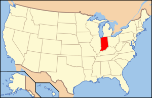 Location of Indiana in the United States | |
The Moore Covered Bridge was northeast of Judson, Indiana. The single-span Burr Arch covered bridge structure was built by the Joseph A. Britton in 1909 and destroyed by flood in 1957.[1]
History
Construction
Joseph A. Britton built this bridge the same year that he built the Phillips Covered Bridge. The location listed is an estimate of where the bridge was actually located. It appears from comparing modern satellite photos to an old Parke County Atlas the location of the bridge may be flooded by a lake now.[2]
Destruction
In 1957, when this bridge and the Weisner Covered Bridge were both destroyed in the same flood, the idea for a Parke County Covered Bridge Festival was born.
See also
References
- 1 2 "Moore Covered Bridge". Covered Bridges. Retrieved 26 February 2015.
- ↑ "Greene Township 1905". Indiana Genealogy Web. Retrieved 26 February 2015.
This article is issued from Wikipedia - version of the 1/13/2016. The text is available under the Creative Commons Attribution/Share Alike but additional terms may apply for the media files.