Moniteau County, Missouri
| Moniteau County, Missouri | |
|---|---|
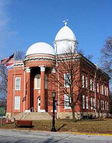 Moniteau County Courthouse in California | |
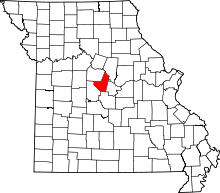 Location in the U.S. state of Missouri | |
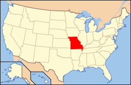 Missouri's location in the U.S. | |
| Founded | February 14, 1845 |
| Named for | Moniteau Creek |
| Seat | California |
| Largest city | California |
| Area | |
| • Total | 419 sq mi (1,085 km2) |
| • Land | 415 sq mi (1,075 km2) |
| • Water | 3.8 sq mi (10 km2), 0.9% |
| Population (est.) | |
| • (2015) | 15,963 |
| • Density | 38/sq mi (15/km²) |
| Congressional district | 4th |
| Time zone | Central: UTC-6/-5 |
Moniteau County is a county located in the U.S. state of Missouri. As of the 2010 census, the population was 15,607.[1] Its county seat is California.[2] The county was organized February 14, 1845 and named for the Moniteau Creek. 'Moniteau' is a French spelling of Manitou, Algonquian for the Great Spirit.
Moniteau County is part of the Jefferson City, MO Metropolitan Statistical Area.
Geography
According to the U.S. Census Bureau, the county has a total area of 419 square miles (1,090 km2), of which 415 square miles (1,070 km2) is land and 3.8 square miles (9.8 km2) (0.9%) is water.[3]
Adjacent counties
- Cooper County (northwest)
- Boone County (northeast)
- Cole County (southeast)
- Miller County (south)
- Morgan County (southwest)
Major highways
Demographics
| Historical population | |||
|---|---|---|---|
| Census | Pop. | %± | |
| 1850 | 6,004 | — | |
| 1860 | 10,124 | 68.6% | |
| 1870 | 11,375 | 12.4% | |
| 1880 | 14,346 | 26.1% | |
| 1890 | 15,630 | 9.0% | |
| 1900 | 15,931 | 1.9% | |
| 1910 | 14,375 | −9.8% | |
| 1920 | 13,532 | −5.9% | |
| 1930 | 12,173 | −10.0% | |
| 1940 | 11,775 | −3.3% | |
| 1950 | 10,840 | −7.9% | |
| 1960 | 10,500 | −3.1% | |
| 1970 | 10,742 | 2.3% | |
| 1980 | 12,068 | 12.3% | |
| 1990 | 12,298 | 1.9% | |
| 2000 | 14,827 | 20.6% | |
| 2010 | 15,607 | 5.3% | |
| Est. 2015 | 15,963 | [4] | 2.3% |
| U.S. Decennial Census[5] 1790-1960[6] 1900-1990[7] 1990-2000[8] 2010-2015[1] | |||
As of the census[9] of 2000, there were 14,827 people, 5,259 households, and 3,728 families residing in the county. The population density was 36 people per square mile (14/km²). There were 5,742 housing units at an average density of 14 per square mile (5/km²). The racial makeup of the county was 92.75% White, 3.78% Black or African American, 0.40% Native American, 0.31% Asian, 0.01% Pacific Islander, 1.48% from other races, and 1.27% from two or more races. Approximately 2.93% of the population were Hispanic or Latino of any race. 35.8% were of German, 20.5% American, 8.2% English and 7.0% Irish ancestry.
There were 5,259 households out of which 35.30% had children under the age of 18 living with them, 58.00% were married couples living together, 8.60% had a female householder with no husband present, and 29.10% were non-families. 25.60% of all households were made up of individuals and 13.00% had someone living alone who was 65 years of age or older. The average household size was 2.56 and the average family size was 3.07.
In the county the population was spread out with 25.90% under the age of 18, 8.20% from 18 to 24, 31.10% from 25 to 44, 20.90% from 45 to 64, and 13.90% who were 65 years of age or older. The median age was 36 years. For every 100 females there were 113.30 males. For every 100 females age 18 and over, there were 116.80 males.
The median income for a household in the county was $37,168, and the median income for a family was $42,487. Males had a median income of $26,807 versus $20,853 for females. The per capita income for the county was $16,609. About 7.30% of families and 9.90% of the population were below the poverty line, including 13.10% of those under age 18 and 9.00% of those age 65 or over.
Education
Public schools
- Clarksburg C-2 School District – Clarksburg
- Clarksburg Elementary School (K-08)
- High Point R-III School District – High Point
- High Point Elementary School (K-08)
- Jamestown C-1 School District – Jamestown
- Jamestown Elementary School (PK-06)
- Jamestown High School (07-12)
- Moniteau County R-I School District – California
- California Elementary School (PK-05)
- California Middle School (06-08)
- California High School (09-12)
- Moniteau County R-V School District – Latham
- Moniteau County Elementary School (K-08)
- Tipton R-VI School District – Tipton
- Tipton Elementary School (PK-06)
- Tipton High School (07-12)
Private schools
- California Christian Academy – California (02-07) – Nondenominational Christian
- Hazel Dell School – Latham (02-09) – Mennonite
- Prairie Union School – Latham (02-09) – Mennonite
- South Latham School – Latham (01-08) – Mennonite
- St. Andrew School – Tipton (K-09) – Roman Catholic
Politics
Local
The Republican Party predominantly controls politics at the local level in Moniteau County. Republicans hold all but three of the elected positions in the county.
| Moniteau County, Missouri | ||||
|---|---|---|---|---|
| Elected countywide officials | ||||
| Assessor | Melissa Hentges | Republican | ||
| Circuit Clerk | Michele A. Higgins | Republican | ||
| County Clerk | Anita Groepper | Republican | ||
| Collector | Cheryl K. Duvall | Democratic | ||
| Commissioner (Presiding) |
Kenneth Kunze | Republican | ||
| Commissioner (District 1) |
Tony Barry | Republican | ||
| Commissioner (District 2) |
Kim F. Roll | Democratic | ||
| Coroner | Loyd Fulks | Republican | ||
| Prosecuting Attorney | Shayne W. Healea | Republican | ||
| Public Administrator | Cher King Caudel | Republican | ||
| Recorder | Michele A. Higgins | Republican | ||
| Sheriff | Jay Gump | Republican | ||
| Surveyor | Joseph Bax | Democratic | ||
| Treasurer | Sarah B. Jones | Republican | ||
State
| Year | Republican | Democratic | Third Parties |
|---|---|---|---|
| 2008 | 54.25% 3,617 | 44.26% 2,951 | 1.48% 99 |
| 2004 | 66.81% 4,480 | 32.48% 2,178 | 0.71% 48 |
| 2000 | 53.09% 3,217 | 44.38% 2,689 | 2.52% 153 |
| 1996 | 36.16% 1,973 | 61.22% 3,340 | 2.62% 143 |
All of Moniteau County is included in Missouri’s 117th District in the Missouri House of Representatives and is represented by Caleb Jones (R-California).
| Party | Candidate | Votes | % | ± | |
|---|---|---|---|---|---|
| Republican | Caleb Jones | 4,064 | 78.99 | ||
| Constitution | Jacob Luetkemeyer | 1,081 | 21.01 | ||
All of Moniteau County is a part of Missouri’s 6th District in the Missouri Senate and is currently represented by Mike Kehoe (R-Jefferson City).
| Party | Candidate | Votes | % | ± | |
|---|---|---|---|---|---|
| Republican | Mike Kehoe | 4,336 | 100.00 | ||
Federal
All of Moniteau County is included in Missouri’s 4th Congressional District and is currently represented by Vicky Hartzler (R-Harrisonville) in the U.S. House of Representatives.
| Party | Candidate | Votes | % | ± | |
|---|---|---|---|---|---|
| Democratic | Ike Skelton | 2,628 | 48.46 | ||
| Republican | Vicky Hartzler | 2,580 | 47.58 | ||
| Libertarian | Jason Michael Braun | 132 | 2.43 | ||
| Constitution | Greg Cowan | 83 | 1.53 | ||
Political culture
| Year | Republican | Democratic | Third Parties |
|---|---|---|---|
| 2008 | 67.02% 4,467 | 31.27% 2,084 | 1.71% 114 |
| 2004 | 70.89% 4,743 | 28.59% 1,913 | 0.52% 35 |
| 2000 | 62.06% 3,764 | 35.88% 2,176 | 2.06% 125 |
| 1996 | 47.63% 2,603 | 38.96% 2,129 | 13.41% 733 |
Missouri Presidential Preference Primary (2008)
- Former U.S. Senator Hillary Clinton (D-New York) received more votes, a total of 858, than any candidate from either party in Moniteau County during the 2008 presidential primary.
| Moniteau County, Missouri | ||
|---|---|---|
| 2008 Republican primary in Missouri | ||
| John McCain | 510 (28.52%) | |
| Mike Huckabee | 693 (38.76%) | |
| Mitt Romney | 466 (26.06%) | |
| Ron Paul | 98 (5.48%) | |
| Moniteau County, Missouri | ||
|---|---|---|
| 2008 Democratic primary in Missouri | ||
| Hillary Clinton | 858 (60.38%) | |
| Barack Obama | 517 (36.38%) | |
| John Edwards (withdrawn) | 30 (2.11%) | |
Communities
- California (county seat)
- Clarksburg
- Enon
- Fortuna
- High Point
- Jamestown
- Latham
- Lupus
- McGirk
- Tipton
See also
References
- 1 2 "State & County QuickFacts". United States Census Bureau. Retrieved September 10, 2013.
- ↑ "Find a County". National Association of Counties. Retrieved 2011-06-07.
- ↑ "2010 Census Gazetteer Files". United States Census Bureau. August 22, 2012. Retrieved November 16, 2014.
- ↑ "County Totals Dataset: Population, Population Change and Estimated Components of Population Change: April 1, 2010 to July 1, 2015". Retrieved July 2, 2016.
- ↑ "U.S. Decennial Census". United States Census Bureau. Retrieved November 16, 2014.
- ↑ "Historical Census Browser". University of Virginia Library. Retrieved November 16, 2014.
- ↑ "Population of Counties by Decennial Census: 1900 to 1990". United States Census Bureau. Retrieved November 16, 2014.
- ↑ "Census 2000 PHC-T-4. Ranking Tables for Counties: 1990 and 2000" (PDF). United States Census Bureau. Retrieved November 16, 2014.
- ↑ "American FactFinder". United States Census Bureau. Retrieved 2008-01-31.
Further reading
- History of Cole, Moniteau, Morgan, Benton, Miller, Maries and Osage counties, Missouri : from the earliest time to the present, including a department devoted to the preservation of sundry personal, business,professional and the private records; besides a valuable fund of notes, original observations, etc. etc. (1889) online
External links
- Digitized 1930 Plat Book of Moniteau County from University of Missouri Division of Special Collections, Archives, and Rare Books
 |
Cooper County | Boone County | | |
| |
||||
| ||||
| | ||||
| Morgan County | Miller County | Cole County |
Municipalities and communities of Moniteau County, Missouri, United States | ||
|---|---|---|
| Cities | | |
| Village | ||
| Townships |
| |
| Unincorporated communities | ||
Coordinates: 38°38′N 92°35′W / 38.63°N 92.58°W