Mongmong-Toto-Maite, Guam
| Mongmong-Toto-Maite Mong Mong-Totu-Maiti | |
|---|---|
| Village | |
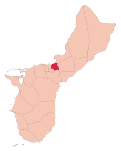 Location of Mongmong-Toto-Maite within the Territory of Guam. | |
| Country | United States |
| Territory | Guam |
| Government | |
| • Mayor | Andrew C. Villagomez (R) |
| Population (2010)[1] | |
| • Total | 6,825 |
| Time zone | ChST (UTC+10) |
| Historical population | |||
|---|---|---|---|
| Census | Pop. | %± | |
| 1960 | 3,015 | — | |
| 1970 | 6,057 | 100.9% | |
| 1980 | 5,245 | −13.4% | |
| 1990 | 5,845 | 11.4% | |
| 2000 | 5,845 | 0.0% | |
| 2010 | 6,825 | 16.8% | |
| Source:[1] | |||
Mongmong-Toto-Maite (Chamorro: Mong Mong-Totu-Maiti) is a municipality in the United States territory of Guam composed of three separate villages east of Hagåtña that experienced development after the Second World War.
Mongmong is adjacent to the Hagåtña Swamp; Toto is situated to the north-east near Barrigada; Maite is located on the cliffs overlooking Agana Bay and the Philippine Sea. The village's population has increased slightly following the island's 2000 census.[2]
Education
Guam Public School System serves the island.
George Washington High School in Mangilao serves the village.[3]
Mayor of Mongmong-Toto-Maite
- Jose E. Santos (1973–1977)
- Norberto F. Ungacta (1977–1981)
- Rodney J. Villagomez (1981–1985)
- Jesus C. Bamba (1985–1989)
- Antonio D. Materne (1989–1997)
- Andrew C. Villagomez (1997–present)
See also
References
- 1 2 "2010 Guam Statistical Yearbook" (PDF). (4.3 MB), (rev. 2011)
- ↑ Therese Hart, "Guam Population slightly up, latest census says," Marianas Variety, August 26, 2011, http://mvguam.com/index.php?option=com_content&view=article&id=19623:guam-population-slightly-up-latest-census-says&catid=59:frontpagenews
- ↑ "Guam's Public High Schools." Guam Public School System. Accessed September 8, 2008.
Hagåtña (capital) | |
| Topics | |
| Islands | |
| Villages | |
| Peaks |
|
Coordinates: 13°28′19″N 144°46′13″E / 13.47194°N 144.77028°E
This article is issued from Wikipedia - version of the 11/17/2016. The text is available under the Creative Commons Attribution/Share Alike but additional terms may apply for the media files.