Randolph County, Missouri
| Randolph County, Missouri | |
|---|---|
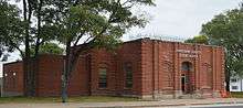 Historic Randolph County Courthouse in Huntsville | |
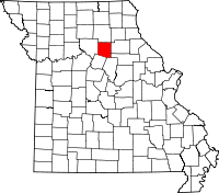 Location in the U.S. state of Missouri | |
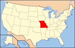 Missouri's location in the U.S. | |
| Founded | January 22, 1829 |
| Named for | John Randolph of Roanoke |
| Seat | Huntsville |
| Largest city | Moberly |
| Area | |
| • Total | 488 sq mi (1,264 km2) |
| • Land | 483 sq mi (1,251 km2) |
| • Water | 5.1 sq mi (13 km2), 1.1% |
| Population (est.) | |
| • (2015) | 25,104 |
| • Density | 53/sq mi (20/km²) |
| Congressional district | 4th |
| Time zone | Central: UTC-6/-5 |
| Website |
www |
Randolph County is a county located in the northern portion of the U.S. state of Missouri. As of the 2010 census, the population was 25,414.[1] Its county seat is Huntsville.[2] The county was organized January 22, 1829 and named for U.S. Representative and U.S. Senator John Randolph of Roanoke of Virginia.[3]
Randolph County comprises the Moberly, MO Micropolitan Statistical Area, which is also included in the Columbia-Moberly-Mexico, MO Combined Statistical Area.
History
Randolph County was primarily settled by migrants from the Upper Southern states, especially Kentucky and Tennessee. They brought slaves and slaveholding traditions with them, and quickly started cultivating crops similar to those in Middle Tennessee and Kentucky: hemp and tobacco. Randolph was one of several counties settled mostly by Southerners to the north and south of the Missouri River. Given their culture and traditions, this area became known as Little Dixie, and Randolph County was at its heart.[4]
Randolph County was home to Omar Bradley, the last of nine 5-star generals of the American military.
Geography
According to the U.S. Census Bureau, the county has a total area of 488 square miles (1,260 km2), of which 483 square miles (1,250 km2) is land and 5.1 square miles (13 km2) (1.1%) is water.[5]
Adjacent counties
- Macon County (north)
- Monroe County (east)
- Shelby County (northeast)
- Audrain County (southeast)
- Boone County (southeast)
- Howard County (south)
- Chariton County (west)
Major highways
Demographics
| Historical population | |||
|---|---|---|---|
| Census | Pop. | %± | |
| 1830 | 2,942 | — | |
| 1840 | 7,198 | 144.7% | |
| 1850 | 9,439 | 31.1% | |
| 1860 | 11,407 | 20.8% | |
| 1870 | 15,908 | 39.5% | |
| 1880 | 22,751 | 43.0% | |
| 1890 | 24,893 | 9.4% | |
| 1900 | 24,442 | −1.8% | |
| 1910 | 26,182 | 7.1% | |
| 1920 | 27,633 | 5.5% | |
| 1930 | 26,431 | −4.3% | |
| 1940 | 24,458 | −7.5% | |
| 1950 | 22,918 | −6.3% | |
| 1960 | 22,014 | −3.9% | |
| 1970 | 22,434 | 1.9% | |
| 1980 | 25,460 | 13.5% | |
| 1990 | 24,370 | −4.3% | |
| 2000 | 24,663 | 1.2% | |
| 2010 | 25,414 | 3.0% | |
| Est. 2015 | 25,104 | [6] | −1.2% |
| U.S. Decennial Census[7] 1790-1960[8] 1900-1990[9] 1990-2000[10] 2010-2015[1] | |||
As of the census[11] of 2000, there were 24,663 people, 9,199 households, and 6,236 families residing in the county. The population density was 51 people per square mile (20/km²). There were 10,740 housing units at an average density of 22 per square mile (9/km²). The racial makeup of the county was 90.58% White, 7.03% Black or African American, 0.48% Native American, 0.39% Asian, 0.02% Pacific Islander, 0.24% from other races, and 1.26% from two or more races. Approximately 1.14% of the population were Hispanic or Latino of any race. 24.1% were of German, 21.4% American, 10.9% English and 9.1% Irish ancestry.
There were 9,199 households out of which 31.40% had children under the age of 18 living with them, 52.70% were married couples living together, 11.10% had a female householder with no husband present, and 32.20% were non-families. 27.90% of all households were made up of individuals and 13.10% had someone living alone who was 65 years of age or older. The average household size was 2.43 and the average family size was 2.94.
In the county the population was spread out with 23.80% under the age of 18, 9.60% from 18 to 24, 29.30% from 25 to 44, 22.40% from 45 to 64, and 14.80% who were 65 years of age or older. The median age was 37 years. For every 100 females there were 107.50 males. For every 100 females age 18 and over, there were 108.10 males.
The median income for a household in the county was $31,464, and the median income for a family was $39,268. Males had a median income of $26,878 versus $20,366 for females. The per capita income for the county was $15,010. About 9.20% of families and 12.50% of the population were below the poverty line, including 17.10% of those under age 18 and 13.20% of those age 65 or over.
Education
Public schools
- Higbee R-VIII School District – Higbee
- Higbee Elementary School (K-06)
- Higbee High School (07-12)
- Moberly School District – Moberly
- North Park Elementary School (K-02)
- South Park Elementary School (PK-02)
- Gratz Brown Elementary School (03-05)
- Moberly Middle School (06-08)
- Moberly High School (09-12)
- Northeast Randolph County R-IV School District – Cairo
- Northeast Randolph County Elementary School (PK-05)
- Northeast Randolph County High School (06-12)
- Renick R-V School District – Renick
- Renick Elementary School (PK-08)
- Westran R-I School District – Huntsville
- Westran Elementary School (PK-05)
- Westran Middle School (06-08)
- Westran High School (09-12)
Private schools
- St. Pius X Elementary School – Moberly (PK-08) – Roman Catholic
- Maranatha Seventh-day Adventist School – Moberly (K-09) – Seventh-day Adventist
Post-secondary
- Central Christian College of the Bible – Moberly – A private, four-year Christian Churches and Churches of Christ university.
- Moberly Area Community College – Moberly – A public, two-year community college.
Politics
Local
The Democratic Party mostly controls politics at the local level in Randolph County. Democrats hold all but five of the elected positions in the county.
| Randolph County, Missouri | ||||
|---|---|---|---|---|
| Elected countywide officials | ||||
| Assessor | Richard Tregnago | Democratic | ||
| Circuit Clerk | Peggy Boots | Democratic | ||
| County Clerk | Will Ellis | Republican | ||
| Collector | Shiela Miller | Democratic | ||
| Commissioner (Presiding) |
Susan Carter | Democratic | ||
| Commissioner (District 1) |
Robert Wayne Wilcox | Republican | ||
| Commissioner (District 2) |
Jerry D. Crutchfield | Democratic | ||
| Coroner | Gerald A. Luntsford | Republican | ||
| Prosecuting Attorney | Michael Fusselman | Republican | ||
| Public Administrator | Martha Creed | Democratic | ||
| Recorder | Mark Price | Democratic | ||
| Sheriff | Mark Nichols | Democratic | ||
| Surveyor | Edward Carpenter | Democratic | ||
| Treasurer | Penny Henry | Republican | ||
State
| Year | Republican | Democratic | Third Parties |
|---|---|---|---|
| 2008 | 53.49% 5,652 | 44.48% 4,700 | 2.02% 214 |
| 2004 | 57.60% 5,841 | 41.09% 4,167 | 1.30% 132 |
| 2000 | 44.50% 4,066 | 53.60% 4,897 | 1.90% 174 |
| 1996 | 31.73% 2,852 | 65.59% 5,895 | 2.67% 240 |
Most of Randolph County is a part of Missouri’s 6th District in the Missouri House of Representatives. The southern portions of the county are in the 47th and 48th District.[12]
All of Randolph County is a part of Missouri’s 18th District in the Missouri Senate.[13]
Federal
All of Randolph County is included in Missouri’s 4th Congressional District and is currently represented by Vicky Hartzler (R-Harrisonville, Missouri) in the U.S. House of Representatives.[14][15]
| Year | Republican | Democratic | Third Parties |
|---|---|---|---|
| 2008 | 60.59% 6,457 | 37.39% 3,984 | 2.02% 215 |
| 2004 | 64.24% 6,551 | 35.16% 3,586 | 0.59% 61 |
| 2000 | 52.73% 4,844 | 44.81% 4,116 | 2.46% 226 |
| 1996 | 36.44% 3,274 | 50.11% 4,502 | 13.46% 1,209 |
Communities
- Cairo
- Clark
- Clifton Hill
- Higbee
- Huntsville (county seat)
- Jacksonville
- Moberly
- Renick
See also
References
- 1 2 "State & County QuickFacts". United States Census Bureau. Retrieved September 12, 2013.
- ↑ "Find a County". National Association of Counties. Retrieved 2011-06-07.
- ↑ Eaton, David Wolfe (1917). How Missouri Counties, Towns and Streams Were Named. The State Historical Society of Missouri. p. 344.
- ↑ The Story of Little Dixie, Missouri, Missouri Division, Sons of Confederate Veterans, accessed 3 June 2008
- ↑ "2010 Census Gazetteer Files". United States Census Bureau. August 22, 2012. Retrieved November 18, 2014.
- ↑ "County Totals Dataset: Population, Population Change and Estimated Components of Population Change: April 1, 2010 to July 1, 2015". Retrieved July 2, 2016.
- ↑ "U.S. Decennial Census". United States Census Bureau. Retrieved November 18, 2014.
- ↑ "Historical Census Browser". University of Virginia Library. Retrieved November 18, 2014.
- ↑ "Population of Counties by Decennial Census: 1900 to 1990". United States Census Bureau. Retrieved November 18, 2014.
- ↑ "Census 2000 PHC-T-4. Ranking Tables for Counties: 1990 and 2000" (PDF). United States Census Bureau. Retrieved November 18, 2014.
- ↑ "American FactFinder". United States Census Bureau. Retrieved 2008-01-31.
- ↑ http://s1.sos.mo.gov/CMSImages/Elections/2013Housemap.pdf
- ↑ http://s1.sos.mo.gov/CMSImages/Elections/2013Senatemap.pdf
- ↑ http://s1.sos.mo.gov/CMSImages/Elections/2012_CongressionalMap.pdf
- ↑ http://hartzler.house.gov/
External links
- Digitized 1930 Plat Book of Randolph County from University of Missouri Division of Special Collections, Archives, and Rare Books
 |
Macon County | | ||
| Chariton County | |
Monroe County | ||
| ||||
| | ||||
| Howard County | Audrain County and Boone County |
Municipalities and communities of Randolph County, Missouri, United States | ||
|---|---|---|
| Cities | | |
| Villages | ||
| Townships |
| |
| Unincorporated communities |
| |
| Footnotes | ‡This populated place also has portions in an adjacent county or counties | |
Coordinates: 39°26′N 92°30′W / 39.43°N 92.50°W