Moapa, Nevada
| Moapa Town, Nevada | |
|---|---|
| Census-designated place | |
|
Moapa US Post Office | |
 Location of Moapa Town in Clark County, Nevada | |
 Moapa Town, Nevada Location in the United States | |
| Coordinates: 36°41′31″N 114°36′29″W / 36.69194°N 114.60806°WCoordinates: 36°41′31″N 114°36′29″W / 36.69194°N 114.60806°W | |
| Country | United States |
| State | Nevada |
| County | Clark |
| Area | |
| • Total | 150.8 sq mi (390.5 km2) |
| • Land | 150.8 sq mi (390.5 km2) |
| • Water | 0.0 sq mi (0.0 km2) |
| Elevation | 1,611 ft (491 m) |
| Population (2010) | |
| • Total | 1,025 |
| • Density | 6.8/sq mi (2.6/km2) |
| Time zone | PST (UTC-8) |
| • Summer (DST) | PDT (UTC-7) |
| FIPS code | 32-47840 |
| GNIS feature ID | 1852656 |
| Website | Advisory board homepage |

Moapa Town is an unincorporated town[1] and census-designated place (CDP) in Clark County, Nevada, United States. The population was 1,025 at the 2010 census.[2] It is the largest town in Clark County by land area. Both the second and the third tallest structures in Nevada, the Moapa Entrevision Tower and the Moapa Kemp Tower respectively, are located in Moapa.
History
Two Hal Roach short silent comedies were filmed here: Black Cyclone in 1925, and Flying Elephants, with Laurel and Hardy, in 1927.[3] Moapa was the site of a wildfire that began on July 1, 2010. The fire covered at least 680 acres (280 ha) and destroyed at least 15 buildings, largely in the Warm Springs Ranch.[4]
Geography
According to the United States Census Bureau, the CDP has a total area of 150.8 square miles (390.5 km²), all of it land.
Demographics
As of the census[5] of 2000, there were 928 people, 273 households, and 220 families residing in the CDP. The population density was 6.2 people per square mile (2.4/km²). There were 310 housing units at an average density of 2.1 per square mile (0.8/km²). The racial makeup of the CDP was 62.93% White, 0.22% African American, 1.40% Native American, 1.83% Asian, 0.65% Pacific Islander, 30.50% from other races, and 2.48% from two or more races. Hispanic or Latino of any race were 35.02% of the population.
There were 273 households out of which 51.3% had children under the age of 18 living with them, 65.9% were married couples living together, 9.9% had a female householder with no husband present, and 19.4% were non-families. Of all households 14.7% were made up of individuals and 4.4% had someone living alone who was 65 years of age or older. The average household size was 3.40 and the average family size was 3.81.
In the CDP the population was spread out with 38.8% under the age of 18, 7.7% from 18 to 24, 26.8% from 25 to 44, 19.5% from 45 to 64, and 7.2% who were 65 years of age or older. The median age was 29 years. For every 100 females there were 106.7 males. For every 100 females age 18 and over, there were 100.7 males.
The median income for a household in the CDP was $48,365, and the median income for a family was $49,327. Males had a median income of $38,929 versus $20,990 for females. The per capita income for the CDP was $17,587. About 1.7% of families and 3.1% of the population were below the poverty line, including 3.2% of those under age 18 and none of those age 65 or over.
Architectural structures
Lying within Moapa is the second tallest structure in Nevada, the 1,400-foot (430 m) Moapa Entravision Tower, located at the coordinates 36°36′3.5″ N, 114°35′9.1″ W.[6] The Moapa Kemp Tower, also located in Moapa Town, is the third tallest structure in Nevada. It is a 1,316-foot (401 m) guyed television mast at the coordinates 36°35′5″N, 114°36′3″W.
Solar power station
The 350 MW Moapa Solar Project is a photovoltaic power station which has been proposed by K Road Power.[7]
References
- ↑ http://www.clarkcountynv.gov/Depts/admin_services/tlservices/Pages/Moapa%20Town%20Advisory%20Board.aspx Moapa Town Board
- ↑ "Profile of General Population and Housing Characteristics: 2010 Demographic Profile Data (DP-1): Moapa Town CDP, Nevada". U.S. Census Bureau, American Factfinder. Retrieved March 13, 2012.
- ↑ http://www.imdb.com/title/tt0017893/locations?ref_=ttfc_ql_6
- ↑ Kyle Hansen (2010-07-01). "Fire near Moapa destroys 10 homes, burns more than 680 acres". Las Vegas Sun.
- ↑ "American FactFinder". United States Census Bureau. Retrieved 2008-01-31.
- ↑ "Registration 1249595". FCC. Retrieved July 1, 2010.
- ↑ Bureau of Land Management (November 22, 2011). "2012 Renewable Energy Priority Projects".
External links
Municipalities and communities of Clark County, Nevada, United States | ||
|---|---|---|
| Cities | 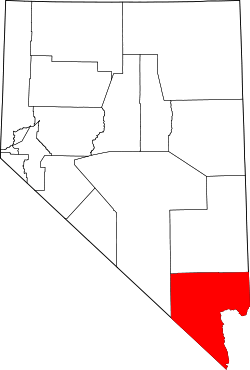 | |
| CDPs | ||
| Unincorporated communities | ||
| Townships |
| |
| Ghost towns | ||
| Indian reservations | ||
| Footnotes | ‡This populated place also has portions in an adjacent county or counties | |