Middlesex Canal
|
Middlesex Canal | |
|
Remnants of the aqueduct that carried the canal over the Shawsheen River on the Billerica-Wilmington town line | |
 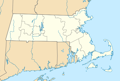  | |
| Location | Lowell-Woburn, Massachusetts (surviving fragments) |
|---|---|
| Area | 245 acres (99 ha) |
| Built | 1803 |
| Architect | Loammi Baldwin; James Sullivan |
| NRHP Reference # | 72000117[1] |
| Added to NRHP | August 21, 1972 |

The Middlesex Canal was a 27-mile (44-kilometer) barge canal connecting the Merrimack River with the port of Boston. When operational it was 30 feet (9.1 m) wide, and 3 feet (0.9 m) deep, with 20 locks, each 80 feet (24 m) long and between 10 and 11 feet (3.0 and 3.4 m) wide. It also had 8 aqueducts.
The canal was one of the first civil engineering projects of its type in the United States, and was studied by engineers working on other major canal projects such as the Erie Canal. A number of innovations made the canal possible, including hydraulic cement, which was used to mortar its locks, and an ingenious floating towpath to span the Concord River.
Conception
In the years following the American Revolutionary War, the young United States began a period of economic expansion away from the coast. Because of extremely poor roads, the cost of bringing goods such as lumber and fur to the coast could be quite high. Up and down the Atlantic coast, companies were formed to develop canals as comparatively inexpensive means to bring goods from the interior of the country to the coast, and to send imported goods into the interior.
In Massachusetts several ideas were proposed for bringing goods to the principal port of Boston. A group of leading Massachusetts businessmen and politicians proposed a connection from the Merrimack River to Boston Harbor in 1793. The Middlesex Canal Corporation was chartered on June 22, 1793 with a signature by Governor John Hancock. Hancock was also among the investors who purchased shares, along with other luminaries such as John Adams, John Quincy Adams, James Sullivan, and Christopher Gore. Sullivan was chosen company president, and its vice president and eventual chief engineer was Loammi Baldwin, a native of Woburn who had attended science lectures at Harvard College and was a friend of physicist Benjamin Thompson.
Construction
The route of the canal was first surveyed in August 1793. Local lore is that it is on this expedition that Baldwin was introduced to a particular apple variety that now bears his name. The route survey, however, was sufficiently uncertain that a second survey was made in October. Due to discrepancies in their results, Baldwin was authorized by the proprietors to travel to Philadelphia in an effort to secure the services of William Weston, a British engineer working on canal projects in Pennsylvania.[2] Baldwin's application to Weston was successful: Weston came to Massachusetts and spent nine days in July and August 1794 surveying and identifying two possible routes, accompanied by Baldwin and several of the latter's sons.[3] The proprietors then secured contracts to acquire the land for the canal, some of which was donated by its owners; in sixteen cases the proprietors used eminent domain proceedings to take land.[4]

The basic plan was for the canal's principal water source to be the Concord River at its highest point in North Billerica, with additional water to be drawn as needed from Horn Pond in Woburn. The site where the canal met the Concord River had been the site of a grist mill since the 17th century, which the proprietors purchased along with all of its water rights. From this point the canal descended six miles to the Merrimack River in East Chelmsford (now western Lowell) and 22 miles to the Charles River in Charlestown.
In late September 1794 ground was broken in North Billerica. Work on the canal was performed by a number of contractors. In some instances local workers were contracted to dig sections, while in other areas contract labor was brought in from Massachusetts and New Hampshire for the construction work. A variety of engineering challenges were overcome, leading to innovations in construction materials and equipment. A form of hydraulic cement (made in part from volcanic materials imported at great expense from Sint Eustatius in the West Indies) was used to make the stone locks watertight. Because of its cost and the cost of working in stone, a number of the locks were made of wood instead. An innovation was made in earth-moving equipment with the development of a precursor of the dump truck, where one side of the carrier was hinged to allow the rapid dumping of material at the desired location.
Water was diverted into the canal on December 1800, and by 1803 the canal was filled to Charlestown. The first boat operated on part of the canal in April 22, 1802.
Operational history
The canal ran from Middlesex Village in East Chelmsford, Massachusetts (later renamed Lowell), through several Middlesex County towns. At first it terminated in Medford, but was later extended to Charlestown, Massachusetts with a branch near Medford Center to the Mystic River.[5] A series of other canals were constructed, in part by the canal proprietors, along the Merrimack River, enabling freight to be transported as far inland as Concord, New Hampshire. The water source for the canal was the Concord River at North Billerica. This was also the highest point of the canal, and is the present location of the Middlesex Canal Association's museum.
Freight boats required 18 hours from Boston up to Lowell, and 12 hours down, thus averaging 2.5 miles per hour; passenger boats were faster, at 12 and 8 hours, respectively (4 miles per hour). A roundtrip between Boston and Concord, New Hampshire usually took 7–10 days. These speeds were maintained to prevent wakes from damaging the canal sides.
The canal was one of the main thoroughfares in eastern New England until the advent of the railroad. The Boston and Lowell Railroad (now a part of the MBTA Commuter Rail system) was built using the plans from the original surveys for the canal. Portions of the line follow the canal route closely, and the canal was used to transport construction materials and also an engine for the railroad. Its use was not restricted to freight and transit: people from the city would ride passenger boats on daylong excursions to the countryside.
The canal was no longer economically viable after the introduction of railroad competition, and the company collected its last tolls in 1851. The Middlesex Turnpike, incorporated 1805, also contributed to its downfall. Investors who held their shares in the company lost money: shareholders invested a total of $740 per share but only reaped $559.50 in dividends. Those who sold their shares at an appropriate time made money: valued at $25 in 1794, shares reached a value of $500 in 1804, and were worth $300 in 1816.[6]
Before the corporation was dissolved, the proprietors proposed to convert the canal into an aqueduct to bring drinking water to Boston, but this effort was unsuccessful. After the canal ceased operation its infrastructure quickly fell into disrepair. In 1852 the company ordered dilapidated bridges over the canal torn down and the canal underneath filled in. Permission was given for the company to liquidate and pay the proceeds to the stockholders, and its 1793 charter was revoked in 1860. The company's records were given over to the state for preservation.[7] The canal corporation's land and dam in North Billerica, as well as the water rights on the Concord River, were sold to Charles and Thomas Talbot, who erected the Talbot Mills complex that now stands in the Billerica Mills Historic District.
Parts of the canal bed were covered by roads in the 20th century, including parts of the Mystic Valley Parkway in Medford and Winchester, and parts of Boston Avenue in Somerville and Medford. Boston Avenue crosses the Mystic River where the canal did. Parts of the canal in eastern Somerville were filled in by leveling Ploughed Hill in the late 19th century. Ploughed Hill was the site of notorious anti-Catholic riots in 1832, and had for many years held only the ruins of the destroyed Ursuline convent and school.
Impact
The opening of the canal diminished the commercial viability of the port of Newburyport, Massachusetts, the outlet of the Merrimack River, since all trade from the Merrimack Valley in New Hampshire now went via the canal to Boston, rather than through the sometimes difficult to navigate river.[8]
The canal also played a prominent role in the eventual growth of Lowell as a major industrial center. Its opening brought on a decline in business at the Pawtucket Canal, a transit canal opened in the 1790s which bypassed the Pawtucket Falls just downstream from the Middlesex Canal's northern end. Its owners converted the Pawtucket Canal for use as a power provider, leading to the growth of the mill businesses on its banks beginning in the 1820s. The Middlesex Canal was used to for transport of raw materials, finished goods, and personnel to and from Lowell.
The canal's use of the Concord River had significant long-term environmental consequences. The raising of the dam height at North Billerica was believed to cause flooding of seasonal hay meadows upstream, and prompted numerous lawsuits against the canal proprietors. These were all ultimately unsuccessful, due in part to the uncertainty of the science, and also in part to the political power of the proprietors. As the canal was in decline in its later years, the state legislature finally ordered the dam height to be lowered, but then repealed the order before it was executed. Analysis done in the 20th century suggests that the dam, which still stands (although no longer at its greatest height), probably had a flooding effect on hay meadows as far as 25 miles up the watershed. Many of these meadows had to be abandoned, and some now form portions of the Great Meadows National Wildlife Refuge; they are classified as wetlands.
The canal featured a number of innovations, and was referred to as an example for later engineering projects. The use of hydraulic cement to mortar the locks is the first known use of the material in North America. The route was surveyed using a Wye level (an early version of a dumpy level), again the first recorded use in America. At North Billerica, where the canal met the Concord River at the mill pond, a floating towpath was devised to handle the needs of crossing traffic patterns.[9] Many early civil engineers, including several of Loammi Baldwin's sons, learned their trade working on the canal, and eventually educated a whole generation of engineers. Baldwin's son Loammi Jr., who worked on the canal, is recognized as the "Father of Civil Engineering in America" for his role in leading civil engineering projects and in educating a whole generation of civil engineers in the discipline.
Today
|
Middlesex Canal Historic and Archeological District | |
|
Map of the Middlesex Canal, 1801, before it was extended south of Medford.[5] | |
|
| |
| Location | The entire route of the canal from Lowell to Charlestown. |
|---|---|
| Area | 253 acres (102 ha) |
| Built | 1803 |
| NRHP Reference # | 09000936[1] |
| Added to NRHP | November 19, 2009 |
_map%2C_1801.jpg)
Though significant portions of the Middlesex Canal are still visible, urban and suburban sprawl is quickly overcoming many of the remains. The Middlesex Canal Association, founded in 1962, has erected markers along portions of the canal's path. Prominent portions of the canal that are still visible include water-filled portions in Wilmington, Billerica, and near the Baldwin House in Woburn. Dry walkable sections can be found in Winchester, most notably a section at the Mystic Lakes where an aqueduct was situated, and Wilmington, where aqueduct remnants are also visible in the town park off Route 38. Most of the canal south of Winchester has been overbuilt by roads and residential construction, although traces may still be discerned in a few places.
In 1967 the canal was designated a Historic Civil Engineering Landmark (one of the first such designations made) by the American Society of Civil Engineers. The surviving elements of the canal are the subject of a 1972 listing on the National Register of Historic Places, while the entire route, including parts that have been overbuilt, is the subject of a second listing in 2009.
The Middlesex Canal Association maintains a museum in North Billerica, MA at the Faulkner Mills. Directions and additional information are available at the Middlesex Canal Association website.
_map.jpg) Map of lower stretch of Middlesex Canal, 1852.
Map of lower stretch of Middlesex Canal, 1852. A particularly fine segment of the canal in Wilmington.
 An overgrown dried-out remnant of the canal in Chelmsford.
 A walkable section of the canal in Winchester.
 Foundation remnants lining the Mystic River in Somerville and Medford.
Notes
- 1 2 National Park Service (2010-07-09). "National Register Information System". National Register of Historic Places. National Park Service.
- ↑ Clarke, p. 25
- ↑ Clarke, pp. 28-29
- ↑ Clarke, p. 35
- 1 2 https://web.archive.org/web/20080919124926/http://medfordhistorical.org/middlesexcanal.php. Archived from the original on September 19, 2008. Retrieved July 28, 2008. Missing or empty
|title=(help) - ↑ Clarke, pp. 123-124
- ↑ Clarke, pp. 127-130
- ↑ Muir, Diana, Reflections in Bullough's Pond, University Press of New England, p.112
- ↑ Clarke, p. 10
References
- Clarke, Mary Stetson (1974). The Old Middlesex Canal. Easton, PA: Center for Canal History and Technology. ISBN 0930973054.
External links
| Wikimedia Commons has media related to Middlesex Canal. |
- Middlesex Canal Association
- Middlesex Canal Mapbook
- New England Magazine article, January 1898
- Early Canal Transportation: The Boats of the Middlesex Canal
- Life on the Middlesex Canal, Alan Seaburg, Anne Miniver press 2009
- The incredible ditch: a bicentennial history of the Middlesex Canal By Carl Seaburg, Alan Seaburg, Thomas Dahill, Medford Historical Society (Medford, Mass., 1997)
- Paintings: Middlesex Canal by Joseph Payro 1930s
- Report of the Joint Special Committee Upon the Subject of the Flowage of Meadows on the Concord and Sudbury Rivers, by Massachusetts, General Court, published 1860. This is how the Middlesex Canal Corporation was dissolved.
| Topics |  | ||||||||||||||||||||||||||||||
|---|---|---|---|---|---|---|---|---|---|---|---|---|---|---|---|---|---|---|---|---|---|---|---|---|---|---|---|---|---|---|---|
| Lists by county | |||||||||||||||||||||||||||||||
| Lists by city |
| ||||||||||||||||||||||||||||||
| Other lists | |||||||||||||||||||||||||||||||
| |||||||||||||||||||||||||||||||