Mexican Federal Highway 12
| ||||
|---|---|---|---|---|
| Carretera Federal 12 | ||||
| Route information | ||||
| Maintained by Secretariat of Communications and Transportation | ||||
| Length: | 68.00 km[1] (42.25 mi) | |||
| Major junctions | ||||
| West end: |
| |||
| East end: | Bahía de los Ángeles | |||
| Highway system | ||||
|
Mexican Federal Highways
| ||||

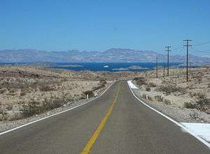
The first view of the Gulf of California along Highway 12.

Highway 12 approaching Parador Punta Prieta junction.
Federal Highway 12 (Carretera Federal 12) is a Federal Highway of Mexico.[2] Federal Highway 12 travels from Mexican Federal Highway 1 in central Baja California to Bahía de los Ángeles and its total length is 68 km (42.25 mi).[3]
References
- ↑ "Datos Viales de Baja California" (PDF) (in Spanish). Dirección General de Servicios Técnicos, Secretaría de Comunicaciones y Transportes. 2011. p. 6. Retrieved 2011-08-21.
- ↑ "Mapa Nacional de Comunicaciones y Transportes" (PDF). Secretaría de Comunicaciones y Transportes de Mexico. Retrieved December 11, 2008.
- ↑ "On the Road In (Mexico) - Distancias de Baja". Bell and Bell. Retrieved June 30, 2010.
| Highways |
|
|---|---|
| Toll roads | |
This article is issued from Wikipedia - version of the 10/9/2015. The text is available under the Creative Commons Attribution/Share Alike but additional terms may apply for the media files.