Mevo Dotan
| Mevo Dotan מְבוֹא דּוֹתָן | |
|---|---|
 | |
 Mevo Dotan | |
| Coordinates: 32°25′12.39″N 35°10′10.24″E / 32.4201083°N 35.1695111°ECoordinates: 32°25′12.39″N 35°10′10.24″E / 32.4201083°N 35.1695111°E | |
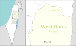
| District | Judea and Samaria Area |
| Council | Shomrom |
| Region | West Bank |
| Affiliation | Amana |
| Founded | 1977 |
| Founded by | Amana |
| Population (2015)[1] | 364 |
Mevo Dotan (Hebrew: מְבוֹא דּוֹתָן; lit. Dothan's approach) is a communal Israeli settlement in the West Bank. Located in the northern Samarian hills,[2] south of the Dotan Valley on road 585 east of Baqa al-Gharbiyye and adjacent to the Palestinian town of Ya'bad, it falls under the jurisdiction of Shomron Regional Council. In 2015 it had a population of 364.
The international community considers Israeli settlements in the West Bank illegal under international law, but the Israeli government disputes this.[3] Mevo Dotan is built on land belonging to Ya'bad.[4]
History
Mevo Dotan was established in October 1977 by a group of religious Orthodox and non-religious Jewish Israelis who lived in tents adjacent to the police building of Sa-Nur, and was named for being on the way to the ancient town of Dothan (Gen 37:17)).. The group relocated to its hilltop location in June 1981 with the aid of the Amana settlement organization. The local Arab residents called the hilltop the 'Bald Mountain' (Jabl al-Akra) because of its barren state. One of the reasons for choosing this location was to settle state-owned lands in an area that had no Jewish population. Over the years, many of the religious families moved away.
In 2001, following the outbreak of the Second Intifada, and the degradation of the security level in the area, almost half the residents left the village. The heads of the village committee called for public assistance in repopulating the empty homes and in 2003, the 'Golan Yeshiva' decided to accept the challenge. Several families moved to the village, founded a kollel and rejuvenated the religious life in the village.
Alonei Arava Nature Reserve
Two kilometers south of Mevo Dotan is the Alonei Arava Nature Reserve, named after the oak trees (alonim) that grow in the area and the nearby Arab village of Arrabeh. East of the nature reserve is Jabal al-Aqra' (326 m), and the nature reserve overlaps the hill's northwest range.[5]
References
- ↑ "List of localities, in Alphabetical order" (PDF). Israel Central Bureau of Statistics. Retrieved 16 October 2016.
- ↑ Mevo Dotan Prime Minister's Office
- ↑ "The Geneva Convention". BBC News. 10 December 2009. Retrieved 27 November 2010.
- ↑ Israeli Settlers Attack Taxi Driver, Shut Down Main Road near Jenin, December 31, 2015 (WAFA)
- ↑ Hareuveni, Imanuel (1985). קום התהלך בארץ: מדריך שמורות טבע בישראל [Nature Reserves in Israel] (in Hebrew) (2nd ed.). Israel: Israel Ministry of Defense. p. 226. ISBN 965-05-0193-2.
שם השמורה – לפי עצי האלון הגדלים בה ולפי הצורה העברית של שם הכפר הסמוך ערבה (בו מוצע לזהות, לפי אחת הסברות, את אֲרֻבּוֹת, מרכז המחוז התשיעי של מלכות שלמה ועיר מושבו של הנציב השלישי, מ-12 נציביו של המלך שלה [מל"א ד', 4, 10])." "השמורה משתרעת על שלוחה צפ'-מע' של ג'בל אל-אקרע המתנשאת לרום 276 מ'.
External links
- Official website
- pictures of Mevo Dotan
- Jerusalem Post 6/23/05: "Hermesh between the crosshairs" Peace Now Five Doves United Jerusalem
- Peres to Blair: Two West Bank settlements could be evacuated Haaretz