Rome Metro
|
The logo of Metropolitane Italia. | |||
|
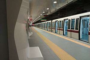
A S300 train at Conca d'Oro station | |||
| Overview | |||
|---|---|---|---|
| Native name | Metropolitana di Roma | ||
| Locale | Rome, Italy | ||
| Transit type | Rapid transit | ||
| Number of lines | 3[1] | ||
| Number of stations | 73[1][2][Note 1] | ||
| Annual ridership | 279 million (2012)[1] | ||
| Operation | |||
| Began operation | 1955 | ||
| Operator(s) | ATAC | ||
| Number of vehicles | 83 trains[1] | ||
| Technical | |||
| System length | 60.0 km (37.3 mi)[1][2][3] | ||
| Track gauge |
1,435 mm (4 ft 8 1⁄2 in) (standard gauge) | ||
| Electrification | Overhead lines | ||
| |||
The Rome Metro (Italian: Metropolitana di Roma) is an underground public transportation system that operates in Rome, Italy. The network opened in 1955, making it the oldest in the country. The Metro comprises three lines – Line A (orange), Line B (blue) and Line C (green) – which operate on 60.0 kilometres (37.3 mi) of route, serving 73 stations.[1][2][Note 1] The original lines in the system, Lines A and B, form an X shape with the lines intersecting at Termini Station, the main train station in Rome. Line B splits at the Bologna station into two branches. While Line C opened in 2014, it is not yet connected to the rest of the Metro network. Plans have also been announced for a fourth line.
Rome's local transport provider, ATAC, operates the Rome Metro and several other rail services: the Roma–Lido line, the Roma-Giardinetti line, and the Roma–Nord line. The first of these, the Roma–Lido, which connects Rome to Ostia, on the sea, is effectively part of the metro network. It is run on similar lines and uses trains similar to those in service on the Metro. The Roma–Giardinetti line, although designated as a railway, is actually a narrow-gauge tram line while the Roma–Nord line is a suburban railway.
Metro lines
| Line | Terminals | Opened | Last extension | Length (km) |
Stations | Passengers (millions) |
Travel time (minutes) |
|---|---|---|---|---|---|---|---|
| |
Battistini ↔ Anagnina | 1980 | 2000 | 18.4[4] | 27 | 164.2 | 41 |
| |
Laurentina ↔ Rebibbia / Jonio | 1955 | 2015 | 23.5[5][6] | 26 | 125.9[7] | 34/34 |
| |
Monte Compatri-Pantano ↔ Lodi | 2014 | 2015 | 18.1[2] | 21 | n/a | 34 |
| Total: | 60.0[1][2][8] | 73[1][2][Note 1] | |||||
Line A
Line A runs from the southeastern suburbs of Rome, then along the northeast section of downtown, and then to the northern section of the city, near Vatican City. It connects with Line B at Termini Station, along with many other national and regional rail services. It has 27 stations, with terminals at Battistini and Anagnina. It is identified by the colour orange.
Line A was the second line built in Rome. Approval was given for the construction of the city's second metro line in 1959.
Work on Line A began in 1964 in the Tuscolana area, but suffered a series of delays caused by poor organisation. Above all, the originally planned method of construction, the cut and cover, posed serious problems for road traffic in south-east Rome. Work on the Metro was suspended and began again five years later, using bored tunnels, which partially resolved the traffic problems but caused numerous claims for compensation for vibrations caused by the machines. Work was also frequently interrupted by archaeological finds made during the excavations, particularly near Piazza della Repubblica.
Line A entered service in February 1980. In the late 1990s it was extended from Ottaviano, in the Prati district, to Battistini to the west.
Line B
Line B was the first Metro line in Rome. Line B connects the north-east of the city with the south-west. It has 26 stations with terminals at Rebibbia, Jonio and Laurentina (just east of EUR). It is identified by the colour blue. Transfers are available with Line A and other rail services at Termini Station.
Line B was planned during the 1930s by the Fascist government to provide a rapid connection between the main train station, Termini, and a new district to the south-east of the city, E42, the planned location of the Universal Exposition (or Expo), which was to be held in Rome in 1942. The exposition never took place due to Italy's entry into the Second World War in 1940. When its construction was interrupted, some of the tunnels on the city-centre side of the Metro (between Termini and Piramide) had already been completed, and they were used as air raid shelters during the war.
Work restarted in 1948, together with the development of the site formerly designated for the Expo into a residential and business district under the name EUR. The metro was officially opened on 9 February 1955 by the then President of the Republic Luigi Einaudi. Regular services began the following day.
In 1990, Line B was extended from Termini to Rebibbia in the east of the city and the entire line was modernised. A new 4 km (2.5 mi) long branch (B1) was opened connecting Piazza Bologna with Conca d'Oro on 13 June 2012; the branch's last stop (and new terminus), Jonio, was opened on 21 April 2015.
Line C
Opened on November 9, 2014, line C is intended to run from Grottarossa (north of the Vatican) to Pantano (the former terminus of the Roma-Giardinetti light railway) via the city centre. Line C is the first Metro line to extend beyond the city limits; it will also intersect with Line A at Ottaviano (beside the Vatican) and San Giovanni, with Line B at Colosseo, and with the planned Line D at piazza Venezia, thus creating a fourth metro hub in Rome.
A further 5.4-kilometre (3.4 mi) section of Line C, serving six additional stations opened on 29 June 2015, and the line's western terminus was moved from Parco di Centocelle to Lodi.[2]

The first section of the line, from Centocelle to Pantano,[9] is the furthest from the city centre and includes 15 of the planned 30 stops. Phase two will extend the line to Lodi and then San Giovanni (where it will intersect with line A), with a further two stations in service.[10] After the third phase, the line will be further extended with two stations, Amba Aradam/Ipponio and Fori Imperiali/Colosseo, located in the city centre.[11]
Progress on the line has been slow with projected completion dates being repeatedly delayed. Rome is one of the oldest cities in the world and the construction of the Metro system has encountered considerable obstacles owing to the frequent archaeological discoveries. While the excavation of the tunnels themselves can be undertaken well below the probable location of most archaeological finds, the excavation of stairwells and ventilation shafts - which must, by necessity, connect with the surface - pose considerable difficulties.
The trains operating on line C are completely automated, and use the same AnsaldoBreda Driverless Metro system also featured on the Copenhagen Metro.
Other rail lines operated by ATAC

Roma–Lido
Construction of the Roma–Lido line began shortly after the end of the first world war and was completed some six years later in 1924. It began operation as a steam locomotion railway but electrification was completed less than a year later.
The line is operated as an integrated part of the metro system, but is entirely overland. It runs from the Roma Porta San Paolo station beside the Line B Piramide station and runs alongside the B line as far as EUR Magliana. It then continues separately on to the seaside district of Ostia. The line terminates beside the end of Via Cristoforo Colombo.
Roma–Giardinetti
Officially termed a railway, the Roma–Giardinetti line is a narrow gauge tram which connects Laziali (a smaller, local train station some 800 metres east of Temini's main concourse) with Giardinetti, just past the Grande Raccordo Anulare (GRA) - Rome's orbital motorway. The line originally ran to Frosinone some 137 km (85 mi) from Rome, but has been gradually reduced in length, most recently when the section from Giardinetti to Pantano, which will become a permanent part of the new C line metro, was taken out of service.
Roma–Civitacastellana–Viterbo
.jpeg)
The Roma–Civitacastellana–Viterbo line (also called Roma Nord railway) began life as narrow gauge tram running from Piazza della Libertà in Rome to Civita Castellana. However the next stretch of the line, to Viterbo, was built as a railway and over the years the tram section was converted into a railway as well. A process which concluded with the moving of the Roman terminus from the street-level terminus at Piazza della Libertà across the river to a new underground station in Piazzale Flaminio, beside the subsequently constructed metro A line station, after the Second World War.
The line is operated in two modes: as an urban service from Piazzale Flaminio to Montebello, and as a suburban service from Piazzale Flaminio to Viterbo. The urban service operates with a frequency of about one train every 10 minutes, while the suburban service operates considerably less frequently, with less than a third of the trains making the full two and a half hour journey from Rome to Viterbo.
Future expansions
Line D
The start of the construction of the line has been indefinitely postponed. The line would link the north eastern areas of Rome with EUR in the south west. The D line would be 22 km (14 mi) long and would feature 22 stations. It would intersect Line A at Spagna, Line B and the Roma-Lido railway at EUR Magliana, Line B1 at Jonio, Line C at Venezia.
See also
Notes
- 1 2 3 Counting Termini (Rome Metro), the interchange station between Line A and Line B, only once.
References
- 1 2 3 4 5 6 7 8 "Home > Azienda - I numeri di atac - Trasporto pubblico" [Home > Company - The numbers of ATAC - Public transportation] (in Italian). ATAC. 8 November 2014. Retrieved 2015-04-06.
- 1 2 3 4 5 6 7 Marco Chiandoni (30 June 2015). "Rome metro Line C reaches Lodi". International Railway Journal. Retrieved 2015-06-30.
- ↑ http://www.ilpendolaremagazine.it/news/2015/06/27/il-settimanale-video-prossima-fermata-lodi-metro-c-roma-avvicina-centro/
- ↑ http://www.metropolitanadiroma.it/notizie-metro-roma/33-la-linea-a-della-metropolitana-di-roma.html
- ↑ https://web.archive.org/web/20090821083704/http://www.metroroma.it/IT-IT/AZIENDA/DESCRIZIONE/Pagine/I%20numeri%20di%20metro.aspx
- ↑ http://www.romametropolitane.it/articolo.asp?CodMenu=2&CodArt=137
- ↑ http://www.agenzia.roma.it/documenti/carta_servizi/40.pdf
- ↑ http://www.ilpendolaremagazine.it/news/2015/06/27/il-settimanale-video-prossima-fermata-lodi-metro-c-roma-avvicina-centro/
- ↑ http://www.metroxroma.it/2013/10/tratta-t3-avanti-tutta-fermarsi-costerebbe-180-mln/ (in Italian)
- ↑ http://www.metroxroma.it/2013/09/linea-c-riaprono-i-cantieri-a-san-giovanni-nellinverno-2015/ (in Italian)
- ↑ http://www.comune.roma.it/wps/portal/pcr?contentId=NEW449951&jp_pagecode=newsview.wp&ahew=contentId:jp_pagecode (in Italian)
External links
| Wikimedia Commons has media related to Rome Metro. |
- Rome Metro Map on Google Maps with Geolocation
- The Public transport company of the city of Rome (Italian) (English)
- Roma Metropolitane – public transportation website (Italian)
- Roma at UrbanRail.net (English)
- Martin G. Conde, ROME – IMPERIAL FORA. The Velia Hill: Metro ‘C’ Archaeological Surveys (2006-2007). S10 (b1, b2, b3). (2006-2007)
Maps
- Planned underground and suburban lines on 1986 (archived version)
- Network map (real-distance)
| .svg.png) | |
| FL lines | ||
| Local railways | ||
| Urban surface systems | ||
| Ticketing systems | ||
| Commuter rail | 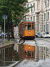 | ||||||
|---|---|---|---|---|---|---|---|
| Rapid transit | |||||||
| Trams |
| ||||||
| Trolleybuses |
| ||||||
| People movers | |||||||