Metropolitan Borough of Kensington
| Kensington | |
|---|---|
 Kensington within the County of London | |
| History | |
| • Created | 1900 |
| • Abolished | 1965 |
| • Succeeded by | Royal Borough of Kensington and Chelsea |
| Status |
Metropolitan borough (and Royal borough from 1901) |
| Government |
Kensington Borough Council |
| • HQ | Kensington High Street |
| • Motto | Quid Nobis Ardut (What is hard for us) |
 Coat of arms of the borough council | |
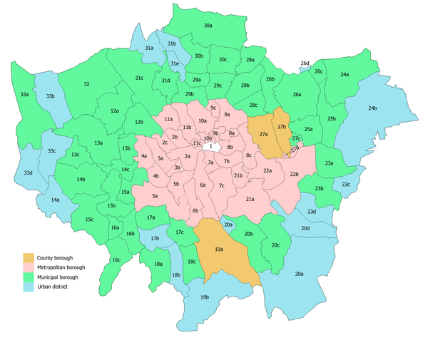
The Metropolitan Borough of Kensington was a Metropolitan borough in the County of London from 1900 to 1965.
History
It bordered Chelsea, Fulham, Hammersmith, Paddington, and Westminster.
It included Kensington, South Kensington, Earls Court, Notting Hill, Brompton and part of Kensal Green.
In 1901 it was granted the status of a royal borough, and therefore from then was also known as the Royal Borough of Kensington.[1] The status was granted after the death of Queen Victoria, in accordance with her wish (she was born at Kensington Palace in the borough).
In 1965 it was amalgamated with the Metropolitan Borough of Chelsea to form the Royal Borough of Kensington and Chelsea.
A number of street name plaques still bear the designation "Royal Borough of Kensington"; one such sign, in Portobello Road, is seen fleetingly in the Disney film Bedknobs and Broomsticks (1971).
The Town Hall in Kensington High Street was an Italianate building dating from 1880 designed by Robert Walker. It was demolished "in controversial circumstances" in June 1982.[2]
Coat of arms
The coat of arms is derived from those of the former Lords of the Manor, and that of the parish church, which is dedicated to the Virgin Mary.[3]
Population and area
The Kensington borough covered 2,291 acres (9.3 km2) once part of Kensal New Town (a detached part of Chelsea before 1901) became incorporated. The population of Kensington recorded in the Census, which excludes Kensal New Town before 1901, was:
Kensington Vestry 1801–1899
| Year[4] | 1801 | 1811 | 1821 | 1831 | 1841 | 1851 | 1861 | 1871 | 1881 | 1891 |
|---|---|---|---|---|---|---|---|---|---|---|
| Population | 8,556 | 10,886 | 14,428 | 20,902 | 26,834 | 44,053 | 70,108 | 120,299 | 163,151 | 166,308 |
Metropolitan Borough 1900–1961
| Year[5] | 1901 | 1911 | 1921 | 1931 | 1941 | 1951 | 1961 |
|---|---|---|---|---|---|---|---|
| Population | 176,628 | 172,317 | 175,859 | 180,677 | [6] | 168,160 | 171,272 |
Politics

Under the Metropolis Management Act 1855 any parish that exceeded 2,000 ratepayers was to be divided into wards; however the parish of St Mary Abbotts Kensington had already been divided into three wards by a local act in 1851 - "The Kensington Improvement Act, 1851". So the incorporated vestry inherited these wards and assigned vestrymen to them: The Holy Trinity Brompton (27), St John's Notting Hill & St James' Norland (27) and St Mary Abbotts (30).[7]
In 1894 as its population had increased the incorporated vestry was re-divided into eight wards (electing vestrymen): Golborne (18), Norland (15), Pembridge (15), Holland (15), Earl's Court (12), Queen's Gate (15), Redcliffe (15) and Brompton (15).[8][9]
The metropolitan borough was divided into nine wards for elections: Brompton, Earl's Court, Golborne, Holland, Norland, Pembridge, Queen's Gate, Redcliffe and St Charles.[10][11]
Parliament constituency
For elections to Parliament, the borough was divided into two constituencies:
In 1950 the borough's representation was increased to two and a half seats, when part of it was merged with Chelsea:
References
- ↑ "The King has been pleased to direct Letters Patent to be passed under the Great Seal of the United Kingdom of Great Britain and Ireland, granting the title Royal to the Metropolitan Borough of Kensington, and ordaining and declaring that the said Borough shall henceforth be called and styled the Royal Borough of Kensington, and the Council for the Borough The Mayor, Aldermen, and Councillors of the Royal Borough of Kensington." The London Gazette: no. 27378. p. 7472. 19 November 1901.
- ↑ Royal Borough of Kensington & Chelsea website
- ↑ (Civic Heraldry) accessed 15 Jan 2008
- ↑ Statistical Abstract for London, 1901 (Vol. IV); Census tables for Metropolitan Borough of Kensington
- ↑ GB Historical GIS / University of Portsmouth, Kensington MetB through time | Population Statistics | Total Population, A Vision of Britain through Time. http://www.visionofbritain.org.uk/unit/10108044/cube/TOT_POP Date accessed: 19th February 2015
- ↑ The census was suspended for World War II
- ↑ The London Gazette Issue: 21802. 20 October 1855. pp. 3890–3891. Retrieved 9 April 2015.
- ↑ The London Gazette Issue: 26542. 14 August 1894. pp. 4717–4718. Retrieved 9 April 2015.
- ↑ The London Gazette Issue: 26563. 23 October 1894. p. 5942. Retrieved 9 April 2015.
- ↑ Post Office London County Suburbs Directory, 1919. 1919. Retrieved 18 February 2015.
- ↑ Ordnance Survey 'County Series 3rd Edition' Map of London (1912-14) at 1:2500 scale. Accessed at https://www.old-maps.co.uk/
Further reading
- Robert Donald, ed. (1907). "London: Kensington". Municipal Year Book of the United Kingdom for 1907. London: Edward Lloyd.
Local government districts abolished or transferred by the London Government Act 1963 | ||
|---|---|---|
| London | ||
| Essex | ||
| Hertfordshire | ||
| Middlesex, CC | ||
| Kent | ||
| Surrey | ||
| Transfers | Middlesex to Hertfordshire: Potters Bar
| |
Coordinates: 51°30′08″N 0°11′42″W / 51.5021°N 0.1951°W