Barcelona Metro


The Barcelona Metro (Catalan and Spanish: Metro de Barcelona)[lower-alpha 1] is an unofficial brand name for an extensive network of rapid transit electrified railway lines that run mostly underground in central Barcelona and into the city's suburbs. It is part of the larger public transport system of Barcelona, the capital of Catalonia (Spain), with unified fares under the Autoritat del Transport Metropolità (ATM) scheme. As of 2014, the network is operated by two separate companies: Transports Metropolitans de Barcelona (TMB) and Ferrocarrils de la Generalitat de Catalunya (FGC). It is made up of 12 lines, combining the lines owned by the two companies. Two lines, L9 and L10 are being built at present, with both lines having different sections of each opened between 2009 and 2016. They are due to be completed in the near future..[2] Three lines on the network have opened as automatic train operation/driverless vehicle systems since 2009: Line 11, Line 9 and Line 10, in chronological order.
History
The first rapid transit railway service in Barcelona was founded in 1863 by the private company Ferrocarril de Sarrià a Barcelona ("Railway from Sarrià to Barcelona", after 1916 Sarrià joined the municipality of Barcelona). Later this line evolved in what now is basically the current L6 metro service. This railway system, now part of the Ferrocarrils de la Generalitat de Catalunya company, was later inspired by the London Underground naming style having long names for the lines ("Sarrià line", "Balmes line"...).
Much later, in the 1920s, a second and a third rapid transit railway systems were founded with the construction of the Gran Metro between Lesseps and the Plaça de Catalunya (part of the modern L3) and, two years later, the Metro Transversal (now part of L1). This third one was built between the Plaça de Catalunya and la Bordeta to link the city centre with the Plaça d'Espanya and Montjuïc, the site of the 1929 Barcelona International Exposition. These two later rapid transit companies contrasted with the first one in being inspired by the Métropolitain de Paris (from where the word "metro" comes).
Today the network consists of 12 lines managed by 2 different operators: Transports Metropolitans de Barcelona (TMB) and Ferrocarrils de la Generalitat de Catalunya (FGC, or Catalan Government Railways). Fares and nomenclature are controlled by the Autoritat del Transport Metropolità, a city-wide system that also includes local and regional buses, tramways and some commuter and regional train services.
Lines
The major network, operated by TMB, consists of eight lines, numbered L1 to L5 and L9 to L11 (which are distinguished on network maps by different colours), covering 102.6 kilometres (63.8 mi) of route and 141 stations.[3]
FGC lines are numbered L6, L7, L8 and L12. These lines, except all L12 and part of L7, share tracks with commuter rail lines.
The Barcelona Metro lines do not have a name of their own but are generally referred to by their colour or by the number and the names of their termini.
The lines run as follows:
| Line Number | Termini | Operator | Current Length | Approved Length | Current Stations | Approved Stations | Year of Opening |
|---|---|---|---|---|---|---|---|
| Hospital de Bellvitge–Fondo | TMB | 20.700 km | 29.758 km | 30 | 38 | 1926 | |
| Paral·lel–Badalona Pompeu Fabra | TMB | 13.700 km | 18.466 km | 18 | 34 | 1995 | |
| Zona Universitària–Trinitat Nova | TMB | 18.400 km | 20.024 km | 26 | 36 | 1924 | |
| Trinitat Nova–La Pau | TMB | 17.300 km | 18.916 km | 22 | 26 | 1973 (1926) | |
| Cornellà Centre–Vall d'Hebron | TMB | 19.168 km | 19.168 km | 26 | 27 | 1959 | |
| Pl. Catalunya–Sarrià | FGC | 4.884 km | 8 (2[lower-alpha 2] shared with L7) | 1929 (1863) | |||
| Pl. Catalunya–Av. Tibidabo | FGC | 4.634 km | 4.634 km | 7 (2[lower-alpha 3] shared with L6) | 7 | 1953 (1863) | |
| Pl. Espanya–Molí Nou-Ciutat Cooperativa | FGC | 11.266 km | 11.266 km | 11 | 21 | 2000 (1912) | |
| La Sagrera–Can Zam | 7.867 km | 9 (3 shared with L10) | |||||
| La Sagrera–Gorg | TMB | 5.570 km | 47.800 km | 6 (3 shared with L9) | 33 | 2010 | |
| Trinitat Nova–Can Cuiàs | TMB | 2.109 km | 5 | 2003 | |||
| Sarrià–Reina Elisenda | FGC | 0.600 km | 3.200 km | 2 | 5 | 2016 (1976) |
In addition to those, Renfe and FGC trains and the increasingly important Trambaix and Trambesòs routes and stations are displayed on most recent maps, including the info maps in the metro stations, all in a single variety of dark green.
L9 and L10

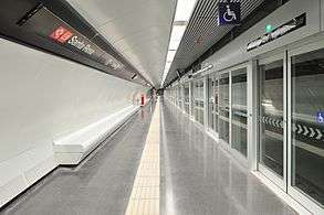
Construction work is taking place currently on L9/L10, which will run from Badalona and Santa Coloma de Gramenet to the Zona Franca district and El Prat International Airport. The lines, which share a central section between Bon Pastor and Torrassa (L1), will be the longest automated metro line in Europe, at 47.8 kilometres (29.7 mi), and will have 52 stations. The project was approved in 2000[4] but has been challenged by some technical difficulties and some of their sections are pending further geological analysis. The first section of Line 9 that runs between La Sagrera and Can Zam opened in 2009, and by June 2010 eleven new stations on the new Lines L9 and L10 had opened. As of February 2016, the 15-station, 19.6-kilometre (12.2 mi) south section of Line L9 between Zona Universitària and the airport opened.[5]
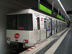
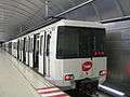
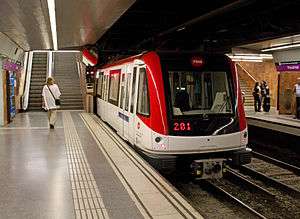
Rolling stock
- TMB rolling stock
-
Series 500

-

Series 2000

-

Series 2100

-
Series 3000
-

Series 4000

-

Series 5000

-

Series 6000

- FGC rolling stock
-

Series 112

-

Series 113 (4 cars) and 114 (3 cars)


-

Series 213

Cards and pricing
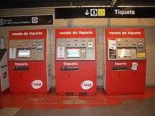
In addition to the one-way ticket (€2.15 as of February 2016[6]) there are a number of other tickets and cards. All of the Autoritat del Transport Metropolità (ATM) transport cards are valid and can be used in the Barcelona Metro. These are:
- Airport Ticket, is a one-way ticket for the airport stations, only required if you travel with a one-way ticket or a T10
- T10, which includes ten rides at a discounted price
- T Dia, unlimited trips within a day
- T50/30, 50 journeys made in 30 consecutive days from the first use
- T Familiar (70/30), 70 journeys made in 30 consecutive days from the first use
- T Mes, unlimited journeys made in 30 consecutive days from the first use
- T Trimestre, unlimited journeys made in 90 consecutive days from the first use
- T Jove, young ticket (less than 25 years old) for unlimited journeys made in 90 consecutive days from the first use
All of the metro stations are within fare zone 1. Fares can be found on this page.
Stations


As of mid 2016, there are currently 180 operational stations in the Barcelona Metro, served by the 12 lines in current use, which will increase to 209 when lines L9 and L10 are finally completed. The average distance between stations is 650 metres.
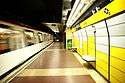
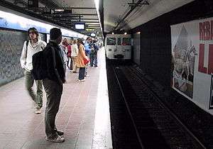
An overwhelming majority of stations in the network lack related buildings or structures aboveground, mostly consisting of an access with stairs, escalators or elevators. The official TMB metro indicator, a red rhombus with a M inside, remains unused by FGC lines, which use their company logo and a different rhombus-shaped logo (actually rather similar to the one used inside the Madrid Metro) inside stations. Below ground their decoration is remarkably sober, with the exception of a few stations.
Disused stations
A number of stations in the network have been closed, were never inaugurated, or have been moved to a nearby location. See the main article for more details.
Accessibility
Accessibility for wheelchairs and for parents with pushchairs is being improved but the metro system is not yet fully accessible. A project of improvements is gradually adding more lifts from street level to ticket office level and then from ticket office level to the platforms, though some stations remain without access. 17 of 180 are not fully accessible as 2016. See Transports Metropolitans de Barcelona for more information on which stations are currently accessible.
Transportation in the Metropolitan Area of Barcelona
The Barcelona Metro is part of a larger transportation network, regulated and fare-integrated by Autoritat del Transport Metropolità.
Among these services, there are two large systems which operate both inside and outside the city limits of Barcelona: the commuter train lines operated by Renfe, amalgamated in the Rodalies Barcelona, or Ferrocarrils de la Generalitat de Catalunya lines which start in the metro lines the company operates (L6, L7 and L8) and which become a fully-fledged railway system which serves most of the metropolitan area: list of FGC lines. FGC is developing Sabadell Metro and Terrassa Metro as extensions of its network in the large cities of Sabadell and Terrassa respectively.
See also
Barcelona Metro topics
- List of Barcelona metro stations
- Disused Barcelona metro stations
- Autoritat del Transport Metropolità
- Spanish solution, also known as Barcelona solution
Rapid transit in Barcelona
- Transport in Barcelona
- List of railway stations in Barcelona
- Rodalies de Catalunya and FGC-operated Rodalies Barcelona
- List of Rodalies Barcelona railway stations
- FGC suburban lines
- Trambaix and Trambesòs
- Tramvia blau
- List of tram stations in Barcelona
- Funicular de Montjuïc
- Funicular de Vallvidrera
Other metro systems in Spain
- Metro Bilbao
- Madrid Metro
- Palma de Mallorca Metro
- Seville Metro
- Valencia Metro
- Málaga Metro
- List of metro systems
Notes
References
- ↑ "Spanish Statistics National Institute INE". Ine.es. Archived from the original on 14 November 2011. Retrieved 11 April 2012.
- ↑ http://people.reed.edu/~reyn/metrobcn.pdf
- ↑ "Transport in figures - Basic transport data". TMB. 31 December 2013. Retrieved 9 May 2014. — length of TMB lines.
- ↑ http://people.reed.edu/~reyn/Linia9.pdf
- ↑ "Driverless metro reaches Barcelona airport". Railway Gazette International. 12 February 2016. Retrieved 15 February 2016.
- ↑ "Integrated Fare System - Transports Metropolitans de Barcelona". tmb.cat.
External links
| Wikimedia Commons has media related to Barcelona Metro. |
- Transports Metropolitans de Barcelona
- Ferrocarrils de la Generalitat de Catalunya
- Barcelona Metro
- CityMayors article on Barcelona Metro
- Barcelona rail network map
- Wefer.com
- Barcelona metro map for wheelchair users
| Road |
| ||||||||||
|---|---|---|---|---|---|---|---|---|---|---|---|
| Public transport |
| ||||||||||
| Mainline railway stations | |||||||||||
| Air |
| ||||||||||
| Leisure |
| ||||||||||
| Other | |||||||||||
| |||||||||||
| Barcelona Metro lines | ||||||||||||||||||||||||||||||||||||||||||||||||||||||||||||||||||||||||||||||||||||||||||||||||||||||||||||||||||||||||||||||||||||||||||||||||||||||||||||||||||||||||||||||||||||||||||||||||||||||||||||||||||||||||||||||||||||||||||||||||||||||||||||||||||||||||||||||||||||||||||||||||||||||||||||||||||||||
|---|---|---|---|---|---|---|---|---|---|---|---|---|---|---|---|---|---|---|---|---|---|---|---|---|---|---|---|---|---|---|---|---|---|---|---|---|---|---|---|---|---|---|---|---|---|---|---|---|---|---|---|---|---|---|---|---|---|---|---|---|---|---|---|---|---|---|---|---|---|---|---|---|---|---|---|---|---|---|---|---|---|---|---|---|---|---|---|---|---|---|---|---|---|---|---|---|---|---|---|---|---|---|---|---|---|---|---|---|---|---|---|---|---|---|---|---|---|---|---|---|---|---|---|---|---|---|---|---|---|---|---|---|---|---|---|---|---|---|---|---|---|---|---|---|---|---|---|---|---|---|---|---|---|---|---|---|---|---|---|---|---|---|---|---|---|---|---|---|---|---|---|---|---|---|---|---|---|---|---|---|---|---|---|---|---|---|---|---|---|---|---|---|---|---|---|---|---|---|---|---|---|---|---|---|---|---|---|---|---|---|---|---|---|---|---|---|---|---|---|---|---|---|---|---|---|---|---|---|---|---|---|---|---|---|---|---|---|---|---|---|---|---|---|---|---|---|---|---|---|---|---|---|---|---|---|---|---|---|---|---|---|---|---|---|---|---|---|---|---|---|---|---|---|---|---|---|---|---|---|---|---|---|---|---|---|---|---|---|---|---|---|---|---|---|---|---|---|---|---|---|---|---|---|---|---|---|---|---|---|---|
| ||||||||||||||||||||||||||||||||||||||||||||||||||||||||||||||||||||||||||||||||||||||||||||||||||||||||||||||||||||||||||||||||||||||||||||||||||||||||||||||||||||||||||||||||||||||||||||||||||||||||||||||||||||||||||||||||||||||||||||||||||||||||||||||||||||||||||||||||||||||||||||||||||||||||||||||||||||||

Members of International Metro Organizations | |||||||||||||||||||
|---|---|---|---|---|---|---|---|---|---|---|---|---|---|---|---|---|---|---|---|
| |||||||||||||||||||
| |||||||||||||||||||