Merom Golan
| Merom Golan מְרוֹם גּוֹלָן | |
|---|---|
 | |
 Merom Golan | |
| Coordinates: 33°08′00″N 35°46′33″E / 33.13333°N 35.77583°ECoordinates: 33°08′00″N 35°46′33″E / 33.13333°N 35.77583°E | |
| District | Northern |
| Council | Golan |
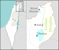
| Region | Golan Heights |
| Affiliation | Kibbutz Movement |
| Founded | 14 July 1967 |
| Population (2015)[1] | 675 |
| Website | merom-golan.org.il |
Merom Golan (Hebrew: מְרוֹם גּוֹלָן) is an Israeli settlement and kibbutz in the Israeli-occupied Golan Heights. Located at the foot of Mount Bental, it falls under the jurisdiction of Golan Regional Council. In 2015, it had a population of 675.
The international community considers Israeli settlements in the Golan Heights illegal under international law, but the Israeli government disputes this.[2]
History
Kibbutz Golan (later Merom Golan) was established on 14 July 1967 with funds from the Upper Galilee Regional Council on the site of the abandoned military camp of Aleika.[3]
Geography
Climate
| Climate data for Merom Golan (Temperature: 1995–2010, Precipitation: 1980-2010) | |||||||||||||
|---|---|---|---|---|---|---|---|---|---|---|---|---|---|
| Month | Jan | Feb | Mar | Apr | May | Jun | Jul | Aug | Sep | Oct | Nov | Dec | Year |
| Record high °C (°F) | 21.2 (70.2) |
22.0 (71.6) |
29.7 (85.5) |
33.3 (91.9) |
38.2 (100.8) |
38.0 (100.4) |
40.8 (105.4) |
41.4 (106.5) |
38.3 (100.9) |
35.1 (95.2) |
28.6 (83.5) |
24.2 (75.6) |
41.4 (106.5) |
| Average high °C (°F) | 9.9 (49.8) |
11.0 (51.8) |
14.5 (58.1) |
18.8 (65.8) |
24.5 (76.1) |
27.7 (81.9) |
29.2 (84.6) |
29.4 (84.9) |
27.7 (81.9) |
24.1 (75.4) |
17.5 (63.5) |
12.3 (54.1) |
20.55 (68.99) |
| Daily mean °C (°F) | 5.7 (42.3) |
6.5 (43.7) |
9.3 (48.7) |
12.8 (55) |
17.2 (63) |
20.7 (69.3) |
23.1 (73.6) |
23.1 (73.6) |
20.9 (69.6) |
17.5 (63.5) |
11.8 (53.2) |
7.9 (46.2) |
14.71 (58.48) |
| Average low °C (°F) | 1.5 (34.7) |
2.0 (35.6) |
4.1 (39.4) |
6.8 (44.2) |
10.0 (50) |
13.8 (56.8) |
17.0 (62.6) |
16.8 (62.2) |
14.1 (57.4) |
10.9 (51.6) |
6.1 (43) |
3.4 (38.1) |
8.88 (47.97) |
| Record low °C (°F) | −14.2 (6.4) |
−12.5 (9.5) |
−6.7 (19.9) |
−4.5 (23.9) |
−0.2 (31.6) |
4.0 (39.2) |
7.7 (45.9) |
6.7 (44.1) |
3.4 (38.1) |
−2.0 (28.4) |
−6.1 (21) |
−8.8 (16.2) |
−14.2 (6.4) |
| Average rainfall mm (inches) | 201 (7.91) |
196 (7.72) |
115 (4.53) |
40 (1.57) |
9.1 (0.358) |
0 (0) |
0 (0) |
0 (0) |
1.9 (0.075) |
22 (0.87) |
86 (3.39) |
159 (6.26) |
830 (32.683) |
| Average rainy days (≥ 0.1 mm) | 13 | 13 | 10 | 5 | 2.0 | 0.5 | 0.1 | 0 | 0.7 | 5 | 8 | 11 | 68.3 |
| Average relative humidity (%) | 80 | 79 | 73 | 64 | 57 | 57 | 60 | 67 | 65 | 62 | 69 | 78 | 67.6 |
| Source: Israel Meteorological Service[4][5] | |||||||||||||
See also
References
- ↑ "List of localities, in Alphabetical order" (PDF). Israel Central Bureau of Statistics. Retrieved 16 October 2016.
- ↑ "The Geneva Convention". BBC. 10 December 2009.
- ↑ 1967 Israel, the War and the Year that Transformed the Middle east by Tom Segev p.574-575
- ↑ "Temperature average". Israel Meteorological Service. Retrieved December 2011. Check date values in:
|access-date=(help)(Hebrew) - ↑ "Precipitation average". Retrieved 12 July 2011.(Hebrew)
External links
| Wikimedia Commons has media related to Merom Golan. |
This article is issued from Wikipedia - version of the 9/18/2016. The text is available under the Creative Commons Attribution/Share Alike but additional terms may apply for the media files.