Medina, Wisconsin
| Medina, Wisconsin | |
|---|---|
| Town | |
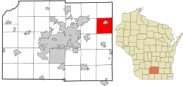 Location in Dane County and the state of Wisconsin. | |
| Coordinates: 43°9′33″N 89°3′47″W / 43.15917°N 89.06306°WCoordinates: 43°9′33″N 89°3′47″W / 43.15917°N 89.06306°W | |
| Country | United States |
| State | Wisconsin |
| County | Dane |
| Government | |
| • Type | Unincorporated Town |
| Area | |
| • Total | 33.8 sq mi (87.6 km2) |
| • Land | 33.5 sq mi (86.9 km2) |
| • Water | 0.3 sq mi (0.7 km2) |
| Elevation[1] | 866 ft (264 m) |
| Population (2000) | |
| • Total | 1,235 |
| • Density | 36.8/sq mi (14.2/km2) |
| Time zone | Central (CST) (UTC-6) |
| • Summer (DST) | CDT (UTC-5) |
| ZIP codes | 53559 |
| Area code(s) | 608 |
| FIPS code | 55-50475[2] |
| GNIS feature ID | 1583685[1] |
Medina is a town in Dane County, Wisconsin, United States. The population was 1,235 at the 2000 census. The unincorporated community of Deansville is located in the town.
Geography
According to the United States Census Bureau, the town has a total area of 33.8 square miles (87.6 km²), of which, 33.5 square miles (86.9 km²) of it is land and 0.3 square miles (0.8 km²) of it (0.86%) is water.
Demographics
As of the census[2] of 2000, there were 1,235 people, 447 households, and 362 families residing in the town. The population density was 36.8 people per square mile (14.2/km²). There were 452 housing units at an average density of 13.5 per square mile (5.2/km²). The racial makeup of the town was 95.06% White, 0.57% African American, 0.32% Asian, 3.56% from other races, and 0.49% from two or more races. Hispanic or Latino of any race were 7.61% of the population.
There were 447 households out of which 38.0% had children under the age of 18 living with them, 72.5% were married couples living together, 5.4% had a female householder with no husband present, and 19.0% were non-families. 14.1% of all households were made up of individuals and 5.4% had someone living alone who was 65 years of age or older. The average household size was 2.76 and the average family size was 3.07.
In the town the population was spread out with 27.4% under the age of 18, 6.5% from 18 to 24, 28.4% from 25 to 44, 27.4% from 45 to 64, and 10.2% who were 65 years of age or older. The median age was 38 years. For every 100 females there were 103.8 males. For every 100 females age 18 and over, there were 106.9 males.
The median income for a household in the town was $65,250, and the median income for a family was $66,685. Males had a median income of $38,162 versus $28,375 for females. The per capita income for the town was $27,027. About 5.4% of families and 5.5% of the population were below the poverty line, including 7.3% of those under age 18 and 6.9% of those age 65 or over.
Transportation
Ground transportation
State highways
![]() Wisconsin Highway 19
Wisconsin Highway 19
Wisconsin Highway 19 runs east-west from Mazomanie to Watertown Wisconsin.
![]() Wisconsin Highway 73
Wisconsin Highway 73
Wisconsin Highway 73 runs north-south across central Wisconsin from Ingram to Edgerton.
Air transportation
Airfields
Mathaire Field, Marshall, Wisconsin a 2800 ft grass landing strip Privately owned and operated for single engine and ultralight vehicles.
References
- 1 2 "US Board on Geographic Names". United States Geological Survey. 2007-10-25. Retrieved 2008-01-31.
- 1 2 "American FactFinder". United States Census Bureau. Archived from the original on September 11, 2013. Retrieved 2008-01-31.
