McMinnville, Oregon
| McMinnville | |
|---|---|
| City | |
| McMinnville, Oregon | |
|
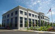
Hotel Oregon in the Downtown Historic District | |
| Nickname(s): Mac | |
 Location in Oregon | |
| Coordinates: 45°12′42″N 123°11′50″W / 45.21167°N 123.19722°WCoordinates: 45°12′42″N 123°11′50″W / 45.21167°N 123.19722°W | |
| Country | United States |
| State | Oregon |
| County | Yamhill |
| Founded | 1856 |
| Incorporated | 1876 |
| Government | |
| • Mayor | Rick Olson |
| Area[1] | |
| • Total | 10.58 sq mi (27.40 km2) |
| • Land | 10.58 sq mi (27.40 km2) |
| • Water | 0 sq mi (0 km2) |
| Elevation | 157 ft (47.9 m) |
| Population (2010)[2] | |
| • Total | 32,187 |
| • Estimate (2013)[3] | 33,131 |
| • Density | 3,042.2/sq mi (1,174.6/km2) |
| Time zone | Pacific (UTC-8) |
| • Summer (DST) | Pacific (UTC-7) |
| ZIP code | 97128 |
| Area code(s) | 503, 971 |
| FIPS code | 41-45000[4] |
| GNIS feature ID | 1163136[5] |
| Website | City of McMinnville |

McMinnville is the county seat and largest city of Yamhill County, Oregon, United States. According to Oregon Geographic Names, it was named by its founder, William T. Newby (1820–1884), an early immigrant on the Oregon Trail, for his hometown of McMinnville, Tennessee. As of the 2010 census, the city had a total population of 32,187.
McMinnville is located at the confluence of the North and South Forks of the Yamhill River in the Willamette Valley. Part of the Portland metropolitan area, it lies 35 miles (56 km) southwest of Portland. The city is home to Linfield College and the Evergreen Aviation Museum (which includes the Spruce Goose).
History

Town founder William T. Newby joined the Great Migration of 1843, later claiming land in 1844 on the present site of McMinnville in what was then known as the Oregon Country. He built a grist mill in 1853 at what would become the west end of Third Street. On May 5th, 1856[6] Newby platted a town and named it after his hometown of McMinnville, Tennessee.[7] Newby would later make a substantial donation of land for the founding of an institution of higher learning in the town, originally called McMinnville College but known today as Linfield College.[7]
McMinnville was incorporated as a town in 1876 and became a city in 1882. County residents voted to move the county seat of Yamhill County from Lafayette to McMinnville in 1886.
McMinnville UFO photographs
McMinnville is known among UFO researchers for photographs published on the front page of the June 9, 1950, edition of the city's newspaper, the News-Register (then known as the Telephone-Register), reportedly of an unidentified flying object seen almost a month earlier, May 11. The Oregonian published the photographs the next day, and within a month they were published in LIFE magazine.[8]
Although these images have come to be known as the "McMinnville UFO photographs", the Trent farm was actually located just outside Sheridan, Oregon, nine miles southwest of McMinnville.[9] The heated debate which followed between UFO researchers and skeptics made the town's name famous and has spurred an annual "UFO Festival" in McMinnville, the second largest such gathering in the United States to that of Roswell, New Mexico.[10]
Geography
McMinnville is located 50 miles (80 km) from the Pacific Ocean, 35 miles (56 km) from Portland, and 26 miles (42 km) from Salem, the state capital.
According to the United States Census Bureau, the city has a total area of 10.58 square miles (27.40 km2), all of it land.[1]
Climate
This region experiences warm (but not hot) and dry summers, with no average monthly temperatures above 71.6 °F (22.0 °C). According to the Köppen Climate Classification system, McMinnville has a warm-summer Mediterranean climate, abbreviated "Csb" on climate maps.[11]
| Climate data for McMinnville | |||||||||||||
|---|---|---|---|---|---|---|---|---|---|---|---|---|---|
| Month | Jan | Feb | Mar | Apr | May | Jun | Jul | Aug | Sep | Oct | Nov | Dec | Year |
| Record high °C (°F) | 20.6 (69.1) |
22.2 (72) |
30.6 (87.1) |
37.2 (99) |
37.8 (100) |
43.3 (109.9) |
43.3 (109.9) |
42.2 (108) |
41.1 (106) |
35 (95) |
26.7 (80.1) |
22.2 (72) |
43.3 (109.9) |
| Average high °C (°F) | 7.7 (45.9) |
10.5 (50.9) |
13.2 (55.8) |
16.8 (62.2) |
20.5 (68.9) |
23.9 (75) |
28.3 (82.9) |
28.2 (82.8) |
24.8 (76.6) |
18.3 (64.9) |
11.7 (53.1) |
8.2 (46.8) |
17.68 (63.82) |
| Daily mean °C (°F) | 4.2 (39.6) |
6.1 (43) |
7.9 (46.2) |
10.3 (50.5) |
13.3 (55.9) |
16.2 (61.2) |
19.1 (66.4) |
19.1 (66.4) |
16.5 (61.7) |
11.9 (53.4) |
7.5 (45.5) |
4.8 (40.6) |
11.41 (52.53) |
| Average low °C (°F) | 0.7 (33.3) |
1.7 (35.1) |
2.5 (36.5) |
3.9 (39) |
6.2 (43.2) |
8.4 (47.1) |
9.9 (49.8) |
9.9 (49.8) |
8.1 (46.6) |
5.5 (41.9) |
3.3 (37.9) |
1.3 (34.3) |
5.12 (41.21) |
| Record low °C (°F) | −21.7 (−7.1) |
−18.9 (−2) |
−10 (14) |
−16.1 (3) |
−4.4 (24.1) |
−0.6 (30.9) |
1.1 (34) |
−1.1 (30) |
−3.9 (25) |
−6.7 (19.9) |
−12.9 (8.8) |
−31.1 (−24) |
−31.1 (−24) |
| Average precipitation mm (inches) | 170 (6.69) |
132 (5.2) |
114 (4.49) |
65 (2.56) |
48 (1.89) |
29 (1.14) |
10 (0.39) |
14 (0.55) |
40 (1.57) |
80 (3.15) |
178 (7.01) |
185 (7.28) |
1,065 (41.92) |
| Average precipitation days | 18 | 16 | 16 | 13 | 10 | 7 | 2 | 3 | 6 | 11 | 17 | 19 | 138 |
| Source: [11] | |||||||||||||
Demographics
| Historical population | |||
|---|---|---|---|
| Census | Pop. | %± | |
| 1870 | 388 | — | |
| 1880 | 670 | 72.7% | |
| 1890 | 1,368 | 104.2% | |
| 1900 | 1,420 | 3.8% | |
| 1910 | 2,400 | 69.0% | |
| 1920 | 2,767 | 15.3% | |
| 1930 | 2,917 | 5.4% | |
| 1940 | 3,706 | 27.0% | |
| 1950 | 6,635 | 79.0% | |
| 1960 | 7,656 | 15.4% | |
| 1970 | 10,125 | 32.2% | |
| 1980 | 14,080 | 39.1% | |
| 1990 | 17,894 | 27.1% | |
| 2000 | 26,499 | 48.1% | |
| 2010 | 32,187 | 21.5% | |
| Est. 2015 | 33,892 | [12] | 5.3% |
| U.S. Decennial Census[13] 2013 Estimate[3] | |||
2010 census
As of the census[2] of 2010, there were 32,187 people, 11,674 households, and 7,779 families residing in the city. The population density was 3,042.2 inhabitants per square mile (1,174.6/km2). There were 12,389 housing units at an average density of 1,171.0 per square mile (452.1/km2). The racial makeup of the city was 82.2% White, 0.7% African American, 1.2% Native American, 1.5% Asian, 0.2% Pacific Islander, 10.7% from other races, and 3.5% from two or more races. Hispanic or Latino of any race were 20.6% of the population.
There were 11,674 households of which 35.5% had children under the age of 18 living with them, 48.2% were married couples living together, 13.0% had a female householder with no husband present, 5.4% had a male householder with no wife present, and 33.4% were non-families. 26.4% of all households were made up of individuals and 12.4% had someone living alone who was 65 years of age or older. The average household size was 2.61 and the average family size was 3.14.
The median age in the city was 34 years. 25.8% of residents were under the age of 18; 12.7% were between the ages of 18 and 24; 24.7% were from 25 to 44; 22.2% were from 45 to 64; and 14.6% were 65 years of age or older. The gender makeup of the city was 48.2% male and 51.8% female.
2000 census
As of the census[4] of 2000, there were 26,499 people residing in the city, among 9,367 households and 6,463 families. The population density is 2,675.8 people per square mile (1,033.5/km²). There are 9,834 housing units at an average density of 993.0 per square mile (383.5/km²). The racial makeup of the city is 86.39% White, 1.39% Native American, 1.25% Asian, 0.68% Black or African American, and 0.18% Pacific Islander. 14.64% of the population are Hispanic or Latino of any race. 7.26% identify themselves as from other races, and 2.86% from two or more races.
There are 9,367 households out of which 35.4% have children under the age of 18 living with them, 53.5% are married couples living together, 10.8% have a female householder with no husband present, and 31.0% are non-families. 23.9% of all households are made up of individuals and 11.5% have someone living alone who is 65 years of age or older. The average household size is 2.66 and the average family size is 3.13.
In the city, the population is spread out with 26.3% under the age of 18, 14.7% from 18 to 24, 26.9% from 25 to 44, 17.9% from 45 to 64, and 14.3% who are 65 years of age or older. The median age is 32 years. For every 100 females there are 93.7 males. For every 100 females age 18 and over, there are 90.6 males.
The median income for a household in the city is $38,953, and the median income for a family is $44,013. Males have a median income of $33,517 versus $24,405 for females. The per capita income for the city is $17,085. 12.9% of the population and 8.2% of families are below the poverty line. Out of the total population, 14.0% of those under the age of 18 and 7.8% of those 65 and older are living below the poverty line.
Economy
Since the 1990s, the majority of the vineyards of the Willamette Valley American Viticultural Area (AVA) are in the area surrounding McMinnville, thus giving this city a claim to the title of the capital of Oregon's wine industry. In January 2005, a McMinnville AVA was established after an application from Youngberg Hill Vineyards. The AVA includes 14 wineries and 523 acres (2.12 km2) within the Willamette Valley AVA. The city is at the northeastern border of its AVA namesake.[14]
Arts and culture
Annual cultural events

Turkey Rama is a three-day festival held in downtown McMinnville celebrating the ongoing tradition of the turkey barbecue. The barbecue was started in 1938 by turkey farmers in Yamhill County, when the main source of wealth in the county was based on the booming turkey-farming industry. Now, commercial exhibitions have replaced the "turkey exhibitions", and so the turkey-judging competitions and turkey races have been eliminated in favor of more "turkey-friendly" rides, booths, and outdoor entertainment.
The Dragging the Gut Festival is a three-day event held annually in downtown McMinnville on the fourth weekend in August.[15] The festival gives participants the chance to relive the classic 1950s car cruising on the main street that took place for decades in small towns.[16] The Dragging the Gut Festival's Car Show is a traditional sitting car show held 10 a.m. to 5 p.m. on the Saturday (August 26, 2017) of the Dragging the Gut Festival. The car show is held in McMinnville at the Evergreen Aviation & Space Museum, home of Howard Hughes' famed "Spruce Goose" flying boat.[17][18] The car show is a side event of the festival before the Saturday main cruising event begins.[19]
The International Pinot Noir Celebration has been held every July since 1987 on the Linfield College campus.
Museums and other points of interest

The Evergreen Aviation and Space Museum is located in McMinnville and is best known as the home of the Spruce Goose, the world's largest propeller-driven seaplane, built by the famed aviator Howard Hughes. The museum, home to another 80 historic aircraft and exhibits, is a pair of large symmetrical buildings with glass facades, a local landmark which can be seen for miles. Additional major exhibits include a SR-71 "Blackbird", a Titan II SLV Missile (with its launch control center), and a Grumman F6F3 "Hellcat." There is also an "IMAX class" digital 3D theater, the Wings & Waves indoor waterpark (containing wave pool, 4 slides emerging from 747 on building's roof, and educational displays), and the newly built Boy Scout Jamboree park. The space museum houses classrooms for the Engineering and Aerospace Academy of McMinnville High School.
Parks and recreation
McMinnville Community Center is headquarters for the McMinnville Parks and Recreation Department, which administers several parks throughout the city. Among these are Joe Dancer Park, which was named after a longtime city manager. It is a 100-acre (0.40 km2) park with soccer, baseball, and softball fields, a playground, and the Drew Ottley Memorial Skate Park. City Park is within walking distance from the downtown business district. It opened 1910, when the city sold $3,000 in park bonds to finance construction of a bandstand and a small zoo featuring bears, deer and other local animals. Near the site of Lower City Park, along Cozine Creek, there used to be a large flour mill, called the Star Mill. The mill was closed in 1921 and was damaged by a fire in 1927. The City of McMinnville sold $8,500 in bonds to finance the purchase of the property. The tract ran from Star Mill Way to Cozine Creek and West Second Street, to the Mill pond site. The pond site is now occupied by tennis courts. Wortman Park is a large forested park with a small stream running through it. A disc golf course was installed 1991 and is home to the annual Squirrel Open, an Oregon Disc Sports Association's Oregon Series tournament.
Education

McMinnville is served by the McMinnville School District. McMinnville used to have two high schools, McMinnville High School and Media Arts & Communications Academy (MACA). However, In the 2010–11 school year, MACA's campus was closed down then joined to the Mcminnville High School residing at the old Adam's Elementary School building. McMinnville also has two colleges, Linfield College and the McMinnville campus of Chemeketa Community College, the main campus is based in Salem. Among the private schools in McMinnville are Bethel Christian School, McMinnville Christian High School, and St. James Catholic Elementary School.[20]
Media
- News Register - local paper
- The Linfield Review - Linfield College student paper
- The Bruin - McMinnville High School student paper[21]
- McMinnville Community Media - community television[22]
- KKJC-LP 93.5 FM - Christian talk radio operated by Calvary Chapel of McMinnville
- KLYC 1260 AM
- KSLC 90.3 FM - Linfield College student radio
Infrastructure
Transportation
McMinnville is located on Oregon Route 99W approximately 38 miles (61 km) south of downtown Portland and approximately 46 miles (74 km) north of Corvallis. Oregon Route 18 forms a bypass around the city along its southern border and connects McMinnville with the Oregon Coast just north of Lincoln City approximately 55 miles (89 km) west. Oregon Highway 18 is also known as Three Mile Lane from its McMinnville city center interchange east to the McMinnville Municipal Airport. The southern end of Oregon Route 47 is located just northeast of city limits and connects McMinnville with Washington County.
Major thoroughfares in McMinnville are Highway 99W and Adams and Baker Streets which form a north–south couplet through the center of the town; Lafayette Avenue (which was at one time the route of U.S. Highway 99W), East Third Street (the main street through the downtown core), and West Second Street (the main street connecting downtown with the western residential areas). Baker Creek Road, Evans Street, Riverside Drive, South Davis Street, Fellows Street, Cypress Street and Booth Bend Road are also important collector streets connecting industrial or residential areas with the downtown core or the primary arterial streets.
McMinnville Municipal Airport is owned and operated by the City of McMinnville.[23] McMinnville Airport is home to Evergreen International Aviation and a fixed-base operator. While it primarily is used by private pilots and the occasional private jet, it is capable of handling larger aircraft. For example, Evergreen Airlines flew in an empty 747-100 cargo aircraft into the airport so that it could be used as part of the Evergreen Aviation & Space Museum's water park feature.
The Portland & Western Railroad serves McMinnville on its Westside Branch. Major railroad shippers include Cascade Steel Rolling Mills, Land O'Lakes Purina LLC, RB Rubber Products and McMinnville Gas. P&W maintains a depot in downtown McMinnville, itself a remnant from the Red Electric interurban passenger service which served McMinnville from 1914–1929. McMinnville is used as a hub for P&W, with trains operating between McMinnville and Newberg, Willamina, Dallas and Albany.
Historically, McMinnville had a landing for riverboats traveling up the Yamhill River. The Yamhill Lock located near Lafayette helped facilitate river navigation up to McMinnville. However, the use of the Yamhill River for commercial purposes was short-lived; the city's only recreational boat dock has been unusable for many years. River levels are unpredictable and difficult for boaters (water levels can be very high in winter and very low in summer).
Public Transit is provided by the Yamhill County Transit Area. Three city routes provide Monday–Friday service starting at 6:30 AM and continuing through 7:50 PM. A Saturday "Loop" runs from 10:00 AM through 6:00 PM. YCTA also provides intercity service to all communities in Yamhill County on four different routes; hourly weekday and infrequent Saturday service to Newberg and Tigard, and weekday commuter trips to Hillsboro and Salem.
Intercity bus service is also provided by Caravan Airport Transportation and Valley Retriever between Portland and Newport, each with one daily trip in each direction stopping in McMinnville. Greyhound Bus formerly served McMinnville until 2004 with a stop on its Portland–San Francisco route, ending nearly 80 years of service on the route dating back to the Southern Pacific Railroad's rail and bus passenger service.
Health care
Notable people
- Scott Brosius - World Series MVP Award-winning baseball player
- Jim Bunn - Oregon politician
- Catt family - 21st century bank robbing family[24]
- Beverly Cleary - children's author
- Verne Duncan - Oregon and Idaho politician
- Matthew Haughey - noted blogger
- Bill Krueger - Major League Baseball, and senior baseball analyst for FSN Northwest
- Ehren McGhehey - Jackass cast member
- Joe Paterson - Major League Baseball pitcher for the Arizona Diamondbacks
- Ad Rutschman - College Football Hall of Fame coach[25]
- Ross Shafer - comedian, television host, and motivational speaker
- Raemer Schreiber - physics pioneer that worked at Los Alamos during WWII
- Charlie Sitton - former professional basketball player
- Will Vinton - Oscar-winning director and producer of animated films
References
- 1 2 "US Gazetteer files 2010". United States Census Bureau. Retrieved 2012-12-21.
- 1 2 "American FactFinder". United States Census Bureau. Retrieved 2012-12-21.
- 1 2 "Population Estimates". United States Census Bureau. Retrieved 2014-10-02.
- 1 2 "American FactFinder". United States Census Bureau. Retrieved 2008-01-31.
- ↑ "US Board on Geographic Names". United States Geological Survey. 2007-10-25. Retrieved 2008-01-31.
- ↑ "Newby". Retrieved 2016-08-16.
- 1 2 Charles Henry Carey, History of Oregon: Volume 1. Chicago: Pioneer Historical Publishing Co., 1922; pg. 759.
- ↑ Dr. Bruce Maccabee Research Website
- ↑ "McMinnville Farmer, Wife See 'Saucer,'" The Oregonian, June 10, 1950, pg. 7.
- ↑ "2014 UFO Festival and Alien Costume Parade". McMinnville Downtown Association. Retrieved January 25, 2014.
- 1 2 "Weatherbase: McMinnville, Oregon". Canty Media. 2015. Retrieved February 27, 2015.
- ↑ "Annual Estimates of the Resident Population for Incorporated Places: April 1, 2010 to July 1, 2015". Retrieved July 2, 2016.
- ↑ United States Census Bureau. "Census of Population and Housing". Retrieved October 2, 2014.
- ↑ Federal Register, Volume 70 Issue 11 (Tuesday, January 18, 2005)
- ↑ "Dragging the Gut Festival". Dragging the Gut. 2014. Retrieved February 27, 2015.
- ↑ Karl Klooster (2010-10-14). "Retro cruise-in revs up Mac". News-Register (McMinnville).
- ↑ "Dragging the Gut Festival Car Show webpage".
- ↑ "Official Dragging the Gut Festival Website at GutFest.com".
- ↑ Dragging the Gut (1-4-2012). "Ducks' Rose Bowl shine originated in Newberg: KOCH CAR SHOW". News-Register (McMinnville). Check date values in:
|date=(help) - ↑ "Saint James Catholic School".
- ↑ "About". The Bruin. 2011. Retrieved February 27, 2015.
- ↑ "MCM-TV: McMinnville Community Media". McMinnville Community Media. 2012. Retrieved February 27, 2015.
- ↑ Airport. City of McMinnville. Retrieved on April 30, 2009.
- ↑ I Would Only Rob Banks for My Family; article; Skip Hollandsworth; June 2014 issue; Texas Monthly; accessed May 2014
- ↑ College Football Hall of Fame || Famer Search
External links
 Media related to McMinnville, Oregon at Wikimedia Commons
- Entry for McMinnville from the Oregon Blue Book
- "McMinnville". The Oregon Encyclopedia.
- Find A Grave information on William T. Newby
- Visit McMinnville
Municipalities and communities of Yamhill County, Oregon, United States | ||
|---|---|---|
| Cities | 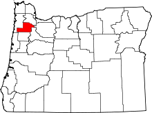 | |
| CDPs | ||
| Other unincorporated communities |
| |
| Indian reservation | ||
| Footnotes | ‡This populated place also has portions in an adjacent county or counties | |