McDonald, Ohio
| McDonald, Ohio | |
|---|---|
| Village | |
 Location of McDonald, Ohio | |
 Location of McDonald in Trumbull County | |
| Coordinates: 41°9′40″N 80°43′29″W / 41.16111°N 80.72472°WCoordinates: 41°9′40″N 80°43′29″W / 41.16111°N 80.72472°W | |
| Country | United States |
| State | Ohio |
| County | Trumbull |
| Government | |
| • Mayor | Glenn Holmes |
| Area[1] | |
| • Total | 1.69 sq mi (4.38 km2) |
| • Land | 1.69 sq mi (4.38 km2) |
| • Water | 0 sq mi (0 km2) |
| Elevation[2] | 965 ft (294 m) |
| Population (2010)[3] | |
| • Total | 3,263 |
| • Estimate (2012[4]) | 3,220 |
| • Density | 1,930.8/sq mi (745.5/km2) |
| Time zone | Eastern (EST) (UTC-5) |
| • Summer (DST) | EDT (UTC-4) |
| ZIP code | 44437 |
| Area code(s) | 330 |
| FIPS code | 39-45934[5] |
| GNIS feature ID | 1048957[2] |
McDonald is a village in Trumbull County, Ohio, United States. The population was 3,263 at the 2010 census. It is part of the Youngstown-Warren-Boardman, OH-PA Metropolitan Statistical Area.
History
The community was named after the local McDonald family.[6] McDonald was created as a "company town" or "factory town" by the Carnegie Steel Co. (later known as US Steel).
Geography
McDonald is located at 41°09′40″N 80°43′29″W / 41.161013°N 80.724820°W.[7]
According to the United States Census Bureau, the village has a total area of 1.69 square miles (4.38 km2), all land.[1]
Demographics
| Historical population | |||
|---|---|---|---|
| Census | Pop. | %± | |
| 1920 | 621 | — | |
| 1930 | 1,714 | 176.0% | |
| 1940 | 1,529 | −10.8% | |
| 1950 | 1,858 | 21.5% | |
| 1960 | 2,727 | 46.8% | |
| 1970 | 3,177 | 16.5% | |
| 1980 | 3,744 | 17.8% | |
| 1990 | 3,526 | −5.8% | |
| 2000 | 3,481 | −1.3% | |
| 2010 | 3,263 | −6.3% | |
| Est. 2015 | 3,152 | [8] | −3.4% |
2010 census
As of the census[3] of 2010, there were 3,263 people, 1,269 households, and 940 families residing in the village. The population density was 1,930.8 inhabitants per square mile (745.5/km2). There were 1,370 housing units at an average density of 810.7 per square mile (313.0/km2). The racial makeup of the village was 97.3% White, 1.1% African American, 0.2% Native American, 0.2% Asian, 0.1% from other races, and 1.1% from two or more races. Hispanic or Latino of any race were 1.5% of the population.
There were 1,269 households of which 33.1% had children under the age of 18 living with them, 56.2% were married couples living together, 12.9% had a female householder with no husband present, 5.0% had a male householder with no wife present, and 25.9% were non-families. 22.9% of all households were made up of individuals and 10.7% had someone living alone who was 65 years of age or older. The average household size was 2.57 and the average family size was 3.01.
The median age in the village was 41.3 years. 24.2% of residents were under the age of 18; 7.6% were between the ages of 18 and 24; 23.3% were from 25 to 44; 30.1% were from 45 to 64; and 14.9% were 65 years of age or older. The gender makeup of the village was 48.4% male and 51.6% female.
2000 census
As of the census[5] of 2000, there were 3,481 people, 1,307 households, and 1,001 families residing in the village. The population density was 2,072.4 people per square mile (800.0/km2). There were 1,352 housing units at an average density of 804.9 per square mile (310.7/km2). The racial makeup of the village was 97.73% White, 1.01% African American, 0.26% Native American, 0.11% Asian, 0.03% Pacific Islander, 0.20% from other races, and 0.66% from two or more races. Hispanic or Latino of any race were 0.95% of the population.
There were 1,307 households out of which 34.8% had children under the age of 18 living with them, 61.1% were married couples living together, 12.0% had a female householder with no husband present, and 23.4% were non-families. 21.7% of all households were made up of individuals and 11.4% had someone living alone who was 65 years of age or older. The average household size was 2.66 and the average family size was 3.11.
In the village the population was spread out with 25.9% under the age of 18, 7.4% from 18 to 24, 27.3% from 25 to 44, 25.5% from 45 to 64, and 13.9% who were 65 years of age or older. The median age was 38 years. For every 100 females there were 90.6 males. For every 100 females age 18 and over, there were 84.6 males.
The median income for a household in the village was $41,738, and the median income for a family was $51,346. Males had a median income of $37,935 versus $22,219 for females. The per capita income for the village was $18,173. About 2.9% of families and 4.0% of the population were below the poverty line, including 4.5% of those under age 18 and 4.4% of those age 65 or over.
References
- 1 2 "US Gazetteer files 2010". United States Census Bureau. Archived from the original on January 24, 2012. Retrieved 2013-01-06.
- 1 2 "US Board on Geographic Names". United States Geological Survey. 2007-10-25. Retrieved 2008-01-31.
- 1 2 "American FactFinder". United States Census Bureau. Retrieved 2013-01-06.
- ↑ "Population Estimates". United States Census Bureau. Archived from the original on June 17, 2013. Retrieved 2013-06-17.
- 1 2 "American FactFinder". United States Census Bureau. Archived from the original on September 11, 2013. Retrieved 2008-01-31.
- ↑ Overman, William Daniel (1958). Ohio Town Names. Akron, OH: Atlantic Press. p. 80.
- ↑ "US Gazetteer files: 2010, 2000, and 1990". United States Census Bureau. 2011-02-12. Retrieved 2011-04-23.
- ↑ "Annual Estimates of the Resident Population for Incorporated Places: April 1, 2010 to July 1, 2015". Retrieved July 2, 2016.
- ↑ "Census of Population and Housing". Census.gov. Archived from the original on May 11, 2015. Retrieved June 4, 2015.
Municipalities and communities of Trumbull County, Ohio, United States | ||
|---|---|---|
| Cities | 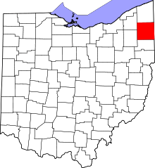 | |
| Villages | ||
| Townships | ||
| CDPs |
| |
| Unincorporated communities | ||
| Footnotes | ‡This populated place also has portions in an adjacent county or counties | |