Marshallville, Georgia
| Marshallville, Georgia | |
|---|---|
| City | |
 Location in Macon County and the state of Georgia | |
| Coordinates: 32°27′12″N 83°56′32″W / 32.45333°N 83.94222°WCoordinates: 32°27′12″N 83°56′32″W / 32.45333°N 83.94222°W | |
| Country | United States |
| State | Georgia |
| County | Macon |
| Area | |
| • Total | 3.2 sq mi (8.2 km2) |
| • Land | 3.2 sq mi (8.2 km2) |
| • Water | 0 sq mi (0 km2) |
| Elevation | 515 ft (157 m) |
| Population (2000) | |
| • Total | 1,335 |
| • Density | 417.2/sq mi (162.8/km2) |
| Time zone | Eastern (EST) (UTC-5) |
| • Summer (DST) | EDT (UTC-4) |
| ZIP code | 31057 |
| Area code(s) | 478 |
| FIPS code | 13-49924[1] |
| GNIS feature ID | 0356378[2] |
Marshallville is a city in Macon County, Georgia, United States. The population was 1,335 at the 2000 census.
History
Marshallville was founded in the 1820s and originally built up chiefly by Germans. It was incorporated as a town in 1854 and as a city in 1953.[3]
Geography
Marshallville is located at 32°27′12″N 83°56′32″W / 32.45333°N 83.94222°W (32.453423, -83.942159).[4]
According to the United States Census Bureau, the city has a total area of 3.2 square miles (8.3 km2), all of it land.
Demographics
| Historical population | |||
|---|---|---|---|
| Census | Pop. | %± | |
| 1870 | 424 | — | |
| 1880 | 543 | 28.1% | |
| 1890 | 1,086 | 100.0% | |
| 1900 | 879 | −19.1% | |
| 1910 | 1,082 | 23.1% | |
| 1920 | 1,150 | 6.3% | |
| 1930 | 931 | −19.0% | |
| 1940 | 905 | −2.8% | |
| 1950 | 1,121 | 23.9% | |
| 1960 | 1,308 | 16.7% | |
| 1970 | 1,376 | 5.2% | |
| 1980 | 1,540 | 11.9% | |
| 1990 | 1,457 | −5.4% | |
| 2000 | 1,335 | −8.4% | |
| 2010 | 1,448 | 8.5% | |
| Est. 2015 | 1,333 | [5] | −7.9% |
As of the census[1] of 2000, there were 1,335 people, 523 households, and 365 families residing in the city. The population density was 422.8 people per square mile (163.1/km²). There were 582 housing units at an average density of 184.3 per square mile (71.1/km²). The racial makeup of the city was 20.82% White, 78.43% African American, 0.30% Native American, 0.15% from other races, and 0.30% from two or more races. Hispanic or Latino of any race were 0.45% of the population.
There were 523 households out of which 29.4% had children under the age of 18 living with them, 30.2% were married couples living together, 35.0% had a female householder with no husband present, and 30.2% were non-families. 28.9% of all households were made up of individuals and 14.5% had someone living alone who was 65 years of age or older. The average household size was 2.55 and the average family size was 3.13.
In the city the population was spread out with 27.1% under the age of 18, 11.4% from 18 to 24, 22.7% from 25 to 44, 24.9% from 45 to 64, and 13.9% who were 65 years of age or older. The median age was 36 years. For every 100 females there were 80.4 males. For every 100 females age 18 and over, there were 74.4 males.
The median income for a household in the city was $21,800, and the median income for a family was $24,375. Males had a median income of $27,557 versus $20,167 for females. The per capita income for the city was $11,306. About 27.1% of families and 29.5% of the population were below the poverty line, including 44.7% of those under age 18 and 30.1% of those age 65 or over.
References
- 1 2 "American FactFinder". United States Census Bureau. Retrieved 2008-01-31.
- ↑ "US Board on Geographic Names". United States Geological Survey. 2007-10-25. Retrieved 2008-01-31.
- ↑ Hellmann, Paul T. (May 13, 2013). Historical Gazetteer of the United States. Routledge. p. 238. Retrieved 30 November 2013.
- ↑ "US Gazetteer files: 2010, 2000, and 1990". United States Census Bureau. 2011-02-12. Retrieved 2011-04-23.
- ↑ "Annual Estimates of the Resident Population for Incorporated Places: April 1, 2010 to July 1, 2015". Retrieved July 2, 2016.
- ↑ "Census of Population and Housing". Census.gov. Retrieved June 4, 2015.
Municipalities and communities of Macon County, Georgia, United States | ||
|---|---|---|
| Cities | 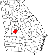 | |