Mapiri Municipality
| Mapiri Municipality | |
|---|---|
| Municipality | |
|
Mapiri and the Mapiri River, La Paz Department | |
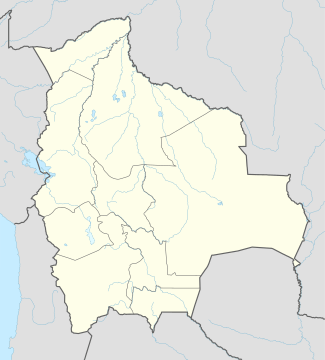 Mapiri Municipality Location of the Mapiri Municipality within Bolivia | |
| Coordinates: 15°18′31″S 68°14′28″W / 15.3087°S 68.2412°WCoordinates: 15°18′31″S 68°14′28″W / 15.3087°S 68.2412°W | |
| Country |
|
| Department | La Paz Department |
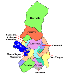
| Province | Larecaja Province |
| Seat | Mapiri |
| Government | |
| • Mayor | Enrique Calle Onorio (2007) |
| • President | Ramiro Jorge Vargas Orosco (2007) |
| Area | |
| • Total | 525 sq mi (1,361 km2) |
| Population (2001) | |
| • Total | 9,633 |

Mapiri Municipality is the seventh municipal section of the Larecaja Province in the La Paz Department, Bolivia. Its seat is Mapiri.
Languages
The languages spoken in the Mapiri Municipality are mainly Spanish, Quechua and Aymara.
| Language | Inhabitants |
|---|---|
| Quechua | 3.649 |
| Aymara | 1.767 |
| Guaraní | 6 |
| Another native | 7 |
| Spanish | 8.567 |
| Foreign | 17 |
| Only native | 363 |
| Native and Spanish | 4.653 |
| Only Spanish | 3.915 |
Ref.: obd.descentralizacion.gov.bo
References
External links
This article is issued from Wikipedia - version of the 11/1/2014. The text is available under the Creative Commons Attribution/Share Alike but additional terms may apply for the media files.