Manipal
| Manipal ಮಣಿಪಾಲ | |
|---|---|
| Suburb | |
|
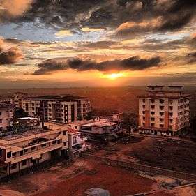
The greens of Manipal | |
 Manipal | |
| Coordinates: 13°20′49″N 74°47′17″E / 13.347°N 74.788°ECoordinates: 13°20′49″N 74°47′17″E / 13.347°N 74.788°E | |
| Country |
|
| State | Karnataka |
| District | Udupi |
| City | Udupi |
| Area | |
| • Total | 26 km2 (10 sq mi) |
| Elevation | 73 m (240 ft) |
| Population (2011) | |
| • Total | 34,369 |
| • Density | 1,300/km2 (3,400/sq mi) |
| Languages | |
| • Official | Kannada |
| • Regional | Tulu, Konkani |
| Time zone | IST (UTC+5:30) |
| PIN | 576 104 |
| Telephone code | 0820 |
| ISO 3166 code | IN-KA |
| Vehicle registration | KA -20 |
| Website |
karnataka |

Manipal (maṇipāl) is is a suburb within the city of Udupi in Karnataka, India and is administered by the Udupi City Municipality. It is located on the rocky hinterland of the Malabar Coast of south-west India, about 8 km (5.0 mi) east the Arabian Sea. From its location on a plateau, it commands a panoramic view of the Arabian Sea to the west and the Western Ghats to the east. Home to the Manipal University, the town attracts over twenty five thousand students every year.[1] It is one of the most cosmopolitan towns of India, with people from over 57 nations studying there. It is famously called the Campus town by the locals residing. [2] Manipal is also the international headquarters of Syndicate Bank. A regional Information Technology hub, Manipal has one of the highest densities of mobile phone users in India.[3]
Location
Situated 5 km (3.1 mi) from the temple city of Udupi and 65 km (40 mi) north of Mangalore, Manipal was previously part of the Shivalli village panchayat. The name is derived from "Mann" and "palla", anglicised to Manipal. Mann means mud and Palla means lake in Tulu language . This lake, roughly a 400m diameter circle, after which Manipal is named is located in the middle of the town, and used to offer boating facilities. Manipal was once a barren hill with few trees. This hill was transformed to a University town by Dr. T. M. A. Pai who first started the Kasturba Medical College in 1953, now a part of the university.[4]
Transport
Road
Manipal is connected to Mangalore and towns like Udupi and Karkala by several bus services which run every few minutes. The town also has overnight bus services to cities like Bangalore, Hyderabad and Mumbai which are mainly run by private companies as well the government run KSRTC.
Air
The nearest International Airport is Mangalore International Airport (formerly Bajpe Airport), which is located around 50 km (31 mi) from Manipal, connecting it to Indian cities like Mumbai, Bangalore, Hyderabad, Chennai and Delhi and internationally to the middle eastern countries like Oman, Kuwait, Bahrain, Qatar, Saudi Arabia, and United Arab Emirates. Pre paid taxis are available to transport passengers to Manipal and Udupi.
Buses also connect Manipal directly to the Kempegowda International Airport in Bangalore, to cater to the large number of international students studying at the university. KSRTC recently started "Flybus", it's premium daily bus service, from Manipal to Kempegowda International Airport in Bangalore.
Rail
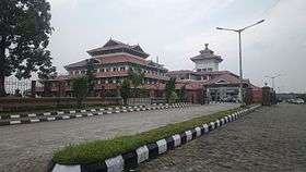
The nearest railway station is located about four kilometers west of Manipal, Indrali in Udupi on the Konkan railway line. Mangalore Central(MAQ) station is the nearest major railway station.
Climate
From September - February, the weather in Manipal is tropical with daily temperatures averaging 27 °C (81 °F). From June - August, Manipal witnesses one of the most extreme monsoons in the world, with the annual precipitation ranging from 500–560 cm (200–220 in). The months of March - May are hot and humid, with the daily temperatures typically peaking at 35 °C (95 °F).[5]
Education
Manipal gained prominence in the mid 1950s, when its founder Dr. T.M.A. Pai founded the Kasturba Medical College in 1953. He later went on to found the Manipal Institute of Technology in 1957 and later 21 other colleges, all of which became a part of Manipal University in 1993.[6]
Manipal is a major technology and medical research hub, with major conferences and seminars organised almost every week. Since the establishment of MUTBI, the in-house business incubator of the university, a large number of student-run technology and media startups have sprung up.
Places in and around Manipal
Tiger Circle, popularly referred to by its initials by the locals and the university community is the main commercial center in Manipal. All the buses and taxis leave from here.
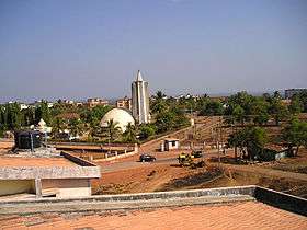
Manipal has a planetarium named after Dr. Pai. It is the second oldest planetarium in the state of Karnataka, after Bangalore’s Nehru Planetarium.
At one end of Manipal is End Point, which is a cliff overlooking the Swarna river. From this point, one can see the Arabian sea in the western horizon and the Western Ghats in the eastern horizon.
Udupi's Malpe beach is located about seven kilometers from Manipal. Udupi town is located about 5 km from Manipal. Udupi houses the Krishna Mutt, one of the most famous Krishna temples of the South. It is the centre for the Dwaitha school of Vedanta Philosophy.
Agumbe, a popular hill station on the Western ghats is around fifty kilometers east of Manipal, private buses ply daily to Agumbe. The major religious centre Sringeri is at distance of 88 kilometers from Manipal.
The surrounding areas of Manipal is very scenic and there are many places with waterfalls, which are very beautiful to see during the rainy and winter seasons. A mild trek may be required to reach these places.
Geographic Location
 |
Kundapur | Hebri | | |
| Udupi | |
Karkala | ||
| ||||
| | ||||
| Mangalore |
See also
References
- ↑ http://timesofindia.indiatimes.com/city/bangalore/Mangalore-a-melting-pot/articleshow/4044055.cms
- ↑ http://manipal.edu/mu/about-us/history.html
- ↑ "A cool crowd". The Hindu. 2006-12-23. Retrieved 2007-06-11.
- ↑ "Manipal Karnataka". Mapsofindia.com. Retrieved 2012-08-16.
- ↑ "Manipal Climate - Averages".
- ↑ "Mix it like Manipal". indianexpress.com. Retrieved 2014-08-13.
External links
| Wikimedia Commons has media related to Manipal. |