Mandara Mountains
For the Indian mountain, see Mount Mandara.
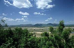
The Mandara Mountains looking north-east from Jimeta/Yola.
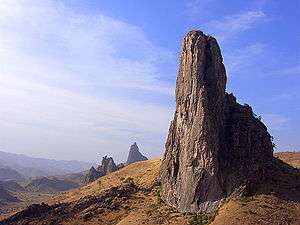
Kapsiki Peak near Rhumsiki is one of the most photographed parts of the Mandara.
The Mandara Mountains (Monts Mandara) are a volcanic range extending about 200km (about 125 mi) along the northern part of the Cameroon-Nigeria border, from the Benue River in the south (9°18′N 12°48′E / 9.3°N 12.8°E) to the north-west of Maroua in the north (11°00′N 13°54′E / 11.0°N 13.9°E). The highest elevation is 1,494 m (4,900 ft), the summit of Mount Oupay (10°53′N 13°47′E / 10.883°N 13.783°E).
The region is densely populated, mainly by speakers of Chadic languages. The Mofu ethnic group lives in the Mandara Mountains.
Extensive archaeological research has been undertaken in the Mandara Mountains, including work at Diy-Gid-Biy (DGB) sites.[1]
See also
References
- ↑ "Les Diy-Gid-Biy du Mont Mandara". UNESCO World Heritage List. Retrieved 29 May 2016.
External links
This article is issued from Wikipedia - version of the 5/29/2016. The text is available under the Creative Commons Attribution/Share Alike but additional terms may apply for the media files.