Mahuwan
| Mahuwan महुवन | |
|---|---|
| Village development committee | |
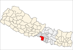
 Mahuwan Location in Nepal | |
| Coordinates: 27°07′N 84°48′E / 27.12°N 84.80°ECoordinates: 27°07′N 84°48′E / 27.12°N 84.80°E | |
| Country |
|
| Zone | Narayani Zone |
| District | Parsa District |
| Population (1991) | |
| • Total | 3,106 |
| Time zone | Nepal Time (UTC+5:45) |
Mahuwan is a village development committee in Parsa District in the Narayani Zone of southern Nepal. The village is surrounded by Ramnagari in South, Lakhanpur in West, Vouratar in East and Kauwaban Kataiya in North. At the time of the 1991 Nepal census it had a population of 3106 people living in 558 individual households. Most peoples are Hindu by relion besides two or more family of Muslim. Bhojpuri is the language commonly used. Parasnath is a historical temple of god shiva located at the centre of the village of the name of which the district Parsa was named. [1]
References
- ↑ "Nepal Census 2001". Nepal's Village Development Committees. Digital Himalaya. Retrieved 9 December 2008.
This article is issued from Wikipedia - version of the 2/2/2015. The text is available under the Creative Commons Attribution/Share Alike but additional terms may apply for the media files.