Magway Region
| Magway Region မကွေးတိုင်းဒေသကြီး | ||
|---|---|---|
| Division | ||
| Myanma transcription(s) | ||
| • Burmese | magwe: tuing: desa. kri: | |
| ||
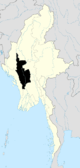
 Location of Magway Region in Myanmar | ||
| Coordinates: 20°15′N 94°45′E / 20.250°N 94.750°ECoordinates: 20°15′N 94°45′E / 20.250°N 94.750°E | ||
| Country |
| |
| Region | Central | |
| Capital | Magway | |
| Government | ||
| • Chief Minister | Aung Moe Nyo (NLD) | |
| • Legislature | Magway Region Hluttaw | |
| Area | ||
| • Total | 44,820.6 km2 (17,305.3 sq mi) | |
| Area rank | 4th | |
| Population (2014)[1] | ||
| • Total | 3,917,055 | |
| • Rank | 7th | |
| • Density | 87/km2 (230/sq mi) | |
| Demographics | ||
| • Ethnicities | Bamar, Chin, Rakhine, Shan, Karen | |
| • Religions | Buddhism, animism | |
| Time zone | MST (UTC+06:30) | |
Magway Region (Magwe Region Burmese: မကွေးတိုင်းဒေသကြီး, pronounced: [məɡwé táiɴ dèθa̰ dʑí], formerly Magway Division) is an administrative division in central Myanmar. Magway Region is the second largest of Myanmar's seven divisions, with an area of 44,820 square kilometres (17,306 sq mi).
Geography
Mayway Region sits approximately between north latitude 18° 50' to 22° 47' and east longitude 93° 47' to 95° 55'. It is bordered by Sagaing Region to the north, Mandalay Region to the east, Bago Region to the south, and Rakhine State and Chin State to the west.
History
Fossils of the early primates over 40 million years old were excavated in the Pondaung and Ponnya areas in Magway Region, leading the government to proclaim that Myanmar as "the birthplace of humanity in the world". An ancient city of the Pyu, Peikthano-myo, about 2000 years old, is located in Taungdwingyi Township, Magway Region.
The history of Magway Region mirrors that of the other divisions of central Burma.
Administrative divisions
Magway Region is made up of the districts of Magwe, Minbu, Thayet, Pakokku and Gangaw comprising 25 townships and 1,696 ward village-tracts. The capital is the city of Magwe (1994 population estimated at 300,000). Other major city are Pakokku, Aunglan, Yenangyaung and Minbu.
Government
Legislature
Demographics
| Historical population | ||
|---|---|---|
| Year | Pop. | ±% |
| 1973 | 2,634,757 | — |
| 1983 | 3,243,166 | +23.1% |
| 2014 | 3,917,055 | +20.8% |
| Source: 2014 Myanmar Census[1] | ||
The population of Magway Region is 3,912,711 in 2014. Over 95% the people are Bamar, with very small numbers of minorities such as Chin, Rakhine, Karen, Shan, and others, including a tiny Anglo-Burmese population. During colonial times, this part of Burma had a large Anglo-Burmese population, descended from Western oil workers and their Burmese partners. Approximately 98% of the population is Buddhist.
Transport
The Irrawaddy River is the major transportation system in Magway Region, both in terms of volume of goods and population served. Most major towns in the region are river ports on the Irrawaddy; among them are Magway, Pakokku, Minbu, Yenangyaung, Chauk, Allanmyo, and Thayetmyo.
For those areas not on the Irrawaddy, the major form of transport in Magway Region is by road. The region is divided by the Irrawaddy and on the western side of the river the road system is less developed. Towns are connected with two-lane roads and many parts of the roads are in bad condition. Most towns have regular bus transportation to Rangoon (Yangon) and Mandalay.
The Pyay to Nyaung-U and Myingyan railway runs through eastern Magway with connections to the capital Naypyidaw, Rangoon and Mandalay. The major stops in Magway on that line are Taungdwingyi and Natmauk. In addition, there are two rail lines running north from the Irrawaddy port of Pakokku, one to Chaung-U in Sagaing Region and the other to the Myittha River valley past Myaing and Kyaw.[2]
The capital Magway has a small non-commercial airport with air traffic for the city of Magway mostly coming in through Bagan Airport at Nyaung U some 113 km to the north along the Irrawaddy. There are commercial airports at Gangaw, Kyauktu,[3] Pakokku, and Pauk.[2] As of 2010, however, none of them have regularly scheduled flights.
Economy
The principal product of Magway Region is petroleum. It produces most of the oil and natural gas in Burma. The following oil fields are located in the Magway Region: the Mann, Yenangyaung, Chauk, Kyauk-khwet, Letpando and Ayadaw oil fileds.[4]
In May 2002 Russia agreed to help Myanmar build a 10-megawatt nuclear reactor and two laboratories in the region.[5] Other industries include cement, cotton weaving, and tobacco, iron and bronze. Magway Region produces a large quantity of edible oil as well as petroleum, hence gaining a reputation as the "oil pot of Myanmar".
Agriculture is also important. The major crops are sesamum and groundnut. Other crops grown are rice, millet, maize, sunflower, beans and pulses, tobacco, toddy, chili, onions, and potatoes. Famous products of Magway Region include: Thanaka (Limonia acidissima) and Phangar (Chebulic myorobalan) fruit.
Magway has almost no tourist industry.
Education
According to official statistics,[6] Magway Region had 3859 schools of which only 70 were high schools. Only about 10% of the division's primary school students reach high school.
| AY 2002-2003 | Primary | Middle | High |
|---|---|---|---|
| Schools | 3605 | 184 | 70 |
| Teachers | 14,800 | 3730 | 1377 |
| Students | 428,000 | 128,000 | 44,000 |
Most of 12 colleges and universities in the division are located in Magway and Pakokku. The University of Medicine, Magway is one of the most selective universities in the country.Yenangyaung Degree Colledge and Govetnment Technical Institute are located in Yenangyaung.
Health care
The general state of health care in Myanmar is poor. The military government spends anywhere from 0.5% to 3% of the country's GDP on health care, consistently ranking among the lowest in the world.[7][8] Although health care is nominally free, in reality, patients have to pay for medicine and treatment, even in public clinics and hospitals. Public hospitals lack many of the basic facilities and equipment. Moreover, the health care infrastructure outside of Yangon and Mandalay is extremely poor. In 2003, Magway Region had less than a quarter of hospital beds than Yangon Region with a slightly greater population.[9]
| 2002–2003 | # Hospitals | # Beds |
|---|---|---|
| Specialist hospitals | 0 | 0 |
| General hospitals with specialist services | 3 | 550 |
| General hospitals | 25 | 750 |
| Health clinics | 36 | 576 |
| Total | 64 | 1916 |
Notable sites
- Fort Min Hla and Fort Kway Chaung: Two late Konbaung era forts built to resist a British invasion. One is Fort Minhla, situated inside the town of Minhla. Fort Kway Chaung is located at opposite bank of Irrawaddy river.
References
- 1 2 Census Report. The 2014 Myanmar Population and Housing Census. 2. Naypyitaw: Ministry of Immigration and Population. May 2015. p. 17.
- 1 2 "Map of Magway Division" Myanmar's Net
- ↑ "Burma Airports: Kyauktu Airport Map" Maplandia
- ↑ Myanmar Ministry of Information (2002) Myanmar, facts and figures 2002 Union of Myanmar Ministry of Information, Yangon, page 42 OCLC 50131671
- ↑ "Burma's Nuclear Ambition". Irrawaddy May 30, 2007. Retrieved 2007-06-03.
- ↑ "Education statistics by level and by State and Division". Myanmar Central Statistical Organization. Retrieved 2009-04-09.
- ↑ "PPI: Almost Half of All World Health Spending is in the United States". 2007-01-17.
- ↑ Yasmin Anwar (2007-06-28). 06.28.2007 "Burma junta faulted for rampant diseases" Check
|url=value (help). UC Berkeley News. - ↑ "Hospitals and Dispensaries by State and Division". Myanmar Central Statistical Organization. Retrieved 2009-04-11.
 |
Chin State | Sagaing Region | | |
| |
Mandalay Region | |||
| ||||
| | ||||
| Rakhine State | Bago Region |
Capital: Magway | ||
| Gangaw District |
|   |
| Magway District | ||
| Minbu District | ||
| Pakokku District | ||
| Thayet District |
| |
| Main cities and towns | ||
| States | ||
|---|---|---|
| Regions | ||
| Self-Administered Zones | ||
| Self-Administered Divisions | ||
| Union Territories | ||