Madison County, Florida
| Madison County, Florida | |
|---|---|
 Madison County Courthouse | |
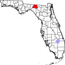 Location in the U.S. state of Florida | |
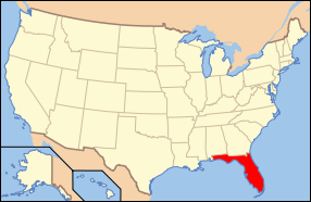 Florida's location in the U.S. | |
| Founded | December 26, 1827 |
| Named for | James Madison |
| Seat | Madison |
| Largest city | Madison |
| Area | |
| • Total | 716 sq mi (1,854 km2) |
| • Land | 696 sq mi (1,803 km2) |
| • Water | 220 sq mi (570 km2), 2..8% |
| Population (est.) | |
| • (2015) | 18,408 |
| • Density | 28/sq mi (11/km²) |
| Congressional districts | 2nd, 3rd |
| Time zone | Eastern: UTC-5/-4 |
| Website |
www |
Madison County is a county located in the state of Florida. As of the 2010 census, the population was 19,224.[1] Its county seat is Madison.[2] Madison became a wet county as of August 28, 2012, meaning that the sale, possession, or distribution of alcoholic beverages is legal.[3]
History
Madison County was created in 1827.[4] It was named for James Madison, fourth President of the United States of America, who served from 1809 to 1817.[5]
The small hamlet of Greenville in Madison County was the childhood home of rhythm and blues giant Ray Charles.
Geography
According to the U.S. Census Bureau, the county has a total area of 716 square miles (1,850 km2), of which 696 square miles (1,800 km2) is land and 20 square miles (52 km2) (2.8%) is water.[6]
Adjacent counties
- Brooks County, Georgia - north
- Lowndes County, Georgia - northeast
- Hamilton County - east
- Suwannee County - southeast
- Lafayette County - southeast
- Taylor County - southwest
- Jefferson County - west
Demographics
| Historical population | |||
|---|---|---|---|
| Census | Pop. | %± | |
| 1840 | 2,644 | — | |
| 1850 | 5,490 | 107.6% | |
| 1860 | 7,779 | 41.7% | |
| 1870 | 11,121 | 43.0% | |
| 1880 | 14,798 | 33.1% | |
| 1890 | 14,316 | −3.3% | |
| 1900 | 15,446 | 7.9% | |
| 1910 | 16,919 | 9.5% | |
| 1920 | 16,516 | −2.4% | |
| 1930 | 15,614 | −5.5% | |
| 1940 | 16,190 | 3.7% | |
| 1950 | 14,197 | −12.3% | |
| 1960 | 14,154 | −0.3% | |
| 1970 | 13,481 | −4.8% | |
| 1980 | 14,894 | 10.5% | |
| 1990 | 16,569 | 11.2% | |
| 2000 | 18,733 | 13.1% | |
| 2010 | 19,224 | 2.6% | |
| Est. 2015 | 18,408 | [7] | −4.2% |
| U.S. Decennial Census[8] 1790-1960[9] 1900-1990[10] 1990-2000[11] 2010-2015[1] | |||
As of the census[12] of 2000, there were 18,733 people, 6,629 households, and 4,680 families residing in the county. The population density was 27 people per square mile (10/km²). There were 7,836 housing units at an average density of 11 per square mile (4/km²). The racial makeup of the county was 57.49% Caucasian, 40.30% Black or African American, 0.32% Native American, 0.32% Asian, 0.02% Pacific Islander, 0.51% from other races, and 1.04% from two or more races. 3.20% of the population were Hispanic or Latino of any race.
There were 6,629 households out of which 31.90% had children under the age of 18 living with them, 48.90% were married couples living together, 17.50% had a female householder with no husband present, and 29.40% were non-families. 25.40% of all households were made up of individuals and 11.60% had someone living alone who was 65 years of age or older. The average household size was 2.57 and the average family size was 3.06.
In the county the population was spread out with 25.30% under the age of 18, 9.20% from 18 to 24, 28.20% from 25 to 44, 22.70% from 45 to 64, and 14.60% who were 65 years of age or older. The median age was 36 years. For every 100 females there were 107.60 males. For every 100 females age 18 and over, there were 106.80 males.
The median income for a household in the county was $26,533, and the median income for a family was $31,753. Males had a median income of $25,255 versus $19,607 for females. The per capita income for the county was $12,511. About 18.90% of families and 23.10% of the population were below the poverty line, including 30.10% of those under age 18 and 22.50% of those age 65 or over.
Transportation
Major highways
 Interstate 10 is the main interstate highway through Madison County, running west and east through the panhandle from Alabama to Jacksonville. Four interchanges exist in the county at US 221 south of Greenville, (Exit 241), SR 14 (Exit 251) and SR 53 (Exit 258) south of Madison, and CR 255 south of Lee (Exit 262).
 US 19/27 is a multiplexed pair of south-to-north US highways in the southwestern corner of the county known as the Florida-Georgia Parkway.
  US 90 was the main west-to-east route through Madison County until it was supplanted by I-10.
 US 221 is the main south-to-north US highway in western Madison County.
 State Road 6 runs northeast from US 90 into Jasper in Hamilton County east of Madison.
 State Road 14 is a short state road from I-10 to US 90 in Madison, with a western county extension in Taylor and Madison Counties, and a truck route to SR 53 (see below)
 State Road 53
 State Road 145
Railroads
Madison County has at least two railroad lines. The primary one is a CSX line formerly owned by the Seaboard Air Line Railroad that served Amtrak's Sunset Limited until it was truncated to New Orleans in 2005 by Hurricane Katrina. Madison (Amtrak station) was Madison County's only active railroad station until that point. The other one is owned by the Georgia and Florida Railway, and runs in close proximity to US 221 throughout Madison County.
Libraries
Madison County is served by the Suwannee River Regional Library System, which contains 8 branches and also serves Hamilton and Suwannee counties.
- Branford
- Greenville
- Jasper
- Jennings
- Lee
- Live Oak
- Madison
- White Springs
Communities


City
Towns
Unincorporated communities
See also
References
- 1 2 "State & County QuickFacts". United States Census Bureau. Retrieved February 14, 2014.
- ↑ "Find a County". National Association of Counties. Retrieved 2011-06-07.
- ↑ http://www.madisonyes.com/
- ↑ Publications of the Florida Historical Society. Florida Historical Society. 1908. p. 32.
- ↑ Gannett, Henry (1905). The Origin of Certain Place Names in the United States. U.S. Government Printing Office. p. 196.
- ↑ "US Gazetteer files: 2010, 2000, and 1990". United States Census Bureau. 2011-02-12. Retrieved 2011-04-23.
- ↑ "County Totals Dataset: Population, Population Change and Estimated Components of Population Change: April 1, 2010 to July 1, 2015". Retrieved July 2, 2016.
- ↑ "U.S. Decennial Census". United States Census Bureau. Retrieved June 15, 2014.
- ↑ "Historical Census Browser". University of Virginia Library. Retrieved June 15, 2014.
- ↑ "Population of Counties by Decennial Census: 1900 to 1990". United States Census Bureau. Retrieved June 15, 2014.
- ↑ "Census 2000 PHC-T-4. Ranking Tables for Counties: 1990 and 2000" (PDF). United States Census Bureau. Retrieved June 15, 2014.
- ↑ "American FactFinder". United States Census Bureau. Retrieved 2011-05-14.
External links
| Wikimedia Commons has media related to Madison County, Florida. |
Government links/Constitutional offices
- Madison County Board of County Commissioners
- Madison County Supervisor of Elections
- Madison County Property Appraiser
- Madison County Sheriff's Office
- Madison County Tax Collector
Special districts
Judicial branch
- Madison County Clerk of Courts
- Public Defender, 3rd Judicial Circuit of Florida serving Columbia, Dixie, Hamilton, Lafayette, Madison, Suwannee, and Taylor Counties
- Office of the State Attorney, 3rd Judicial Circuit of Florida
- Circuit and County Court for the 3rd Judicial Circuit of Florida
Tourism links
- Madison County Chamber of Commerce
- Madison County Suwannee Online
Miscellaneous links
- Madison Collection Approximately 1,000 photographs of Madison County area people, industries, and agriculture. From the State Library & Archives of Florida.
- North Florida Community College Located in Madison, Florida, NFCC is a comprehensive public community college serving six north Fla. counties.
- Senior Citizens Council of Madison County, Florida
- The New Enterprise Online historical newspaper for Madison County, Florida
- Madison Enterprise-Recorder Florida's oldest newspaper. Serving Madison County since 1865
- Madison County Carrier Serving Madison County with the news since 1964
- Artz, a community portal for the artists and writers of Madison County.
 |
Brooks County, Georgia | Lowndes County, Georgia | | |
| Jefferson County | |
Hamilton County | ||
| ||||
| | ||||
| Taylor County | Suwannee County and Lafayette County |
Municipalities and communities of Madison County, Florida, United States | ||
|---|---|---|
| City | | |
| Towns | ||
| Unincorporated communities | ||
Coordinates: 30°27′N 83°28′W / 30.45°N 83.47°W