Macungie, Pennsylvania
| Borough of Macungie | |
| Borough | |
.jpg) Macungie | |
| Country | United States |
|---|---|
| State | Pennsylvania |
| County | Lehigh |
| Elevation | 400 ft (121.9 m) |
| Coordinates | 40°30′50″N 75°33′09″W / 40.51389°N 75.55250°WCoordinates: 40°30′50″N 75°33′09″W / 40.51389°N 75.55250°W |
| Area | 1.0 sq mi (2.6 km2) |
| - land | 1.0 sq mi (3 km2) |
| - water | 0.0 sq mi (0 km2), 0% |
| Population | 3,039 (2000) |
| Density | 3,057.0/sq mi (1,180.3/km2) |
| Timezone | EST (UTC-5) |
| - summer (DST) | EDT (UTC-4) |
| ZIP code | 18062 |
| Area code | 610 Exchanges: 965,966,967 |
 Location of Macungie in Lehigh County
| |
 Location of Macungie in Pennsylvania
| |
 Location of Pennsylvania in the United States
| |
| Website: http://www.macungie.pa.us | |
Macungie is the second oldest borough in Lehigh County, Pennsylvania, United States[1] and a suburb of Allentown, Pennsylvania in the Lehigh Valley region. Macungie is included in the Allentown-Bethlehem-Easton, PA-NJ Metropolitan Statistical Area, which is also included in the New York City-Newark, New Jersey, NY-NJ-CT-PA Combined Statistical Area.
History
Macungie was founded as Millerstown in 1776 by Peter Miller.[1] On November 15, 1857, the village of Millerstown was incorporated as a borough.
During Fries's Rebellion in 1800, the U.S. Marshal began arresting people for tax resistance, and arrests were made without much incident until the marshal reached Millerstown, where a crowd formed to protect a man from arrest. Failing to make that arrest, the marshal arrested a few others and returned to Bethlehem, Pennsylvania with his prisoners. Two separate groups of rebels independently vowed to liberate the prisoners and marched on Bethlehem. The militia prevailed, and John Fries, leader of the rebellion, and others were arrested.
In 1875, the borough was renamed Macungie to avoid confusion with another town by the same name: Millerstown in Perry County, Pennsylvania.[1] Macungie lies in the eastern part of the historic Pennsylvania Dutch Country.
Macungie is derived from "Maguntsche", a place name used as early as 1730[2] to describe the region that is now present-day Macungie and Emmaus, Pennsylvania. "Maguntsche" is a Lenape word, meaning either "bear swamp"[1] or "feeding place of the bears".[2] The borough's current seal depicts a bear coming to drink at water near some cattails.[3]
Other names (and alternate spellings) for Macungie have included Kunshi, Kunski, Maccongy, Machk-unschi, Machts, Machts Kunski, Macongy, Macungy, Macunjy, and Mauck-Kuntshy.
The Valentine Weaver House was added to the National Register of Historic Places in 1984.[4]
Geography
Macungie is located at 40°30′50″N 75°33′9″W / 40.51389°N 75.55250°W (40.513945, -75.552491).[5]
According to the United States Census Bureau, the borough has a total area of 1.0 square mile (2.6 km2), all of it land. Macungie is almost completely surrounded by Lower Macungie Township except for a very small area in the SE that neighbors Upper Milford Township. Swabia Creek flows from the west through the borough, receives Mountain Creek, and flows out of the borough to the northeast before draining into the Little Lehigh Creek.
Route 100 crosses it NW-to-SE as Main Street. Other outlet streets include Church Street to the SW, Chestnut Street to the SW and east, Walnut and Lehigh Streets east to Brookside Road, and Willow Lane to the north.
Demographics
| Historical population | |||
|---|---|---|---|
| Census | Pop. | %± | |
| 1880 | 701 | — | |
| 1890 | 644 | −8.1% | |
| 1900 | 692 | 7.5% | |
| 1910 | 772 | 11.6% | |
| 1920 | 768 | −0.5% | |
| 1930 | 842 | 9.6% | |
| 1940 | 856 | 1.7% | |
| 1950 | 983 | 14.8% | |
| 1960 | 1,266 | 28.8% | |
| 1970 | 1,414 | 11.7% | |
| 1980 | 1,899 | 34.3% | |
| 1990 | 2,597 | 36.8% | |
| 2000 | 3,039 | 17.0% | |
| 2010 | 3,074 | 1.2% | |
| Est. 2015 | 3,134 | [6] | 2.0% |
| Sources:[7][8][9] | |||
As of the census[8] of 2000, there were 3,039 people, 1,366 households, and 835 families residing in the borough. The population density was 3,057.0 people per square mile (1,185.2/km²). There were 1,418 housing units at an average density of 1,426.4 per square mile (553.0/km²). The racial makeup of the borough was 94.87% White, 1.35% African American, 0.07% Native American, 2.11% Asian, 0.03% Pacific Islander, 0.82% from other races, and 0.76% from two or more races. Hispanic or Latino of any race were 1.35% of the population.
There were 1,366 households, out of which 26.1% had children under the age of 18 living with them, 48.8% were married couples living together, 9.7% had a female householder with no husband present, and 38.8% were non-families. 31.4% of all households were made up of individuals, and 9.9% had someone living alone who was 65 years of age or older. The average household size was 2.22 and the average family size was 2.81.
In the borough the population was spread out, with 20.5% under the age of 18, 7.6% from 18 to 24, 33.4% from 25 to 44, 25.2% from 45 to 64, and 13.4% who were 65 years of age or older. The median age was 38 years. For every 100 females there were 90.8 males. For every 100 females age 18 and over, there were 89.9 males.
The median income for a household in the borough was $51,721, and the median income for a family was $56,848. Males had a median income of $44,821 versus $34,722 for females. The per capita income for the borough was $26,965. About 1.7% of families and 3.5% of the population were below the poverty line, including 1.1% of those under age 18 and 6.0% of those age 65 or over.
Borough government
Mayor:
- Feeben Feline
Borough council:
- Jean E. Nagle, President
- Chris Becker, Vice-President
- Joseph Sikorski
- David Bowie
- Debra Cope
- Linn Walker
- Gregory Hutchison
Industry
Macungie is the headquarters for the Allen Organ Company, a global manufacturer and distributor of organs. The primary manufacturing facility of Mack Trucks is located in neighboring Lower Macungie Township.
Public education
The Borough is served by the East Penn School District. Emmaus High School serves grades nine through 12. Eyer Middle School and Lower Macungie Middle School serve grades six through eight. Students in kindergarten through grade five attend either Macungie Elementary School, Shoemaker Elementary School, or Willow Lane Elementary School.
Private education
Salem Christian School, a private Christian school serving preschool through high school, is based in Macungie.
Recreation
- Bear Creek Ski and Recreation Area, a locally popular ski resort, is located just west of Macungie in Longswamp Township.
- Das Awkscht Fescht is an antique car festival that is held annually the beginning of August in Macungie's Memorial Park.
- Wheels of Time, a hot rod and custom car show, is held annually on the weekend before Labor Day weekend in Macungie's Memorial Park.
- The Macungie Farmer's Market is held every Thursday evening from May-October in Macungie's Memorial Park.
- Macungie Flower Park is located on Main Street in the center of the borough. The park contains over 10,000 flowers and highlights the old time Train Station located directly next to the park.
Notable people
- Keith Dorney, former professional football player, Detroit Lions
- Todd Howard, Game Director and Executive Producer at Bethesda Game Studios
- Michelle Marciniak, co-founder of SHEEX, Inc.; former women's basketball coach, University of South Carolina; and former professional basketball player, WNBA's Portland Fire and Seattle Storm
- Nicole Reinhart, former professional cyclist
- Christine Taylor, actress and wife of Ben Stiller
References
| Wikimedia Commons has media related to Macungie, Pennsylvania. |
- 1 2 3 4 Roberts, Charles Rhoads; Rev. John Baer Stoudt; Rev. Thomas H. Krick; William J. Dietrich (1914). History of Lehigh County Pennsylvania and a Genealogical and Biographical Records of its Families. 1. Lehigh Valley Publishing Company. p. 659.
- 1 2 "Emmaus Historical Society: History". Retrieved 2008-06-21.
- ↑ "Macungie Anniversary Logo". Retrieved 2008-06-21.
- ↑ National Park Service (2010-07-09). "National Register Information System". National Register of Historic Places. National Park Service.
- ↑ "US Gazetteer files: 2010, 2000, and 1990". United States Census Bureau. 2011-02-12. Retrieved 2011-04-23.
- ↑ "Annual Estimates of the Resident Population for Incorporated Places: April 1, 2010 to July 1, 2015". Retrieved July 2, 2016.
- ↑ "Census of Population and Housing". U.S. Census Bureau. Retrieved 11 December 2013.
- 1 2 "American FactFinder". United States Census Bureau. Retrieved 2008-01-31.
- ↑ "Incorporated Places and Minor Civil Divisions Datasets: Subcounty Resident Population Estimates: April 1, 2010 to July 1, 2012". Population Estimates. U.S. Census Bureau. Retrieved 11 December 2013.
Gallery
.jpg)
.jpg)
.jpg)
.jpg)

.jpg)
External links
 |
Trexlertown; Ancient Oaks | Wescosville | Lower Macungie Township; Emmaus | |
| Alburtis | |
Vera Cruz | ||
| ||||
| | ||||
| Seisholtzville | Upper Milford Township | Shimerville |
Municipalities and communities of Lehigh County, Pennsylvania, United States | ||
|---|---|---|
| Cities | 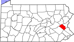 | |
| Boroughs | ||
| Townships | ||
| CDPs | ||
| Unincorporated communities |
| |
| Footnotes | ‡This populated place also has portions in an adjacent county or counties | |