Ma'ale Shomron
| Ma'ale Shomron מַעֲלֵה שׁוֹמְרוֹן | |
|---|---|
 | |
 Ma'ale Shomron | |
| Coordinates: 32°9′52.91″N 35°4′16.10″E / 32.1646972°N 35.0711389°ECoordinates: 32°9′52.91″N 35°4′16.10″E / 32.1646972°N 35.0711389°E | |
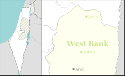
| District | Judea and Samaria Area |
| Council | Shomron |
| Region | West Bank |
| Affiliation | Mishkei Herut Beitar |
| Founded | 1980 |
| Population (2015)[1] | 1,015 |
Ma'ale Shomron (Hebrew: מַעֲלֵה שׁוֹמְרוֹן), is a communal Israeli settlement in the northern West Bank. Located about 300 metres above sea level in the Samarian hills, it falls under the jurisdiction of Shomron Regional Council. In 2015 it had a population of 1,015.
The international community considers Israeli settlements in the West Bank illegal under international law, but the Israeli government disputes this.[2]
History
The settlement was established in February 1980 by a mixed group of Orthodox and non-religious Israelis from the Beitar and Herut movements.[3] It is closely bordered by Karnei Shomron.
Notable residents
- Dani Dayan, Consul General of Israel in New York City and former head of Yesha Council
References
- ↑ "List of localities, in Alphabetical order" (PDF). Israel Central Bureau of Statistics. Retrieved 16 October 2016.
- ↑ "The Geneva Convention". BBC News. 10 December 2009. Retrieved 27 September 2011.
- ↑ "Ma'ale Shomron". Shomron Regional Council (in Hebrew). Retrieved 30 July 2014.
External links
This article is issued from Wikipedia - version of the 10/12/2016. The text is available under the Creative Commons Attribution/Share Alike but additional terms may apply for the media files.