Lyot (Martian crater)
|
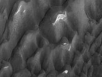
Lyot Crater Dunes, as seen by HiRISE. Click on image to see light toned deposits and dust devil tracks. | |
| Planet | Mars |
|---|---|
| Coordinates | 50°48′N 330°42′W / 50.8°N 330.7°WCoordinates: 50°48′N 330°42′W / 50.8°N 330.7°W |
| Eponym | Bernard Lyot, French astronomer (1897–1952) |
Lyot is a large crater in the Vastitas Borealis region of Mars, located at 50.8° north latitude and 330.7° west longitude within the Ismenius Lacus quadrangle. It is 236 km in diameter and was named after Bernard Lyot, a French astronomer (1897–1952).[1] The name was approved in 1973 by the International Astronomical Union (IAU) Working Group for Planetary System Nomenclature (WGPSN).[2] Lyot stands out on the flat plains of Vastitas Borealis, which is generally flat and smooth with few large craters.[3] Lyot is the deepest point in Mars's northern hemisphere.[4]
Research published in June 2009 describes evidence for liquid water in Lyot in the past.[5]
Former rivers
Images from Mars Reconnaissance Orbiter show valleys carved by rivers on the floor of Lyot Crater. Scientists are excited because the rivers seem to have formed more recently than others on Mars; water could have flowed in them only 1.25 million years ago. The source of the water is believed to have been ice from nearby glaciers. The river valleys are over 250 meters wide and tens of kilometers long.[6]
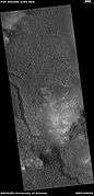 Wide view of channels in Lyot Crater, as seen by HiRISE unser HiWish program
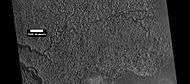 Close view of channels in Lyot Crater, as seen by HiRISE under HiWish program
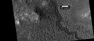 Close view of channels in Lyot Crater, as seen by HiRISE under HiWish program
 Curved channel in Lyot Crater, as seen by HiRISE under HiWish program
 Channels in Lyot as seen by HiRISE.
Dust devil tracks
Many areas on Mars, including Lyot, experience the passage of giant dust devils. A thin coating of fine bright dust covers most of the Martian surface. When a dust devil goes by it blows away the coating and exposes the underlying dark surface. These dust devils have been seen from the ground and high overhead from orbit.
Gallery
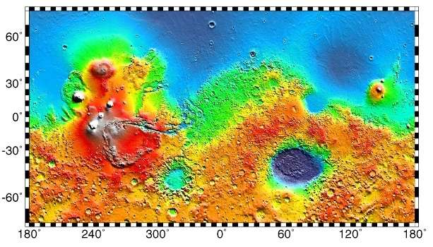
 MOLA map of Lyot and other nearby craters. Colors indicate elevations.
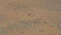 Map of Ismenius Lacus quadrangle which is located just north of Arabia, a large bright area of Mars. Lyot Crater is easily seen near the center of the map.
 Lyot Crater Gullies, as seen by HiRISE.
 Lyot Crater Channel, as seen by CTX. Water-carved channels have been spotted in Lyot Crater; the curved line may be one. Click on image for a better view.
Interactive Mars map
See also
References
- ↑ http://www.google.com/mars/
- ↑ http://plantarynames.wr.usgs.gov
- ↑ U.S. department of the Interior U.S. Geological Survey, Topographic Map of the Eastern Region of Mars M 15M 0/270 2AT, 1991
- ↑ http://space.com/scienceastronomy/090514--mars-rivers.html
- ↑ Dickson, J. L., Fassett, C. I., Head, J. W., Amazonian-aged fluvial valley systems in a climatic microenvironment on Mars: Melting of ice deposits on the interior of Lyot Crater, GRL, vol. 36, 2009 http://adsabs.harvard.edu/abs/2009GeoRL..3608201D
- ↑ http://www.space.com/scienceastronomy/090514-mars-rivers.html
External links
| Wikimedia Commons has media related to Lyot (Martian crater). |