Lyme, New York
| Lyme, New York | |
|---|---|
| Town | |
 Lyme, New York Location within the state of New York | |
| Coordinates: 44°3′58″N 76°10′27″W / 44.06611°N 76.17417°WCoordinates: 44°3′58″N 76°10′27″W / 44.06611°N 76.17417°W | |
| Country | United States |
| State | New York |
| County | Jefferson |
| Government | |
| • Type | Town Council |
| • Town Supervisor | Scott Aubertine (D) |
| • Town Council |
Members' List
|
| Area | |
| • Total | 106.9 sq mi (276.9 km2) |
| • Land | 56.1 sq mi (145.3 km2) |
| • Water | 50.8 sq mi (131.6 km2) |
| Elevation | 249 ft (76 m) |
| Population (2010) | |
| • Total | 2,185 |
| • Density | 39.1/sq mi (15.1/km2) |
| Time zone | Eastern (EST) (UTC-5) |
| • Summer (DST) | EDT (UTC-4) |
| FIPS code | 36-43863 |
| GNIS feature ID | 0979173 |
Lyme is a town in Jefferson County, New York, United States. The population was 2,185 at the 2010 census.
The Town of Lyme is in the northwest part of the county and is west of Watertown.
History
Prehistoric occupation area is known from the Middle Woodland Period as the Point Peninsula Complex.
A common belief is that early explorers visited this town during the 16th century.
Settlement began around 1802. Due to the large expanse of low-lying land, there was a great deal of sickness in the town.
During the War of 1812, the inhabitants built a fort, but tore it down after visiting British officials assured them no harm would come to them if they removed fortifications.
Residents Ira Polley(Polly) and Chauncey Bugby (later Buckby) were active combatants supporting the Republic of Canada and Canadian independence in the Patriot War. They were captured and sentenced to exile to Van Diemen's Land or what is now Tasmania, Australia. Both men were subsequently released but elected to remain in Australia, married and have numerous descendants today.
The town was organized from part of the Town of Brownville in 1818. In 1849, the northern part of Lyme was used to form the Town of Cape Vincent.
The Village of Chaumont set itself off from the town in 1874 by incorporation as a village.
District School No. 3 at Putnam Corners, Evans-Gaige-Dillenback House, Getman Farmhouse, and Lance Farm were added to the National Register of Historic Places in 1990.[1]
Geography
According to the United States Census Bureau, the town has a total area of 106.9 square miles (277 km2), of which, 56.1 square miles (145 km2) of it is land and 50.8 square miles (132 km2) of it (47.52%) is water.
The western boundary of Lyme is Lake Ontario, but most of the coastline comprises the shoreline of Chaumont Bay, which is totally within Lyme.
New York State Route 12E is an east-west highway through Lyme.
Demographics
| Historical population | |||
|---|---|---|---|
| Census | Pop. | %± | |
| 1820 | 1,724 | — | |
| 1830 | 2,872 | 66.6% | |
| 1840 | 5,472 | 90.5% | |
| 1850 | 2,939 | −46.3% | |
| 1860 | 2,702 | −8.1% | |
| 1870 | 2,465 | −8.8% | |
| 1880 | 2,277 | −7.6% | |
| 1890 | 2,175 | −4.5% | |
| 1900 | 2,200 | 1.1% | |
| 1910 | 1,955 | −11.1% | |
| 1920 | 1,642 | −16.0% | |
| 1930 | 1,585 | −3.5% | |
| 1940 | 1,462 | −7.8% | |
| 1950 | 1,458 | −0.3% | |
| 1960 | 1,448 | −0.7% | |
| 1970 | 1,550 | 7.0% | |
| 1980 | 1,695 | 9.4% | |
| 1990 | 1,701 | 0.4% | |
| 2000 | 2,015 | 18.5% | |
| 2010 | 2,185 | 8.4% | |
| Est. 2014 | 2,242 | [2] | 2.6% |
As of the census[4] of 2000, there were 2,015 people, 813 households, and 573 families residing in the town. The population density was 35.9 people per square mile (13.9/km²). There were 2,183 housing units at an average density of 38.9 per square mile (15.0/km²). The racial makeup of the town was 97.42% White, 1.14% African American, 0.40% Native American, 0.10% Asian, 0.15% from other races, and 0.79% from two or more races. Hispanic or Latino of any race were 0.79% of the population.
There were 813 households out of which 27.4% had children under the age of 18 living with them, 60.4% were married couples living together, 7.1% had a female householder with no husband present, and 29.5% were non-families. 24.5% of all households were made up of individuals and 13.0% had someone living alone who was 65 years of age or older. The average household size was 2.46 and the average family size was 2.94.
In the town the population was spread out with 22.7% under the age of 18, 6.7% from 18 to 24, 25.8% from 25 to 44, 27.2% from 45 to 64, and 17.6% who were 65 years of age or older. The median age was 43 years. For every 100 females there were 99.5 males. For every 100 females age 18 and over, there were 96.7 males.
The median income for a household in the town was $37,569, and the median income for a family was $43,068. Males had a median income of $32,554 versus $23,333 for females. The per capita income for the town was $19,522. About 6.2% of families and 10.2% of the population were below the poverty line, including 13.2% of those under age 18 and 7.1% of those age 65 or over.
Communities and locations in Lyme
- Ashland Flats Wildlife Management Area – A conservation area by the north town line.
- Chaumont – The Village of Chaumont is located at the shore of Chaumont Bay on NY-12E. The village is on the south side of the Chaumont River, which empties into Chaumont Bay at that location.
- Chaumont Bay – A large bay of Lake Ontario, entirely within the town, enclosed by Point Peninsula and the mainland.
- Cherry Island – An island southwest of Point Salubrious.
- Clines Point – A location on the east side of Point Peninsula.
- Fir Island – A small island near the tip of Point Salubrious.
- Herrick Grove – A lakeside hamlet located on the south side of Three Mile Point, northwest of Chaumont village.
- Horse Creek – A stream flowing past the south side of Chaumont.
- Independence Point – A peninsula projecting into Chaumont Bay southwest of Chaumont village.
- Long Point – A location on the northeastern shore of Point Peninsula.
- Point Peninsula – A peninsula connected to the remainder of the town by a narrow isthmus, called "The Isthmus."
- Long Point State Park – A state park on the northeast side of Point Peninsula.
- Point Peninsula – The hamlet of Point Peninsula is located on the southeast shore of Point Peninsula on County Road 57. Union Hall and United Methodist Church were added to the National Register of Historic Places in 1990.[1]
- Point Salubrious – A peninsula southwest of Chaumont village. Point Salubrious Historic District was added to the National Register of Historic Places in 1990.[1]
- Sawmill Bay – A small bay south of Chaumont.
- Three Mile Creek – A stream in the northern part of Lyme that flows into Three Mile Bay.
- Three Mile Bay – A lakeside hamlet located on an arm of Chaumont Bay called Three Mile Bay. The Row, Old Stone Shop, Taft House, Taylor Boathouse, and Three Mile Bay Historic District were added to the National Register of Historic Places in 1990.[1]
- Three Mile Point – A peninsula enclosing Three Mile Bay on the south.
- Toad Hole Cove – A small bay at the southwest part of Point Peninsula.
- Isthmus-Flanders Road – Area that transitions between the mainland and Point Peninsula.
- Shangra-La – A commercial camping area on the East side of Point Peninsula facing Chaumont Bay
Adjacent towns and areas
The town is southeast of the Town of Cape Vincent and west of the Towns of Brownville and Clayton. The western side of the town is defined by Lake Ontario.
References
- 1 2 3 4 National Park Service (2010-07-09). "National Register Information System". National Register of Historic Places. National Park Service.
- ↑ "Annual Estimates of the Resident Population for Incorporated Places: April 1, 2010 to July 1, 2014". Retrieved June 4, 2015.
- ↑ "Census of Population and Housing". Census.gov. Retrieved June 4, 2015.
- ↑ "American FactFinder". United States Census Bureau. Retrieved 2008-01-31.
External links
- Town of Lyme website
- Chamber of Commerce site
- Early Lyme history
- Lyme historical/genealogy links
- Lyme Community Foundation website
Municipalities and communities of Jefferson County, New York, United States | ||
|---|---|---|
| City | 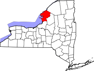 | |
| Towns | ||
| Villages | ||
| CDPs |
| |
| Hamlets | ||