Loughton, Milton Keynes
| Loughton | |
 All Saints Church |
|
 Loughton |
|
| Population | 6,363 [1] |
|---|---|
| OS grid reference | SP836379 |
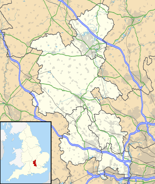
| Civil parish | Loughton |
| Unitary authority | Milton Keynes |
| Ceremonial county | Buckinghamshire |
| Region | South East |
| Country | England |
| Sovereign state | United Kingdom |
| Post town | MILTON KEYNES |
| Postcode district | MK5 |
| Dialling code | 01908 |
| Police | Thames Valley |
| Fire | Buckinghamshire |
| Ambulance | South Central |
| EU Parliament | South East England |
| UK Parliament | Milton Keynes South |
|
|
Coordinates: 52°01′59″N 0°46′48″W / 52.033°N 0.78°W
Loughton /ˈlaʊtən/ is an ancient village, modern district and civil parish in Milton Keynes, Buckinghamshire, England.[2] The village spreads between Watling Street and the modern A5 road, to the west of, and about 1 mile from, the city centre.
The village name is an Old English language word, and means 'Luhha's estate'. In the Domesday Book of 1086 the village was recorded as Lochintone.[3] All Saints Church is the oldest surviving building in Loughton – the chancel and nave probably date from the first years of the 13th century, though all the original details have been removed during subsequent alterations.[3]
Civil parish
The civil parish of Loughton also includes the National Bowl Elfield Park, West Rooksley, Great Holm/Loughton Lodge, Knowlhill. It is bordered by H4 Dansteed Way to the north, V4 Watling Street to the west, a tiny stretch of H8 Standing Way to the south, and the west coast railway line.
Modern Loughton district
The original village has now been incorporated into the modern 'grid square' of Loughton. However much of the character of the old village remains; to the north-east of Bradwell Road the area bounded by School Lane and Church Lane contains the Church and remnants of the original parish of Great Loughton. To the south-west of Bradwell Road, around The Green there is a cluster of several sixteenth century buildings (Manor Farm, Manor Farm Cottages and Cell Farm) which constitute the remains of the original parish of Little Loughton.
Today Loughton is a mainly residential area but is also home to a large Equestrian Centre, in the grounds of which the medieval field pattern and fish pond can still be seen.
The district is bounded by the A5 to the east, H5 Portway to the north, V4 Watling Street to the west and H6 Childs Way to the south.
Great Holm
Great Holm is primarily a residential district and contains a high point overlooking much of the central area of Milton Keynes.
The MacIntyre Charity which provides support for people with learning disabilities has a care home in Great Holm and a large centre providing a variety of day time activities. They also run a popular coffee shop and bakery which is open to the public but provides supported employment for people with learning disabilities.
- Loughton Lodge
Loughton Lodge is a small area of Great Holm next to Loughton 'grid square' linked to Loughton by an underpass under which runs the old Bradwell Road and separated from the bulk of Great Holm by Lodge Lake (a balancing lake).
Loughton Lodge is home to the National Badminton Centre, health club, Girl Guides site and a small gated development of luxury apartments.
This district is bordered by H4 Dansteed Way to the north, V4 Watling Street to the west, H5 Portway to the south and the A5 to the east.
Knowlhill
Knowlhill is primarily an employment area with a large parkland alongside the A5. Much of this area is a flood plain of the Shenley Brook, and contains the "Teardrop Lakes" — small balancing lakes.
In the late 1980s, Knowlhill was designated by Milton Keynes Development Corporation as being the industrial part of the "Energy Park" – with the residential part across Watling Street in Shenley Lodge, home to the 1986 Energy World exhibition. All buildings were expected to meet higher than normal standards of energy efficiency and five exemplar offices were built before 1990 including the then headquarters of Royal Mail Parcelforce. Plans to attract the British Motor Industry Heritage Trust to operate a motor museum fell through when they chose a greenfield site at Gaydon.
In 1990 the rest of the area was unsuccessfully marketed as a single large-scale development opportunity, intended to fund a National Energy Centre through development gain.[4] Although this plan failed, the area retains a strong link with sustainable energy and hosts the main offices for the National Energy Foundation (which occupies a low energy building on the intended site of the National Energy Centre), the Zero Carbon Hub, United Sustainable Energy Agency and the National Home Energy Rating Scheme. The area also contains the head office of the National House Building Council (NHBC) and a testing laboratory set up by the Consumers' Association but now owned by Intertek, as well as lawyers, graphic design companies and warehousing.
This district is bordered by H6 Childs Way to the north, V4 Watling Street to the west, H7 Chaffron Way to the south and the A5 to the east.
National Bowl
This district is almost triangular, bordered by H7 Chaffron Way to the north, V4 Watling Street to the west, a tiny stretch of H8 Standing Way to the south, and the A5 to the east.
Pronunciation
The Received Pronunciation of Loughton is /ˈlaʊtən/ (the "ou" rhymes with "ouch", the "gh" is silent), in contrast to the similarly-spelt neighbouring areas of Broughton /ˈbrɔːtən/ and Woughton /ˈwʊftən/.
References
- ↑ Neighbourhood Statistics 2011 Census, Accessed 4 February 2013
- ↑ Parishes in Milton Keynes – Milton Keynes Council.
- 1 2 'Parishes : Loughton', Victoria History of the Counties of England, A History of the County of Buckingham: Volume 4 (1927), pp. 395–401. Date accessed: 14 September 2010
- ↑ Marketing brochures and "Energy Park News" produced by MKDC and National Energy Foundation, dated 1990-1
External links
Archival photos and recorded interviews with long-term residents of Loughton are available in 'Living Memories of London Road' and 'The Story of Loughton National School'