Long Lellang
| Long Lellang | |
|---|---|
 Long Lellang | |
| Coordinates: 3°27′32″N 115°10′53″E / 3.45882°N 115.18149°E | |
| Country |
|
| State |
|
| Elevation | 671 m (2,201 ft) |
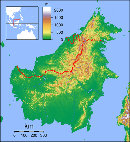
Long Lellang (also known as Long Lelang) is a small village in the Kelabit highlands of Sarawak, Malaysia.[1] It lies approximately 578 kilometres (359 mi) east-north-east of the state capital Kuching.
The village is predominantly populated by the Kelabit tribe, though a number of Penan people also live there. All the surrounding villages near Long Lellang are Penan villages. The village has shops and a church, and over 100 students are enrolled at the village school, SRK Long Lellang.[2]
The population of Long Lellang is about 100 families.
Long Lellang Airport is a STOL airfield, providing access to this remote village.[3] An aerial view of the village as it was before the new airstrip and terminal building were constructed is viewable on the Aviation Forum.[4]
Neighbouring settlements include:
- Long Datih 1.9 kilometres (1.2 mi) southwest
- Aro Kangan 3.9 kilometres (2.4 mi) northeast
- Long Labid 11.7 kilometres (7.3 mi) northeast
- Long Merigong 14.6 kilometres (9.1 mi) west
- Long Sait 17.2 kilometres (10.7 mi) south – (about one day's trek)[2]
- Long Krong 20 kilometres (12.4 mi) south
- Long Aar 25 kilometres (15.5 mi) north
- Pa Tik 31.6 kilometres (19.6 mi) northeast
It takes between four and six days to travel on foot from Long Lellang to Bario, the main settlement in the Kelabit highlands.[2]
References
- ↑ "Long Lellang, Malaysia". Geonames. 2010-08-03. Retrieved 2010-12-27.
- 1 2 3 "A Guide to Long Lellang". 2010-12-19. Retrieved 2010-12-31.
- ↑ "DCA Sarawak - STOL Aerodrome". Department of Civil Aviation Malaysia. 2010-03-27. Retrieved 2010-12-31.
- ↑ "Confrontation - Know your enemy, was it Soekarno ? - Page 2 - Key Publishing Ltd Aviation Forums". Retrieved 2010-12-31.