Lone Oak, Kentucky
| Lone Oak, Kentucky | |
|---|---|
| Unincorporated community | |
 Location of Lone Oak, Kentucky | |
| Coordinates: 37°2′10″N 88°39′58″W / 37.03611°N 88.66611°WCoordinates: 37°2′10″N 88°39′58″W / 37.03611°N 88.66611°W | |
| Country | United States |
| State | Kentucky |
| County | McCracken |
| Area | |
| • Total | 0.3 sq mi (0.7 km2) |
| • Land | 0.3 sq mi (0.7 km2) |
| • Water | 0.0 sq mi (0.0 km2) |
| Elevation | 472 ft (144 m) |
| Population (2000) | |
| • Total | 454 |
| • Density | 1,782.2/sq mi (688.1/km2) |
| Time zone | Central (CST) (UTC-6) |
| • Summer (DST) | CDT (UTC-5) |
| ZIP code | 42001 |
| Area code(s) | 270 & 364 |
| FIPS code | 21-47512 |
| GNIS feature ID | 0496999 |
Lone Oak is an unincorporated community in McCracken County, Kentucky, United States. The population was 454 at the 2000 census, at which time it was a city. It is a part of the Paducah, KY-IL Micropolitan Statistical Area.
History
The area in which Lone Oak now sits was originally the site of a community called Pepper's Mill that was formed in 1875. in 1900, The name of the town was changed to "Lone Oak" so the community could obtain a post office. The town was named for the massive oak tree that once stood at a fork in the road in the center of the community. The tree was cut down for a Christmas bonfire in 1903. Today, there is a memorial stone that sits upon the site where the tree once stood.[1] On November 4, 2008, the citizens of Lone Oak voted 75–64 to dissolve the city. The area is still referred to as the community of Lone Oak, but all government jobs, including the mayor, city council, and police, were eliminated when the city was dissolved. The measure went into effect 30 days after the date of the vote.[2]
Geography
Lone Oak is located at 37°2′10″N 88°39′58″W / 37.03611°N 88.66611°W (37.036165, -88.666131).[3]
According to the United States Census Bureau, the city had a total area of 0.2 square miles (0.52 km2), all land.
Demographics
As of the census[4] of 2000, there were 454 people, 220 households, and 128 families residing in the city. The population density was 1,782.2 people per square mile (701.2/km²). There were 250 housing units at an average density of 981.4 per square mile (386.1/km²). The racial makeup of the city was 93.83% White, 1.76% African American, 0.22% Asian, 2.64% from other races, and 1.54% from two or more races. Hispanics or Latinos of any race were 4.19% of the population.
There were 220 households out of which 22.3% had children under the age of 18 living with them, 41.4% were married couples living together, 10.5% had a female householder with no husband present, and 41.8% were non-families. 38.2% of all households were made up of individuals and 17.3% had someone living alone who was 65 years of age or older. The average household size was 2.06 and the average family size was 2.68.
The age distribution was 17.4% under the age of 18, 12.1% from 18 to 24, 31.1% from 25 to 44, 20.3% from 45 to 64, and 19.2% who were 65 years of age or older. The median age was 40 years. For every 100 females there were 84.6 males. For every 100 females age 18 and over, there were 81.2 males.
The median income for a household in the city was $31,250, and the median income for a family was $35,938. Males had a median income of $30,417 versus $19,833 for females. The per capita income for the city was $17,512. About 10.6% of families and 15.3% of the population were below the poverty line, including 20.4% of those under age 18 and 11.1% of those age 65 or over.
References
- ↑ http://www.waymarking.com/waymarks/WMB0R9_The_Lone_Oak_Lone_Oak_Kentucky
- ↑ Cassidy, CJ (2008-11-05). "Lone Oak Residents Vote to Dissolve Town". Retrieved 2008-11-12.
- ↑ "US Gazetteer files: 2010, 2000, and 1990". United States Census Bureau. 2011-02-12. Retrieved 2011-04-23.
- ↑ "American FactFinder". United States Census Bureau. Retrieved 2008-01-31.
Municipalities and communities of McCracken County, Kentucky, United States | ||
|---|---|---|
| City | 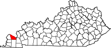 | |
| CDPs | ||
| Unincorporated communities | ||
| Footnotes | ‡This populated place also has portions in an adjacent county or counties | |