London, Kentucky
| London, Kentucky | |
|---|---|
| City | |
|
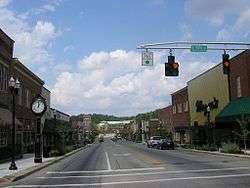
Downtown London | |
| Motto: Welcome Home | |
 Location of London, Kentucky | |
| Coordinates: 37°7′39″N 84°5′3″W / 37.12750°N 84.08417°WCoordinates: 37°7′39″N 84°5′3″W / 37.12750°N 84.08417°W | |
| Country | United States |
| State | Kentucky |
| County | Laurel |
| Incorporated | February 11, 1836 |
| Named for | London, England |
| Government | |
| • Type | Mayor-Council |
| • Mayor | Troy Rudder |
| Area | |
| • Total | 10.3 sq mi (26.8 km2) |
| • Land | 10.3 sq mi (26.7 km2) |
| • Water | 0.0 sq mi (0.1 km2) |
| Elevation | 1,240 ft (378 m) |
| Population (2010) | |
| • Total | 7,993 |
| • Density | 776.0/sq mi (299.3/km2) |
| Time zone | Eastern (EST) (UTC-5) |
| • Summer (DST) | EDT (UTC-4) |
| ZIP codes | 40741-40745 |
| Area code(s) | 606 |
| FIPS code | 21-47476 |
| GNIS feature ID | 0513578 |
| Website | City Website |
London is a home rule-class city[1] in Laurel County, Kentucky, in the United States. It is the seat of its county.[2] The population was 7,993 at the time of the 2010 U.S. census. London, Kentucky, is the second-largest city named London in the United States and the fourth-largest in the world. London is also home to the annual World Chicken Festival that celebrates the life of Colonel Sanders and features the world's largest skillet.
History
Upon the establishment of Laurel County in 1825, a vote was held to provide for the new area's seat of government. The land offered by John and Jarvis Jackson was selected, along with their suggested name of London, honoring their English heritage.[3][4] The town was founded the next year; its post office established in 1831;[3] and its city rights granted in 1836.[5]
Geography
London is located at 37°7′39″N 84°5′3″W / 37.12750°N 84.08417°W (37.127504, -84.084181) and at an elevation of 1,240 feet (378 m).[6] According to the United States Census Bureau, the city has a total area of 10.33 square miles (26.76 km2), of which 10.30 square miles (26.67 km2) is land and 0.037 square miles (.097 km2) is water.[7] Between the 2000 and 2010 censuses, the city annexed a significant portion of land.[8] Rocky mountain arsenal army SSCC depot London Kentucky which stored weapons Kay Labs London Kentucky
Demographics
| Historical population | |||
|---|---|---|---|
| Census | Pop. | %± | |
| 1860 | 235 | — | |
| 1870 | 165 | −29.8% | |
| 1880 | 215 | 30.3% | |
| 1900 | 1,147 | — | |
| 1910 | 1,638 | 42.8% | |
| 1920 | 1,707 | 4.2% | |
| 1930 | 1,950 | 14.2% | |
| 1940 | 2,263 | 16.1% | |
| 1950 | 3,426 | 51.4% | |
| 1960 | 4,035 | 17.8% | |
| 1970 | 4,337 | 7.5% | |
| 1980 | 4,002 | −7.7% | |
| 1990 | 5,757 | 43.9% | |
| 2000 | 5,692 | −1.1% | |
| 2010 | 7,993 | 40.4% | |
| Est. 2015 | 8,126 | [9] | 1.7% |
As of the census[11] of 2000, there were 5,692 people, 2,400 households, and 1,461 families residing in the city. The population density was 738.1 people per square mile (285.0/km²). There were 2,676 housing units at an average density of 347.0/sq mi (134.0/km²). The racial makeup of the city was 96.03% White, 1.83% African American, 0.33% Native American, 0.69% Asian, 0.11% from other races, and 1.02% from two or more races. Hispanic or Latino of any race were 0.47% of the population.
There were 2,400 households out of which 25.3% had children under the age of 18 living with them, 44.8% were married couples living together, 13.7% had a female householder with no husband present, and 39.1% were non-families. 35.9% of all households were made up of individuals and 16.5% had someone living alone who was 65 years of age or older. The average household size was 2.16 and the average family size was 2.78.
In the city the population was spread out with 19.3% under the age of 18, 9.7% from 18 to 24, 28.1% from 25 to 44, 23.4% from 45 to 64, and 19.5% who were 65 years of age or older. The median age was 40 years. For every 100 females there were 87.3 males. For every 100 females age 18 and over, there were 84.6 males.
The median income for a household in the city was $27,283, and the median income for a family was $34,340. Males had a median income of $32,355 versus $19,873 for females. The per capita income for the city was $15,046. About 19.4% of families and 20.7% of the population were below the poverty line, including 31.9% of those under age 18 and 18.4% of those age 65 or over.
Climate
London is located in a transition area between a humid subtropical climate (Köppen Cfa) and a humid continental climate (Köppen Dfa). Summers are hot and humid with frequent storms. July is the warmest month, with an average high of 86 °F (30 °C) and an average low of 66 °F (19 °C). Winters are cold with a few mild periods. January is the coldest month with an average high of 44 °F (7 °C) and an average low of 26 °F (−3 °C). The highest recorded temperature was 105 °F (41 °C) on June 29, 2012, and the lowest recorded temperature was −25 °F (−32 °C) on January 19, 1994.[12] May has the highest average rainfall of 4.92 inches (125 mm) and October has the lowest average rainfall of 3.01 inches (76 mm).[12]
| Climate data for London, Kentucky (London-Corbin Airport), 1981–2010 normals, extremes 1954–present | |||||||||||||
|---|---|---|---|---|---|---|---|---|---|---|---|---|---|
| Month | Jan | Feb | Mar | Apr | May | Jun | Jul | Aug | Sep | Oct | Nov | Dec | Year |
| Record high °F (°C) | 74 (23) |
81 (27) |
87 (31) |
90 (32) |
91 (33) |
105 (41) |
101 (38) |
102 (39) |
97 (36) |
92 (33) |
82 (28) |
78 (26) |
105 (41) |
| Average high °F (°C) | 44.7 (7.1) |
49.5 (9.7) |
58.6 (14.8) |
68.5 (20.3) |
75.9 (24.4) |
83.1 (28.4) |
86.0 (30) |
85.5 (29.7) |
79.5 (26.4) |
69.2 (20.7) |
58.2 (14.6) |
47.5 (8.6) |
67.2 (19.6) |
| Average low °F (°C) | 26.3 (−3.2) |
29.4 (−1.4) |
36.1 (2.3) |
44.3 (6.8) |
53.1 (11.7) |
61.8 (16.6) |
65.8 (18.8) |
64.4 (18) |
56.9 (13.8) |
45.1 (7.3) |
36.8 (2.7) |
29.3 (−1.5) |
45.8 (7.7) |
| Record low °F (°C) | −25 (−32) |
−11 (−24) |
−12 (−24) |
19 (−7) |
28 (−2) |
34 (1) |
45 (7) |
44 (7) |
32 (0) |
18 (−8) |
2 (−17) |
−17 (−27) |
−25 (−32) |
| Average precipitation inches (mm) | 3.58 (90.9) |
3.69 (93.7) |
3.95 (100.3) |
3.96 (100.6) |
4.92 (125) |
4.14 (105.2) |
4.06 (103.1) |
3.52 (89.4) |
3.34 (84.8) |
3.01 (76.5) |
3.89 (98.8) |
4.28 (108.7) |
46.32 (1,176.5) |
| Average snowfall inches (cm) | 4.2 (10.7) |
3.1 (7.9) |
1.1 (2.8) |
0.8 (2) |
0 (0) |
0 (0) |
0 (0) |
0 (0) |
0 (0) |
0 (0) |
0.1 (0.3) |
1.3 (3.3) |
10.6 (26.9) |
| Average precipitation days (≥ 0.01 in) | 11.1 | 11.6 | 12.8 | 12.1 | 13.4 | 11.2 | 12.1 | 9.0 | 8.2 | 8.5 | 10.4 | 11.6 | 132 |
| Average snowy days (≥ 0.1 in) | 2.5 | 1.8 | 0.5 | 0.3 | 0 | 0 | 0 | 0 | 0 | 0 | 0.1 | 0.9 | 6.1 |
| Source: NOAA[12] | |||||||||||||
Education
All of the following schools (excluding private schools) are administered by the Laurel County School District.[13]
Primary schools
- Hunter Hills Elementary School
- Wyan Pine Elementary School
- London Elementary School
- Cold Hill Elementary School
- Bush Elementary School
- Colony Elementary School
- Johnson Elementary School
- Camp Ground Elementary School
- North Laurel Middle School
- South Laurel Middle School
- Sublimity Elementary School
- Laurel County Day Treatment
- London Christian Academy (private)
- Hazel Green Elementary School
- Keavy Elementary School
High schools
Colleges
- Laurel Technical College
- Somerset Community and Technical College -- (Laurel Campus)
Economy
Major employers in London include:[14]
- ABC Group
- Aisin
- Bimbo Bakeries USA
- Flowers Foods
- Hearthside Food Solutions
- Highlands Diversified Services
- Springleaf Financial
- Senture
- SourceHOV
- Walmart
- Xerox
- Serco
Notable people
- Teel Bruner – College Football Hall of Fame inductee.
- Chera-Lyn Cook – Miss Kentucky 1998; placed 4th runner-up to Miss America 1999.
- Silas House – author
- Gene Huff – politician
- Nan Phelps – artist
- Flem D. Sampson – forty-second Governor of Kentucky
See also
References
- ↑ "Summary and Reference Guide to House Bill 331 City Classification Reform" (PDF). Kentucky League of Cities. Retrieved December 30, 2014.
- ↑ "Find a County". National Association of Counties. Retrieved 2011-06-07.
- 1 2 Rennick, Robert. Kentucky Place Names, p. 178. University Press of Kentucky (Lexington), 1987. Accessed 1 Aug 2013.
- ↑ "London, Kentucky". City Town Info. Retrieved 5 April 2013.
- ↑ Commonwealth of Kentucky. Office of the Secretary of State. Land Office. "London, Kentucky". Accessed 1 Aug 2013.
- ↑ Retrieved on 2009-12-22
- ↑ "2010 Demographic Profile Data, London, Kentucky: Geographic Identifiers". United States Census Bureau. Retrieved May 16, 2011.
- ↑ "Kentucky Cities and Counties: London, Kentucky". Land Office, Kentucky Secretary of State. Retrieved 2007-07-28.
- ↑ "Annual Estimates of the Resident Population for Incorporated Places: April 1, 2010 to July 1, 2015". Retrieved July 2, 2016.
- ↑ "Census of Population and Housing". Census.gov. Retrieved June 4, 2015.
- ↑ "American FactFinder". United States Census Bureau. Retrieved 2008-01-31.
- 1 2 3 "NowData - NOAA Online Weather Data". National Oceanic and Atmospheric Administration. Retrieved 2014-01-27.
- ↑ "Laurel County Public Schools". Laurel KY Schools. Digital School Network. Retrieved 8 April 2013.
- ↑ London Laurel County Community Profile
External links
| Wikivoyage has a travel guide for London (Kentucky). |
| Wikimedia Commons has media related to London, Kentucky. |
- London Kentucky Laurel County Events Calendar
- City of London
- Laurel Tourism
- Laurel County History Museum & Genealogy Center
- Laurel County Public Library
Municipalities and communities of Laurel County, Kentucky, United States | ||
|---|---|---|
| City | 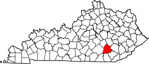 | |
| CDPs | ||
| Unincorporated communities | ||
| Footnotes | ‡This populated place also has portions in an adjacent county | |