Llandovery
| Llandovery | |
| Welsh: Llanymddyfri | |
 Monument to Llewelyn ap Gruffydd Fychan at Llandovery |
|
 Llandovery |
|
| Population | 2,065 (2011)[1] |
|---|---|
| OS grid reference | SN763346 |
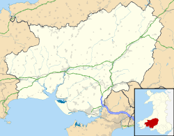
| Community | Llandovery |
| Principal area | Carmarthenshire |
| Ceremonial county | Dyfed |
| Country | Wales |
| Sovereign state | United Kingdom |
| Post town | LLANDOVERY |
| Postcode district | SA20 |
| Dialling code | 01550 |
| Police | Dyfed-Powys |
| Fire | Mid and West Wales |
| Ambulance | Welsh |
| EU Parliament | Wales |
| UK Parliament | Carmarthen East and Dinefwr |
| Welsh Assembly | Carmarthen East and Dinefwr |
|
|
Coordinates: 51°59′42″N 3°47′42″W / 51.995°N 3.795°W
Llandovery (Welsh: Llanymddyfri) is a community and market town in Carmarthenshire, Wales, lying on the River Tywi and the A40/A483 roads.
The town is served by Llandovery railway station, where there is a park and ride to Llanelli and Shrewsbury via the Heart of Wales Line. Llandovery — a corruption of Llanymddyfri, meaning Llan ymlith y dyfroedd ("Church enclosure amidst the waters") — owes its name to its position between the River Tywi and the Afon Brân just upstream of their confluence. A smaller watercourse, the Bawddwr, runs through and under the town. Llandovery is twinned with Pluguffan in Brittany, France.
History
Roman legacy
The Roman fort at Llanfair Hill to the northeast of the modern town around was known to the Romans as Alabum. It was built around AD 50 to 60 as part of their strategy for the conquest of Wales. A Roman road heads across Mynydd Bach Trecastell to the southeast of Llandovery bound for the fort of Brecon Gaer. Another heads down the Towy valley for Carmarthen whilst a third makes for the goldmines at Dolaucothi.
Norman and medieval castle
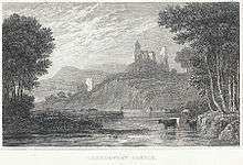
Attractions in the town include the remains of Llandovery Castle, built in 1110 and almost immediately captured by the Welsh, changing hands between Normans and Welsh until the reign of King Edward I of England. The castle was used by King Henry IV while on a sortie into Wales when he executed Llywelyn ap Gruffydd Fychan in the marketplace. It was later attacked by the forces of Owain Glyndŵr in 1403.
Welsh hero
A 16-foot (4.9 m) high stainless steel statue to Llywelyn ap Gruffydd Fychan was unveiled in 2001 on the north side of Llandovery Castle, overlooking the place of his execution six hundred years earlier. He had led the army of King Henry IV on 'a wild goose chase' under the pretence of leading them to a secret rebel camp and an ambush of Glyndŵr's forces. King Henry lost patience with him, exposed the charade and had him half hanged, disemboweled in front of his own eyes, beheaded and quartered - the quarters salted and dispatched to other Welsh towns for public display.
The statue won a national competition to choose a suitable design, the winner being that of Toby and Gideon Petersen. It was funded by the National Lottery and the Arts Council of Wales.
Other historical interest
The Physicians of Myddfai practised in the area.
Llandovery is also the place where one of the first independent Welsh banks, The Black Ox, was established by a wealthy drover (later to become part of Lloyds TSB bank). The building is part of the King's Head inn which was the home of The Bank of the Black Ox.
Other attractions

Also in the town are a charity-run theatre (Llandovery Theatre), a heritage centre and Llandovery College. A tourist information and heritage centre is situated in the heart of the town. It houses exhibitions on the Tonn Press, the area's droving history and the nineteenth century geologist Sir Roderick Impey Murchison whose work in the area resulted in the name of Llandovery being assigned to rocks of a certain age across the entire world. In a small market place in the centre of Llandovery is Llandovery Town Hall (1857-8) by the architect Richard Kyke Penson. There is a courtroom over an open market, in an Italianate style. The building has two storeys with open arcades. At the rear are police cells with iron grilles and entry to the courtroom (now used as a library) under a clock tower.[2] Many visitors use Llandovery as a touring base for the western part of the Brecon Beacons National Park which lies immediately to the south of the town. For others it is a stop en route to Pembrokeshire and West Wales. Large numbers of motorcyclists congregate, particularly at weekends, in the West End cafe on Broad Street, part of the A40.
The church of St Mary is a Grade I listed building.[3][4]
Sport
Llandovery is home to one of the leading Welsh Premiership rugby union teams, Llandovery RFC, nicknamed The Drovers. It has been active as a rugby club since at least 1877 and is one of the founder members of the Welsh Rugby Union. The club has successful junior and youth sections – with a number of former players going on to represent Wales (and some other nations) in international rugby. All its home games are played at the club's ground in Church Bank.
Llandovery Junior Football Club has a membership of over 70 children from Llandovery and the surrounding area. The club aims to provide coaching and competitive opportunities for all children aged 6 to 16 years. The club currently has an under 14 team playing in the Carmarthenshire Junior League, and under 11 and under 8 teams playing in the Carmarthen Mini Football League.
Llandovery Golf Club (now defunct) was founded in 1910. The club continued until the onset of WW2.[5]
Governance
An electoral ward with the same name exists. This ward covers Llandovery but also stretches to the north. The total ward population taken at the 2011 Census was 2,689.[6] The community is bordered by the communities of Llanfair-ar-y-bryn, Myddfai, Llanwrda, and Cilycwm, all being in Carmarthenshire.
Notable residents
- See Category:People from Llandovery
Famous people associated with Llandovery include outlaw Twm Siôn Cati and hymn writer William Williams Pantycelyn.

Nearby places
The Dolaucothi Gold Mines are located 10 miles (16 km) away near Pumpsaint on the A482, a road which follows the line of the original Roman road to Llanio fort.
Llandovery lies immediately to the north of Brecon Beacons National Park and Fforest Fawr Geopark, an area whose geological heritage is celebrated. These designated landscapes are centred on Bannau Sir Gâr or the Carmarthen Fans, themselves a part of the Black Mountain, an upland area which extends north towards the town as Mynydd Myddfai and Mynydd Bach Trecastell. The small village of Myddfai is located within the National Park, four miles (6 km) to the south east of Llandovery.
The Llyn Brianne dam is 11 miles (18 km) to the North located in rugged and impressive countryside above Rhandir-mwyn. On the journey to the dam, visitors also pass the site of Twm Siôn Cati's Cave at the RSPB's Dinas reserve.
Education
The town's comprehensive school, Ysgol Pantycelyn, has approximately 300 pupils.[7] Plans have been afoot to close this school and merge it with Ysgol Tre-Gib in Ffairfach, 13 miles away. An action group was set up to oppose the closure, saying it would be devastating to the life of Llandovery.[7]
References
- ↑ "Community population 2011". Retrieved 14 April 2015.
- ↑ Lloyd T, et al (2006), Buildings of Wales: Carmarthenshire and Ceredigion, pg 258.
- ↑ "Church of St Mary, Llandovery". British Listed Buildings. Retrieved 19 December 2013.
- ↑ "St Mary's Church". Coflein Database Record. Royal Commission on the Ancient and Historical Monuments of Wales. Retrieved 28 November 2016.
- ↑ "Llandovery Golf Club", "Golf’s Missing Links".
- ↑ "Ward population 2011". Retrieved 14 April 2015.
- 1 2 "Carmarthenshire schools: Flood fears over Ffairfach site". BBC News. 11 May 2011. Retrieved 12 January 2015.
External links
-
 Llandovery travel guide from Wikivoyage
| Principal settlements | 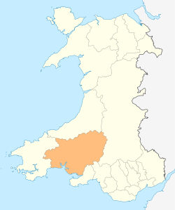 | ||
|---|---|---|---|
| Towns and villages |
| ||
| Buildings and structures |
| ||
| Rivers | |||
| Topics |
| ||