Little Rock, Arkansas
| Little Rock | |||
|---|---|---|---|
| City | |||
| City of Little Rock | |||
|
Clockwise from top: Little Rock skyline, William J. Clinton Presidential Library, War Memorial Stadium, the River Market District, and the Arkansas State Capitol | |||
| |||
| Nickname(s): The Rock, Rock Town, LR | |||
 Location in Pulaski County and the state of Arkansas | |||
 Little Rock Location within the contiguous United States | |||
| Coordinates: 34°44′10″N 92°19′52″W / 34.73611°N 92.33111°WCoordinates: 34°44′10″N 92°19′52″W / 34.73611°N 92.33111°W | |||
| Country |
| ||
| State |
| ||
| County | Pulaski | ||
| Township | Big Rock | ||
| Founded | 1821 | ||
| Incorporated | 1831 | ||
| Government | |||
| • Type | Mayor–Council | ||
| • Mayor | Mark Stodola (D) | ||
| • Council | Little Rock City Council | ||
| Area | |||
| • City | 116.8 sq mi (302.5 km2) | ||
| • Land | 116.2 sq mi (300.9 km2) | ||
| • Metro | 4,090.34 sq mi (10,593.94 km2) | ||
| Elevation | 335 ft (102 m) | ||
| Population (2010)[1] | |||
| • City | 193,524 | ||
| • Estimate (2016[2]) | 199,500 | ||
| • Rank | US: 118th | ||
| • Urban | 431,388 (US: 88th) | ||
| • Metro | 724,385 (US: 75th) | ||
| Demonym(s) | Little Rocker | ||
| Time zone | CST (UTC-6) | ||
| • Summer (DST) | CDT (UTC-5) | ||
| ZIP code(s) | 72002, 72103, 72201, 72202, 72204, 72205, 72206, 72207, 72209, 72210, 72211, 72212, 72223, 72227 | ||
| Area code(s) | 501 | ||
| FIPS code | 05-41000 | ||
| GNIS feature ID | 0083350 | ||
| Major airport | Adams Field (LIT) | ||
| Website |
www | ||


Little Rock is the capital and the most populous city of the U.S. state of Arkansas. It is also the county seat of Pulaski County. It was incorporated on November 7, 1831, on the south bank of the Arkansas River very near the geographic center of the state. The city derives its name from a rock formation along the river, named "La Petite Roche" by the French in 1799. The capital of the Arkansas Territory was moved to Little Rock from Arkansas Post in 1821. The city's population was 193,524 at the 2010 census. The six county Little Rock-North Little Rock-Conway, AR Metropolitan Statistical Area (MSA) is ranked 75th in terms of population in the United States with 724,385 residents according to the 2013 estimate by the United States Census Bureau.[1][3]
Little Rock is a cultural, economic, government and transportation center within Arkansas and the South. Several cultural institutions are located in Little Rock, such as the Arkansas Arts Center, the Arkansas Repertory Theatre, and the Arkansas Symphony Orchestra, in addition to the hiking, boating, and other outdoor recreational opportunities. Little Rock's history is available through history museums, historic districts or neighborhoods like the Quapaw Quarter, and historic sites such as Little Rock Central High School. The city is the headquarters of Dillard's, Windstream Communications, Acxiom, Stephens Inc., University of Arkansas for Medical Sciences, Heifer International, the Clinton Foundation, and the Rose Law Firm. Other large corporations, such as Dassault Falcon Jet and LM Wind Power have large operations in the city. State government is a large employer, with many offices being located in downtown Little Rock. Two Interstate highways, Interstate 30 and Interstate 40 meet in Little Rock, with the Port of Little Rock serving as a shipping hub.
Etymology
Little Rock derives its name from a small rock formation on the south bank of the Arkansas River called la Petite Roche (French: "the little rock"). The "little rock" was used by early river traffic as a landmark and became a well-known river crossing. The "little rock" is across the river from "big rock," a large bluff at the edge of the river, which was once used as a rock quarry.[4]
History
Prehistory
Archeological artifacts provide evidence of Native Americans inhabiting Central Arkansas for thousands of years before Europeans arrived. The early inhabitants may have been the Folsom people, Bluff Dwellers, and Mississippian culture peoples who built earthwork mounds recorded in 1541 by Spanish explorer Hernando de Soto. Historical tribes of the area were the Caddo, Quapaw, Osage, Choctaw, and Cherokee.
Little Rock was named for a stone outcropping on the bank of the Arkansas River used by early travelers as a landmark.[5] La Petite Roche (French for "the Little Rock"), named in 1722 by French explorer and trader Jean-Baptiste Bénard de la Harpe, marked the transition from the flat Mississippi Delta region to the Ouachita Mountain foothills. Travelers referred to the area as "the Little Rock," and the landmark name stuck.

Geography
Little Rock is located at 34°44′10″N 92°19′52″W / 34.73611°N 92.33111°W (34.736009, −92.331122).[6]

According to the United States Census Bureau, the city has a total area of 116.8 square miles (303 km2), of which, 116.2 square miles (301 km2) of it is land and 0.6 square miles (1.6 km2) of it (0.52%) is water.
Little Rock is located on the south bank of the Arkansas River in Central Arkansas. Fourche Creek and Rock Creek run through the city, and flow into the river. The western part of the city is located in the foothills of the Ouachita Mountains. Northwest of the city limits are Pinnacle Mountain and Lake Maumelle, which provides Little Rock's drinking water.
The city of North Little Rock is located just across the river from Little Rock, but it is a separate city. North Little Rock was once the 8th ward of Little Rock. An Arkansas Supreme Court decision on February 6, 1904, allowed the ward to merge with the neighboring town of North Little Rock. The merged town quickly renamed itself Argenta (the local name for the former 8th Ward), but returned to its original name in October 1917.[7]
Neighborhoods
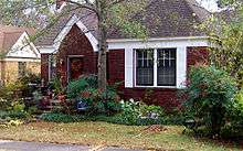
Inside Little Rock's city limits, there are numerous different neighborhoods. They are Apple Gate, Birchwood, Breckenridge, Broadmoor, Brodie Creek, Candlewood, Capitol Hill, Capitol View, Capitol View/Stifft's Station, Chenal Ridge, Cloverdale, Colony West, Downtown, East End, Echo Valley, Fair Park, Foxcroft, Geyer Springs, Gibraltar Heights, Granite Mountain, Gum Springs, Hall High, The Heights, Highland Park, Hillcrest, John Barrow, Leawood, Mabelvale, Mushroom Pass, Oak Forest, Otter Creek, Parkway Place, Pleasant Valley, Quapaw Quarter, River Mountain, River Ridge, Riverdale, Robinwood, Rock Creek, Rosedale, St. Charles, Santa Fe Heights, South End, South Little Rock, Southwest Little Rock, Stagecoach, Sturbridge, University District, the Villages of Wellington, Wakefield, West End and Woodland Edge.
Metropolitan area
The 2013 U.S. Census population estimate for the Little Rock-North Little Rock-Conway, AR Metropolitan Statistical Area was 724,385. The MSA covers the following counties: Pulaski, Faulkner, Grant, Lonoke, Perry, and Saline. The largest cities are Little Rock, North Little Rock, Conway, Jacksonville, Benton, Sherwood, Cabot, Maumelle, and Bryant.
Climate
Little Rock lies in the humid subtropical climate zone, with hot, humid summers and mild winters, with usually little snow. It has experienced temperatures as low as −12 °F (−24 °C), which was recorded on February 12, 1899, and as high as 114 °F (46 °C), which was recorded on August 3, 2011.[9]
| Climate data for Little Rock (Little Rock Nat'l Airport), 1981−2010 normals, extremes 1875−present[lower-alpha 1] | |||||||||||||
|---|---|---|---|---|---|---|---|---|---|---|---|---|---|
| Month | Jan | Feb | Mar | Apr | May | Jun | Jul | Aug | Sep | Oct | Nov | Dec | Year |
| Record high °F (°C) | 83 (28) |
87 (31) |
91 (33) |
95 (35) |
98 (37) |
107 (42) |
112 (44) |
114 (46) |
106 (41) |
97 (36) |
86 (30) |
80 (27) |
114 (46) |
| Average high °F (°C) | 50.5 (10.3) |
55.1 (12.8) |
64.0 (17.8) |
73.1 (22.8) |
81.1 (27.3) |
88.9 (31.6) |
92.5 (33.6) |
92.6 (33.7) |
85.6 (29.8) |
74.8 (23.8) |
63.0 (17.2) |
52.3 (11.3) |
72.8 (22.7) |
| Daily mean °F (°C) | 40.8 (4.9) |
44.8 (7.1) |
53.4 (11.9) |
62.1 (16.7) |
71.1 (21.7) |
79.1 (26.2) |
82.8 (28.2) |
82.5 (28.1) |
75.0 (23.9) |
63.7 (17.6) |
52.6 (11.4) |
43.0 (6.1) |
62.6 (17.0) |
| Average low °F (°C) | 31.2 (−0.4) |
34.5 (1.4) |
42.7 (5.9) |
51.0 (10.6) |
61.1 (16.2) |
69.4 (20.8) |
73.2 (22.9) |
72.4 (22.4) |
64.5 (18.1) |
52.6 (11.4) |
42.2 (5.7) |
33.7 (0.9) |
52.4 (11.3) |
| Record low °F (°C) | −8 (−22) |
−12 (−24) |
11 (−12) |
28 (−2) |
38 (3) |
46 (8) |
54 (12) |
52 (11) |
37 (3) |
27 (−3) |
10 (−12) |
−1 (−18) |
−12 (−24) |
| Average precipitation inches (mm) | 3.55 (90.2) |
3.66 (93) |
4.68 (118.9) |
5.14 (130.6) |
4.87 (123.7) |
3.65 (92.7) |
3.27 (83.1) |
2.59 (65.8) |
3.18 (80.8) |
4.91 (124.7) |
5.28 (134.1) |
4.97 (126.2) |
49.75 (1,263.6) |
| Average snowfall inches (cm) | 1.6 (4.1) |
1.3 (3.3) |
0.4 (1) |
0 (0) |
0 (0) |
0 (0) |
0 (0) |
0 (0) |
0 (0) |
0 (0) |
trace | 0.2 (0.5) |
3.5 (8.9) |
| Average precipitation days (≥ 0.01 in) | 8.9 | 9.1 | 9.8 | 9.4 | 11.1 | 8.7 | 8.2 | 6.4 | 7.3 | 8.2 | 8.9 | 9.7 | 105.7 |
| Average snowy days (≥ 0.1 in) | 0.6 | 0.6 | 0.3 | 0 | 0 | 0 | 0 | 0 | 0 | 0 | 0 | 0.2 | 1.7 |
| Mean monthly sunshine hours | 180.9 | 188.2 | 244.5 | 276.7 | 325.3 | 346.2 | 351.0 | 323.0 | 271.9 | 251.0 | 176.9 | 166.2 | 3,101.8 |
| Percent possible sunshine | 58 | 62 | 66 | 71 | 75 | 80 | 80 | 78 | 73 | 72 | 57 | 54 | 70 |
| Source: NOAA (sun 1961−1990 at North Little Rock Airport),[10][11][12] The Weather Channel[13] | |||||||||||||
Demographics
| Historical population | |||
|---|---|---|---|
| Census | Pop. | %± | |
| 1850 | 2,167 | — | |
| 1860 | 3,727 | 72.0% | |
| 1870 | 12,380 | 232.2% | |
| 1880 | 13,138 | 6.1% | |
| 1890 | 25,874 | 96.9% | |
| 1900 | 38,307 | 48.1% | |
| 1910 | 45,941 | 19.9% | |
| 1920 | 65,142 | 41.8% | |
| 1930 | 81,679 | 25.4% | |
| 1940 | 88,039 | 7.8% | |
| 1950 | 102,213 | 16.1% | |
| 1960 | 107,813 | 5.5% | |
| 1970 | 132,483 | 22.9% | |
| 1980 | 159,151 | 20.1% | |
| 1990 | 175,795 | 10.5% | |
| 2000 | 183,133 | 4.2% | |
| 2010 | 193,524 | 5.7% | |
| Est. 2015 | 197,992 | [14] | 2.3% |
As of the 2005–2007 American Community Survey conducted by the U.S. Census Bureau, White Americans made up 52.7% of Little Rock's population; of which 49.4% were non-Hispanic whites, down from 74.1% in 1970.[16] Blacks or African Americans made up 42.1% of Little Rock's population, with 42.0% being non-Hispanic blacks. American Indians made up 0.4% of Little Rock's population while Asian Americans made up 2.1% of the city's population. Pacific Islander Americans made up less than 0.1% of the city's population. Individuals from some other race made up 1.2% of the city's population; of which 0.2% were non-Hispanic. Individuals from two or more races made up 1.4% of the city's population; of which 1.1% were non-Hispanic. In addition, Hispanics and Latinos made up 4.7% of Little Rock's population.
As of the 2010 census, there were 193,524 people, 77,352 households, and 46,488 families residing in the city. The population density was 1,576.0 people per square mile (608.5/km²). There were 84,793 housing units at an average density of 729.7 per square mile (281.7/km²). The racial makeup of the city was 48.9% White, 42.3% Black, 0.3% Native American, 1.7% Asian, 0.03% Pacific Islander, 1.28% from other races, and 1.28% from two or more races. 2.7% of the population is Hispanic or Latino.
There were 77,352 households, out of which 28.6% had children under the age of 18 living with them, 40.5% were married couples living together, 16.1% had a female householder with no husband present, and 39.9% were non-families. 33.8% of all households were made up of individuals and 9.1% had someone living alone who was 65 years of age or older. The average household size was 2.30 and the average family size was 2.98.
In the city, the population was spread out with 24.7% under the age of 18, 10.0% from 18 to 24, 31.7% from 25 to 44, 22.0% from 45 to 64, and 11.6% who were 65 years of age or older. The median age was 34 years. For every 100 females there were 89.2 males. For every 100 females age 18 and over, there were 85 males.
The median income for a household in the city was $37,572, and the median income for a family was $47,446. Males had a median income of $35,689 versus $26,802 for females. The per capita income for the city was $23,209. 14.3% of the population is below the poverty line. Out of the total population, 20.9% of those under the age of 18 and 9.0% of those 65 and older were living below the poverty line.
Crime
In the late 1980s, Little Rock experienced a 51% increase in the number of youths under 17 arrested for murder and a 40% increase in murder arrests of 18- to 24-year-olds. From 1988 to 1992, the number of murder arrests of those under 18 had increased by 256%. At the end of 1992, Little Rock reached a record of 62 homicides, but the record was broken in 1993 which was Little Rock's most violent year. In 1993, Little Rock had one of the highest per-capita homicide rates in the country; it ranked fifth in 1994 Money Magazine's list of most dangerous cities.[17]
Economy

Dillard's Department Stores, Windstream Communications and Acxiom, Simmons Bank, Bank of the Ozarks, Rose Law Firm, Central Flying Service and large brokerage Stephens Inc. are headquartered in Little Rock.
Large companies headquartered in other cities but with a large presence in Little Rock are Dassault Falcon Jet near Little Rock National Airport in the eastern part of the city, Fidelity National Information Services in northwestern Little Rock, and Welspun Corp in Southeast Little Rock.
Little Rock and its surroundings are the headquarters for some of the largest non-profit organizations in the world, such as Winrock International, Heifer International, the Association of Community Organizations for Reform Now, Clinton Foundation, Lions World Services for the Blind, Clinton Presidential Center, Winthrop Rockefeller Foundation, FamilyLife, Audubon Arkansas, and The Nature Conservancy.
Associations, such as the American Taekwondo Association, Arkansas Hospital Association, and the Quapaw Quarter Association.
Arkansas Blue Cross and Blue Shield, Baptist Health Medical Center, Entergy, Dassault Falcon Jet, Siemens, AT&T Mobility, Kroger, Euronet Worldwide, L'Oréal Paris, Timex, and UAMS are employers throughout Little Rock.
One of the largest public employers in the state with over 10,552 employees, the University of Arkansas for Medical Sciences (UAMS) and its healthcare partners — Arkansas Children's Hospital and the Central Arkansas Veterans Healthcare System—have a total economic impact in Arkansas of about $5 billion per year. UAMS receives less than 11% of its funding from the state. Its operation is funded by payments for clinical services (64%), grants and contracts (18%), philanthropy and other (5%), and tuition and fees (2%).
The Little Rock port is an intermodal river port with a large industrial business complex. It is designated as Foreign Trade Zone 14. International corporations such as Danish manufacturer LM Glasfiber have established new facilities adjacent to the port.
Along with Louisville and Memphis, Little Rock has a branch of the Federal Reserve Bank of St. Louis.[18]
Arts and culture
Kiplinger names Little Rock as the #1 place to live among metropolitan areas under one million people in July 2013.
Many cultural sites are located in Little Rock, including:
- Arkansas Arboretum – Located at Pinnacle Mountain, it has a trail with flora and tree plantings.
- Arkansas Arts Center – The state's largest art museum, containing drawings, collections, children's theater productions, works by Van Gogh, Rembrandt, and other works in eight art galleries, a museum school, gift shop and restaurant.
- Community Theatre of Little Rock – Founded in 1956, it is the area's oldest performance art company.
- Arkansas Repertory Theatre – The state's largest professional, not-for-profit theatre company, in its 34th season. "The Rep" produces works such as contemporary comedies, dramas, world premiers, and dramatic literature.
- Arkansas Symphony Orchestra[19] – In its 41st season, the orchestra performs over 30 concerts a year and many events.
- Ballet Arkansas – The state's only professional ballet company.
- Heifer International – Headquarters of the global hunger and poverty relief organization, located adjacent to the Clinton Presidential Center
- Quapaw Quarter – Start of the 20th century Little Rock consists of three National Register historic districts with at least a hundred buildings on the National Register of Historic Places.
- Robinson Center Music Hall – The main performance center of the Arkansas Symphony Orchestra.
- Villa Marre – Built in 1881, it comprises Italianate and Second Empire styles refurbished in the 1960s and shown in the opening scenes of the television show "Designing Women."
- Wildwood Park for the Arts – The largest park dedicated to the performing arts in the South. It features seasonal festivals and cultural events.
Museums
.jpg)
- The Arkansas Arts Center, the state's largest cultural institution, is a museum of art and an active center for the visual and performing arts.
- The Museum of Discovery features hands-on exhibits in the fields of science, history and technology.
- The William J. Clinton Presidential Center includes the Clinton presidential library and the offices of the Clinton Foundation and the Clinton School of Public Service. The Library facility, designed by architect James Polshek, cantilevers over the Arkansas River, echoing Clinton's campaign promise of "building a bridge to the 21st century". The archives and library contains 2 million photographs, 80 million pages of documents, 21 million e-mail messages, and nearly 80,000 artifacts from the Clinton presidency. The museum within the library showcases artifacts from Clinton's term and has a full-scale replica of the Clinton-era Oval Office. Opened on November 18, 2004, the Clinton Presidential Center cost $165 million to construct and covers 150,000 square feet (14,000 m²) within a 28-acre (113,000 m²) park.
- The Historic Arkansas Museum is a regional history museum focusing primarily on the frontier time period.
- The MacArthur Museum of Arkansas Military History opened in 2001, the last remaining structure of the original Little Rock Arsenal and one of the oldest buildings in central Arkansas, it was the birthplace of General Douglas MacArthur who went on to be the supreme commander of US forces in the South Pacific during World War II.
- The Old State House Museum is a former state capitol building now home to a history museum focusing on Arkansas' recent history.
- The Mosaic Templars Cultural Center is a state operated history museum focusing on African American history and culture in Arkansas.
Theatre
Founded in 1976, the Arkansas Repertory Theatre is the state's largest nonprofit professional theatre company. A member of the League of Resident Theatres (LORT D), The Rep has produced more than 300 productions, such as 40 world premieres, in its building located in downtown Little Rock. Producing Artistic Director, Robert Hupp leads a resident staff of designers, technicians and administrators in the creation of eight to ten productions for an annual audience in excess of 70,000 for MainStage productions, educational programming and touring. The Rep produces works that range from contemporary comedies and dramas to world premiers and the classics of dramatic literature.
Outside magazine named Little Rock one of its 2013 Best Towns. Dozens of parks such as Pinnacle Mountain State Park are located in Little Rock.
Government
.jpg)
The city has operated under the city manager form of government since November 1957. In 1993, voters approved changes from seven at-large city directors (who rated the position of mayor among themselves) to a popularly elected mayor, seven ward directors and three at-large directors. The position of mayor remained a part-time position until August 2007. At that point, voters approved making the mayor's position a full-time position with veto power. The current Mayor is Mark Stodola, a former Little Rock City Attorney and prosecuting attorney. The current City Manager is Bruce T. Moore, who is the longest-serving City Manager in Little Rock history. The city employs over 2,500 individuals in 14 different departments, including the Police Department, the Fire Department, Parks and Recreation, and the Zoo.
Most Pulaski County government offices are located in the city of Little Rock, including the Quorum, Circuit, District, and Juvenile Courts; and the Assessor, County Judge, County Attorney, and Public Defenders offices.
Both the United States District Court for the Eastern District of Arkansas and the United States Court of Appeals for the Eighth Circuit have judicial facilities in Little Rock. The city is served by the Little Rock Police Department.
Education
Colleges and universities
Little Rock is home to two universities that are part of the University of Arkansas System: the campuses of the University of Arkansas at Little Rock and the University of Arkansas for Medical Sciences are located in the city. A pair of smaller, historically black colleges, Philander Smith College, affiliated with the United Methodist Church, and Arkansas Baptist College, are also located in Little Rock.
The University of Arkansas at Little Rock was founded in 1927 as Little Rock Junior College, under the supervision of the city Board of Education. In its first semester, there were eight instructors and about 100 students. The college is accredited by the North Central Association of Colleges and Schools, a status it has kept since 1929. Housed originally in public school buildings, the college moved in 1949 to another location between University Ave and Fair Park Blvd, North of Asher Ave., on land donated by Raymond Rebsamen, a Little Rock businessman. The college was the sole beneficiary of a continuing trust established by former Governor George W. Donaghey at the time. In 1957, the institution began a four-year degree program, became independent and privately supported under a separate board of trustees, and took the name Little Rock University.
In September 1969, The Little Rock University merged into the University of Arkansas System, to create the University of Arkansas at Little Rock. The University of Arkansas System merger began a period of steady growth, which saw UALR go from about 3,500 students and 75 full-time faculty members in 1969 to about 10,000 students and over 400 full-time faculty members in the 1998 academic year. The university consists of 54 undergraduate major programs, an extensive schedule of night, weekend, and off-campus classes, and various community educational services. UALR began offering graduate and professional work in 1975. Besides the juris doctor offered at the William H. Bowen School of Law, UALR has three doctoral programs and 29 graduate and professional programs, and joint programs with other campuses of the University of Arkansas System.
The University of Arkansas for Medical Sciences (UAMS) is part of the University of Arkansas System. UAMS has about 2,200 students in six academic units: the Colleges of Medicine, Pharmacy, Nursing, Health Related Professions, and Public Health and the Graduate School. UAMS also has more than 660 resident physicians completing their training at UAMS or at one of the seven Area Health Education Centers around the state. UAMS provides hospital and outpatient care, and houses the Winthrop P. Rockefeller Cancer Institute, Harvey and Bernice Jones Eye Institute, Donald W. Reynolds Institute on Aging, Myeloma Institute for Research and Therapy, and Jackson T. Stephens Spine and Neurosciences Institute. Arkansas Children's Hospital and the Central Arkansas Veterans Healthcare System are affiliates of UAMS.
The outreach efforts of UAMS has seven Area Health Education Centers (AHECs) in Fayetteville, Pine Bluff, El Dorado, Texarkana, Fort Smith, Jonesboro, and Helena, Arkansas; networks of senior health centers and centers for young children with special health care needs; and interactive video education and medical consultation services to community hospitals around the state. UAMS is the state's largest basic and applied research institution with programs in multiple melanoma, aging, and other areas.
Located in downtown is the Clinton School of Public Service, a branch of the University of Arkansas System, which offers master's degrees in public service.
Pulaski Technical College has two locations in Little Rock. The Pulaski Technical College Little Rock-South site is located at 13000 Interstate 30 in the former Little Rock Expo building near the Pulaski and Saline County line.
Almost half of the building's 159,000 square feet houses the Pulaski Technical College Transportation Technology Center programs in automotive technology, collision repair technology, commercial driver training, diesel technology, small engine repair technology and motorcycle/all-terrain vehicle repair technology.
The Pulaski Technical College Culinary Arts and Hospitality Management Institute and The Finish Line Cafe are located in Little Rock-South. Breakfast and lunch are offered weekdays.
Pulaski Tech offers general and developmental education courses at its Little Rock-South location.
There is a Missionary Baptist Seminary in Little Rock associated with the American Baptist Association. The school began as Missionary Baptist College in Sheridan in Grant County.
Secondary schools
Public schools

Little Rock is home to both the Arkansas School for the Blind (ASB) and the Arkansas School for the Deaf (ASD), which are state-run schools operated by the Board of Trustees of the ASB–ASD. In addition, eStem Public Charter High School and LISA Academy provide tuition-free public education as charter schools.
The city's comprehensive public school system is operated by the Little Rock School District (LRSD). As of 2012, the district consists of 64 schools with more schools being built. As of the 2009–2010 school year, the district has enrollment of 25,685. It has 5 high schools, 8 middle schools, 31 elementary schools, 1 early childhood (pre-kindergarten) center, 2 alternative schools, 1 adult education center, 1 accelerated learning center, 1 career-technical center, and about 3,800 employees.
LRSD public high schools include:
The Pulaski County Special School District (PCSSD) serves parts of Little Rock. PCSSD high schools are located in the city such as:
Private schools
Various private schools are located in Little Rock, such as:
Public libraries
The Central Arkansas Library System comprises the main building downtown and numerous branches throughout the city, Jacksonville, Maumelle, Perryville, Sherwood and Wrightsville. The Pulaski County Law Library is located at the William H. Bowen School of Law.
Notable places
- American Taekwondo Association World Headquarters. The American Taekwondo Association [ATA] is based in Little Rock where it hosts the World Taekwondo Championships each summer. The ATA World Headquarters is also headquarters for all of the Songahm Taekwondo organizations such as the American Taekwondo Association, the Songahm Taekwondo Federation and the World Traditional Taekwondo Union. These combined organizations have millions of members in the USA and worldwide.
- Arkansas River Trail
- Arkansas State Capitol – a neo-classical structure with many restored interior spaces, constructed from 1899 to 1915.
- Big Dam Bridge – The longest pedestrian/bicycle bridge in North America that has never been used by cars or trucks.
- Clinton Presidential Library
- Heifer International
- Little Rock Marathon
- Little Rock Zoo – Consists of at least 725 animals and over 200 species.
- Pinnacle Mountain State Park
- Willow Springs Water Park – one of the first water theme parks in the U.S. built in 1928.
- A poster traced back to the Cicada 3301 mystery was discovered in downtown Little Rock.[20]
Sports
| Club | League | Venue | Established | Championships |
|---|---|---|---|---|
| Arkansas Travelers | Texas League | Dickey-Stephens Park | 1963 | 7 |
| Little Rock Trojans | NCAA Division I (Sun Belt Conference) | Jack Stephens Center and Gary Hogan Field | 1927 | 3 |

Little Rock is home to the Arkansas Travelers. They are the AA professional Minor League Baseball affiliate of the Seattle Mariners in the Texas League. The Travelers played their last game in Little Rock at Ray Winder Field on September 3, 2006, and moved into Dickey-Stephens Park in nearby North Little Rock in April 2007.
Little Rock was also home to the Arkansas Twisters (later Arkansas Diamonds) of Arena Football 2 and Indoor Football League and the Arkansas RimRockers of the American Basketball Association and NBA Development League. Both of these teams played at Verizon Arena in North Little Rock.
The city is also home to the Little Rock Trojans, the athletic program of the University of Arkansas at Little Rock. The majority of the school's athletic teams are housed in the Jack Stephens Center, which opened in 2005. The Trojans play in the Sun Belt Conference, where the Arkansas State Red Wolves are their chief rival.
Little Rock's War Memorial Stadium plays host to at least one University of Arkansas Razorback football game each year. The stadium is known for being in the middle of a golf course. Each fall, the city closes the golf course on Razorback football weekends for fans to tailgate. It is estimated that over 80,000 people are present for the tailgating activities on these weekends. War Memorial also hosts the Arkansas High School football state championships, and starting in the fall of 2006 hosts one game apiece for the University of Central Arkansas and the University of Arkansas at Pine Bluff. Arkansas State University also plays at the stadium from time to time.
Little Rock was a host of the First and Second Rounds of the 2008 NCAA Men's Basketball Tournament. It has also been a host of the SEC Women's Basketball Tournament.
The now defunct Arkansas RiverBlades and Arkansas GlacierCats, both minor-league hockey teams, were located in the Little Rock area. The GlacierCats of the now defunct Western Professional Hockey League (WPHL) played in Little Rock at Barton Coliseum while the RiverBlades of the ECHL played at the Verizon Arena.
Hubert "Geese" Ausbie played basketball at Philander Smith College in Little Rock, where he earned All-Conference and All-American honors. He later gained fame as a member of the Harlem Globetrotters.
John Kocinski, 250 cc and World Superbike motorcycle racing champion, is from Little Rock.
World Champion Middleweight Boxer Jermain Taylor and NBA players Derek Fisher and Joe Johnson were born and/or have roots in Little Rock.
Little Rock is home to the Grande Maumelle Sailing Club. Established in 1959, the club hosts multiple regattas during the year on both Lake Maumelle and the Arkansas River.
Media
The Arkansas Democrat Gazette is the largest newspaper in the city, as well as the state. As of March 31, 2006, Sunday circulation is 275,991 copies, while daily (Monday-Saturday) circulation is 180,662, according to the Audit Bureau of Circulations. The newspaper also published the free tabloid Sync Weekly and the monthly magazine Arkansas Life.
Daily legal and real estate news is also provided Monday through Friday in the Daily Record. Healthcare news covered by Healthcare Journal of Little Rock. Entertainment and political coverage is provided weekly in Arkansas Times and monthly in the Little Rock Free Press. Business and economics news is published weekly in Arkansas Business. Entertainment, Political, Business, and Economics news is published Monthly in "Arkansas Talks" www.Arkansastalks.org
In addition to area newspapers, the Little Rock market is served by a variety of magazines covering diverse interests. The publications are:
- At Home in Arkansas
- AY Magazine
- Inviting Arkansas
- Little Rock Family
- Little Rock Soiree
- RealLIVING
Television
Many television networks have local affiliates in Little Rock, in addition to numerous independent stations. As for cable TV services, Comcast has a monopoly over Little Rock and much of Pulaski County. Some suburbs have the option of having Comcast, Charter or other cable companies.
Television stations in the Little Rock area are:
| Call letters | Number | Network |
|---|---|---|
| KETS/AETN | 2 | PBS |
| KETS-2 | 2.2 | Create |
| KETS-3 | 2.3 | AETN Plus / World |
| KETS-4 | 2.4 | Arkansas Information Reading Service (audio only; radio reading service) |
| KARK | 4 | NBC |
| 4.2 | Laff | |
| KATV | 7 | ABC |
| KATV-DT2 | 7.2 | Comet TV |
| KATV-DT3 | 7.3 | Grit |
| KTHV | 11 | CBS |
| THV2 | 11.2 | Antenna TV |
| Justice | 11.3 | Justice Network |
| KLRT | 16 | Fox |
| 16.2 | Escape | |
| KVTN | 25 | VTN: Your Arkansas Christian Connection |
| KASN | 38 | The CW |
| KKAP | 36 | Daystar |
| KARZ | 42 | MyNetworkTV |
| KARZ-DT2 | 42.2 | Bounce TV |
| KMYA-DT | 49.1 | Me-TV |
Radio
AM radio Stations in the Little Rock area are:
| Call letters | Frequency | Format |
|---|---|---|
| KAFN | 690 | Sports |
| KMTL | 760 | Gospel |
| KLRT | 850 | Children's |
| KLRG | 880 | Gospel |
| KARN | 920 | Sports Talk |
| WLR | 950 | Community radio |
| KJBN | 1050 | Religious |
| KAAY | 1090 | Christian |
| KPZK | 1250 | Urban/Hip Hop |
| KZTD | 1350 | Bright A/C-Talk |
| KDXE | 1380 | Total Sports |
| KTUV | 1440 | Gospel |
FM radio stations in the Little Rock area are:
| Call letters | Frequency | Format |
|---|---|---|
| KABF | 88.3 | Community radio |
| KUAR | 89.1 | News and info |
| KLRE-FM | 90.5 | Classical |
| KANX | 91.1 | Religious |
| KUCA | 91.3 | Classical |
| KIPR | 92.3 | Mainstream Urban |
| KASR | 92.7 | Sports |
| KKSP | 93.3 | Rock |
| KKPT | 94.1 | Classic Rock |
| KHKN | 94.9 | Adult Hits |
| KSSN | 95.7 | Country |
| KHTE-FM | 96.5 | News/Talk |
| KWLR | 96.9 | Religious |
| KURB | 98.5 | Adult Contemporary |
| KDIS-FM | 99.5 | Religious Talk |
| KDJE | 100.3 | Active Rock |
| KZTS | 101.1 | Mainstream Urban |
| KVLO | 101.7 | Gospel |
| KOKY | 102.1 | Urban Adult Contemporary |
| KPZK-FM | 102.5 | Gospel |
| KARN-FM | 102.9 | News and Talk |
| KABZ | 103.7 | Sports Talk |
| KMJX | 105.1 | Country |
| KOLL | 106.3 | Regional Mexican |
| KHLR | 106.7 | Country |
| KLAL | 107.7 | Top 40 |
Infrastructure
Healthcare
Hospitals in Little Rock include:
- Arkansas State Hospital – Psychiatric Division
- Arkansas Children's Hospital
- Arkansas Heart Hospital
- Baptist Health Medical Center
- Central Arkansas Veteran's Health care System (CAVHS)
- Pinnacle Pointe Hospital
- St. Vincent Health System
- UAMS Medical Center
Transportation
List of highways
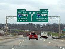
Little Rock is served by two primary Interstate Highways and four auxiliary Interstates. I-40 passes through North Little Rock to the north, and I-30 enters the city from the south, terminating at I-40 in the north of the Arkansas River. Shorter routes designed to accommodate the flow of urban traffic across town include I-430, which bypasses the city to the west, I-440, which serves the eastern part of Little Rock including Clinton National Airport, and I-630 which runs east-west through the city, connecting west Little Rock with the central business district. I-530 runs southeast to Pine Bluff as a spur route.[21]
US 70 parallels I-40 into North Little Rock before multiplexing with I-30 at the Broadway exit (Exit 141B). US 67 and US 167 share the same route from the northeast before splitting. US 67 and US 70 multiplex with Interstate 30 to the southwest. US 167 multiplexes with US 65 and I-530 to the southeast.
Rail
Amtrak serves the city twice daily via the Texas Eagle, with northbound service to Chicago and southbound service to San Antonio, as well as numerous intermediate points. Through service to Los Angeles and intermediate points operates three times a week. The train carries coaches, a sleeping car, a dining car, and a Sightseer Lounge car. Reservations are required.
Aviation
Nine airlines serve 18 national/international gateway cities, e.g. New York City, Chicago, Atlanta, Dallas, Charlotte, Orlando etc. from Clinton National Airport. In 2006 they carried approximately 2.1 million passengers on approximately 116 daily flights to and from Little Rock.
Bus
Greyhound Lines serves Dallas and Memphis, as well as intermediate points, with numerous connections to other cities and towns. Jefferson Lines serves Fort Smith, Kansas City, and Oklahoma City, as well as intermediate points, with numerous connections to other cities and towns. These carriers operate out of the North Little Rock bus station.
Public transportation

Within the city, public bus service is provided by the Rock Region Metro, which until 2015 was named the Central Arkansas Transit Authority (CATA). As of January 2010, CATA operated 23 regular fixed routes, 3 express routes, as well as special events shuttle buses and paratransit service for disabled persons. Of the 23 fixed-route services, 16 offer daily service, 6 offer weekday service with limited service on Saturday, and one route runs exclusively on weekdays. The three express routes run on weekday mornings and afternoons. Since November 2004, downtown areas of Little Rock and North Little Rock have been additionally served by the Metro Streetcar system (formerly the River Rail Electric Streetcar), also operated by Rock Region Metro. The Streetcar is a 3.4-mile (5.5 km)-long heritage streetcar system that runs from the North Little Rock City Hall and throughout downtown Little Rock before crossing over to the William J. Clinton Presidential Library. The streetcar line has fourteen stops and a fleet of five cars with a daily ridership of around 350.
List of people

- Bill Clinton (born 1946), former President of the United States and former governor of the state, lived in the city.
- Hillary Clinton (born 1947), the Democratic candidate for the 2016 U.S. presidential election, U.S. Secretary of State, former U.S. Senator from New York, wife of Bill Clinton, former first lady of Arkansas, and former first lady in the White House, lived in the city.
- Chelsea Clinton (born 1980), daughter of Bill and Hillary Clinton, was born in Little Rock.
- Sheryl Underwood (born 1963), the Emmy-winning co-host of The Talk, stand-up comedian, and actress, was born in Little Rock.
- John Gould Fletcher (1886–1950), Pulitzer Prize-winning Imagist poet and author. He was born in Little Rock to a family. Fletcher suffered from depression and committed suicide by drowning in a pond near his home in Little Rock. Fletcher is buried at Mount Holly Cemetery in Little Rock. The Fletcher Branch Library of the Central Arkansas Library System is named after him.[22]
- Bill Hicks (1961–1994), American comedian and social critic, died at his parents' home in Little Rock.
- The Little Rock Nine, a group of nine African American students enrolled in Little Rock Central High School in 1957 that were initially prevented from entering the racially segregated school by the state government, but ultimately attended after the intervention of the federal government. Among other accomplishments and accolades, they all received the Spingarn Medal from the NAACP in 1958 and the Congressional Gold Medal from President Bill Clinton in 1999.
- Douglas MacArthur (1880–1964), U.S. general, was born in Little Rock.
- Charlotte Moorman (1933–1991), was a cellist and advocate for avant-garde music born in Little Rock.
- Winthrop Rockefeller (1912–1973), businessman, philanthropist, and the first Republican governor of Arkansas since Reconstruction and the grandson of John D. Rockefeller, lived in the city and in Conway County.
Sister cities
 Kaohsiung, Taiwan – 1983
 Hanam, Gyeonggi, South Korea – 1992
 Changchun, People's Republic of China – 1994
 Ragusa, Italy (Emeritus) [23]
.svg.png) Mons, Belgium (Emeritus)[23]
Mons, Belgium (Emeritus)[23] Pachuca, Mexico (Emeritus)[23]
Friendship cities
 Newcastle upon Tyne, England, United Kingdom – 1999
 La Petite-Pierre, France (Emeritus)[23]
See also
- Arkansas Metropolitan Areas
- Baptist Missionary Association of America
- Jack Stephens Center
- List of capitals in the United States
- Little Rock Air Force Base
- National Register of Historic Places listings in Little Rock, Arkansas
- USS Little Rock (CL-92)
- USS Little Rock (LCS-9)[24]
Notes
- ↑ Official records for Little Rock began on 28 February 1875 at the State Capitol and maintained there until 30 April 1942. The next day, and until 7 August 1942, temperature and precipitation were recorded separately at two different locations in and around Little Rock, and the official climatology station has been Adams Field since 8 August 1942. For more information, see Threadex
References
- 1 2 "American FactFinder". United States Census Bureau. Retrieved 2014-06-21.
- ↑ "Population Estimates". United States Census Bureau. Retrieved 2014-06-21.
- ↑ "Census shows overall state population up 9.1 percent". Arkansasonline.com. 2011-02-10. Retrieved 2012-05-22.
- ↑ "Our Historical City". City of Little Rock. Retrieved September 3, 2016.
- ↑ "Colorful Names". Arkansas Department of Parks & Tourism. Archived from the original on November 24, 2013. Retrieved 14 July 2014.
- ↑ "US Gazetteer files: 2010, 2000, and 1990". United States Census Bureau. 2011-02-12. Retrieved 2011-04-23.
- ↑ Bradbury, Cary (2007-11-14). "North Little Rock (Pulaski County)". Retrieved 2008-05-15.
- ↑ Clinton, Bill (2004). My Life. Knopf Publishing Group. p. 244.
- ↑ "Climate Statistics for the Little Rock Area" (PDF). National Weather Service North Little Rock. Retrieved 2011-12-07.
- ↑ "NowData – NOAA Online Weather Data". National Oceanic and Atmospheric Administration. Retrieved 2011-12-31.
- ↑ "Station Name: AR LITTLE ROCK AP ADAMS FLD". National Oceanic & Atmospheric Administration. Retrieved 2014-03-28.
- ↑ "NOAA". NOAA.
- ↑ "Monthly Averages for Little Rock, AR (72201)". The Weather Channel. Retrieved 2012-02-17.
- ↑ "Annual Estimates of the Resident Population for Incorporated Places: April 1, 2010 to July 1, 2015". Retrieved July 2, 2016.
- ↑ "Census of Population and Housing". Census.gov. Retrieved June 4, 2015.
- ↑ "Arkansas – Race and Hispanic Origin for Selected Cities and Other Places: Earliest Census to 1990". U.S. Census Bureau. Retrieved April 21, 2012.
- ↑ http://articles.latimes.com/1995-10-01/news/mn-51945_1_small-cities
- ↑ "Little Rock Branch | Regional Executive Robert Hopkins". St. Louis Fed. Retrieved 2014-02-25.
- ↑ "arkansassymphony.org". arkansassymphony.org. Retrieved 2014-02-25.
- ↑ Tugman, Lindsey (11 March 2014). "10 more unsolved Arkansas mysteries". KTHV. Retrieved 13 March 2014.
- ↑ General Highway Map, Pulaski County, Arkansas (PDF) (Map). 1:62500. Cartography by Planning and Research Department. Arkansas State Highway and Transportation Department. December 22, 2011. Archived (PDF) from the original on 7 July 2011. Retrieved March 9, 2013.
- ↑ "John Gould Fletcher". The Central Arkansas Library System. Retrieved 8 September 2013.
- 1 2 3 4 "Boards and Commissions City of Little Rock". littlerock.org. Retrieved 21 July 2015.
- ↑ "Navy Names Littoral Combat Ship Little Rock" DOD press release. 15 July 2011
Further reading
- The Atlas of Arkansas, Richard M. Smith 1989
- Cities in the U.S.; The South, Fourth Edition, Volume 1, Linda Schmittroth, 2001
- Greater Little Rock: a contemporary portrait, Letha Mills, 1990
- How We Lived: Little Rock as an American City, Frederick Hampton Roy, 1985
- Morgan, James. "Little Rock: The 2005 American Heritage Great American Place" American Heritage, October 2005.
- O'Donnell, William W. (1987). The Civil War Quadrennium: A Narrative History of Day-to-Day Life in Little Rock, Arkansas During the American War Between Northern and Southern States 1861-1865 (2nd ed.). Little Rock, Ark.: Civil War Round Table of Arkansas. LCCN 85-72643 – via Horton Brothers Printing Company.
- Redefining the Color Line: Black Activism in Little Rock, Arkansas, 1940-1970, John A. Kirk, 2002.
External links
| Wikimedia Commons has media related to Little Rock, Arkansas. |
| Wikivoyage has a travel guide for Little Rock. |
- Official website
- Central Arkansas Transit authority. Bus services
- City-Data.com. "Average Climate in Little Rock, Arkansas"
- Gailiano, Amanda. "Lets Get Historical – Early Arkansas". About.com Cities and Towns 19 April 2006.
 "Little Rock". Encyclopædia Britannica (11th ed.). 1911.
- Little Rock at the Encyclopedia of Arkansas History & Culture
| Articles relating to Little Rock, Arkansas | ||||||||||||||||||||||||||
|---|---|---|---|---|---|---|---|---|---|---|---|---|---|---|---|---|---|---|---|---|---|---|---|---|---|---|
| ||||||||||||||||||||||||||
