Little Orleans, Maryland
| Little Orleans, Maryland | |
|---|---|
| Census-designated place | |
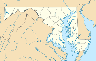  Location within the state of Maryland | |
| Coordinates: 39°37′33″N 78°23′11″W / 39.62583°N 78.38639°WCoordinates: 39°37′33″N 78°23′11″W / 39.62583°N 78.38639°W | |
| Country | United States |
| State | Maryland |
| County | Allegany |
| Area | |
| • Total | 0.7 sq mi (1.8 km2) |
| • Land | 0.7 sq mi (1.8 km2) |
| • Water | 0 sq mi (0 km2) |
| Elevation | 494 ft (151 m) |
| Population (2010) | |
| • Total | 42 |
| • Density | 60/sq mi (23.0/km2) |
| Time zone | Eastern (EST) (UTC-5) |
| • Summer (DST) | EDT (UTC-4) |
| ZIP codes | 21766 |
| Area code(s) | 301 |
| FIPS code | 24-47275 |
| GNIS feature ID | 2583650 |
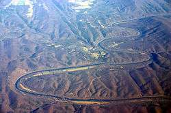
Oblique air photo of the meandering Potomac River at Little Orleans (center), facing north. The photo shows Allegany County, Maryland (left), Morgan County, West Virginia (right), Sideling Hill (right), and the Chesapeake and Ohio Canal.
Little Orleans is an unincorporated community and census-designated place (CDP) in Allegany County, Maryland, United States. As of the 2010 census it had a population of 42.[1]
Little Orleans is located on the Potomac River at the mouth of Fifteenmile Creek across from Orleans Cross Roads, West Virginia. Little Orleans was served by the Chesapeake & Ohio Canal, and by the Western Maryland Railway, both of which have been abandoned. "Bill's Place", a restaurant and store, is located adjacent to the canal. An annual event hosted by Ken Appel, "Apple's East Coast Motorcycle Rally" (formerly East Coast Sturgis) attracts thousands of visitors every August to this otherwise sleepy little town.
References
- ↑ "Geographic Identifiers: 2010 Demographic Profile Data (G001): Little Orleans CDP, Maryland". U.S. Census Bureau, American Factfinder. Retrieved May 28, 2013.
This article is issued from Wikipedia - version of the 10/29/2016. The text is available under the Creative Commons Attribution/Share Alike but additional terms may apply for the media files.