Little Falls (town), New York
| Little Falls, New York | |
|---|---|
| Town | |
 Little Falls, New York Location within the state of New York | |
| Coordinates: 43°1′2″N 74°53′26″W / 43.01722°N 74.89056°WCoordinates: 43°1′2″N 74°53′26″W / 43.01722°N 74.89056°W | |
| Country | United States |
| State | New York |
| County | Herkimer |
| Government | |
| • Type | Town Council |
| • Town Supervisor | Brian T. Marhaver (D) |
| • Town Council |
Members' List
|
| Area | |
| • Total | 22.6 sq mi (58.5 km2) |
| • Land | 22.4 sq mi (58.0 km2) |
| • Water | 0.2 sq mi (0.4 km2) |
| Elevation | 404 ft (123 m) |
| Population (2010) | |
| • Total | 1,587 |
| Time zone | Eastern (EST) (UTC-5) |
| • Summer (DST) | EDT (UTC-4) |
| ZIP code | 13365 |
| Area code(s) | 315 |
| FIPS code | 36-42752 |
| GNIS feature ID | 0979158 |
Little Falls is a town in Herkimer County, New York, United States. The population was 1,587 at the 2010 census. The town is named after a waterfall located nearby.
The Town of Little Falls has on its eastern end a small city called Little Falls. Both town and city are east of Utica.
Geography
According to the United States Census Bureau, the town has a total area of 22.6 square miles (58.5 km²), of which, 22.4 square miles (58.0 km²) of it is land and 0.2 square miles (0.4 km²) of it (0.75%) is water.
The south boundary of the town is defined by the Mohawk River and the Erie Canal.
North-south highways New York State Route 169 and New York State Route 170 converge on the City of Little Falls. New York State Route 5 is an east-west highway north of the Mohawk River.
The town is surrounded by hills.
Demographics
| Historical population | |||
|---|---|---|---|
| Census | Pop. | %± | |
| 1830 | 2,539 | — | |
| 1840 | 3,881 | 52.9% | |
| 1850 | 4,855 | 25.1% | |
| 1860 | 5,989 | 23.4% | |
| 1870 | 5,612 | −6.3% | |
| 1880 | 6,913 | 23.2% | |
| 1890 | 1,055 | −84.7% | |
| 1900 | 931 | −11.8% | |
| 1910 | 638 | −31.5% | |
| 1920 | 684 | 7.2% | |
| 1930 | 741 | 8.3% | |
| 1940 | 777 | 4.9% | |
| 1950 | 874 | 12.5% | |
| 1960 | 1,188 | 35.9% | |
| 1970 | 1,411 | 18.8% | |
| 1980 | 1,434 | 1.6% | |
| 1990 | 1,635 | 14.0% | |
| 2000 | 1,544 | −5.6% | |
| 2010 | 1,587 | 2.8% | |
| Est. 2014 | 1,558 | [1] | −1.8% |
As of the census[3] of 2000, there were 1,544 people, 580 households, and 454 families residing in the town. The population density was 68.9 people per square mile (26.6/km²). There were 637 housing units at an average density of 28.4 per square mile (11.0/km²). The racial makeup of the town was 98.51% White, 0.26% Black or African American, 0.06% Native American, 0.71% Asian, 0.06% from other races, and 0.39% from two or more races. Hispanic or Latino of any race were 0.26% of the population.
There were 580 households out of which 35.9% had children under the age of 18 living with them, 65.0% were married couples living together, 7.8% had a female householder with no husband present, and 21.6% were non-families. 17.8% of all households were made up of individuals and 8.8% had someone living alone who was 65 years of age or older. The average household size was 2.66 and the average family size was 2.98.
In the town the population was spread out with 25.7% under the age of 18, 6.7% from 18 to 24, 29.7% from 25 to 44, 24.2% from 45 to 64, and 13.7% who were 65 years of age or older. The median age was 39 years. For every 100 females there were 101.8 males. For every 100 females age 18 and over, there were 103.0 males.
The median income for a household in the town was $38,875, and the median income for a family was $43,393. Males had a median income of $30,952 versus $21,065 for females. The per capita income for the town was $20,383. About 7.8% of families and 10.7% of the population were below the poverty line, including 13.3% of those under age 18 and 6.5% of those age 65 or over.
In popular culture
In Dana Spiotta's 2006 novel Eat the Document, Mary Whittaker, fleeing from the law under the pseudonym Caroline, travels "ten miles west of Little Falls" (167) when seeking refuge in an underground safe-house. Along with Berry, friend and fellow traveller, Mary hitch-hikes to Little Falls, "The Big Town" (182), for an evening away from the secluded women's commune residing in the hills of Herkimer County. They eat at an unnamed Italian restaurant on Main Street, buy drinks at a bar on the Mohawk River called Waterfront, and finally spend the night at "a small, clean motel with prints of the Erie Canal on the wall" (186).[4]
References
- ↑ "Annual Estimates of the Resident Population for Incorporated Places: April 1, 2010 to July 1, 2014". Retrieved June 4, 2015.
- ↑ "Census of Population and Housing". Census.gov. Retrieved June 4, 2015.
- ↑ "American FactFinder". United States Census Bureau. Retrieved 2008-01-31.
- ↑ Spiotta, Dana. Eat the Document. New York: Scribner, 2006. Print.
External links
| Wikivoyage has a travel guide for Little Falls (New York). |
Municipalities and communities of Herkimer County, New York, United States | ||
|---|---|---|
| City | 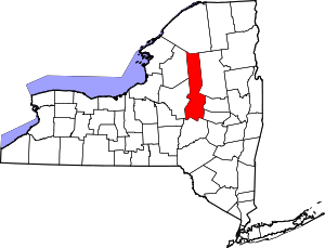 | |
| Towns | ||
| Villages | ||
| CDP | ||
| Hamlets | ||
| Footnotes | ‡This populated place also has portions in an adjacent county or counties | |