List of tallest structures in Ireland
This is a list of the tallest structures on the island of Ireland.
Those in Northern Ireland are denoted by a light blue background, the rest are in the Republic of Ireland.
Tallest structures
Tallest storeyed buildings
| Name | Location | Type | Year completed | Height | Picture |
|---|---|---|---|---|---|
| Obel Tower | Belfast | residential | 2010 | 85 m (279 ft) | 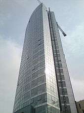 |
| Windsor House | Belfast | office | 1975 | 80 m (260 ft) |  |
| Belfast City Hospital Tower | Belfast | hospital | 1986 | 76 m (249 ft) |  |
| The Elysian | Cork | residential, office | 2008 | 68.28 m (224.0 ft) |  |
| Google Docks (previously Montevetro) | Dublin | office | 2010 | 67 m (220 ft) |  |
| Cork County Hall | Cork | office | 1968 | 64.3 m (211 ft) |  |
| Belfast Hilton Hotel | Belfast | hotel | 1998 | 63 m (207 ft) |  |
| Millennium Tower | Dublin | residential | 1998 | 63 m (207 ft) |  |
| Royal Victoria Hospital Critical Care Building | Belfast | hospital | 2012 | 63 m (207 ft) | |
| The Boat | Belfast | residential, office | 2010 | 62 m (203 ft) | .JPG) |
| BT Riverside Tower | Belfast* | office | 1998 | 61 m (200 ft) | .JPG) |
| Divis Tower | Belfast | residential | 1966 | 61 m (200 ft) |  |
| Liberty Hall | Dublin | Office | 1965 | 59.4 m (195 ft) |  |
| One George's Quay Plaza | Dublin | Mostly office use | 2002 | 59 m (194 ft) |  |
| Riverpoint | Limerick | Mixed use | 2008 | 58.5 m (192 ft) |  |
| Crowne Plaza | Dundalk | Hotel | 2007 | 58 m (190 ft) | |
| Clarion Hotel | Limerick | Hotel | 2002 | 57 m (187 ft) |  |
Tallest churches
| Name | Location | Type | Year completed | Height | Picture |
|---|---|---|---|---|---|
| St John's Cathedral | Limerick | church | 1861 | 93.8 m (308 ft) |  |
| St Colman's Cathedral | Cobh | church | 1914 | 91.4 m (300 ft) |  |
| St Mary's Cathedral | Killarney | church | 1912 | 86.8 m (285 ft) |  |
| St Patrick's College Church | Maynooth | church | 1891 | 83 m (272 ft) |  |
| St Eugene's Cathedral | Derry | church | 1903 | 78 m (256 ft) |  |
| St Macartan's Cathedral | Monaghan | church | 1893 | 74 m (243 ft) |  |
| St Finbarre's Cathedral | Cork | church | 1879 | 73 m (240 ft) |  |
| St Eunan's Cathedral | Letterkenny | church | 1900 | 73 m (240 ft) |  |
| St Anne's Cathedral | Belfast | church | 1904 | 72 m (236 ft)[1] | .JPG) |
| Church of Saints Augustine and John | Dublin | church | 1874 | 70 m (230 ft) |  |
| St Peter and St Paul Cathedral | Ennis | church | 1874 | 69 m (226 ft) |  |
| Sacred Heart Church | Omagh | church | 1899 | 68.6 m (225 ft) |  |
| St. Peter's Roman Catholic Church, Drogheda | Drogheda | church | 1884 | 67.66 m (222.0 ft) |  |
| St Columb's Cathedral | Derry | church | 1633 | 67 m (220 ft) | %2C_August_2009.JPG) |
| St Patrick's Cathedral (Church of Ireland) | Dublin | church | 1191 | 66 m (217 ft) |  |
| St Patrick's Cathedral (Roman Catholic) | Armagh | church | 1904 | 64 m (210 ft) | 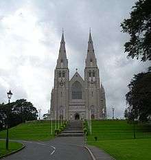 |
| St Patrick's Church (Roman Catholic) | Belfast | church | 1877 | 63 m (207 ft)[2] | .JPG) |
| St George's Church | Dublin | church | 1813 | 61 m (200 ft) |  |
Other categories
Entries in the list that are in Northern Ireland are denoted by an asterisk, the others being in the Republic of Ireland.

Nenagh Castle Keep
- Sculptures
- Spire of Dublin, 120 m (394 ft)
- Spire of Hope, St Anne’s Cathedral, Belfast*, 72m (236 ft)
- Gantry Cranes
- "Samson", Harland and Wolff, Belfast*, 106 m (348 ft)
- Bridges
- River Suir Bridge, Waterford, 100 m (330 ft)
- Boyne River Bridge, 95 m (312 ft)
- Windmills
- Kilgarvan Wind Farm (group of 14 Wind Turbines), 93 m (305 ft)
- Obelisks
- Wellington Monument, Phoenix Park, 63 m (207 ft) (Tallest in Europe)
- Lighthouses
- Fastnet Rock Lighthouse, 44.5 m (146 ft)
- Stadiums
- Croke Park, 40 m (131 ft)
- Moving sculptures
- Irish Wave, Park West, Dublin, 35.4 m (116 ft) (Tallest in Europe)
- Round towers
- Kilmacduagh monastery, 34 m (112 ft)
- Castles
- Nenagh Castle Keep, 31 m (102 ft)
- Standing stones
- Punchestown, 6.5 m (21 ft)
- High crosses
- Muiredach's High Cross, Monasterboice, 6.45 m (21 ft)
Under Construction
- Capital Dock, Dublin 79 m (259 ft). On the site of cancelled "U2 Tower" project. On completion, will be the tallest storeyed building in the Republic and third tallest in Ireland.
- Bolands Quay, Dublin 54 m (177 ft).
Planned
- Dublin Airport New Air Traffic Control Tower, 86.9m, to be built in tandem with new northern runway
- Ilex Tower, Derry 73 m (240 ft) (part of Fort George regeneration project)
- Exo Tower, Point Village, Dublin, 73m. On the site of cancelled "Watchtower" project.
Former

Former Churchill House, Belfast - geograph.org.uk - 511400
- Bellacorick Cooling Tower, 89 m (290 ft), demolished 2007
- Churchill House, Belfast, 66 m (215 ft), demolished 2004
- Ballymun Flats, 42 m (136 ft), demolished 2004-2015
- Nelson's Pillar Monument, 41 m (134 ft), destroyed 1966
See also
References
- ↑ "Belfast Cathedral". Emporis.com. Retrieved 2011-02-22.
- ↑ "St Patrick's Church, Belfast". Emporis.com. Retrieved 2011-02-22.
- Tallest structures in Ireland
- From skyscrapernews:
- Tallest storeyed buildings in Republic of Ireland including planned ones
- Tallest storeyed buildings in Northern Ireland including planned ones
- From emporis:
- Galloway, Peter; Cormac Simms (1992). The Cathedrals of Ireland. Dublin: Institute of Irish Studies. ISBN 0-85389-452-3.
- Punchestown standing stone
- Irish Wave from The Daily Telegraph.
- Mullaghanish transmitter
- http://skyscraperpage.com/diagrams/?searchID=37735326
- http://www.iaa.ie/safe_reg/iaip/Published%20Files/AIP%20Files/ENR/EI_ENR_5_4_en.pdf
- http://www.dublincity.ie/swiftlg/apas/run/WPHAPPDETAIL.DisplayUrl?theApnID=DSDZ2546/15&backURL=%3Ca%20href=wphappcriteria.display?paSearchKey=2483158%3ESearch%20Criteria%3C/a%3E%20%3E%20%3Ca%20href=%27wphappsearchres.displayResultsURL?ResultID=2993671%26StartIndex=1%26SortOrder=APNID%26DispResultsAs=WPHAPPSEARCHRES%26BackURL=%3Ca%20href=wphappcriteria.display?paSearchKey=2483158%3ESearch%20Criteria%3C/a%3E%27%3ESearch%20Results%3C/a%3E
This article is issued from Wikipedia - version of the 8/8/2016. The text is available under the Creative Commons Attribution/Share Alike but additional terms may apply for the media files.